

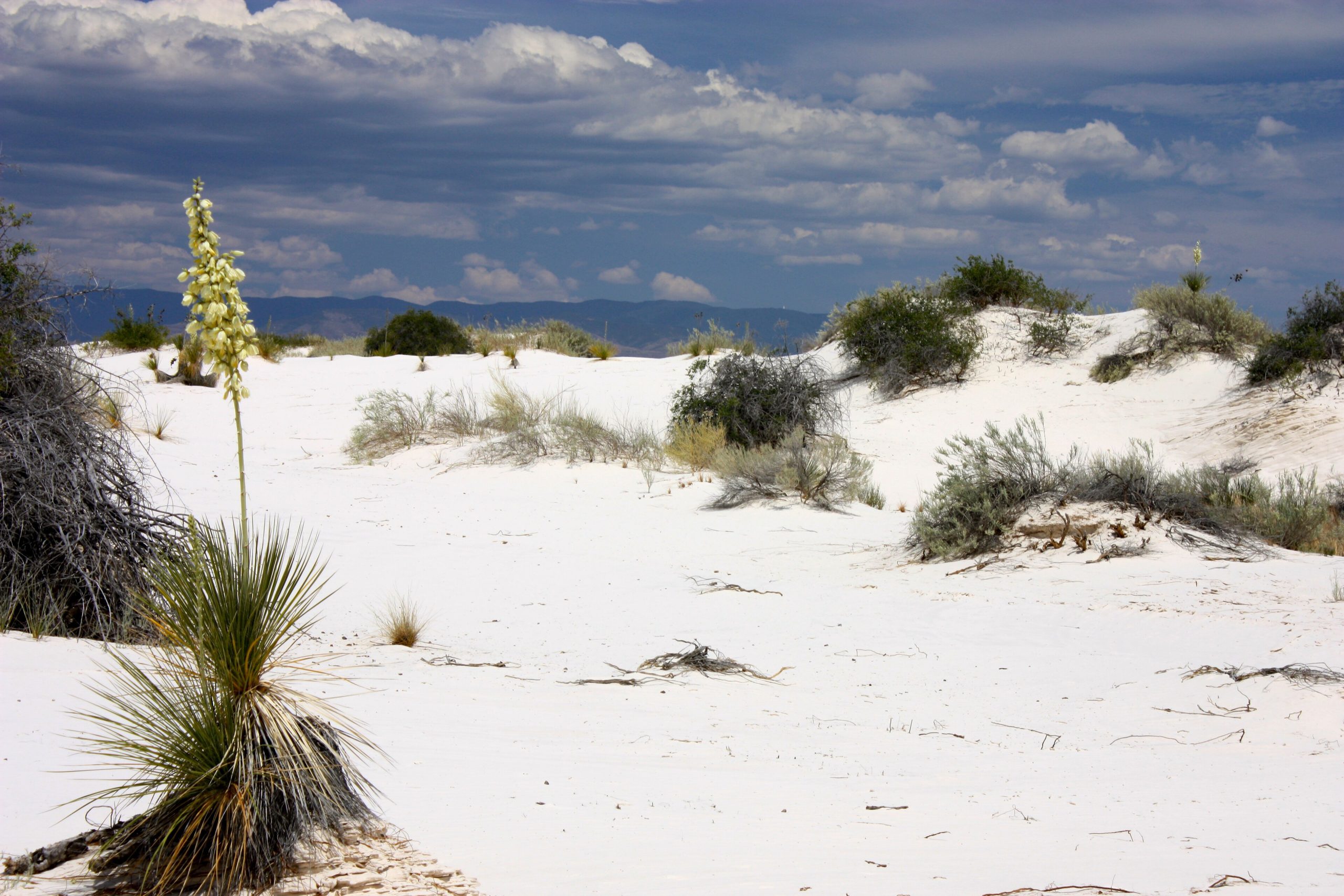
White Sands National Park
White Sands is one of the world’s great natural wonders, a dazzling 275-square-mile sea of pure white gypsum sand rolling across the Tularosa Basin of New Mexico. The largest gypsum dune field on Earth, its wave after wave of blinding-white dunes create a surreal, beautiful landscape where visitors hike, sled and watch some of the most spectacular sunsets and dark skies in the Southwest.
Fast facts
- Established: national monument 1933; national park in 2019
- Size: about 145,000 acres (587 km²), with a 275-square-mile gypsum dune field
- Distinction: the largest gypsum dune field in the world
- Setting: the Tularosa Basin, ringed by desert mountains
- Gateways: Alamogordo and Las Cruces, New Mexico
- Managed by: National Park Service
The landscape
Unlike ordinary sand, these dunes are made of gypsum, which stays cool to the touch and glows brilliant white. Wind constantly reshapes the field, burying and revealing its edges, while specially adapted plants and pale, camouflaged animals, like the bleached earless lizard, survive in this stark environment. Beyond the dunes, desert scrub and the surrounding mountains frame the basin.
Best time to go
Fall through spring brings the most comfortable temperatures for exploring the dunes, with mild days and cool nights. Summer is very hot, so hike early or late and carry ample water. Any time of year, sunrise and sunset set the white sand aglow, and the dark skies make for wonderful stargazing.
Getting there and around
The park lies off US-70 between Las Cruces and Alamogordo, and the Dunes Drive loops eight miles (13 km) into the heart of the field to trailheads and picnic areas. A vehicle is needed to reach and drive into the dunes; note that the park and highway occasionally close for a couple of hours during tests at the surrounding White Sands Missile Range.
Things to do
Walk the marked dune trails, the Alkali Flat and Dune Life Nature trails among them, and sled down the slopes on a saucer (sold at the visitor center). Drive the scenic loop, join a ranger-led sunset stroll, camp in the backcountry dunes by permit, and stay for the stargazing under exceptionally dark skies.
Staying safe
The featureless white dunes make it surprisingly easy to lose your way, so stay oriented, follow the marked trail posts, and turn back if unsure. Heat and sun are intense with no shade or water, so carry plenty, wear protection, and hike in the cooler hours. Check for missile-range closures before you go.
Know before you go
A park pass is required, backcountry camping needs a permit, and the park can close briefly for nearby missile tests. Check the schedule. This page is a general overview, not a live conditions report; always confirm current hours, closures and conditions with the National Park Service before your trip.
- Coordinates
- 32.7645, -106.3082
- Magnetic declination
- 7.4° E (2026)
Set this declination on your compass, then align it to the map's north lines; it is the angle between true north and magnetic north, refreshed each year.
A spread of the park’s main places shows straight away, and the rest appear as you zoom in. You can also search above, or pick any place from the lists below, and the map will go to it.
Getting there 3
Park entrances
Airstrip
On the trail 7
Trailheads
Campground
Sights 8
Viewpoints
Point of interest
Map data comes from third-party sources and may be incomplete or out of date, so carry a current official map (terms).
- Best seasons
- Fall, Winter, Spring
- Difficulty
- Easy to moderate
- Access / trailheads
- In south-central New Mexico off US-70 between Las Cruces and Alamogordo; the Dunes Drive loops into the heart of the dune field.
- Water
- Carry all your water; there is none in the dune field.
- Cell / satellite coverage
- Little to no cell service in the dunes. Carry a map and note your route.
- Nearest ranger / SAR / emergency
- Contact park rangers; life-threatening emergencies: 911.
- Permits & regulations
- Per-vehicle entry fee (America the Beautiful pass accepted); backcountry camping requires a permit. The park and adjacent highway occasionally close for nearby missile-range tests.
- Leave No Trace
- Stay oriented, pack out all waste, protect the fragile dune ecosystem, and follow Leave No Trace.
January
- Below-freezing nights
- Day-to-night swing of 35°F (19°C)
February
- Below-freezing nights
- Day-to-night swing of 36°F (20°C)
March
- Day-to-night swing of 38°F (21°C)
April
- Day-to-night swing of 38°F (21°C)
May
- Day-to-night swing of 38°F (21°C)
June
- Hot days
- Day-to-night swing of 37°F (21°C)
July
- Hot days
- Day-to-night swing of 32°F (18°C)
August
- Hot days
- Day-to-night swing of 31°F (17°C)
September This month
- Day-to-night swing of 33°F (18°C)
October
- Day-to-night swing of 37°F (21°C)
November
- Below-freezing nights
- Day-to-night swing of 38°F (21°C)
December
- Below-freezing nights
- Day-to-night swing of 35°F (19°C)
What to bring depends on your trip: how long you’re out, where you sleep, and how far you go from the road. The planner builds the list for yours.
Plan a trip here →Averages for 1991–2020 from NOAA U.S. Climate Normals, measured at the White Sands National Monument station, 4 miles (7 km) away at 4,006 feet (1,221 m).