

Petrified Forest National Park
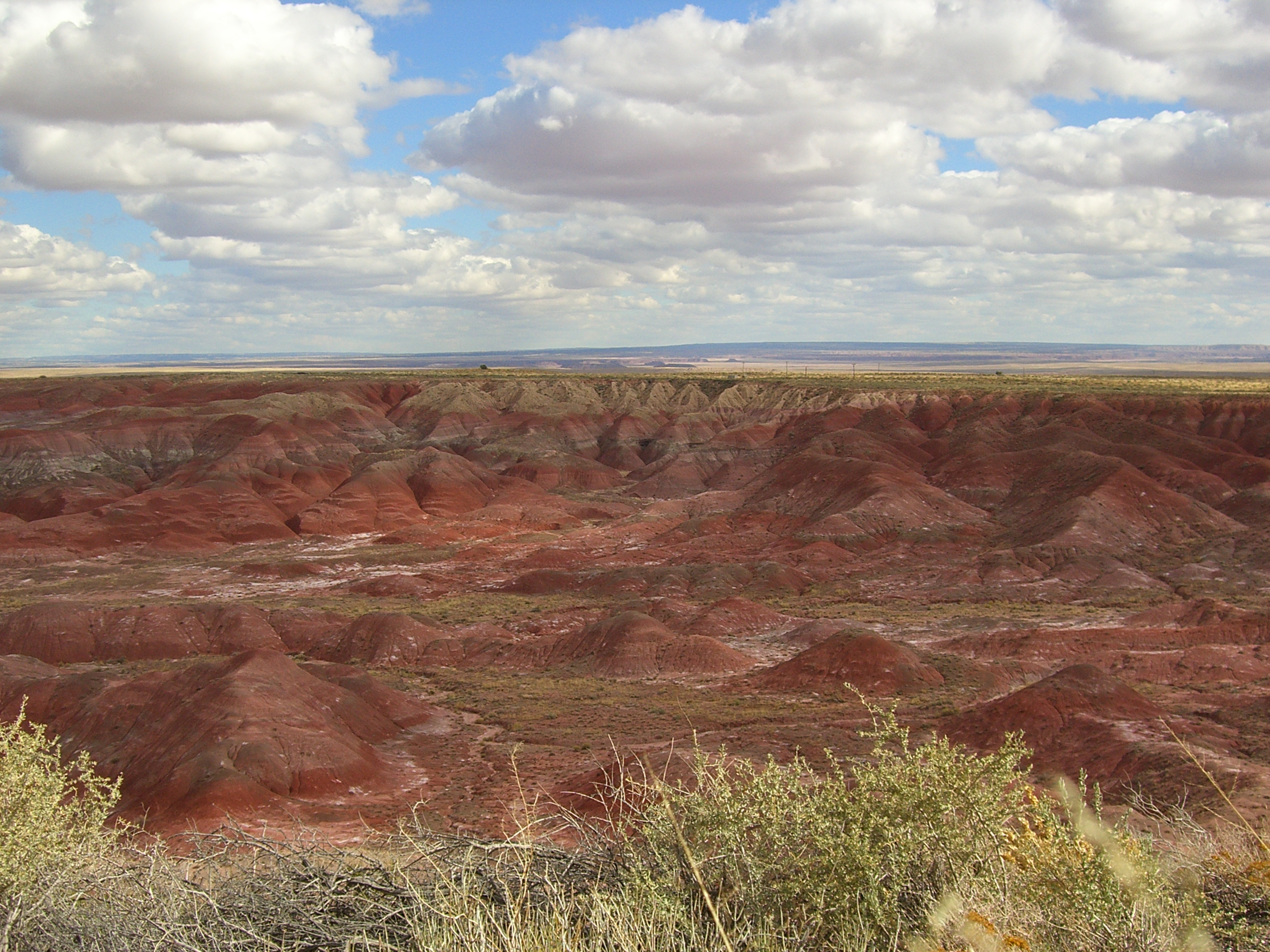
Petrified Forest protects one of the world’s largest and most colorful concentrations of petrified wood, 200-million-year-old logs turned to quartz, scattered across the banded badlands of Arizona’s Painted Desert. Compact and largely explored from a single scenic road, it rewards the curious with fossils, ancient petroglyphs and a stretch of historic Route 66, all in a high-desert setting that demands sun sense.
Fast facts
- Established: national monument 1906; national park in 1962
- Size: about 221,000 acres (894 km²) of high desert and badlands
- Signature feature: petrified wood and the Painted Desert
- Elevation: roughly 5,300–6,200 feet (1,600–1,900 m)
- Also protects: Triassic fossils, petroglyphs and a Route 66 alignment
- Managed by: National Park Service
The landscape
This is open high desert, eroded badlands striped in red, grey, purple and blue, dotted with the glassy, jewel-toned remains of an ancient forest. The Painted Desert spreads across the northern park in soft, layered hills, while the south holds the densest log deposits at sites like Crystal Forest and the Rainbow Forest. Grassland, washes and scattered mesas support pronghorn, coyotes, jackrabbits and reptiles.
Best time to go
Spring and fall bring the most comfortable temperatures and the clearest desert light. Summer is hot and sees monsoon thunderstorms with lightning and flash flooding in the washes; winter is cold and can bring snow that dusts the badlands beautifully. The park is day-use only, with gates that open and close daily, so plan around posted hours.
Getting there and around
A single 28-mile (45 km) road connects the two entrances, off I-40 in the north and US-180 in the south, passing the major overlooks, trailheads and both visitor centers. Most visitors drive the road and stop to walk short interpretive trails; there is no shuttle, so a vehicle is essential.
Things to do
Short, rewarding trails include the Blue Mesa loop through banded badlands, the Crystal Forest loop among petrified logs, and the Giant Logs trail behind the Rainbow Forest Museum. History-minded visitors can see the petroglyphs at Newspaper Rock and the ancestral Puebloan Puerco Pueblo, or photograph the rusted-car Route 66 marker. Experienced hikers can obtain a free permit to backpack into the Painted Desert wilderness.
Staying safe
The desert sun is relentless and there is no water on the trails, so carry plenty, wear sun protection, and start early. In monsoon season, watch for lightning on the exposed badlands and avoid washes when storms threaten. The clay-rich soil turns slick when wet, and wind can whip up dust quickly. Check the forecast and keep an eye on the sky.
Know before you go
A park pass is required, and it is a federal crime to remove petrified wood, buy legally collected pieces from shops outside the park instead. Overnight backpacking needs a free wilderness permit. This page is a general overview, not a live conditions report; always confirm current hours, conditions and permits with the National Park Service before your trip.
- Coordinates
- 34.9748, -109.7726
- Magnetic declination
- 9.1° E (2026)
Set this declination on your compass, then align it to the map's north lines; it is the angle between true north and magnetic north, refreshed each year.
A spread of the park’s main places shows straight away, and the rest appear as you zoom in. You can also search above, or pick any place from the lists below, and the map will go to it.
Getting there 3
Park entrances
On the trail 7
Trailheads
Hut or shelter
Sights 27
Viewpoints
Heritage sites
Peaks
Map data comes from third-party sources and may be incomplete or out of date, so carry a current official map (terms).
- Best seasons
- Spring, Fall (shoulder)
- Difficulty
- Easy to moderate
- Access / trailheads
- Bisected by a 28-mile (45 km) park road linking I-40 in the north to US-180 in the south; both entrances have visitor centers. The park is day-use with gated hours.
- Water
- Carry all your water. There is none on the trails or in the backcountry.
- Cell / satellite coverage
- Limited cell service. Download maps and share your plans before you go.
- Nearest ranger / SAR / emergency
- Contact park rangers at either visitor center; life-threatening emergencies: 911.
- Permits & regulations
- Per-vehicle entry fee (America the Beautiful pass accepted); free wilderness permit required for overnight backpacking. Removing petrified wood is strictly prohibited.
- Leave No Trace
- Leave every piece of petrified wood where it lies, pack out all waste, stay on durable surfaces, and follow Leave No Trace.
January
- Below-freezing nights
February
- Below-freezing nights
March
- Below-freezing nights
- Day-to-night swing of 31°F (17°C)
April
- Day-to-night swing of 33°F (18°C)
May
- Day-to-night swing of 34°F (19°C)
June
- Day-to-night swing of 36°F (20°C)
July
- Hot days
- Day-to-night swing of 32°F (18°C)
August
- Day-to-night swing of 30°F (17°C)
September This month
- Day-to-night swing of 31°F (17°C)
October
- Day-to-night swing of 31°F (17°C)
November
- Below-freezing nights
- Day-to-night swing of 30°F (17°C)
December
- Below-freezing nights
What to bring depends on your trip: how long you’re out, where you sleep, and how far you go from the road. The planner builds the list for yours.
Plan a trip here →Averages for 1991–2020 from NOAA U.S. Climate Normals, measured at the Painted Desert National Park station, 9 miles (14 km) away at 5,760 feet (1,756 m).