

Top 9 things to do in Kings Canyon National Park
Kings Canyon National Park has two parts that most visitors reach, an hour’s drive apart. Grant Grove, at the top, is a forest of giant sequoias. Cedar Grove, at the bottom of a long descent, is the floor of a glacier-cut canyon with granite walls about 4,000 feet (1,200 m) high, and the end of the road. Beyond it is some of the finest backpacking country in the Sierra Nevada. Sequoia National Park adjoins it to the south, and one entrance fee covers both. These are the nine outings we would put first. The order starts with what the park is known for, then goes by what an outing gives back for the time and effort it takes. Distances and heights are National Park Service figures; times are our estimates and do not include the drive.
The road down to Cedar Grove is usually open only from late April to mid-November. In spring and early summer the Kings River is high, fast and very cold, and it is the leading cause of death in these parks: stay off the wet rocks at its edge, however calm a pool looks. Black bears are common, and food must be stored in the metal lockers provided.
1. Walk around the General Grant Tree
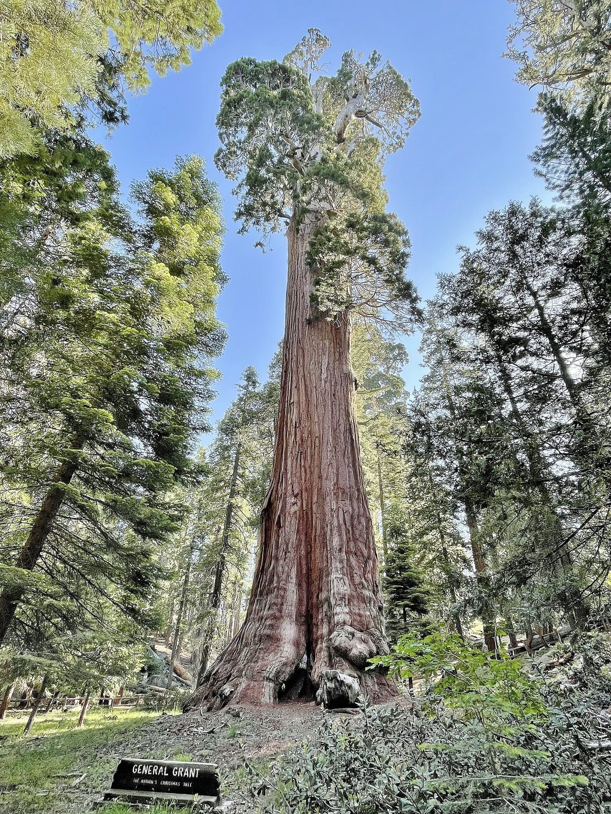
The General Grant is the second-largest tree in the world by volume, 267 feet (81 m) tall and about 40 feet (12 m) across at the base, the widest of any sequoia. It is officially the Nation’s Christmas Tree and a memorial to Americans who died in war. A paved loop circles it through a grove of other giants, passing the Fallen Monarch, a hollow log you walk through that has been used as a shelter, a saloon and a cavalry stable, and a settlers’ cabin built in 1872.
- Distance: a loop of about 0.3 miles (0.5 km), paved
- Allow: 30 to 45 minutes
- Start: General Grant Tree parking area, 1 mile (1.6 km) from the Grant Grove visitor center
- When: all year; the path is packed snow in winter
- Suits: everyone, including wheelchair users
2. Drive the scenic byway down into the canyon
Highway 180 drops about 3,500 feet (1,070 m) from Grant Grove to the Kings River and then follows it upstream to Cedar Grove, about 35 miles (56 km) of bends cut into the canyon wall. Junction View, partway down, looks into the gorge where the Middle and South forks meet, one of the deepest canyons in North America. Lower down the road runs beside the river itself, white with rapids in early summer, past Grizzly Falls, a few steps from the pavement. It ends at Roads End, where the trails begin.
- Distance: about 35 miles (56 km) each way
- Allow: 1 hour each way without stops; a full day with the walks at the bottom
- Start: Grant Grove Village
- When: about late April to mid-November. Fill the tank first: fuel is limited in the canyon.
- Suits: everyone who is comfortable on a winding mountain road
3. Walk around Zumwalt Meadow
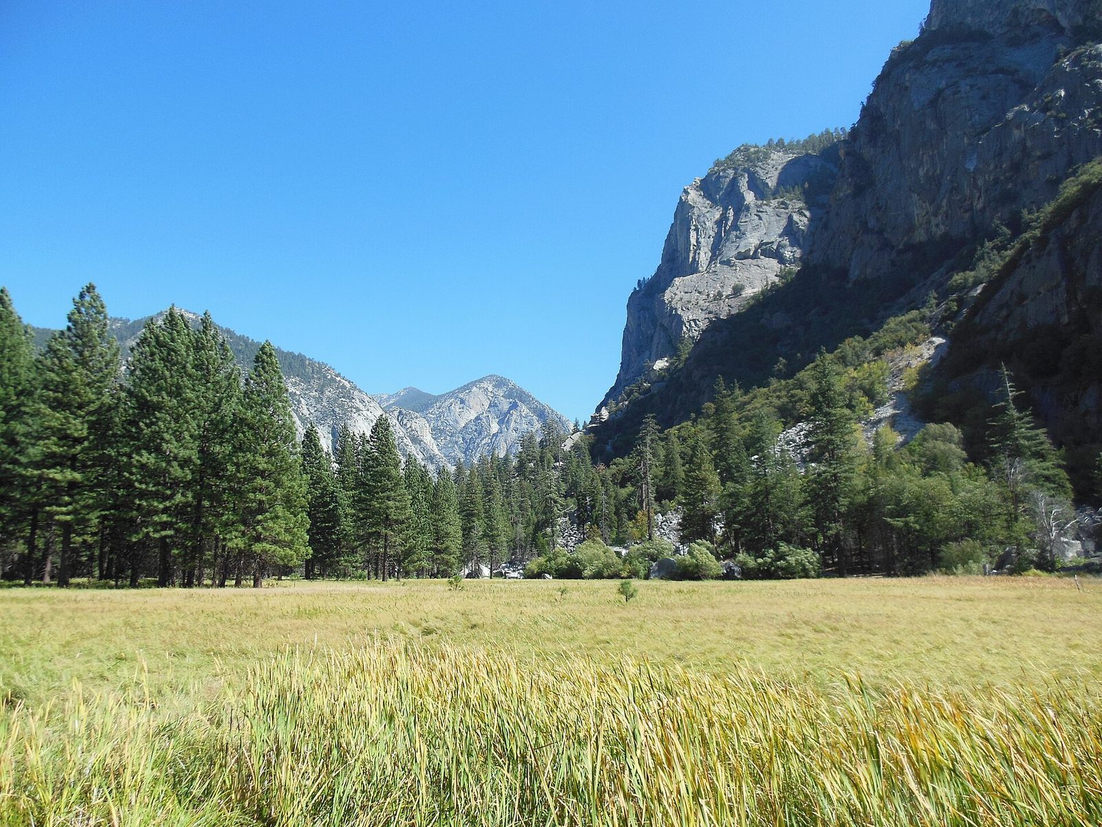
Zumwalt Meadow is the picture of the canyon floor: a green meadow beside the Kings River with the pale cliffs of North Dome and Grand Sentinel standing over it on either side. The trail crosses the river on a suspension bridge, runs along the foot of a rockfall with the best views, and returns by the edge of the meadow through pine and cedar. Mule deer and black bears both graze here early and late in the day. Floods have damaged the boardwalk section in recent years, so the loop is at times an out-and-back.
- Distance: a loop of 1.5 miles (2.4 km), nearly level
- Allow: 1 hour
- Start: Zumwalt Meadow parking area, 1 mile (1.6 km) before Roads End
- When: May to October
- Suits: families
4. Stop at Roaring River Falls
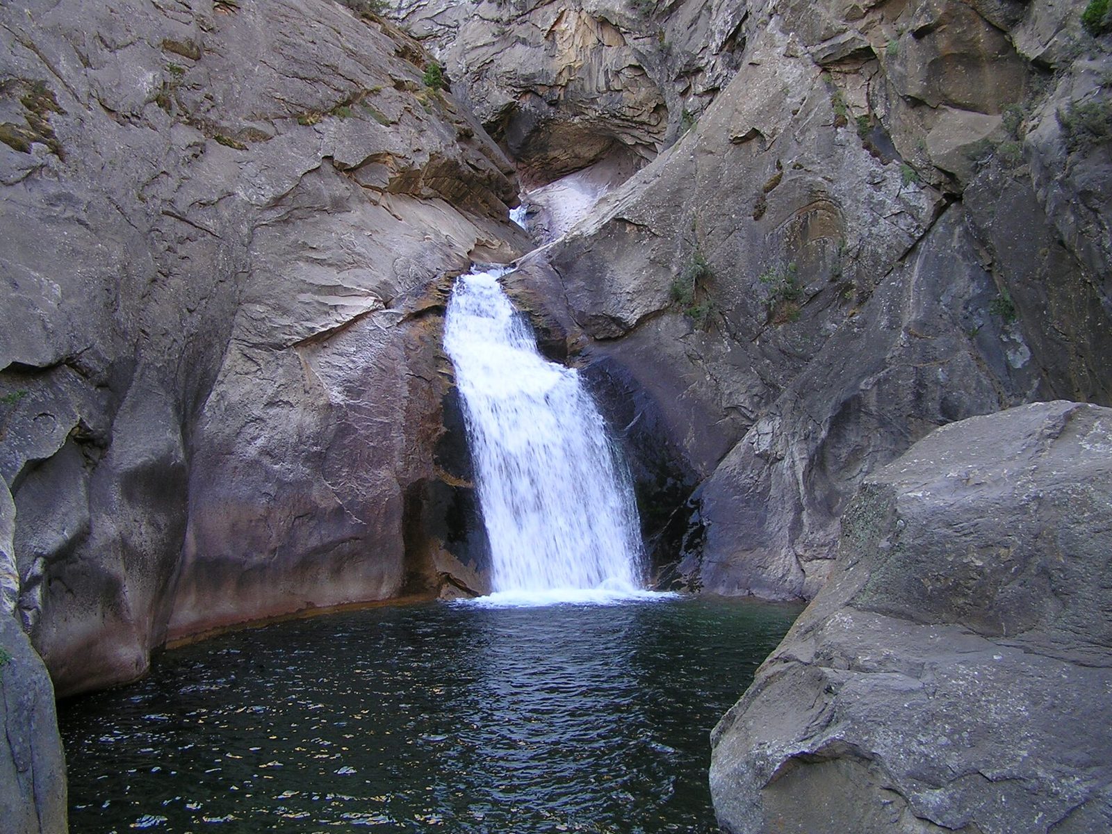
A short paved path through the trees leads to a granite bowl where the Roaring River shoots out of a narrow chute and drops into a deep green pool. It is a powerful fall for its size, loudest in May and June, and the viewing area puts you close to it. Stay behind the rocks at the edge: the pool is cold and its current pulls under the fall.
- Distance: about 0.3 miles (0.5 km) round trip, paved
- Allow: 15 to 20 minutes
- Start: Roaring River Falls parking area, 3 miles (4.8 km) east of Cedar Grove Village
- When: May to October
- Suits: everyone, including wheelchair users with help
5. Hike to Mist Falls
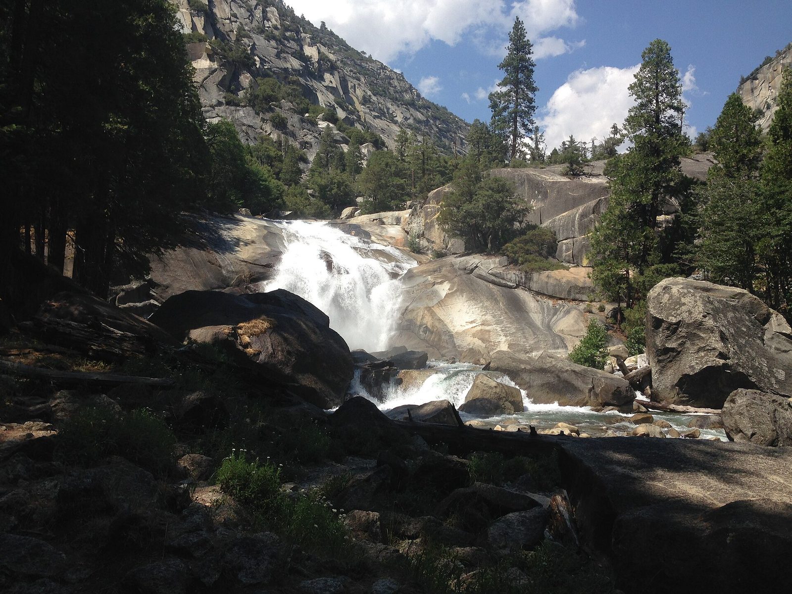
This is the classic day hike of the canyon. The first 2 miles (3.2 km) are flat and sandy, through open forest along the river. Then the trail turns up the South Fork and climbs beside a long run of cascades, over granite slabs, with a view opening behind you down the canyon to a peak called the Sphinx. Mist Falls is a broad sheet of water over a ledge, and in early summer its spray soaks the trail. Rattlesnakes sun themselves on the lower trail, and bears are often seen along it.
- Distance: 8 miles (13 km) round trip
- Climb: about 900 feet (270 m)
- Allow: 4 to 5 hours
- Start: Roads End
- When: May to October; June for the most water. The lower trail is hot by midday.
- Suits: steady walkers
6. Look over the High Sierra from Panoramic Point
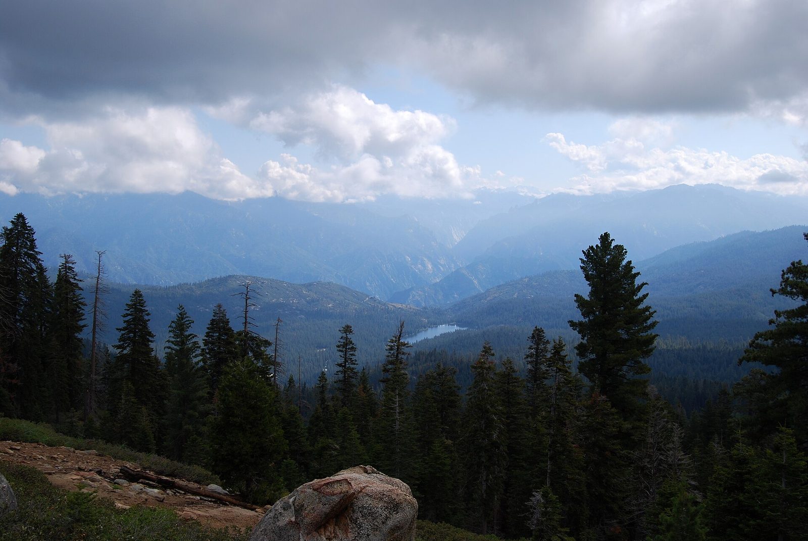
From the giant trees of Grant Grove you cannot see the mountains. A narrow side road and a short paved path fix that, climbing to a ridge at 7,520 feet (2,292 m) with a view east across the whole canyon to the peaks of the Sierra crest, with Hume Lake below. A sign names the summits. It is the best place in Grant Grove at sunrise, and takes ten minutes to walk.
- Distance: 0.5 miles (0.8 km) round trip
- Allow: 30 minutes, plus the drive of 2.3 miles (3.7 km) from Grant Grove Village
- Start: Panoramic Point Road, behind the John Muir Lodge. Trailers and long motorhomes are not allowed.
- When: about late May to October, while the road is open
- Suits: everyone
7. Explore the sequoias and stumps of Grant Grove
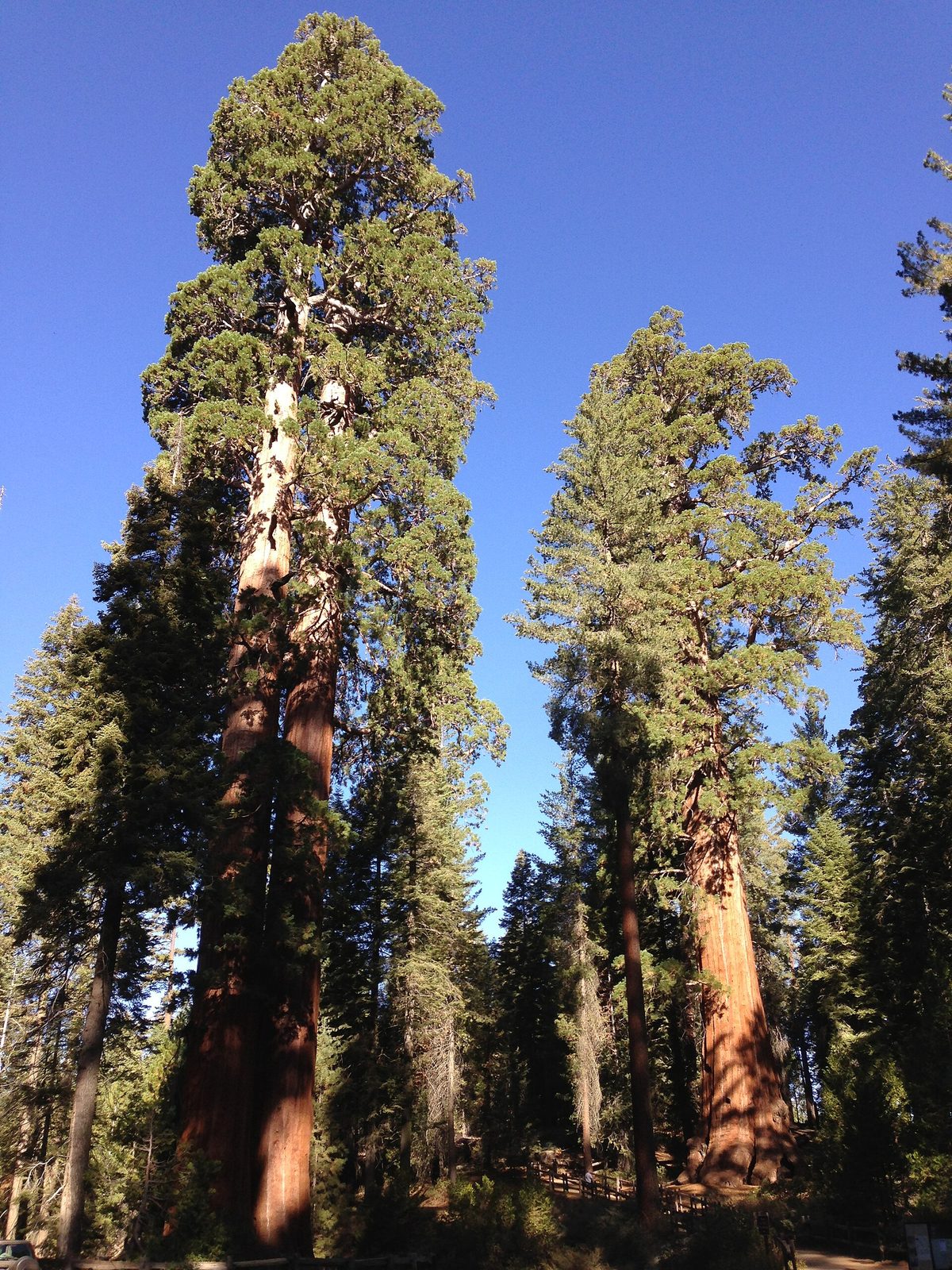
Grant Grove was protected in 1890, a week after Sequoia National Park, because loggers were already cutting the big trees next door. The Big Stump Trail, near the park entrance, loops through the meadow they left: stumps the size of a dance floor, among them the Mark Twain Stump, whose tree was felled in 1891 so that a slice could be shown in a museum in New York. Second-growth sequoias a century old now stand among them. For living giants without the crowd at the Grant Tree, the North Grove loop starts from the far end of the same parking area.
- Distance: a loop of 2 miles (3.2 km) on the Big Stump Trail; 1.5 miles (2.4 km) for the North Grove loop
- Allow: 1 to 1.5 hours each
- Start: Big Stump picnic area, just inside the park entrance, and the General Grant Tree parking area
- When: May to November; on snowshoes in winter
- Suits: most walkers
8. Swim at Muir Rock in late summer
At Roads End, a short path leads to a broad, flat granite boulder on the bank of the Kings River, where John Muir is said to have spoken to visitors about protecting the canyon. Beside it is a deep, clear, slow pool with a sandy beach opposite, and by August, when the river has dropped and warmed a little, it is the best swimming hole in the park. People jump from the rock.
Before about mid-July in a normal year, do not swim here at all. The same pool is a fast, icy current then, and people have drowned at this spot.
- Distance: about 200 yards (180 m) from the parking area
- Allow: 1 to 2 hours
- Start: Roads End
- When: August and September, when the river is low
- Suits: confident swimmers, once the river has dropped
9. Backpack the Rae Lakes Loop
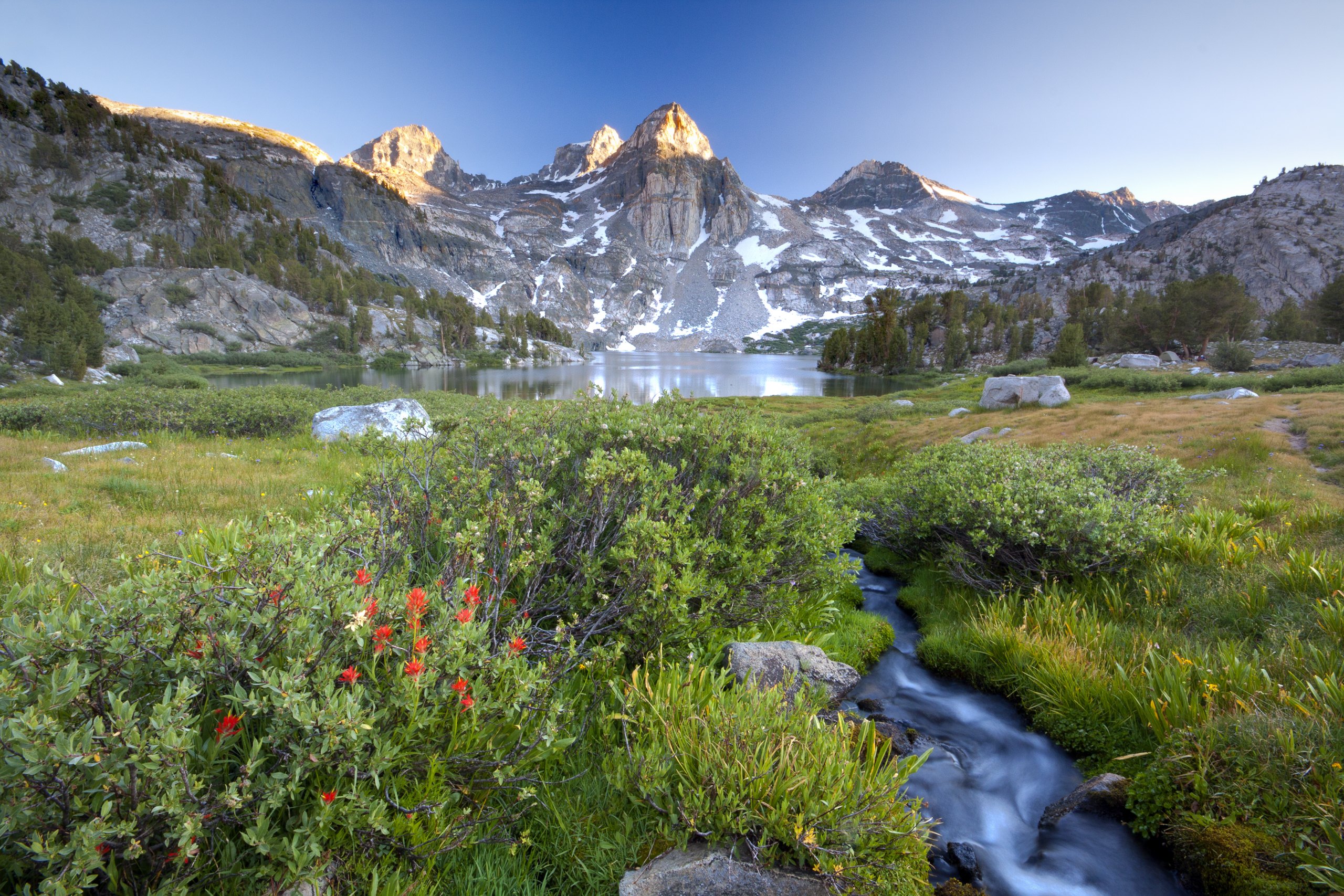
The Rae Lakes Loop is one of the best-known backpacking trips in the Sierra Nevada. From Roads End it climbs past Mist Falls into Paradise Valley, follows Woods Creek up to a chain of lakes under the banded peak called the Painted Lady, crosses Glen Pass at 11,978 feet (3,651 m), and returns down Bubbs Creek. The middle days are on the John Muir Trail. The lakes are among the most beautiful in the range, and they are busy: campsites at Rae Lakes are limited to one night.
Snow can hold on Glen Pass into July, and the creek crossings are dangerous in early season. Bear-resistant food canisters are required.
- Distance: a loop of 41.4 miles (66.6 km)
- Climb: about 7,000 feet (2,130 m) in all
- Allow: four to six days
- Start: Roads End
- When: July to September
- Needs: a wilderness permit, reserved months ahead for summer
- Suits: fit backpackers used to altitude
Before you go
This list covers what stays the same from year to year. Road opening dates, trail and bridge damage, river conditions and fire restrictions change, and the National Park Service posts them on its own site. The link is on our Kings Canyon National Park guide, with the map, permits and how to get there.