

Top 10 things to do in Jasper National Park
Jasper is the largest national park in the Canadian Rockies and the quieter neighbour of Banff: bigger lakes, longer valleys and more room between people. Almost everything on this list lies along three roads out of the town of Jasper, to Maligne Lake, to Miette Hot Springs and south down the Icefields Parkway. These are the ten outings we would put first. The order starts with what the park is known for, then goes by what an outing gives back for the time and effort it takes. Distances and heights are Parks Canada figures; times are our estimates and do not include the drive.
A wildfire in July 2024 burned the valley south of town and part of the town itself. Along the first stretch of the Icefields Parkway and around some trails you will walk through standing black trunks with new green growth under them, and a few places have not yet reopened. This is bear country: carry bear spray and keep 110 yards (100 m) from bears and 33 yards (30 m) from elk.
1. Take a boat to Spirit Island on Maligne Lake
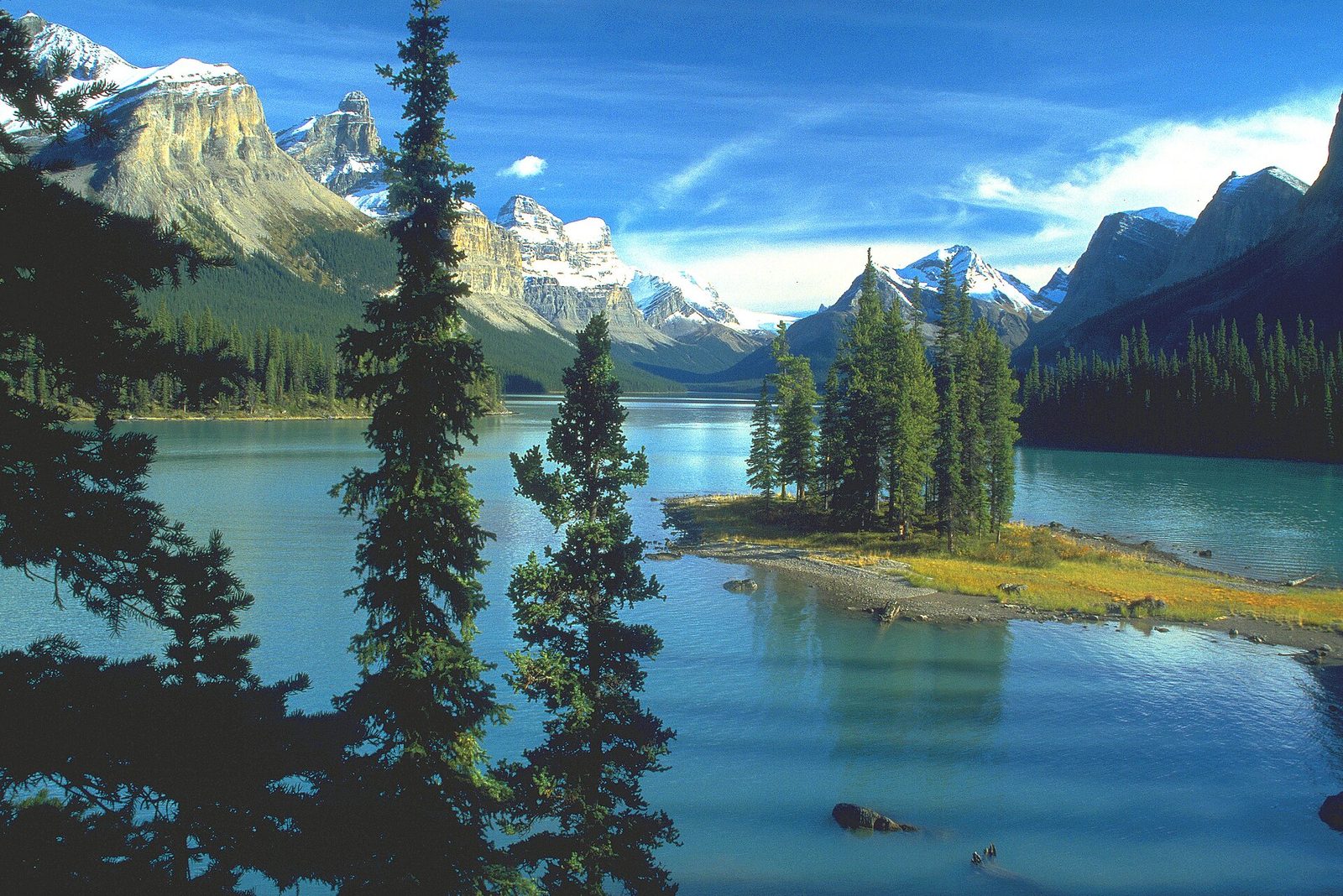
Maligne Lake is the largest natural lake in the Canadian Rockies, 14 miles (22 km) long, with glaciers on the peaks at its far end. Spirit Island, a tiny wooded point about two-thirds of the way down, is the image of the park that most people know, and it can be seen only from the water. Tour boats run to it from the dock at the north end, with a short stop on shore opposite the island. Landing on the island itself is not allowed.
Paddlers can rent a canoe or kayak at the old boathouse. Spirit Island is about 9 miles (14 km) each way, a long day on a cold lake where wind rises in the afternoon, so most paddlers camp at one of the lakeshore campgrounds, which need a reservation. On the drive in, stop at Medicine Lake, which drains away through sinkholes each autumn.
- Distance: 27 miles (44 km) by road from Jasper; about 9 miles (14 km) by water to Spirit Island
- Allow: a full day: an hour’s drive each way and about 1.5 hours on the boat
- Start: Maligne Lake, at the end of Maligne Lake Road
- When: boats run from about late May or June, when the ice goes out, to early October
- Suits: everyone by tour boat; experienced paddlers by canoe
2. Drive the Icefields Parkway to the Athabasca Glacier
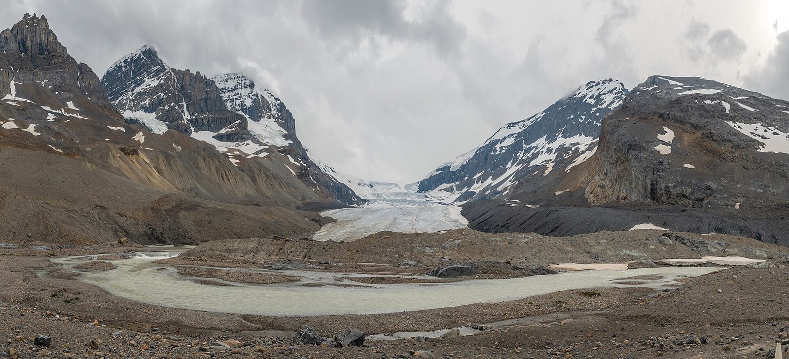
South of Jasper, Highway 93 follows the Athabasca and Sunwapta rivers between two lines of glaciated peaks to the Columbia Icefield, the largest body of ice in the Rocky Mountains. The Athabasca Glacier comes down from it almost to the road. A short, steep trail climbs over bare rock and gravel to a viewpoint near the toe of the ice, passing markers that show where the glacier ended in past decades. It has drawn back more than 0.9 miles (1.5 km) in 125 years.
Do not walk onto the glacier on your own. Crevasses hidden under snow have killed people who stepped past the barriers. Guided ice walks and vehicle tours go onto the ice. It is cold and windy here even in August.
- Distance: 64 miles (103 km) each way from Jasper; about 1.1 miles (1.8 km) round trip on the trail to the toe
- Allow: a full day with stops
- Start: Highway 93 south from Jasper; the trail starts across the road from the Columbia Icefield Discovery Centre
- When: June to September. The road is open in winter but not always passable, and there are no services.
- Suits: everyone by car; most walkers to the viewpoint
3. Stand beside Athabasca Falls
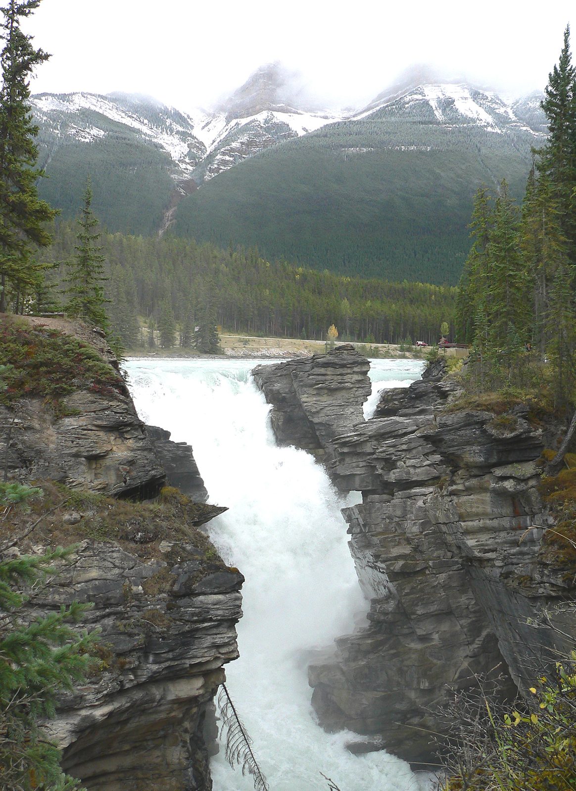
Athabasca Falls is only 75 feet (23 m) high, but the whole Athabasca River goes over it, squeezed into a slot of hard quartzite a few yards wide. Paved paths and bridges take you to the lip, across the gorge and down a flight of steps through an abandoned channel the river cut and then left. The spray reaches the viewing platforms when the river is high in June and July. People who climbed the railings for a photograph have fallen in and died: stay behind them.
- Distance: about half a mile (800 m) of paths
- Allow: 45 minutes
- Start: Athabasca Falls, 19 miles (30 km) south of Jasper beside the Icefields Parkway
- When: all year; fullest in early summer, frozen into blue ice in winter
- Suits: everyone. The upper viewpoints take wheelchairs.
4. Walk the Valley of the Five Lakes
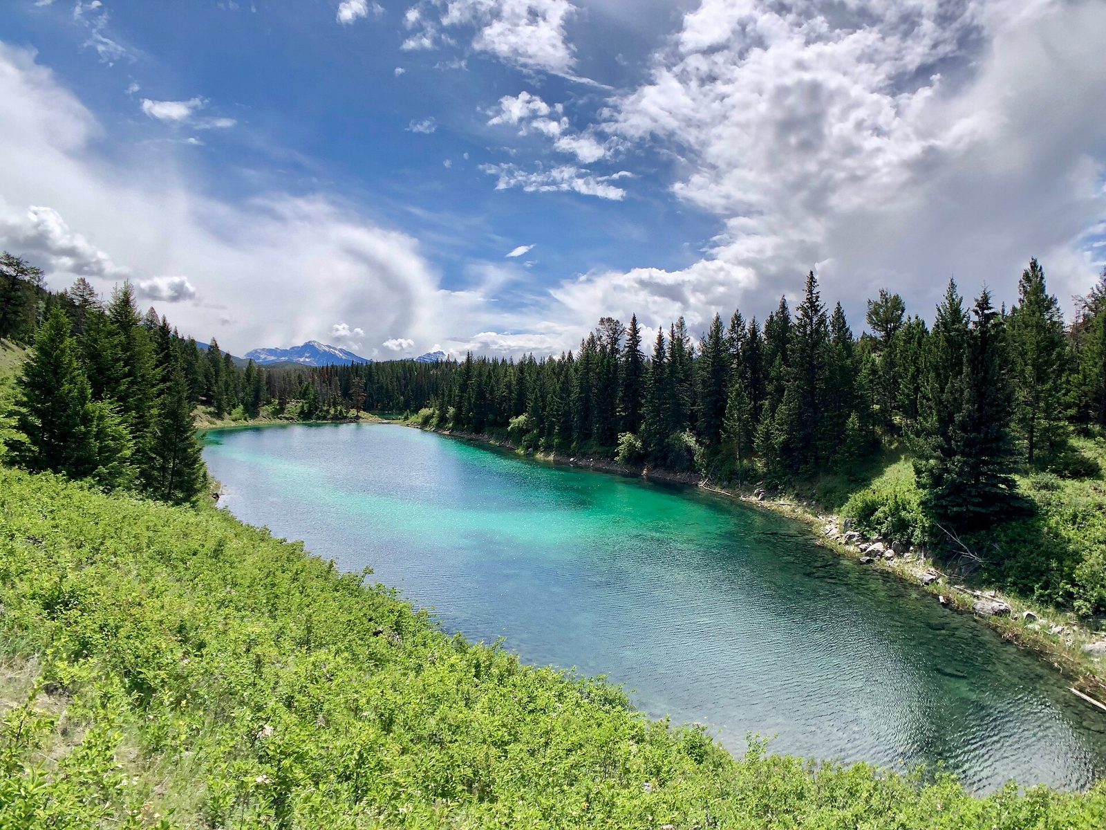
Five small lakes lie in a line along a rocky ridge, each a different shade of jade or blue because each is a different depth. The loop crosses a boardwalk over a creek, climbs a low ridge and passes all five, with a pair of Parks Canada’s red chairs along the way. The 2024 fire burned through here, so the trail now runs through open, blackened forest with fireweed and young growth. There is little shade on a hot day.
- Distance: a loop of 2.8 miles (4.5 km)
- Allow: 1.5 to 2 hours
- Start: Valley of the Five Lakes Trailhead, about 6 miles (9 km) south of Jasper on the Icefields Parkway
- When: May to October
- Suits: families. Stay on the trail: burned trees fall without warning in wind.
5. Walk out to Pyramid Island
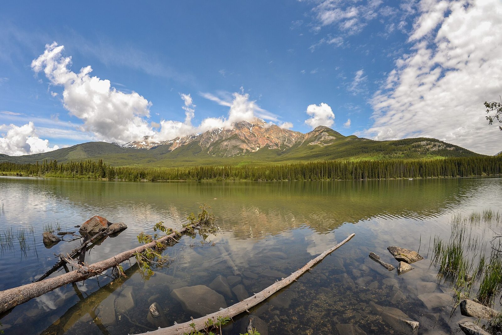
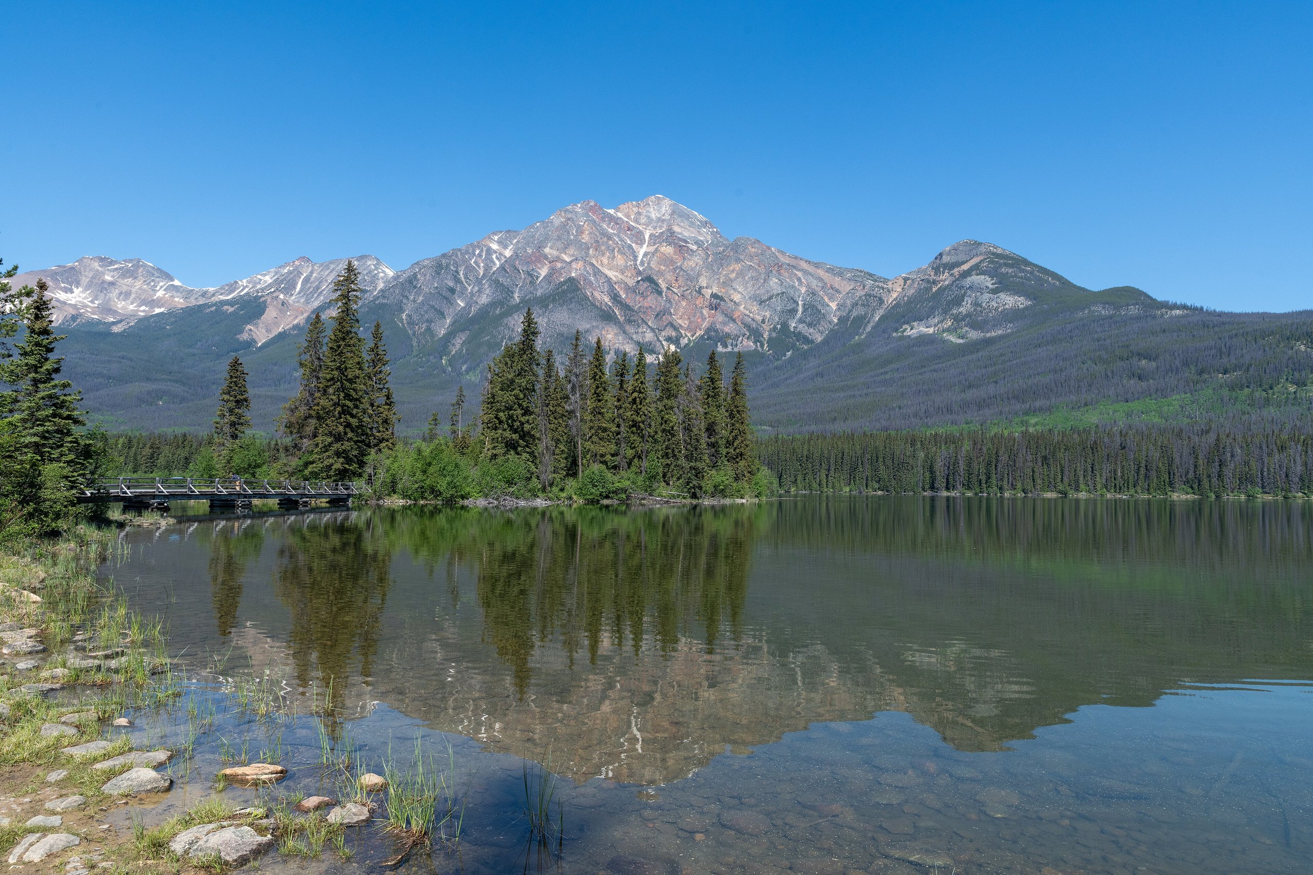
Pyramid Lake sits on a bench above the town under Pyramid Mountain, a 9,076-foot (2,766 m) peak of reddish quartzite. A wooden footbridge leads to a small island with a picnic shelter and benches, and the view from it of the mountain reflected in the lake is the classic sunrise picture in Jasper. Canoes, kayaks and paddleboards are rented at the lake, and trails loop through the forest behind it. In winter the lake is cleared for skating.
- Distance: a few hundred yards to the island
- Allow: 1 hour; half a day with a paddle
- Start: Pyramid Lake Road, about 4 miles (7 km) from the town
- When: all year; early morning for still water
- Suits: everyone. The bridge and island take wheelchairs.
6. Soak at Miette Hot Springs
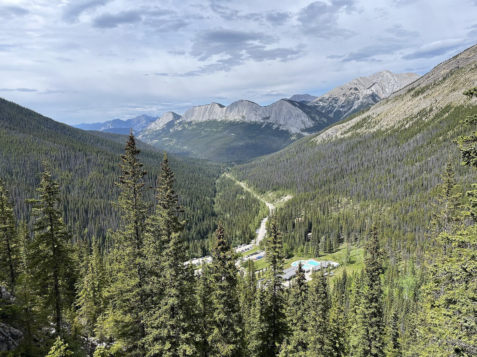
The springs at Miette are the hottest in the Canadian Rockies, about 129°F (54°C) where they come out of the mountain, cooled to about 104°F (40°C) for two outdoor pools that look down the Fiddle River valley. The road in climbs for 11 miles (17 km) through a narrow valley where bighorn sheep are often on the road. For a hike first, the Sulphur Skyline Trail starts beside the pools and climbs steeply to a bare summit with a view over ranges on every side.
- Distance: 38 miles (61 km) from Jasper by road; the Sulphur Skyline is 5 miles (8 km) round trip with about 2,300 feet (700 m) of climbing
- Allow: half a day; a full day with the hike
- Start: Miette Road, off Highway 16 east of Jasper
- When: about mid-May to mid-October. The pools and the road close for winter.
- Suits: everyone at the pools; fit hikers on the skyline
7. Ride the SkyTram up The Whistlers
The Jasper SkyTram is the highest and longest aerial tramway in Canada. In about seven minutes it lifts you from the valley to 7,472 feet (2,277 m) on The Whistlers, above the treeline, with the town, the Athabasca valley and, on a clear day, Mount Robson in view. From the upper station a rough trail climbs about 630 feet (193 m) more to the true summit at 8,100 feet (2,470 m). The mountain is named for the hoary marmots that whistle from its rocks. Bring a warm jacket: the top is far colder and windier than the town.
- Distance: about 1.7 miles (2.8 km) round trip from the upper station to the summit
- Allow: 2 to 3 hours
- Start: Whistlers Road, about 4 miles (7 km) south of the town
- When: about late March to October
- Suits: everyone to the upper station; the summit trail is steep and loose
8. Stop at Sunwapta Falls
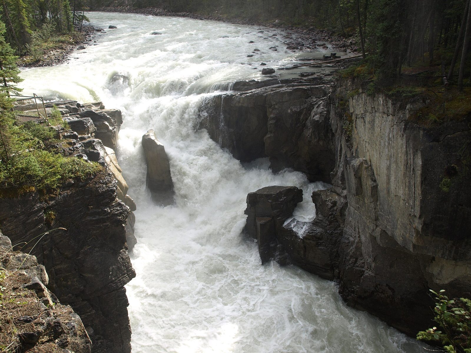
Farther down the Icefields Parkway, the Sunwapta River turns sharply and drops into a limestone gorge around a small island of spruce. The upper falls are a minute from the parking area, with a footbridge straight over the gorge. Few people walk on to the lower falls, a set of three drops reached by a forest trail that descends beside the canyon.
- Distance: at the roadside for the upper falls; about 1.7 miles (2.8 km) round trip to the lower falls
- Allow: 20 minutes, or 1 hour with the lower falls
- Start: Sunwapta Falls Road, 34 miles (55 km) south of Jasper on the Icefields Parkway
- When: May to October; fullest in early summer
- Suits: everyone
9. Look up after dark
Jasper has been a Dark Sky Preserve since 2011, one of the largest in the world that people can easily reach, with rules that keep artificial light down across the park. On a clear, moonless night the Milky Way is plain to the naked eye a few minutes from town, and in autumn and winter the northern lights appear from time to time. Pyramid Island, the shore of Maligne Lake and the Athabasca Glacier area are all used for stargazing. The park holds a dark sky festival each October.
- Allow: an evening
- Start: Pyramid Island, or any pullout away from the town’s lights
- When: September to April for long, dark nights; around the new moon
- Suits: everyone. Dress for standing still, and use a red light.
10. Come in winter
From November to April the park is quiet and cold, with temperatures that can drop below −22°F (−30°C). Marmot Basin, the ski area 20 minutes from town, has long runs and short lift lines by Rockies standards. Cross-country ski trails are set near the town and at Maligne Lake, the lakes are cleared for skating, and elk and bighorn sheep come down to the valley roads. Driving the Icefields Parkway in winter is for prepared drivers only: it is not always ploughed promptly, has no fuel or phone coverage, and requires winter tires.
- Allow: two days or more
- Start: the town of Jasper
- When: December to March for the most dependable snow
- Suits: skiers of every level, and visitors who want the park without crowds
Before you go
This list covers what stays the same from year to year. Fire-recovery closures, road conditions and bear warnings change, and Parks Canada posts them on its own site. The link is on our Jasper National Park guide, with the map, passes and how to get there.