

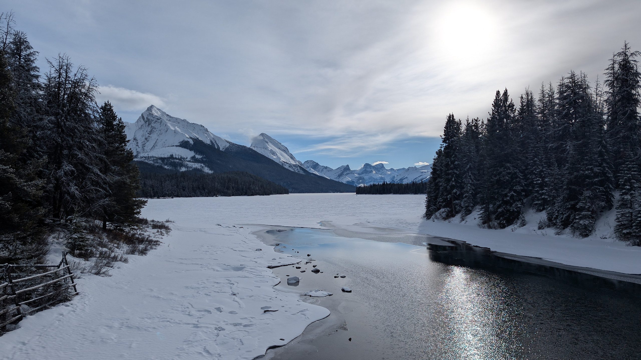
Jasper National Park
Jasper is the wild heart of the Canadian Rockies, at 4,197 square miles (10,870 km²), the largest national park in the range, and one of the world’s great dark-sky preserves. Towering peaks, more than 250 glaciers, over 5,000 lakes and ponds, and 1,550 miles (2,500 km) of trail make it a place to lose yourself for a day or a week, with grizzlies on the meadows and a night sky that blazes.
Fast facts
- Established: 1907 (renamed Jasper in 1930)
- Size: 4,197 square miles (10,870 km²), the largest park in the Canadian Rockies
- Glaciers: more than 250, fed by the Columbia Icefield
- Water: over 5,000 lakes and ponds, including Maligne Lake
- World Heritage: part of the Canadian Rocky Mountain Parks UNESCO site
- Managed by: Parks Canada
The landscape
Jasper is a study in geological force. Jagged peaks such as Mount Edith Cavell pierce the skyline while ancient glaciers cling to the heights and slowly carve the valleys below. The Athabasca River winds through canyons and over falls, the Columbia Icefield feeds waterways in every direction, and Maligne Lake, the largest natural lake in the Canadian Rockies, glows glacial turquoise. Old-growth forest gives way to subalpine and alpine meadows that erupt with summer wildflowers.
Best time to go
Summer (June to August) brings the warmest weather, fully open trails and every facility running, at the cost of crowds and advance-booking pressure. September is the standout, fewer people, golden aspens, and the September elk rut, while November through April turn Jasper into a snowy world of skiing, snowshoeing and ice walks with temperatures that can drop below −22°F (−30°C). Spring is unpredictable, with powerful waterfalls and some trails still closed.
Getting there and around
Most visitors drive in on the Yellowhead Highway (Hwy 16) from Edmonton, roughly four hours, or take the spectacular Icefields Parkway (Hwy 93) north from Banff. Jasper’s small airport has limited service, so Edmonton and Calgary are the usual gateways with shuttle and rental options. A personal vehicle is most practical inside the park, though local transit, tour shuttles and a bike-friendly townsite cover the essentials in summer.
Things to do
Take a boat tour on Maligne Lake to iconic Spirit Island, walk on the Athabasca Glacier at the Columbia Icefield, or hike Maligne Canyon’s gorge trails and suspension bridges. Classic hikes include the Skyline Trail through alpine meadows and the challenging Edith Cavell Ridge. Wildlife viewing turns up grizzlies, black bears, elk, moose, caribou and bighorn sheep, and after dark the Dark Sky Preserve delivers world-class stargazing. Winter adds cross-country skiing, ice walking and dog sledding.
Staying safe
This is real bear country: keep at least 330 feet (100 m) from bears and wolves, carry bear spray and know how to use it, make noise on the trail, and store food in provided lockers. Mountain weather changes rapidly, so pack layers, rain gear and sun protection and start hikes early to beat afternoon storms. Glacial rivers run cold and fast, wear a life jacket when boating and never swim in strong currents, and tell someone your plans, since cell service is limited to absent in most of the park.
Know before you go
A Parks Canada Discovery Pass is required for entry, and backcountry camping needs a separate permit bookable months ahead. Campgrounds and popular lodges fill early, so reserve well in advance. Respect the traditional territory of the Stoney Nakoda, Métis and other Indigenous peoples. This page is a general overview, not a live conditions report; confirm current pricing, closures and permits with Parks Canada before your trip.
- Coordinates
- 52.8041, -118.1702
- Magnetic declination
- 15.1° E (2026)
Set this declination on your compass, then align it to the map's north lines; it is the angle between true north and magnetic north, refreshed each year.
A spread of the park’s main places shows straight away, and the rest appear as you zoom in. You can also search above, or pick any place from the lists below, and the map will go to it.
Getting there 7
Park entrances
Airstrip
Ranger stations
On the trail 52
Trailheads
Campgrounds
Hut or shelters
Picnic sites
Sights 106
Viewpoints
Waterfalls
Beach
Heritage sites
Point of interests
Islands
Peaks 30
Map data comes from third-party sources and may be incomplete or out of date, so carry a current official map (terms).
- Best seasons
- Summer, Early fall (shoulder)
- Difficulty
- Easy to strenuous
- Access / trailheads
- Reach Jasper via the Yellowhead Highway (Hwy 16) from Edmonton or the Icefields Parkway (Hwy 93) from Banff. A personal vehicle is most practical; local transit and shuttles serve the townsite and major sites in summer.
- Water
- Abundant lakes, rivers and streams; filter or treat all backcountry water.
- Cell / satellite coverage
- Limited or no cell service outside the townsite. Carry a map and a satellite messenger, and download maps before you go.
- Nearest ranger / SAR / emergency
- Jasper Dispatch (24/7): 1-780-852-3100; life-threatening emergencies: 911.
- Permits & regulations
- A Parks Canada Discovery Pass is required for entry; backcountry camping needs a separate permit booked months ahead, and some activities require additional bookings.
- Leave No Trace
- Use bear-proof storage, pack out all trash, stay on trail to protect alpine vegetation, and follow Leave No Trace.
January
- Below freezing all day
- Avalanche terrain
February
- Below-freezing nights
- Avalanche terrain
March
- Below-freezing nights
- Avalanche terrain
April
- Below-freezing nights
- Avalanche terrain
May
June
July
August
September This month
October
- Below-freezing nights
- Avalanche terrain
November
- Below-freezing nights
- Avalanche terrain
December
- Below freezing all day
- Avalanche terrain
What to bring depends on your trip: how long you’re out, where you sleep, and how far you go from the road. The planner builds the list for yours.
Plan a trip here →Averages for 1981–2010 from Environment Canada climate normals, measured at the Jasper East Gate station, 37 miles (60 km) away at 3,290 feet (1,003 m). Conditions change with elevation: expect it colder higher up.