

Big Bend National Park
Big Bend is Texas on a grand, lonely scale, a sweep of Chihuahuan Desert wrapped around the forested Chisos Mountains and bounded by the Rio Grande, whose canyons mark the border with Mexico. Remote and vast, with some of the darkest skies in North America, it rewards those who make the long drive with desert, mountain and river all in one enormous, quiet park.
Fast facts
- Established: 1944
- Size: about 801,000 acres (3,240 km²) in far west Texas
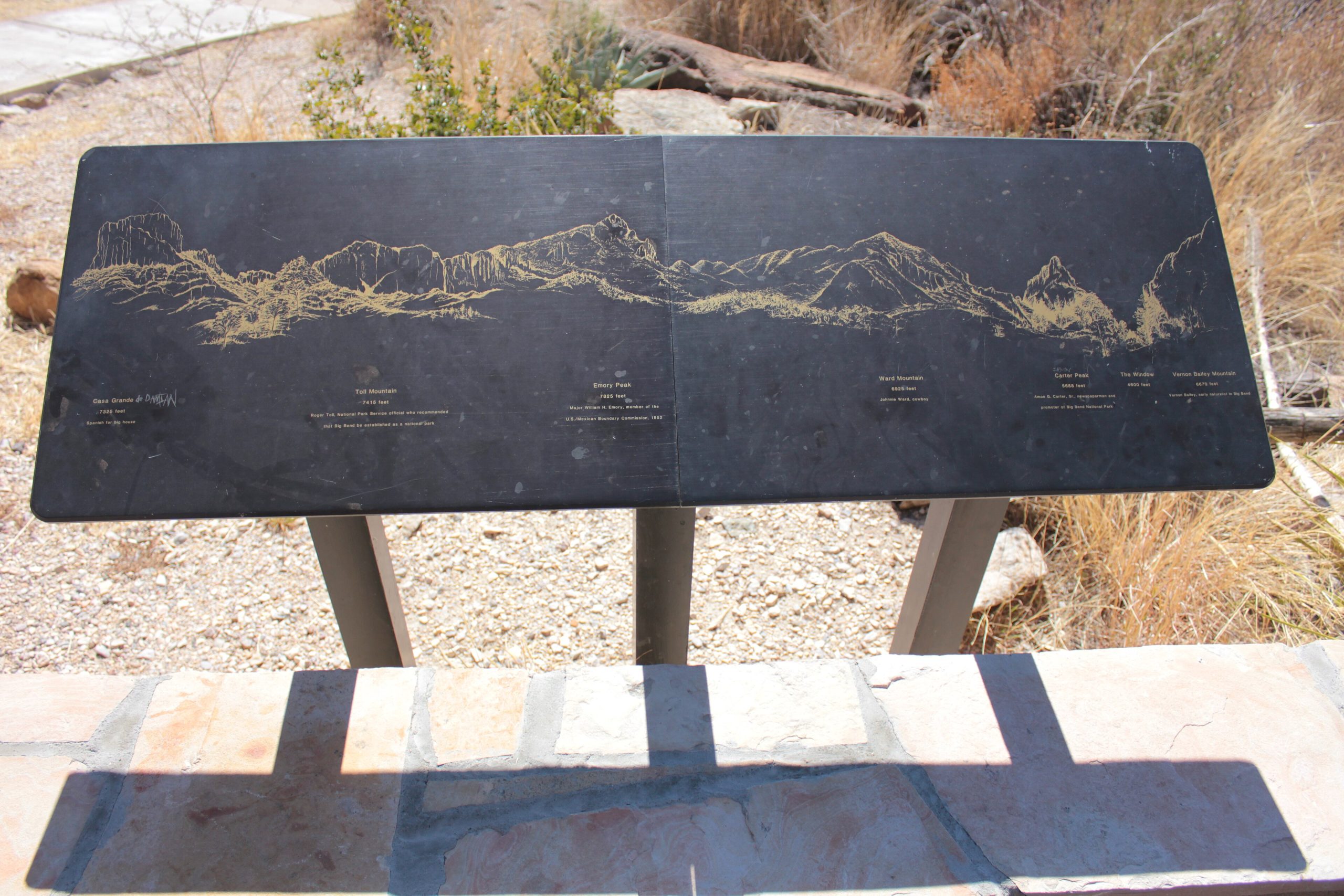
- Range: desert floor to the 7,832-foot (2,387 m) Emory Peak in the Chisos
- River: 118 miles (190 km) of the Rio Grande and its canyons
- Dark sky: a certified International Dark Sky Park with exceptional stargazing
- Managed by: National Park Service
The landscape
Three landscapes meet here: the vast Chihuahuan Desert of creosote and cactus, the wooded “sky island” of the Chisos Mountains rising cool and green above it, and the Rio Grande carving deep limestone canyons like Santa Elena. This variety supports remarkable biodiversity, javelina, black bears and mountain lions in the Chisos, roadrunners and rattlesnakes below, and over 450 bird species.
Best time to go
Late fall through early spring is the prime season, with mild days ideal for hiking and rafting. Summer is brutally hot on the desert floor, though the higher Chisos stay cooler; monsoon storms arrive in late summer. Winter is pleasant by day and cold at night, with the fewest crowds.
Getting there and around
Big Bend is genuinely remote, reached via US-385 or TX-118 with the nearest full services well outside the park. A vehicle is essential, and distances between the desert, the Chisos Basin and the river are long, so fuel up and carry supplies. Some backcountry roads require high clearance.
Things to do
Hike the Chisos high country on the Window and Lost Mine trails or the South Rim loop, walk into Santa Elena Canyon, and soak at the Rio Grande hot springs. Raft or canoe the river’s canyons on a permitted trip, drive the scenic Ross Maxwell route, and stay up for world-class stargazing after dark.
Staying safe
Desert heat and dehydration are the leading dangers, so carry far more water than you think you need, hike early, and rest in shade at midday. Watch for flash floods in canyons and washes, fuel and supply up before the long remote drives, and give rattlesnakes and javelina room.
Know before you go
A park pass is required, and backcountry camping and river trips need permits. Come prepared for remoteness. Carry water, fuel and supplies. This page is a general overview, not a live conditions report; always confirm current conditions, road status and permits with the National Park Service before your trip.
- Coordinates
- 29.3332, -103.3108
- Magnetic declination
- 5.9° E (2026)
Set this declination on your compass, then align it to the map's north lines; it is the angle between true north and magnetic north, refreshed each year.
A spread of the park’s main places shows straight away, and the rest appear as you zoom in. You can also search above, or pick any place from the lists below, and the map will go to it.
Getting there 3
Park entrances
Ranger station
On the trail 42
Trailheads
Campgrounds
Sights 75
Viewpoints
Waterfalls
Heritage sites
Peaks 30
Map data comes from third-party sources and may be incomplete or out of date, so carry a current official map (terms).
- Best seasons
- Late fall, Winter, Early spring
- Difficulty
- Easy to strenuous
- Access / trailheads
- In far west Texas on the Rio Grande, reached via US-385 or TX-118; it is remote, with the nearest towns and services well outside the park.
- Water
- Carry ample water; developed areas have some, but the desert and river corridor demand you bring your own.
- Cell / satellite coverage
- Little to no cell service. Carry a map and share your plans.
- Nearest ranger / SAR / emergency
- Contact park rangers; life-threatening emergencies: 911 (help can be far off).
- Permits & regulations
- Per-vehicle entry fee (America the Beautiful pass accepted); backcountry camping and river trips require permits from the park.
- Leave No Trace
- Stay on trails and roads, pack out all waste, protect desert soils and the river, and follow Leave No Trace.
January
February
March
April
May
June
- Hot days
July
- Hot days
August
- Hot days
September This month
October
November
December
What to bring depends on your trip: how long you’re out, where you sleep, and how far you go from the road. The planner builds the list for yours.
Plan a trip here →Averages for 1991–2020 from NOAA U.S. Climate Normals, measured at the Panther Junction station, 8 miles (13 km) away at 3,740 feet (1,140 m). Conditions change with elevation: expect it colder higher up.