

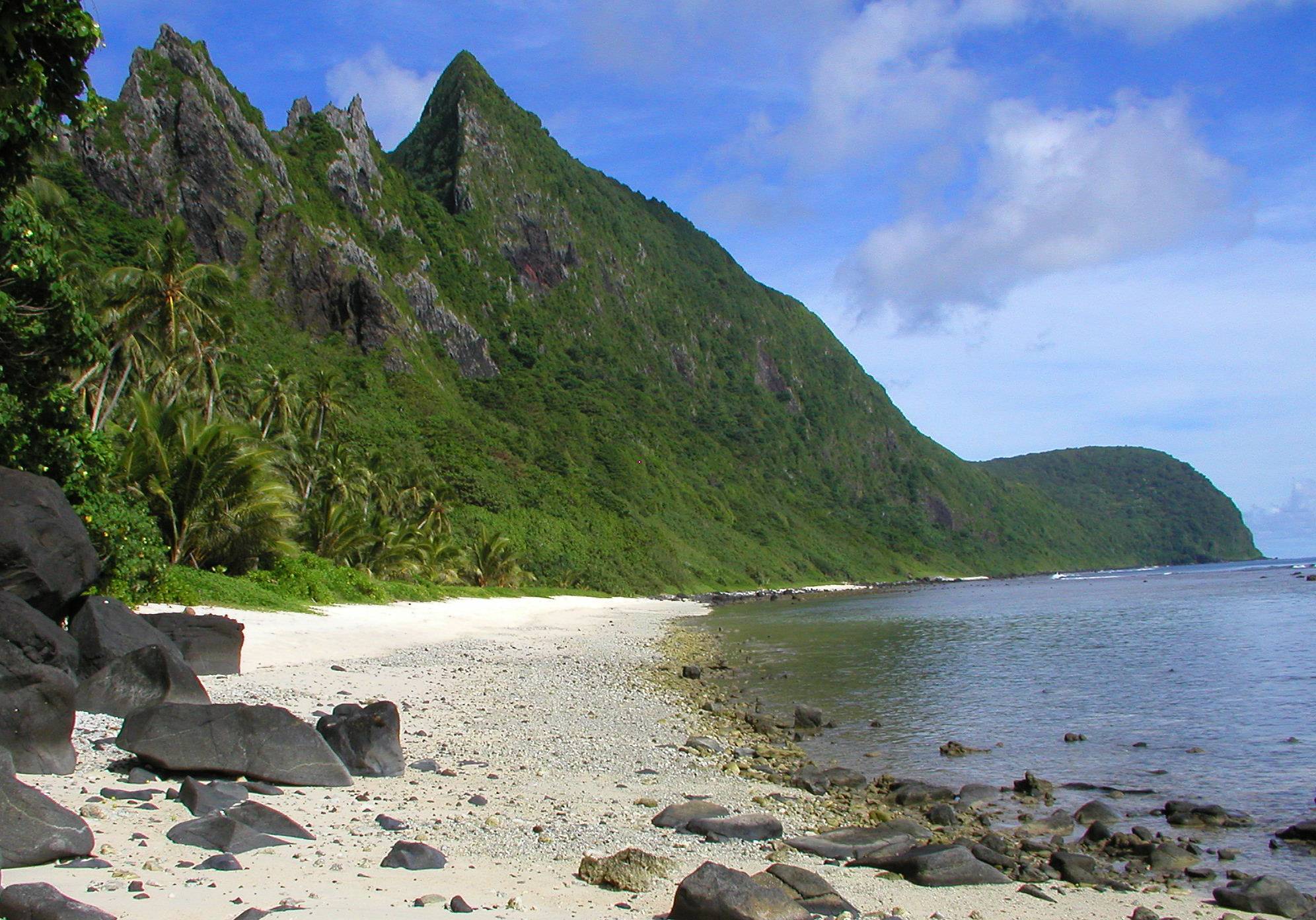
American Samoa National Park
The National Park of American Samoa is the only U.S. national park south of the equator, a scatter of paleotropical rainforest, coral reef and volcanic coastline across three remote South Pacific islands. Unusually, the land isn’t owned by the federal government; it is leased from the Samoan villages who have lived here for 3,000 years, so a visit blends pristine wilderness with a living culture, nearly 2,600 miles (4,200 km) southwest of Hawaii.
Fast facts
- Established: 1988
- Size: about 14 square miles (36 km²) across three island units, much of it coral reef
- Islands: Tutuila, Taʻū and Ofu, plus a shoreline and reef
- Fee: free to enter
- Distinction: the only U.S. national park south of the equator
- Managed by: National Park Service, in partnership with Samoan villages
The landscape
This is a park of ocean depths and cloud forests in one small footprint. Coral reefs and littoral vegetation give way to tropical rainforest climbing steep volcanic ridges, with sea cliffs that stairstep more than 3,000 feet (900 m) to the summit of Lata Mountain on Taʻū, among the tallest sea cliffs in the world. Nearly as much of the park lies underwater as above it, making it a rare pairing of terrestrial and marine protected ecosystems, right down to white-sand beaches on Ofu.
Best time to go
American Samoa has two tropical seasons: a wet season of heavy rain and humidity, and a drier, slightly cooler season. The best window is June to August, within the broader dry season of May to October, when temperatures run 75–84°F (24–29°C) and trails stay firmer. The park is open year-round, but some services run reduced hours in the wet season, so check ahead.
Getting there and around
Access is by air and sea, with the main gateway at Pago Pago International Airport on Tutuila, where the park headquarters sits. Flights connect from Honolulu about twice a week, a journey of roughly 5.5 hours, and smaller flights reach the Taʻū and Ofu units. Plan travel well ahead and stay flexible, as weather can affect flight and boat schedules; on Tutuila you get around by car.
Things to do
Hiking through rainforest ranges from gentle strolls to steep climbs to ridgeline viewpoints and secluded beaches. Snorkeling the vibrant reefs, the south coast of Tutuila is a highlight, is a must, and wildlife includes fruit bats, seabirds and abundant marine life. Cultural experiences are woven throughout: learning the Faʻasamoa way of life, watching a traditional umu earth-oven cooking demonstration, and taking in the great sea cliffs at Siʻu Point on Taʻū.
Staying safe
Check marine and weather forecasts before any outing, as tropical conditions shift fast, and be cautious near the coast where currents can be strong and unpredictable. Stay on designated trails to avoid injury and protect the fragile ecosystem, carry plenty of water and sun protection against the heat and humidity, and don’t fly drones. When visiting villages and cultural sites, dress modestly and ask permission before photographing people. The remote location means limited emergency services, so be self-sufficient and share your plans.
Know before you go
The park is free, but flights, lodging and food are limited and can be costly given the remoteness, so budget accordingly. American Samoa uses the U.S. dollar, and both English and Samoan are spoken. Above all, remember this is living land belonging to the Samoan people, learn about Faʻasamoa and respect local customs. This page is a general overview, not a live conditions report; confirm current conditions, flights and village access with the National Park Service before your trip.
- Coordinates
- -14.2258, -170.0727
- Magnetic declination
- 12.1° E (2026)
Set this declination on your compass, then align it to the map's north lines; it is the angle between true north and magnetic north, refreshed each year.
A spread of the park’s main places shows straight away, and the rest appear as you zoom in. You can also search above, or pick any place from the lists below, and the map will go to it.
Getting there 2
Airstrips
On the trail 1
Trailhead
Sights 57
Beachs
Heritage site
Islands
Peaks 30
Map data comes from third-party sources and may be incomplete or out of date, so carry a current official map (terms).
- Best seasons
- Dry season (June to August; May to October)
- Difficulty
- Easy to strenuous
- Access / trailheads
- Fly into Pago Pago (PPG) on Tutuila from Honolulu (about 5.5 hours), where the park headquarters sits. Smaller flights reach the Taʻū and Ofu units. On Tutuila, travel by car.
- Water
- Carry bottled or treated water; potable water can be limited on the outer islands.
- Cell / satellite coverage
- Cell service is limited in many areas. Plan ahead and share your itinerary.
- Nearest ranger / SAR / emergency
- Contact the park visitor center in Pago Pago; emergency services are limited given the remote location.
- Permits & regulations
- Free to enter. The park land is leased from Samoan villages, so respect local customs and any village access rules; drones are prohibited.
- Leave No Trace
- Stay on trails, don’t touch coral, respect village land and customs, no drones, and follow Leave No Trace.
January
February
March
April
May
June
July
August
September This month
October
November
December
What to bring depends on your trip: how long you’re out, where you sleep, and how far you go from the road. The planner builds the list for yours.
Plan a trip here →Averages for 1991–2020 from NOAA U.S. Climate Normals, measured at the Pago Pago Airport station, 43 miles (70 km) away at 12 feet (4 m). Conditions change with elevation: expect it colder higher up.