

Thaidene Nëné National Park Reserve
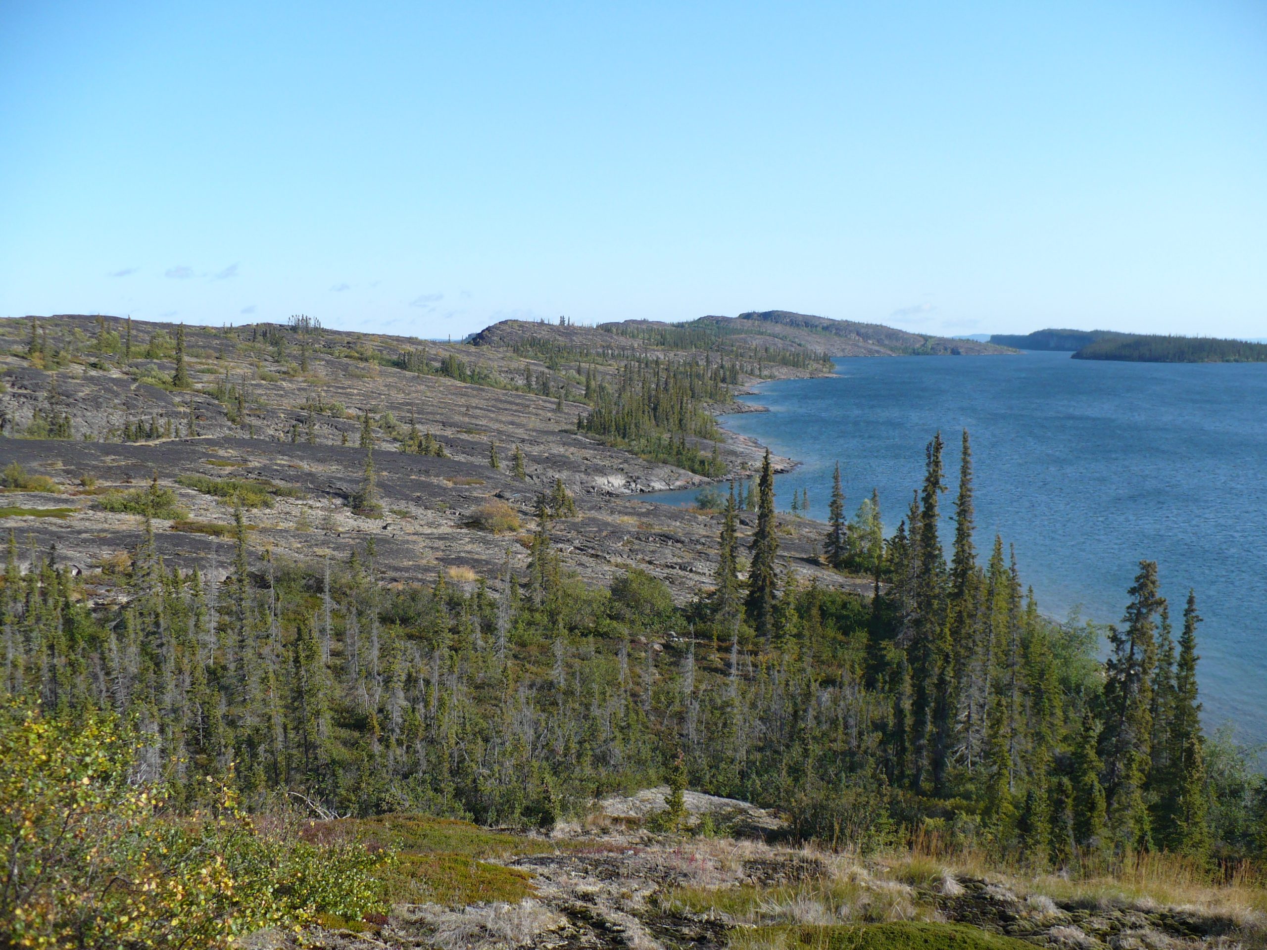
Thaidene Nëné, “Land of the Ancestors” in Denesǫłıné, protects a magnificent transition zone at the east arm of Great Slave Lake, where the northern boreal forest gives way to the open tundra of the Barrenlands. Co-managed with the Łutsël K’e Dene, it is a vast, pristine wilderness of deep clear lakes, waterfalls and wildlife, and a landmark in Indigenous-led conservation.
Fast facts
- Established: 2019, as a national park reserve
- Size: about 5,432 square miles (14,070 km²) at the east arm of Great Slave Lake
- Landscape: the boreal forest–to–tundra transition (taiga and Barrenlands)
- Water: the deep, clear east arm of Great Slave Lake and countless rivers
- Gateway: Łutsël K’e, Northwest Territories (fly-in/boat)
- Managed by: Parks Canada, with the Łutsël K’e Dene First Nation
The landscape
The park straddles the treeline, ancient Canadian Shield rock, spruce forest, and the beginning of the open Barrenlands, around the spectacular east arm of Great Slave Lake, one of the deepest lakes in North America, ringed by cliffs, islands and waterfalls. It shelters barren-ground caribou, moose, grizzly and black bears, wolves, and the fish-rich waters that have sustained the Dene for generations.
Best time to go
The short northern summer is the season for paddling, boating and hiking, when the lakes are ice-free and the land is (briefly) mild, though cold snaps, storms and bugs are all part of the experience. Outside summer the region locks down in cold and darkness, so trips are planned for the warm-weather window.
Getting there and around
There are no roads. Access is by float plane or boat, typically from Yellowknife or the community of Łutsël K’e, and travel within is by canoe, kayak, boat or on foot. Most visitors travel with local Indigenous outfitters, whose knowledge of the land and water is central to a safe and meaningful visit.
Things to do
Paddle and boat the island-studded east arm and its rivers, hike the Shield and tundra, and fish the legendary lake-trout waters. Wildlife and bird watching, visiting waterfalls, and learning from Dene guides about the land, its stories and its stewardship are at the heart of the Thaidene Nëné experience.
Staying safe
Great Slave Lake is big, cold water where storms rise fast, so boating and paddling demand skill, cold-water gear and weather patience. Grizzly and black bears range the land, the wilderness is remote with no services, and rivers run cold. Carry a satellite communicator, store food properly, and lean on your outfitter’s expertise.
Know before you go
A Parks Canada pass and registration are required, access is by air or boat, and most visitors travel with local outfitters. Plan well ahead. This page is a general overview, not a live conditions report; always confirm current access, conditions and options with Parks Canada before your trip.
- Coordinates
- 62.8491, -108.7441
- Magnetic declination
- 12.0° E (2026)
Set this declination on your compass, then align it to the map's north lines; it is the angle between true north and magnetic north, refreshed each year.
A spread of the park’s main places shows straight away, and the rest appear as you zoom in. You can also search above, or pick any place from the lists below, and the map will go to it.
Getting there 4
Airstrips
Sights 5
Waterfalls
Heritage site
Islands
Map data comes from third-party sources and may be incomplete or out of date, so carry a current official map (terms).
- Best seasons
- Summer (fly-in/boat, guided)
- Difficulty
- Strenuous (remote wilderness)
- Access / trailheads
- At the east arm of Great Slave Lake in the Northwest Territories, near Łutsël K’e. Access is by float plane or boat, typically from Yellowknife or the community; there are no roads.
- Water
- Abundant lakes and rivers; filter or treat all water.
- Cell / satellite coverage
- No cell service. Carry a satellite communicator and file a plan.
- Nearest ranger / SAR / emergency
- Coordinate through Parks Canada and Łutsël K’e; response is limited.
- Permits & regulations
- A Parks Canada pass and registration are required; access is by float plane or boat, and most visitors travel with local Indigenous outfitters.
- Leave No Trace
- Pack out everything, respect Dene heritage, and follow strict Leave No Trace.
January
- Below freezing all day
February
- Below freezing all day
March
- Below freezing all day
April
- Below-freezing nights
May
- Below-freezing nights
June
July
August
September This month
October
- Below-freezing nights
November
- Below freezing all day
December
- Below freezing all day
What to bring depends on your trip: how long you’re out, where you sleep, and how far you go from the road. The planner builds the list for yours.
Plan a trip here →Averages for 1981–2010 from Environment Canada climate normals, measured at the Yellowknife Airport station, 183 miles (294 km) away at 675 feet (206 m). That is the nearest station with long-term records, so treat these as a regional guide.