

Wood Buffalo National Park
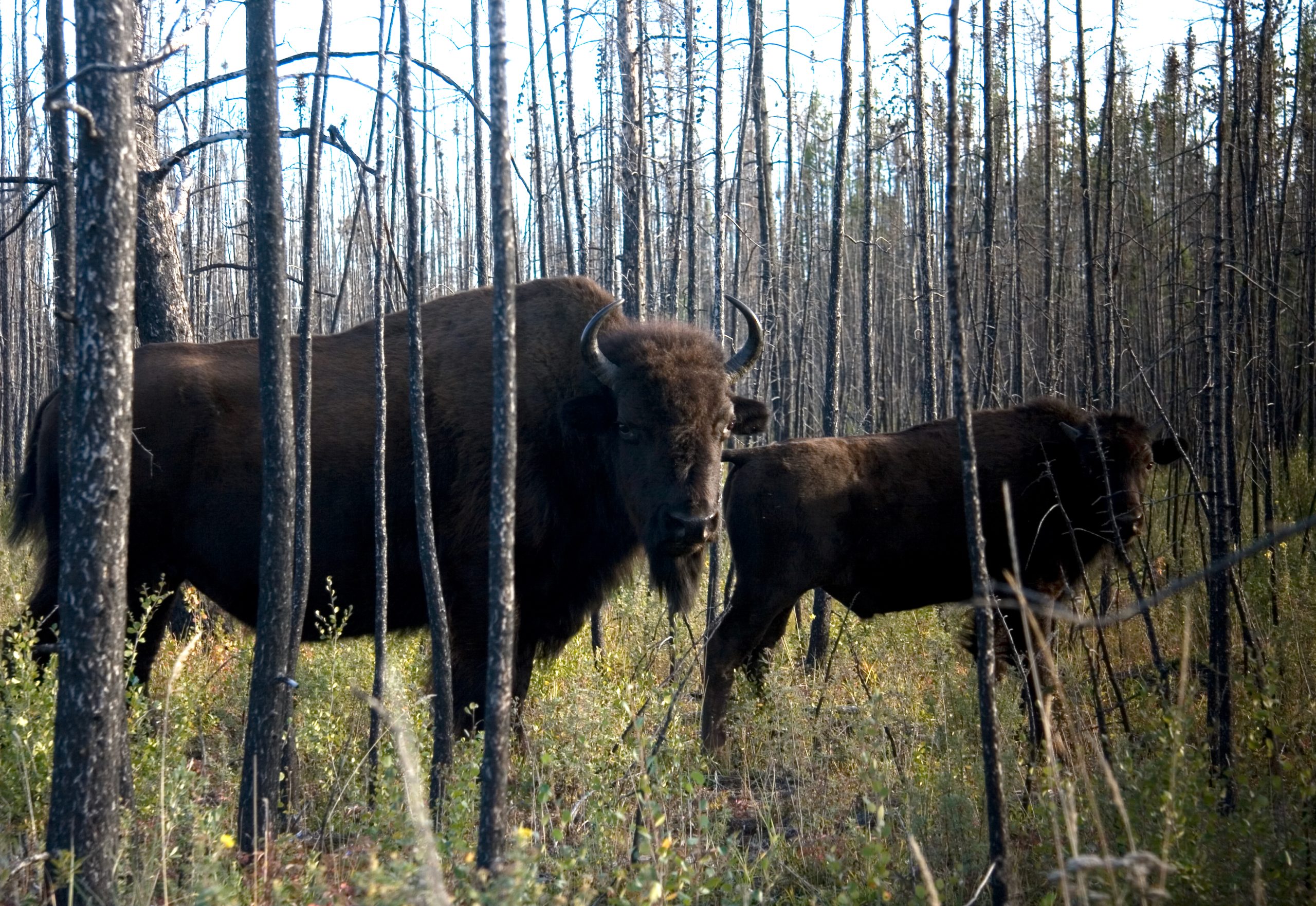
Wood Buffalo is Canada’s largest national park and the world’s largest Dark Sky Preserve, more than 17,000 square miles (44,000 km²) of boreal wilderness straddling northeastern Alberta and the southern Northwest Territories. Established in 1922 to protect free-roaming bison, it now safeguards half the world’s wood bison, the only natural nesting grounds of the whooping crane, and the vast Peace-Athabasca Delta. With around 5,000 visitors a year, it offers solitude on a scale few places can match.
Fast facts
- Established: 1922, Canada’s largest national park
- Size: about 17,275 square miles (44,741 km²) of boreal forest, plains and wetland
- World Heritage: a UNESCO World Heritage Site for its natural value
- Dark sky: the world’s largest Dark Sky Preserve
- Wildlife: North America’s largest wild bison herd and the endangered whooping crane
- Managed by: Parks Canada
The landscape
Wood Buffalo is a mosaic of boreal forest, rolling plains, rivers, wetlands and the remarkable Peace-Athabasca Delta. Its oddities are famous, the Grosbeak Lake boulder field, the strange salt plains, and Pine Lake with its white-sand beaches and warm aquamarine water. The terrain ranges from near-tundra in the north to lush river valleys, supporting an extraordinary diversity of plant and animal life, and it protects the traditional territories of several Indigenous nations.
Best time to go
Late spring through summer (May to September) is the most popular window, with temperatures from the high teens into the high 20s°C, open trails and accessible campsites; Pine Lake Campground typically runs from the Victoria Day long weekend through Labour Day. Winter, by contrast, is the season for the northern lights (the Dark Sky Preserve makes it one of the best aurora-viewing places on Earth), though the cold is extreme and access to areas like Fort Chipewyan is limited.
Getting there and around
Reaching Wood Buffalo takes planning. All-weather road access runs via the Mackenzie Highway to Highway 5 near Hay River, NT, into Fort Smith, mostly hard-packed gravel, so prepare for rough driving. Many visitors instead fly into Fort Smith, the park headquarters, and rent a vehicle. There is no all-weather road to Fort Chipewyan, which requires air travel, and inside the park a vehicle is essential given the vast distances.
Things to do
Wildlife viewing tops the list: wood bison herds, whooping cranes in nesting season, plus moose, wolves, bears and countless birds. As the world’s largest Dark Sky Preserve, the park offers unrivalled stargazing and aurora viewing. Beyond that, hike varied trails from boulder fields to river valleys, paddle the Peace-Athabasca Delta or swim at Pine Lake’s warm beach, wander the salt plains near Grosbeak Lake, and explore the historic community of Fort Smith.
Staying safe
Wood bison are the park’s signature animal and its most underestimated hazard. Keep a wide distance, as they are large, fast and unpredictable. Carry bear spray, store food securely, and stay alert for bears and wolves. Summer insects can be intense, so bring repellent and cover up, and treat the remote gravel roads with care by carrying a spare, extra fuel and supplies. On the delta, respect changing water levels and paddle within your ability.
Know before you go
This is one of Canada’s most remote parks, so come self-reliant: carry a satellite messenger, leave a trip plan, and expect little or no cell service outside Fort Smith. Reserve camping ahead, plan fuel and supplies around the long distances, and check seasonal access before you commit. This page is a general overview, not a live conditions report; confirm current road conditions, closures and reservations with Parks Canada before your trip.
- Coordinates
- 59.3840, -113.3191
- Magnetic declination
- 14.5° E (2026)
Set this declination on your compass, then align it to the map's north lines; it is the angle between true north and magnetic north, refreshed each year.
A spread of the park’s main places shows straight away, and the rest appear as you zoom in. You can also search above, or pick any place from the lists below, and the map will go to it.
On the trail 2
Campground
Picnic site
Sights 3
Viewpoint
Island
Peak
Map data comes from third-party sources and may be incomplete or out of date, so carry a current official map (terms).
- Best seasons
- Summer (May to September), Winter (aurora)
- Difficulty
- Easy to moderate
- Access / trailheads
- All-weather road access via the Mackenzie Highway to Highway 5 near Hay River, NT, then into Fort Smith (mostly hard-packed gravel). Many visitors fly into Fort Smith; Fort Chipewyan has no all-weather road.
- Water
- Abundant rivers, lakes and delta waterways; filter or treat all water.
- Cell / satellite coverage
- Cell service is limited to absent outside Fort Smith. Carry a satellite messenger and leave a trip plan.
- Nearest ranger / SAR / emergency
- Parks Canada / Fort Smith dispatch; life-threatening emergencies: 911.
- Permits & regulations
- No standard entry fee; camping requires a reservation. Pine Lake Campground typically runs from the Victoria Day long weekend through Labour Day.
- Leave No Trace
- Keep well back from bison, pack out all waste, protect the fragile delta and salt plains, and follow Leave No Trace.
January
- Below freezing all day
February
- Below freezing all day
March
- Below freezing all day
April
- Below-freezing nights
May
June
July
August
September This month
October
- Below-freezing nights
November
- Below freezing all day
December
- Below freezing all day
What to bring depends on your trip: how long you’re out, where you sleep, and how far you go from the road. The planner builds the list for yours.
Plan a trip here →Averages for 1981–2010 from Environment Canada climate normals, measured at the Fort Smith Airport station, 65 miles (104 km) away at 673 feet (205 m). That is the nearest station with long-term records, so treat these as a regional guide.