

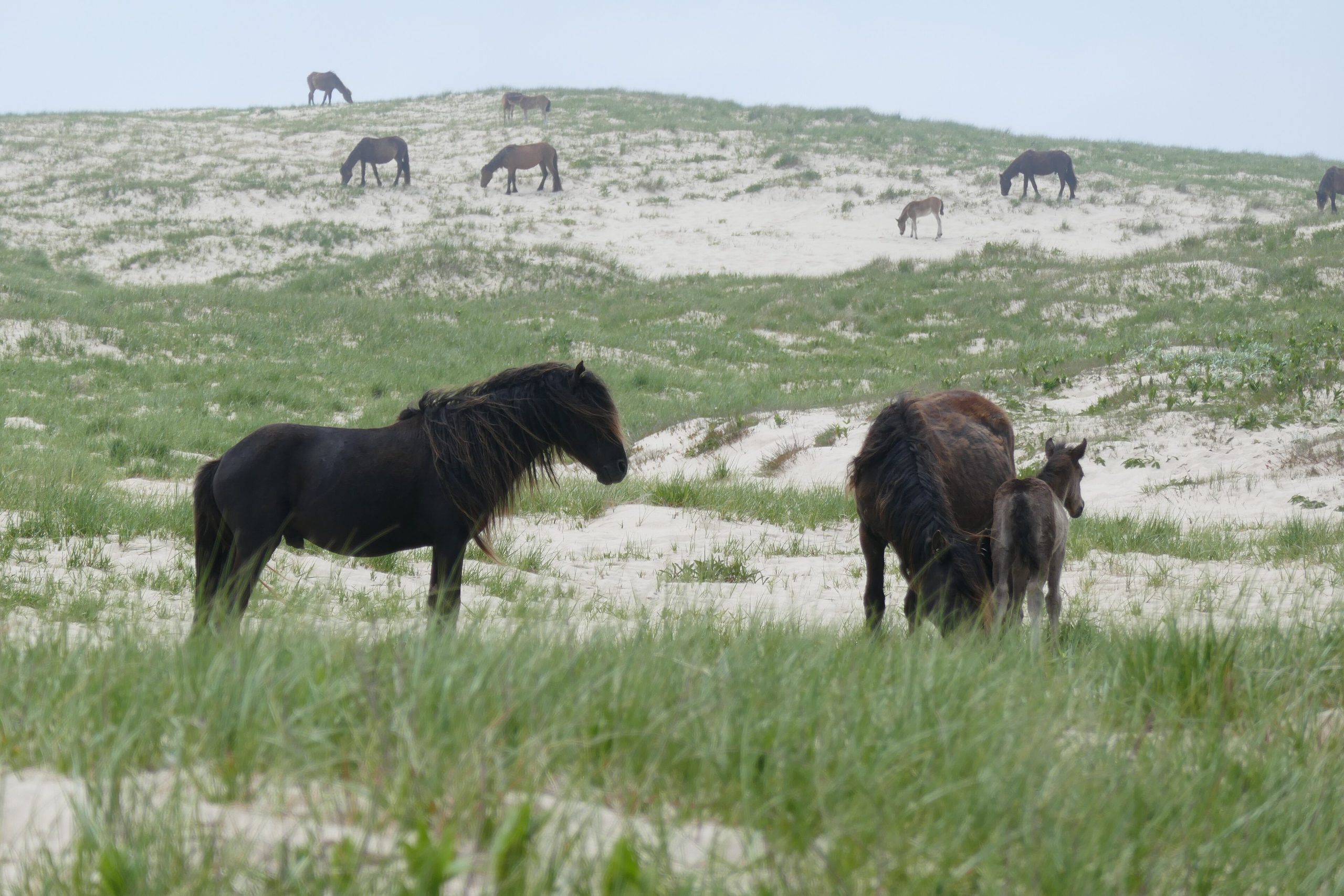
Sable Island National Park Reserve
Sable Island is a thin crescent of windswept sand adrift in the North Atlantic, some 190 miles (300 km) from the Nova Scotia coast, a place of legend known as the “Graveyard of the Atlantic” for its centuries of shipwrecks. Today it is famous for its herd of wild horses roaming the dunes, vast grey-seal colonies, and a stark, otherworldly beauty reached only by the determined few.
Fast facts
- Established: 2013, as a national park reserve
- Size: about 13 square miles (34 km²), a narrow sandbar roughly 26 miles (42 km) long
- Famous for: its wild horses and one of the world’s largest grey-seal colonies
- Location: about 190 miles (300 km) southeast of mainland Nova Scotia
- Access: tightly controlled, by charter plane or boat only
- Managed by: Parks Canada
The landscape
The island is essentially a giant, mobile sand dune shaped by wind and Atlantic storms, grass-anchored dunes, freshwater ponds, and long beaches with no trees and little shelter. Despite its harshness it teems with life: the free-roaming Sable Island horses, tens of thousands of grey seals, and huge seabird colonies, including the world’s main breeding site for the Ipswich sparrow.
Best time to go
Visits are possible in the milder months, roughly June through October, when weather occasionally allows the fragile flights and landings, but fog and storms frequently cancel trips, so flexibility is essential. There is no true “peak season” so much as a narrow window of opportunity dictated entirely by the Atlantic weather.
Getting there and around
Reaching Sable Island is difficult and weather-dependent: visitors arrive by chartered small aircraft that land on the beach when conditions permit, or by private vessel, always after registering with Parks Canada. Numbers are limited and most day trips are guided; once ashore, you explore on foot, staying well away from the wildlife and fragile dunes.
Things to do
The experience is quiet observation and photography, watching the wild horses graze the dunes, the grey seals hauled out by the thousand, and the seabirds, all against an endless horizon of sand and sea. Learning the island’s dramatic history of shipwrecks and lifesaving stations adds depth to a genuinely once-in-a-lifetime visit.
Staying safe
This is a remote, exposed island with no shelter and unpredictable Atlantic weather, so trips can be delayed or cancelled and you must be flexible and self-sufficient for the day. Keep a strict distance from the wild horses and seals, respect the fragile dunes, and follow your guide’s and Parks Canada’s instructions closely.
Know before you go
Access is tightly controlled. You must register with Parks Canada in advance and arrange charter transport, with weather the deciding factor. This page is a general overview, not a live conditions report; always confirm current access, conditions and requirements with Parks Canada before your trip.
- Coordinates
- 43.9879, -59.9096
- Magnetic declination
- 16.2° W (2026)
Set this declination on your compass, then align it to the map's north lines; it is the angle between true north and magnetic north, refreshed each year.
A spread of the park’s main places shows straight away, and the rest appear as you zoom in. You can also search above, or pick any place from the lists below, and the map will go to it.
Getting there 1
Airstrip
Sights 6
Heritage sites
Point of interests
Peak
Map data comes from third-party sources and may be incomplete or out of date, so carry a current official map (terms).
- Best seasons
- Summer (June to October, fly-in/boat)
- Difficulty
- Moderate (remote, access-controlled)
- Access / trailheads
- A remote crescent of sand roughly 190 miles (300 km) off the coast of Nova Scotia in the Atlantic. Access is by chartered small plane (weather permitting) or private boat only.
- Water
- Bring all fresh water; carry everything you need for the day.
- Cell / satellite coverage
- No reliable cell service, rely on your operator’s communications.
- Nearest ranger / SAR / emergency
- Coordinate through Parks Canada; the Canadian Coast Guard covers marine emergencies.
- Permits & regulations
- Access is tightly controlled. Visitors must register with Parks Canada in advance and arrive by charter aircraft or private vessel; day trips are typically guided.
- Leave No Trace
- Keep well back from the wild horses and seals, stay off fragile dunes, pack out everything, and follow strict Leave No Trace.
January
- Below freezing all day
February
- Below freezing all day
March
- Below-freezing nights
April
- Below-freezing nights
May
June
July
August
September This month
October
November
December
- Below-freezing nights
What to bring depends on your trip: how long you’re out, where you sleep, and how far you go from the road. The planner builds the list for yours.
Plan a trip here →Averages for 1981–2010 from Environment Canada climate normals, measured at the Deming station, 105 miles (170 km) away at 52 feet (16 m). That is the nearest station with long-term records, so treat these as a regional guide.