

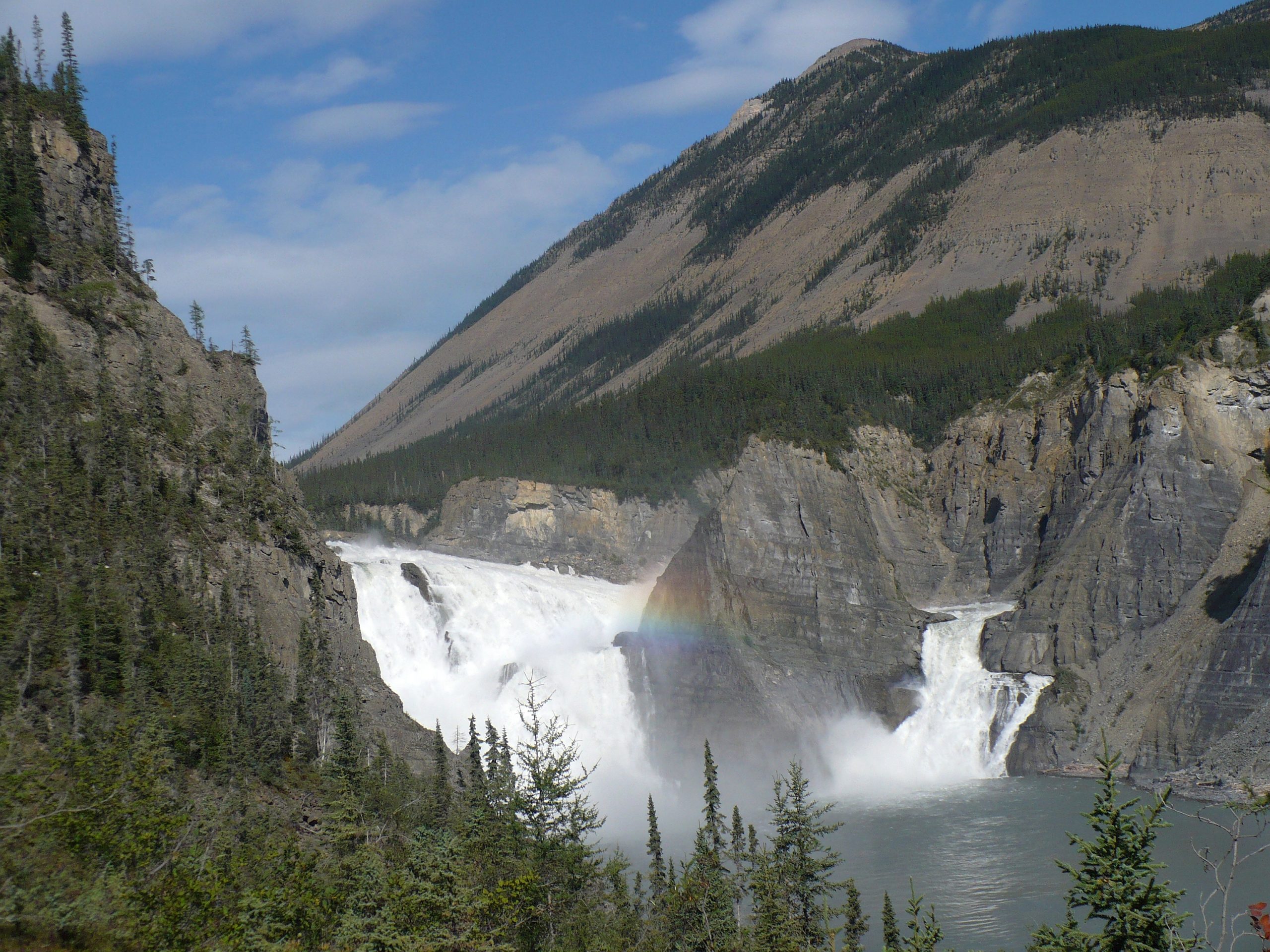
Nahanni National Park Reserve
Nahanni is the stuff of northern legend, a wilderness built around the wild South Nahanni River, which plunges over Virginia Falls (twice the height of Niagara) and knifes through four towering canyons on its way through the Mackenzie Mountains. One of the first UNESCO World Heritage Sites, it is a bucket-list river expedition into some of the most spectacular and remote country in Canada.
Fast facts
- Established: 1972 (reserve); greatly expanded 2009
- Size: about 11,600 square miles (30,050 km²) in the southwest Northwest Territories
- Signature site: Virginia Falls (Náįlįcho), roughly 310 feet (96 m) high
- Recognition: one of the first UNESCO World Heritage Sites (1978)
- Access point: Fort Simpson, Northwest Territories (fly-in)
- Managed by: Parks Canada, with the Dehcho First Nations
The landscape
The South Nahanni carves through the Mackenzie Mountains in a series of deep canyons up to a kilometre high, past hot springs, tufa mounds and the thundering drop of Virginia Falls. Boreal forest, alpine tundra and karst landscapes surround the river, sheltering grizzlies, Dall sheep, mountain caribou and wolves in a vast, roadless wilderness.
Best time to go
The river season runs roughly June through September, when the Nahanni is runnable and the weather is at its (still unpredictable) best. Early summer brings higher, colder water; late summer is warmer with more settled conditions. Outside this window the North locks down in cold and darkness.
Getting there and around
There are no roads into Nahanni. Access is by floatplane, usually from Fort Simpson, landing on the river or at Virginia Falls, and travel within is by canoe or raft downstream. The vast majority of visitors join a licensed river outfitter, as running the Nahanni safely demands whitewater skill and full self-sufficiency.
Things to do
Paddling or rafting the South Nahanni, often a one- to two-week expedition, is the definitive experience, past Virginia Falls, the canyons, and hot springs. Flightseeing tours offer a shorter taste of the falls and canyons from the air, and hiking side trips reveal alpine country and sweeping river views.
Staying safe
The Nahanni is powerful, cold whitewater in a remote wilderness. Scouting, skill and respect are essential, which is why most people go with outfitters. Grizzly and black bears range the valley, weather turns fast, and rescue is far off, so carry a satellite communicator, complete the orientation, and travel prepared.
Know before you go
A Parks Canada pass and registration/orientation are required, access is by charter air, and most visitors book a licensed river outfitter well in advance. This page is a general overview, not a live conditions report; always confirm current conditions, water levels and options with Parks Canada before your trip.
- Coordinates
- 61.6886, -126.3535
- Magnetic declination
- 18.4° E (2026)
Set this declination on your compass, then align it to the map's north lines; it is the angle between true north and magnetic north, refreshed each year.
A spread of the park’s main places shows straight away, and the rest appear as you zoom in. You can also search above, or pick any place from the lists below, and the map will go to it.
Getting there 2
Airstrips
On the trail 2
Campgrounds
Sights 33
Waterfalls
Point of interest
Peaks 30
Map data comes from third-party sources and may be incomplete or out of date, so carry a current official map (terms).
- Best seasons
- Summer (June to September, fly-in)
- Difficulty
- Strenuous (remote, fly-in)
- Access / trailheads
- In the Dehcho region of the southwest Northwest Territories. Access is by floatplane, typically from Fort Simpson or Muncho Lake; there are no roads.
- Water
- Rivers and streams; filter or treat all water.
- Cell / satellite coverage
- No cell service. Carry a satellite communicator and file a trip plan.
- Nearest ranger / SAR / emergency
- Coordinate through Parks Canada in Fort Simpson; response is limited.
- Permits & regulations
- A Parks Canada pass and registration/orientation are required; access is by air, and most visitors travel with licensed river outfitters.
- Leave No Trace
- Pack out everything, respect Dene heritage, and follow strict Leave No Trace.
January
- Below freezing all day
February
- Below freezing all day
March
- Below freezing all day
April
- Below-freezing nights
May
June
July
August
September This month
October
- Below-freezing nights
November
- Below freezing all day
December
- Below freezing all day
What to bring depends on your trip: how long you’re out, where you sleep, and how far you go from the road. The planner builds the list for yours.
Plan a trip here →Averages for 1981–2010 from Environment Canada climate normals, measured at the Fort Liard Airport station, 139 miles (225 km) away at 708 feet (216 m). That is the nearest station with long-term records, so treat these as a regional guide. Conditions change with elevation: expect it colder higher up.