

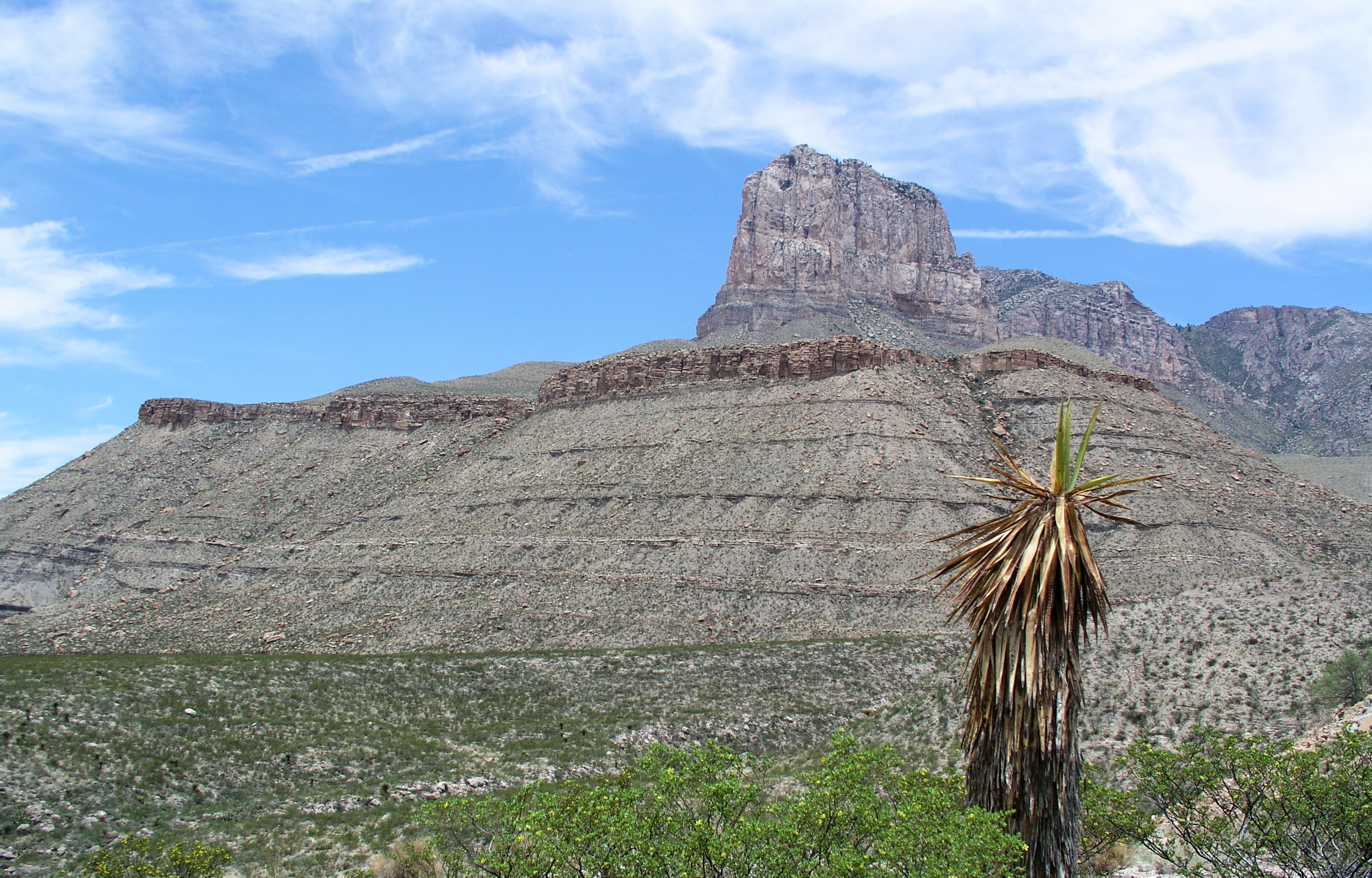
Guadalupe Mountains National Park
The Guadalupe Mountains rise abruptly from the Chihuahuan Desert of far west Texas, a rugged, wind-scoured range built from an ancient fossilized reef and crowned by Guadalupe Peak, the highest point in Texas. Quiet and demanding, the park hides the surprising green oasis of McKittrick Canyon amid the desert, blazing gold each fall, and offers some of the finest wilderness hiking in the Southwest.
Fast facts
- Established: authorized 1966; opened 1972
- Size: about 86,400 acres (350 km²) in far west Texas
- High point: Guadalupe Peak, 8,751 feet (2,667 m), the highest in Texas
- Geology: an exposed Permian fossil reef, the Capitan Reef
- Gateway: about 110 miles (180 km) east of El Paso via US-62/180
- Managed by: National Park Service
The landscape
The range is the exposed remnant of a 260-million-year-old reef, now a high desert massif of limestone canyons, escarpments and a forested crest. The desert floor of cactus and agave gives way in sheltered McKittrick Canyon to maples and oaks fed by a spring-fed stream, while the high country holds relict conifer forest, a striking layering of desert, canyon and mountain worlds.
Best time to go
Fall is the signature season, when McKittrick Canyon’s maples turn brilliant and temperatures ease; spring is mild and good for hiking too. Summer is very hot and often fiercely windy, so start early and carry extra water. Winter can bring cold, snow and high winds to the exposed heights.
Getting there and around
The park sits on US-62/180 about 110 miles (180 km) east of El Paso, with the Pine Springs visitor center and campground as the base. There are no roads into the high country and few services, so a vehicle gets you to the trailheads and the rest is on foot. Come fully self-supplied.
Things to do
Climb the strenuous switchbacks to Guadalupe Peak for the top-of-Texas view, walk the gentler McKittrick Canyon trail to the historic Pratt Cabin and the Grotto, and hike Devil’s Hall and the dunes of the west side. Backpackers head into the high wilderness for solitude and dark skies, with the park’s trails among the best in the region.
Staying safe
Heat, sun and relentless wind are the main hazards, and there is no water on the trails. Carry far more than you expect to need, start early, and turn back before you are spent. Trails are steep and exposed, storms can bring lightning and cold, and the remoteness means you must be self-sufficient.
Know before you go
An entrance fee applies, backcountry camping needs a permit, and services are minimal, so carry water, food and fuel. This page is a general overview, not a live conditions report; always confirm current conditions and permits with the National Park Service before your trip.
- Coordinates
- 31.9068, -104.8683
- Magnetic declination
- 6.7° E (2026)
Set this declination on your compass, then align it to the map's north lines; it is the angle between true north and magnetic north, refreshed each year.
A spread of the park’s main places shows straight away, and the rest appear as you zoom in. You can also search above, or pick any place from the lists below, and the map will go to it.
Getting there 1
Ranger station
On the trail 22
Trailheads
Campgrounds
Picnic sites
Sights 14
Viewpoint
Heritage site
Point of interest
Peaks 11
Map data comes from third-party sources and may be incomplete or out of date, so carry a current official map (terms).
- Best seasons
- Fall (foliage), Spring
- Difficulty
- Moderate to strenuous
- Access / trailheads
- In far west Texas on US-62/180, about 110 miles (180 km) east of El Paso; the Pine Springs visitor center is the main hub. Services are minimal, so come prepared.
- Water
- Carry all your water; there is essentially none on the trails or in the backcountry.
- Cell / satellite coverage
- Little to no cell service. Carry a map and share your plans.
- Nearest ranger / SAR / emergency
- Contact park rangers; life-threatening emergencies: 911.
- Permits & regulations
- Per-person entrance fee (America the Beautiful pass accepted); backcountry and wilderness camping require a permit.
- Leave No Trace
- Stay on trails, pack out all waste, protect fragile canyon and mountain habitat, and follow Leave No Trace.
January
- Below-freezing nights
February
March
April
May
June
July
August
September This month
October
November
December
What to bring depends on your trip: how long you’re out, where you sleep, and how far you go from the road. The planner builds the list for yours.
Plan a trip here →Averages for 1991–2020 from NOAA U.S. Climate Normals, measured at the Pine Springs station, 3 miles (5 km) away at 5,591 feet (1,704 m). Conditions change with elevation: expect it colder higher up.