

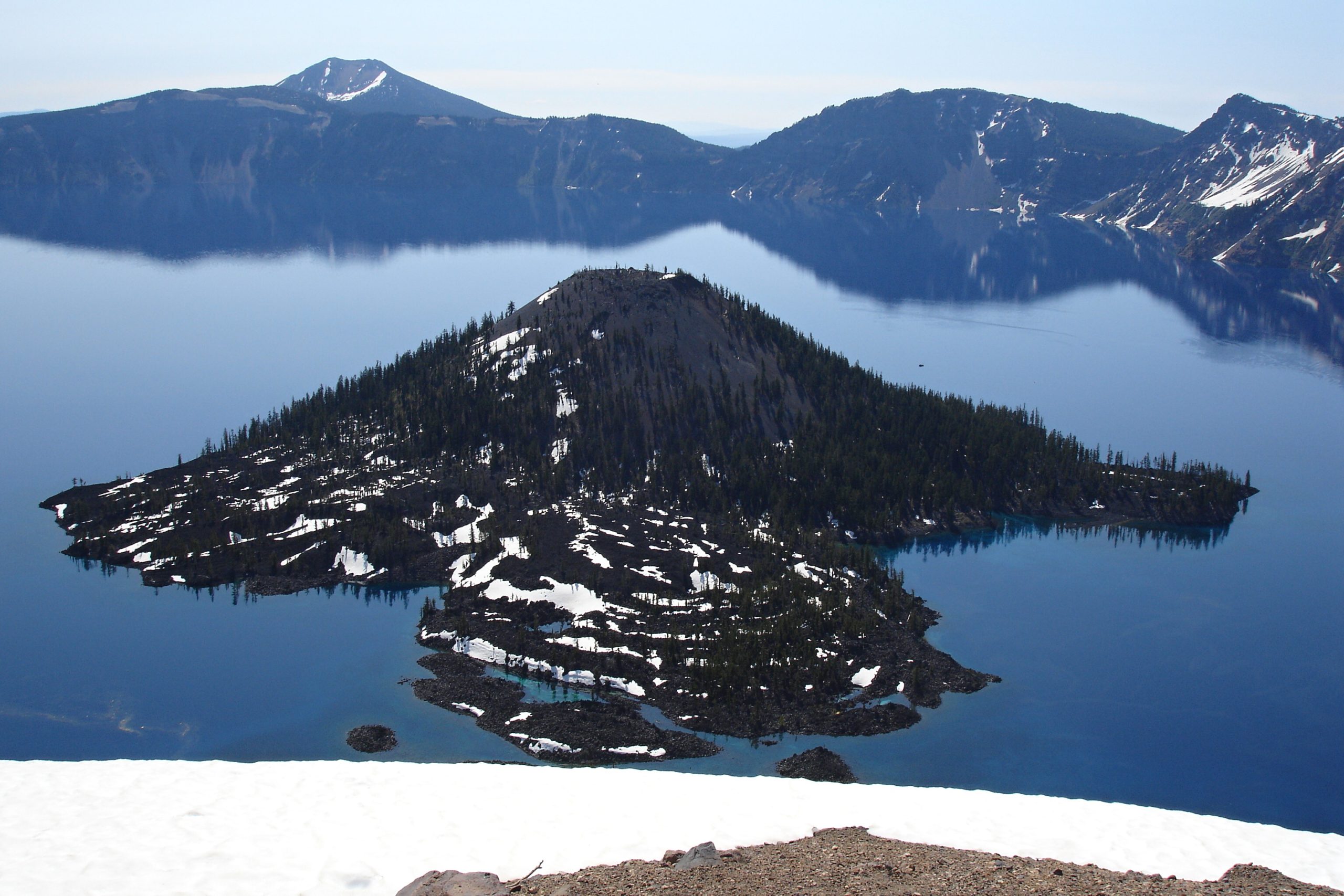
Crater Lake National Park
Crater Lake holds the deepest, and arguably the bluest, water in the United States, a nearly 2,000-foot (600 m)-deep lake filling the caldera of a volcano that collapsed some 7,700 years ago. Ringed by cliffs and fed only by snow and rain, its astonishing clarity and color have made this southern Oregon landmark one of the most striking natural sights in the country.
Fast facts
- Established: 1902, the sixth U.S. national park
- Size: about 183,000 acres (741 km²) in the Oregon Cascades
- The lake: 1,943 feet (592 m) deep, the deepest in the U.S.
- Origin: the collapsed caldera of Mount Mazama
- Gateways: Klamath Falls and Medford, Oregon
- Managed by: National Park Service
The landscape
The caldera cliffs plunge to the intensely blue lake, with Wizard Island, a cinder cone, rising from the water near the western shore. Around the rim spreads a high volcanic landscape of pumice slopes and old-growth forest, buried under some of the deepest average snowfall in the country. Beyond the rim lie quiet backcountry forests, meadows and the Pacific Crest Trail.
Best time to go
Summer and early fall are effectively the season: the Rim Drive and most trails are buried in snow much of the year and typically open only from around July into October. Once clear, the rim offers hiking, boat tours and swimming access. Winter is long and snowy, drawing snowshoers and skiers to the rim under massive snowpack.
Getting there and around
The park is reached via OR-62 in southern Oregon, with the south entrance open year-round to the rim and the north entrance and Rim Drive seasonal. A vehicle is essential to reach and circle the rim; the 33-mile (53 km) Rim Drive, when open, is the classic tour, with overlooks and trailheads all along it.
Things to do
Drive the Rim Drive for ever-changing lake views, hike to Watchman Peak or Garfield Peak for panoramas, and descend the steep Cleetwood Cove trail, the only lake access, for a boat tour to Wizard Island or a bracing swim. Backpackers walk the Pacific Crest Trail, and winter visitors snowshoe the snowy rim.
Staying safe
The caldera rim has steep, crumbling, often snow-corniced edges, so stay back and on trails. The lake water is cold and deep, and the Cleetwood Cove trail is a strenuous climb back out. Weather turns fast at altitude, snow lingers into summer, and deep snowpack shapes any shoulder-season or winter visit. Come prepared.
Know before you go
A park pass is required, backcountry camping needs a permit, and the Rim Drive’s opening date varies each year with the snowpack. Always check before you go. This page is a general overview, not a live conditions report; always confirm current road status, conditions and permits with the National Park Service before your trip.
- Coordinates
- 42.9287, -122.1342
- Magnetic declination
- 13.9° E (2026)
Set this declination on your compass, then align it to the map's north lines; it is the angle between true north and magnetic north, refreshed each year.
A spread of the park’s main places shows straight away, and the rest appear as you zoom in. You can also search above, or pick any place from the lists below, and the map will go to it.
Getting there 4
Park entrances
Ranger stations
On the trail 31
Trailheads
Campgrounds
Picnic sites
Sights 48
Viewpoints
Waterfalls
Islands
Peaks 28
Map data comes from third-party sources and may be incomplete or out of date, so carry a current official map (terms).
- Best seasons
- Summer, Early fall
- Difficulty
- Easy to strenuous
- Access / trailheads
- In southern Oregon’s Cascades via OR-62; only the south and (seasonally) north entrances reach the rim. Nearest hubs are Klamath Falls and Medford.
- Water
- Potable water at developed areas; treat backcountry sources. Do not rely on the lake.
- Cell / satellite coverage
- Little to no cell service. Carry a map and share your plans.
- Nearest ranger / SAR / emergency
- Contact park rangers; life-threatening emergencies: 911.
- Permits & regulations
- Per-vehicle entry fee (America the Beautiful pass accepted); backcountry camping needs a permit. The Rim Drive and most services are closed by snow much of the year.
- Leave No Trace
- Stay on trails and back from crumbling rim edges, pack out all waste, and follow Leave No Trace.
January
- Below-freezing nights
February
- Below-freezing nights
March
- Below-freezing nights
April
- Below-freezing nights
May
- Below-freezing nights
June
July
August
September This month
October
- Below-freezing nights
November
- Below-freezing nights
December
- Below-freezing nights
What to bring depends on your trip: how long you’re out, where you sleep, and how far you go from the road. The planner builds the list for yours.
Plan a trip here →Averages for 1991–2020 from NOAA U.S. Climate Normals, measured at the Crater Lake NPS HQ station, 1 miles (2 km) away at 6,485 feet (1,977 m). Conditions change with elevation: expect it colder higher up.