

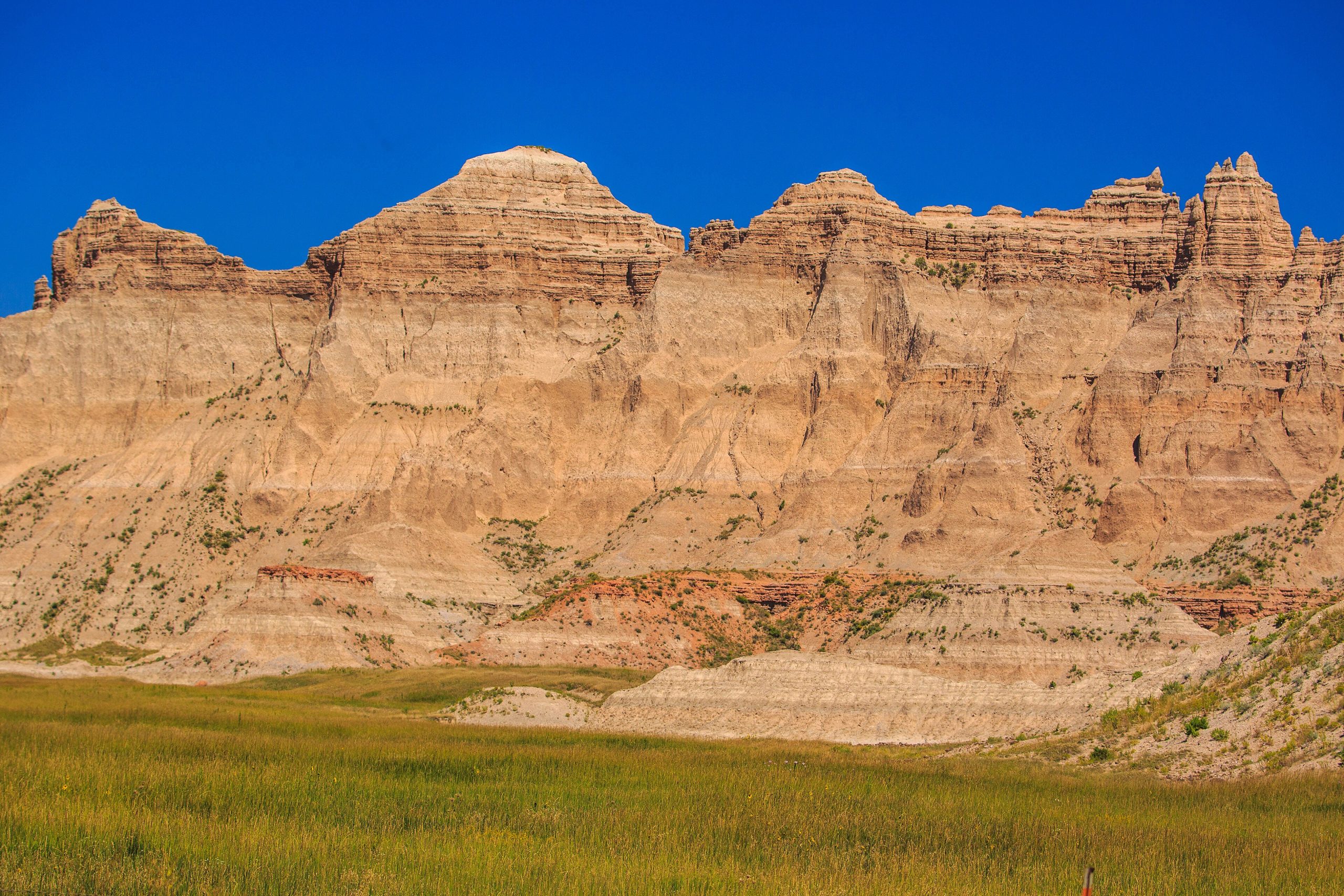
Badlands National Park
The Badlands rise from the South Dakota prairie like a maze of eroded spires and striped buttes, a stark, beautiful moonscape carved from ancient seabeds and volcanic ash. Alongside the dramatic rock, the park protects one of the largest mixed-grass prairies in the country, alive with bison, bighorn sheep and prairie dogs, and it holds one of the world’s richest fossil beds.
Fast facts
- Established: national monument 1939; national park in 1978
- Size: about 244,000 acres (987 km²) of badlands and mixed-grass prairie
- Fossils: a world-class record of Oligocene mammals
- Wildlife: bison, bighorn sheep, pronghorn and the reintroduced black-footed ferret
- Gateway: Wall, South Dakota, off I-90
- Managed by: National Park Service
The landscape
Water and wind have sculpted soft sedimentary layers into the park’s signature pinnacles, ridges and canyons, banded in reds, tans and grays. Between the rock formations spreads open prairie grassland, and the sharp boundary between the two, the “Wall”, is one of the park’s defining features. Bison graze the flats, bighorns pick across the buttes, and rattlesnakes shelter in the rocks.
Best time to go
Spring and fall bring the most comfortable temperatures and good wildlife activity. Summer is hot, with afternoon thunderstorms and lightning on the exposed terrain, so hike early. Winter is cold and quiet, with snow-dusted formations and few visitors for those prepared for the cold.
Getting there and around
The park lies off I-90 in southwestern South Dakota, and the Badlands Loop Road (Highway 240) is the scenic spine, linking the overlooks, the visitor center and the main trailheads. A vehicle is the practical way to tour it, with short trails branching off the loop into the formations.
Things to do
Drive the Loop Road for the classic overlooks, then walk trails like the Notch, Door and Castle to get among the formations, or scramble the accessible badlands off-trail (the park allows open hiking). Watch for bison and bighorns in the Sage Creek area, visit the fossil exhibits, and enjoy some of the darkest night skies on the northern plains.
Staying safe
Summer heat and lightning are the main hazards, so carry plenty of water and get off exposed ground when storms build. Give bison a very wide berth (they are fast and dangerous), watch for rattlesnakes among the rocks, and avoid the clay slopes when wet, as they turn treacherously slick.
Know before you go
A park pass is required, and while backcountry camping needs no permit, you must carry all your water and be self-sufficient. This page is a general overview, not a live conditions report; always confirm current conditions and closures with the National Park Service before your trip.
- Coordinates
- 43.6993, -102.3936
- Magnetic declination
- 6.3° E (2026)
Set this declination on your compass, then align it to the map's north lines; it is the angle between true north and magnetic north, refreshed each year.
A spread of the park’s main places shows straight away, and the rest appear as you zoom in. You can also search above, or pick any place from the lists below, and the map will go to it.
Getting there 2
Park entrances
On the trail 4
Trailheads
Campgrounds
Sights 27
Viewpoints
Peaks 9
Map data comes from third-party sources and may be incomplete or out of date, so carry a current official map (terms).
- Best seasons
- Spring, Fall
- Difficulty
- Easy to moderate
- Access / trailheads
- In southwestern South Dakota off I-90 (exits near Wall and Cactus Flat); the Badlands Loop Road (Hwy 240) links the overlooks and trailheads.
- Water
- Carry all your water; the badlands are dry and trail water is unavailable.
- Cell / satellite coverage
- Patchy cell service. Carry a map and share your plans.
- Nearest ranger / SAR / emergency
- Contact park rangers; life-threatening emergencies: 911.
- Permits & regulations
- Per-vehicle entry fee (America the Beautiful pass accepted); backcountry camping is allowed with no permit but requires self-sufficiency.
- Leave No Trace
- Keep well back from bison, stay off wet clay slopes, pack out all waste, and follow Leave No Trace.
January
- Below-freezing nights
February
- Below-freezing nights
March
- Below-freezing nights
April
May
June
July
- Hot days
August
- Hot days
- Day-to-night swing of 31°F (17°C)
September This month
- Day-to-night swing of 31°F (17°C)
October
November
- Below-freezing nights
December
- Below-freezing nights
What to bring depends on your trip: how long you’re out, where you sleep, and how far you go from the road. The planner builds the list for yours.
Plan a trip here →Averages for 1991–2020 from NOAA U.S. Climate Normals, measured at the Interior station, 3 miles (5 km) away at 2,440 feet (744 m).