

Auyuittuq National Park
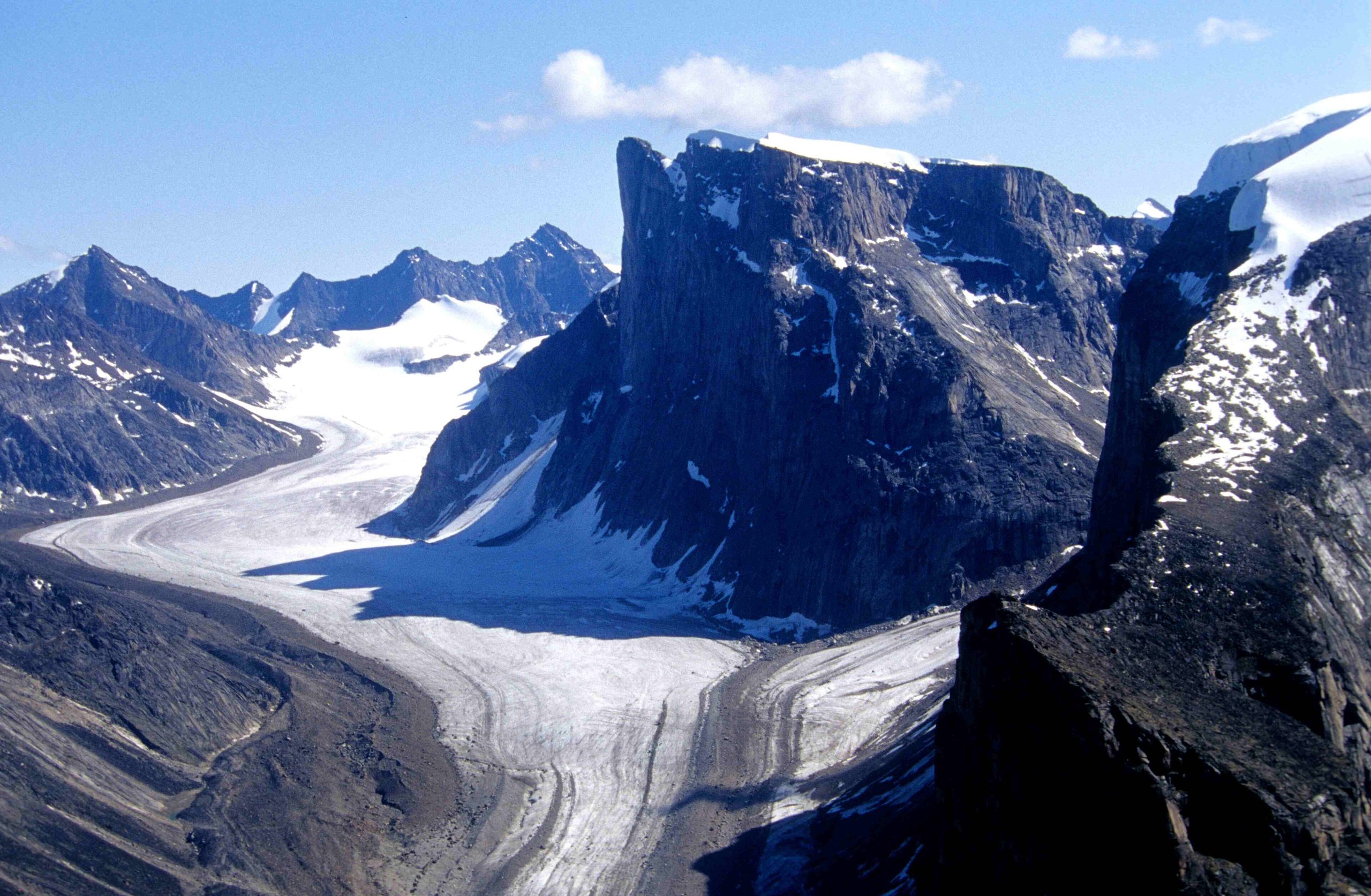
Auyuittuq, “the land that never melts”, is a realm of granite spires, sweeping glaciers and Arctic fjords on Baffin Island. Its centerpiece, the Akshayuk Pass, cuts through the Cumberland Peninsula between towering peaks like Mount Thor and Mount Asgard, drawing hardened backpackers and world-class climbers to one of the most dramatic and demanding wilderness routes in the Arctic.
Fast facts
- Established: 1976 (park reserve); national park in 2001
- Size: about 7,370 square miles (19,089 km²) on Baffin Island
- Landmarks: Akshayuk Pass, Mount Thor (Earth’s greatest vertical drop) and Mount Asgard
- Ice: the vast Penny Ice Cap
- Gateways: Pangnirtung and Qikiqtarjuaq, Nunavut
- Managed by: Parks Canada
The landscape
The park is a landscape of extremes, sheer granite walls, the Penny Ice Cap and dozens of glaciers spilling toward deep fjords, with the U-shaped Akshayuk Pass running between them. Above the Arctic Circle and largely frozen, it is stark and treeless, its valleys braided with icy meltwater rivers and its cliffs among the tallest on Earth.
Best time to go
Summer, roughly July and August, is the main hiking season, when the pass is (mostly) snow-free but rivers run high with meltwater. Spring brings ski-touring and snowmobile access with more stable travel over snow. Even in summer, storms, cold and snow are constant possibilities, and the season is short.
Getting there and around
Access is via the Inuit hamlets of Pangnirtung (south end) or Qikiqtarjuaq (north end), reached by air, from which visitors travel by boat or snowmobile to the park boundary. Inside, travel is entirely on foot or ski through Akshayuk Pass, with emergency shelters spaced along the route but no other services.
Things to do
Trekking the roughly 60-mile (97 km) Akshayuk Pass is the signature journey, past glaciers, spires and the famous faces of Thor and Asgard. The park is also a legendary big-wall climbing and mountaineering destination, and in spring a ski-touring objective, all serious, self-supported undertakings.
Staying safe
This is expedition terrain: glacier travel, crevasses, and swift, cold, sometimes impassable river crossings all demand skill and caution, and weather can pin you down for days. Polar bears range the coast, cold is a constant threat, and rescue is far off. Carry a satellite communicator, complete the mandatory orientation, and travel only with solid Arctic experience.
Know before you go
A Parks Canada pass and mandatory registration and orientation are required, and you must be fully self-sufficient or with a licensed guide. This page is a general overview, not a live conditions report; always confirm current conditions, river levels and requirements with Parks Canada before your trip.
- Coordinates
- 67.3521, -66.0208
- Magnetic declination
- 27.5° W (2026)
Set this declination on your compass, then align it to the map's north lines; it is the angle between true north and magnetic north, refreshed each year.
A spread of the park’s main places shows straight away, and the rest appear as you zoom in. You can also search above, or pick any place from the lists below, and the map will go to it.
On the trail 9
Hut or shelters
Sights 55
Point of interests
Islands
Peaks 30
Map data comes from third-party sources and may be incomplete or out of date, so carry a current official map (terms).
- Best seasons
- Summer hiking (Jul–Aug); spring ski touring
- Difficulty
- Strenuous (serious expedition terrain)
- Access / trailheads
- On Baffin Island, Nunavut, near the communities of Pangnirtung and Qikiqtarjuaq, reached by boat or snowmobile from those hamlets (themselves accessed by air).
- Water
- Glacial rivers and streams; filter or treat all water.
- Cell / satellite coverage
- No cell service. Carry a satellite communicator and file a trip plan.
- Nearest ranger / SAR / emergency
- Coordinate through Parks Canada in Pangnirtung; response is limited given the terrain.
- Permits & regulations
- A Parks Canada pass and mandatory registration/orientation are required; conditions are severe, so trips are for experienced, self-sufficient parties.
- Leave No Trace
- Pack out everything, respect Inuit heritage, and follow strict Leave No Trace.
January
- Below freezing all day
February
- Below freezing all day
March
- Below freezing all day
April
- Below freezing all day
May
- Below freezing all day
June
- Below-freezing nights
July
August
September This month
- Below-freezing nights
October
- Below freezing all day
November
- Below freezing all day
December
- Below freezing all day
What to bring depends on your trip: how long you’re out, where you sleep, and how far you go from the road. The planner builds the list for yours.
Plan a trip here →Averages for 1981–2010 from Environment Canada climate normals, measured at the Clyde Airport station, 225 miles (362 km) away at 87 feet (27 m). That is the nearest station with long-term records, so treat these as a regional guide. Conditions change with elevation: expect it colder higher up.