

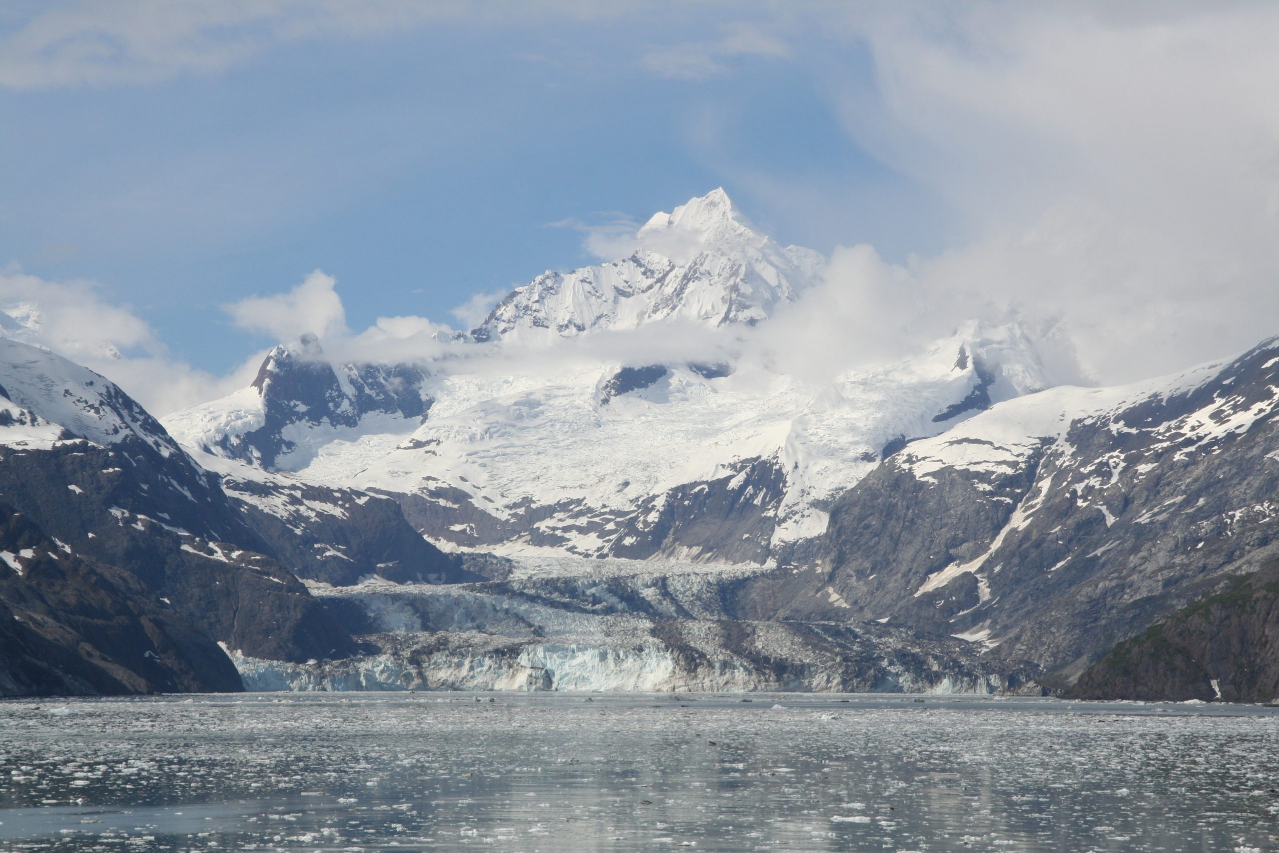
Glacier Bay National Park
Glacier Bay is 3.3 million acres (13,000 km²) of southeastern Alaska where the ice age is still visibly at work, a 65-mile (100 km) fjord lined with more than a thousand glaciers, tidewater faces calving icebergs into the sea, and temperate rainforest climbing the slopes above. A UNESCO World Heritage Site and biosphere reserve, it is one of the best places on Earth to watch a landscape rebuild itself in the wake of retreating ice.
Fast facts
- Established: national monument in 1925; national park and preserve in 1980
- Size: more than 3.3 million acres (13,000 km²) of mountains, ice, rainforest and coastal water
- Glaciers: over 1,000, including Margerie Glacier
- Location: about 120 miles (190 km) west of Juneau, Alaska
- Recognition: UNESCO World Heritage Site and International Biosphere Reserve
- Managed by: National Park Service
The landscape
A long, winding fjord cuts deep into the Coast Mountains, framed by peaks topping 6,000 feet (1,800 m) and blanketed lower down by Sitka spruce and western hemlock. The environment is dynamic (ice constantly calves from glacier faces with a thunderous crack), and it supports a rich food web, from kelp forests and tide pools to humpback whales, orcas, sea otters and Steller sea lions offshore, and brown bears and mountain goats on land.
Best time to go
The season runs May through September, with June and July offering the most reliable weather and longest days. Summer highs sit in the mid-50s to low 60s°F, and marine wildlife is at its peak. Humpbacks return to feed and harbor-seal pups ride the ice floes. Even in high summer, expect sudden rain and fog, so plan for wet weather.
Getting there and around
There are no roads into Glacier Bay. Most visitors fly into Gustavus, about 10 miles (16 km) from the Bartlett Cove visitor center, or arrive by Alaska Marine Highway ferry. Inside the park you travel only by boat, kayak or on foot (there are no internal roads or shuttles), so exploring the bay usually means a guided day cruise, a kayak rental or a private charter.
Things to do
Day boat tours run deep into the bay, with rangers narrating the calving glaciers and pointing out whales, sea lions and puffins. Sea kayaking puts you at water level beneath the ice cliffs. On land, trails range from easy walks around Bartlett Cove to backcountry routes, rangers lead guided walks and beach tours, and with the right permits you can fish for salmon and halibut or camp at Bartlett Cove or in the backcountry.
Staying safe
Cold water is the central risk: always wear a life jacket on boats and kayaks, dress in quick-drying layers, and treat immersion as a hypothermia emergency. Keep at least 100 yards (90 m) from bears and 25 yards (23 m) from otters, seals and whales, and never approach a calving glacier face. Weather shifts fast from sun to storm, so check conditions often and avoid hiking alone in remote areas. Cell service is essentially nonexistent, so carry charts, a compass or GPS, and leave your itinerary with someone.
Know before you go
Book lodging and tours in Gustavus or Hoonah well ahead, especially in summer, and secure any backcountry camping or route permits through the National Park Service. There is no entrance fee, but there are also no paved roads or commercial conveniences inside the park, so come self-reliant. This page is a general overview, not a live conditions report; always confirm current conditions, closures and permits with the National Park Service before your trip.
- Coordinates
- 58.8143, -136.8656
- Magnetic declination
- 17.3° E (2026)
Set this declination on your compass, then align it to the map's north lines; it is the angle between true north and magnetic north, refreshed each year.
A spread of the park’s main places shows straight away, and the rest appear as you zoom in. You can also search above, or pick any place from the lists below, and the map will go to it.
Getting there 1
Airstrip
On the trail 4
Trailheads
Campground
Sights 91
Viewpoint
Point of interests
Islands
Peaks 30
Map data comes from third-party sources and may be incomplete or out of date, so carry a current official map (terms).
- Best seasons
- Summer (May to September)
- Difficulty
- Easy to strenuous
- Access / trailheads
- No roads reach the park. Fly into Gustavus (GST) near the Bartlett Cove visitor center, or arrive via the Alaska Marine Highway ferry. Inside, travel is by boat, kayak or on foot only.
- Water
- Streams available near Bartlett Cove and along the shore; filter or treat all water. Carry fresh water on boat and kayak trips.
- Cell / satellite coverage
- Cell service is virtually nonexistent. Carry charts, a compass or GPS and a satellite messenger, and leave a float plan.
- Nearest ranger / SAR / emergency
- U.S. Coast Guard for marine emergencies; contact the Bartlett Cove ranger station. Life-threatening emergencies: 911.
- Permits & regulations
- No entrance fee; backcountry camping and some routes require a free permit and an orientation. Cruise ships operate under NPS concession limits.
- Leave No Trace
- Strict pack-in/pack-out policy; store food away from bears, keep clear of calving glacier faces, and follow Leave No Trace.
January
- Below freezing all day
February
- Below-freezing nights
March
- Below-freezing nights
April
May
June
July
August
September This month
October
November
- Below-freezing nights
December
- Below-freezing nights
What to bring depends on your trip: how long you’re out, where you sleep, and how far you go from the road. The planner builds the list for yours.
Plan a trip here →Averages for 1991–2020 from NOAA U.S. Climate Normals, measured at the Glacier Bay station at 45 feet (14 m). Conditions change with elevation: expect it colder higher up.