

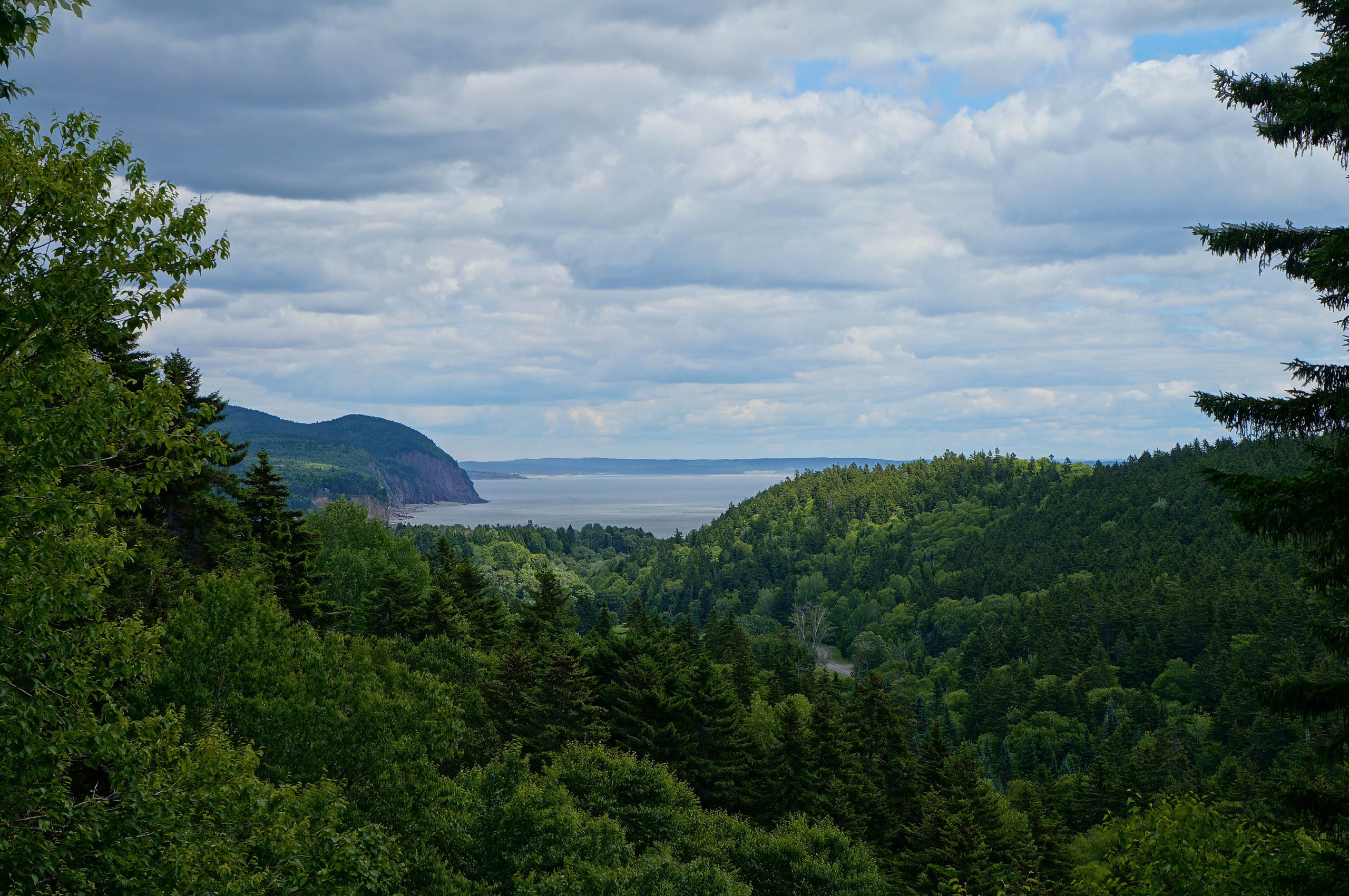
Top 10 things to do in Fundy National Park
Fundy National Park lies on the New Brunswick shore of the Bay of Fundy, home to the highest tides in the world. Twice a day the sea here rises and falls about 40 feet (12 m), uncovering wide flats of sand, mud and rock where boats sat afloat a few hours before. Behind the coast, the park climbs onto a plateau of Acadian forest cut by deep river valleys, with waterfalls, lakes and bogs, and moose, beavers and peregrine falcons. The fishing village of Alma sits at the park’s gate. These are the ten outings we would put first. The order starts with what the park is known for, then goes by what an outing gives back for the time and effort it takes. Distances are approximate; times are our estimates and do not include stops.
The tide comes in fast across the flats and can cut you off below the cliffs: check the tide times before you walk out, and start back well before low tide turns. The rocks and seaweed on the shore are very slippery. Fog can roll in from the bay in minutes, even on a sunny day, and the water is cold enough for hypothermia all year. Ticks are common in the woods and fields from spring to fall.
1. Walk on the sea floor at Alma Beach
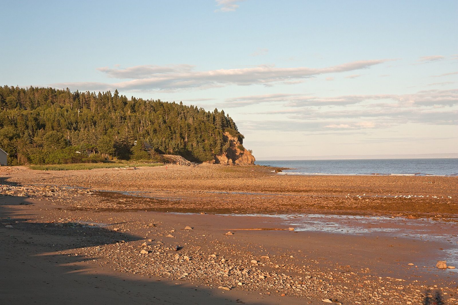
At low tide, the water off Alma Beach pulls back more than half a mile (1 km), and you can walk out across the ribbed sand and rock where the sea will be deep a few hours later, among tide pools, mud snails and the odd stranded jellyfish. Come back six hours later and the beach is under water. Watch the fishing boats in Alma’s harbour next door, which sit on the mud at low tide and float again at high tide.
- Allow: 1 to 2 hours, timed around low tide
- Start: Alma Beach, by the park’s east entrance near the village of Alma
- When: all year; check the tide table
- Suits: everyone
2. See Dickson Falls
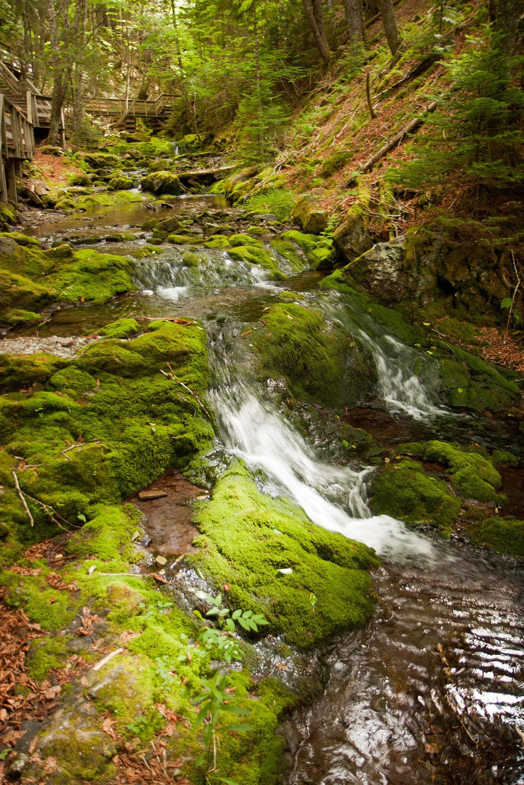
The park’s most popular short walk follows boardwalks and stairs down into a narrow, mossy ravine, where Dickson Brook tumbles over a series of small falls under a canopy of old hemlock and spruce. It is cool and green even on a hot day, and the ferns and moss make it feel like a rainforest. Viewpoints at the top look out over the bay.
- Distance: about 1 mile (1.5 km) loop, with stairs
- Allow: 45 minutes
- Start: Dickson Falls parking area, on Point Wolfe Road
- When: May to October
- Suits: most walkers who can manage stairs
3. Cross the covered bridge to Point Wolfe
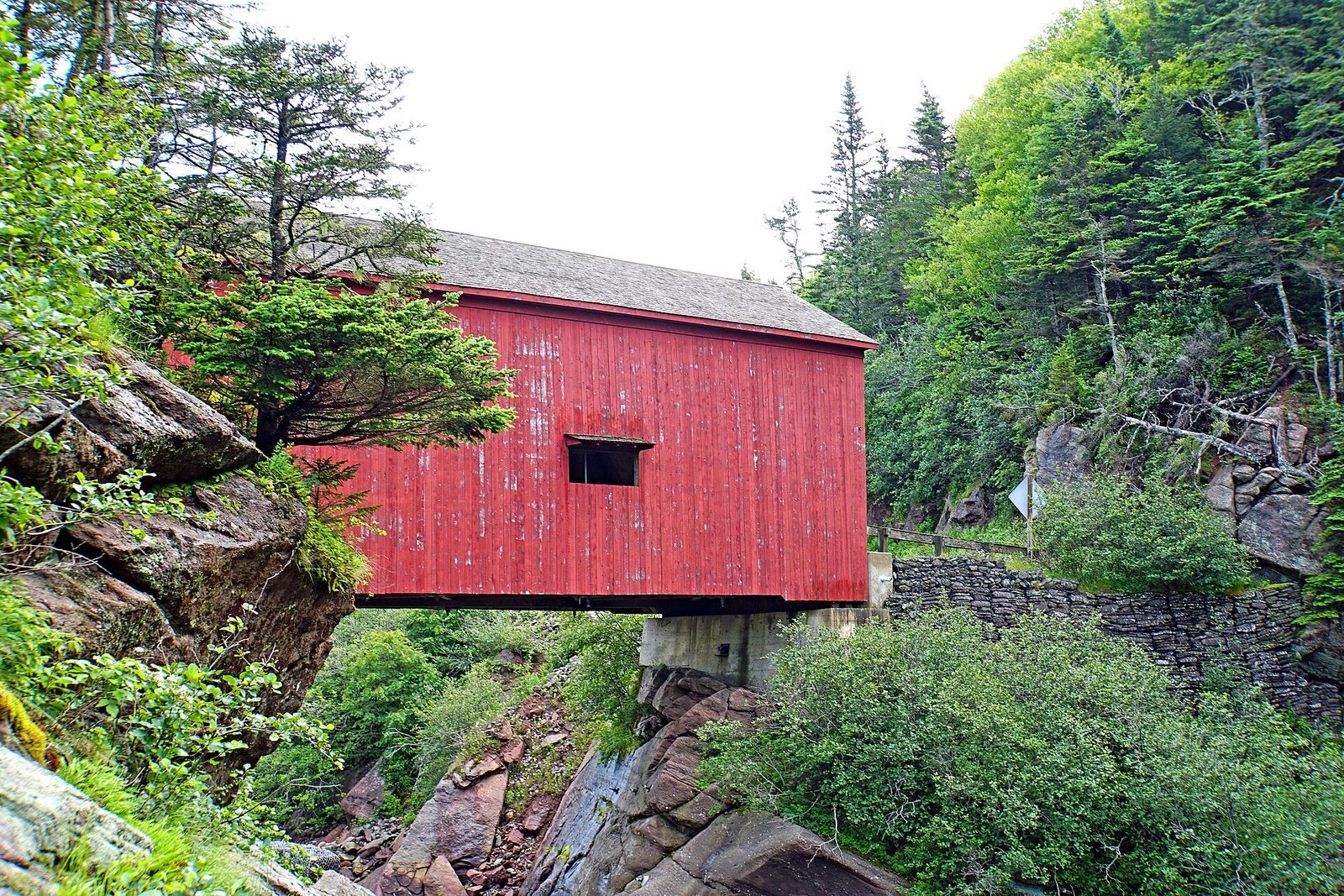
At the end of Point Wolfe Road, a red covered bridge spans the gorge of the Point Wolfe River above the site of a sawmill village that once shipped lumber from here. Below it, a short trail leads down to the beach at the river’s mouth, where at low tide the sea floor is exposed far out into the bay, framed by cliffs and forested headlands. It is the park’s most photographed place.
- Distance: a short walk to the beach
- Allow: 1 hour
- Start: Point Wolfe, at the end of Point Wolfe Road
- When: May to October; low tide for the beach
- Suits: everyone
4. Hike to Laverty Falls
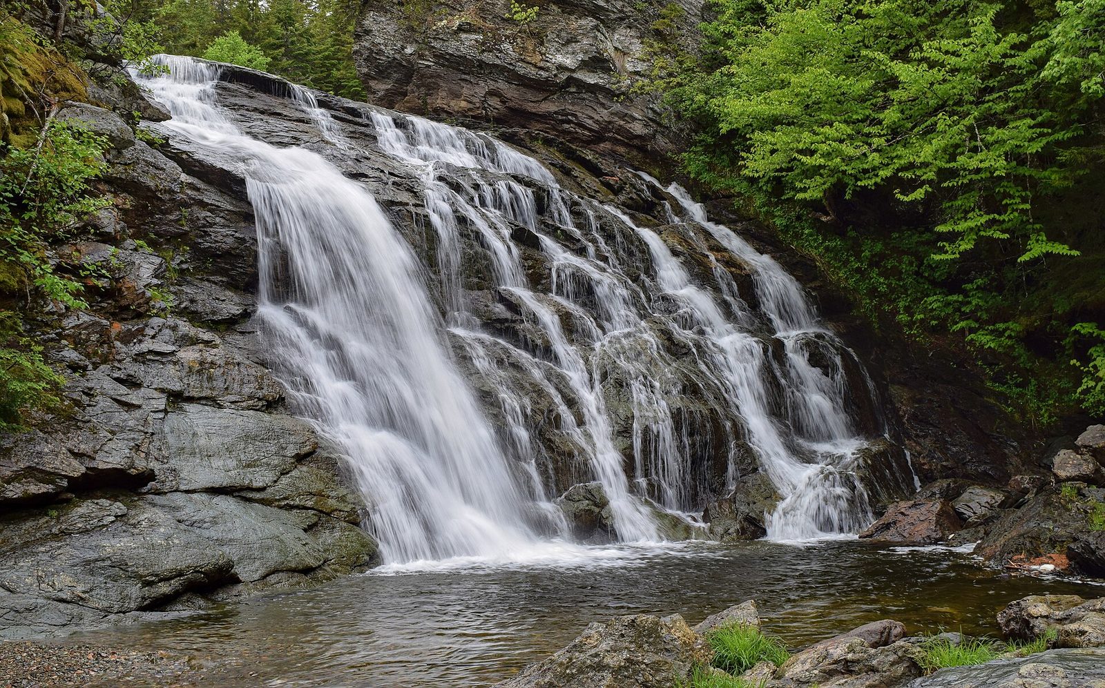
One of the park’s most popular hikes leads through mixed forest on the plateau and down to Laverty Falls, where the stream drops over a ledge into a deep, dark pool, a favourite swimming hole on hot summer days, though the water is cold. It is an easy walk in, with a climb on the way back.
- Distance: about 3 miles (5 km) round trip
- Allow: 2 hours
- Start: Laverty Falls trailhead, off Laverty Road
- When: May to October
- Suits: most walkers
5. Make the trip to Third Vault Falls
The park’s tallest waterfall drops about 50 feet (16 m) over a cliff into a secluded, rocky ravine. The trail to it crosses the plateau through quiet forest, then drops steeply into the gorge at the end. It is a longer walk than Laverty Falls, with fewer people, and the falls are best after rain.
- Distance: about 4.6 miles (7.4 km) round trip
- Allow: 3 hours
- Start: Third Vault Falls trailhead, on Laverty Road
- When: May to October
- Suits: steady walkers
6. Explore the tide pools at Herring Cove
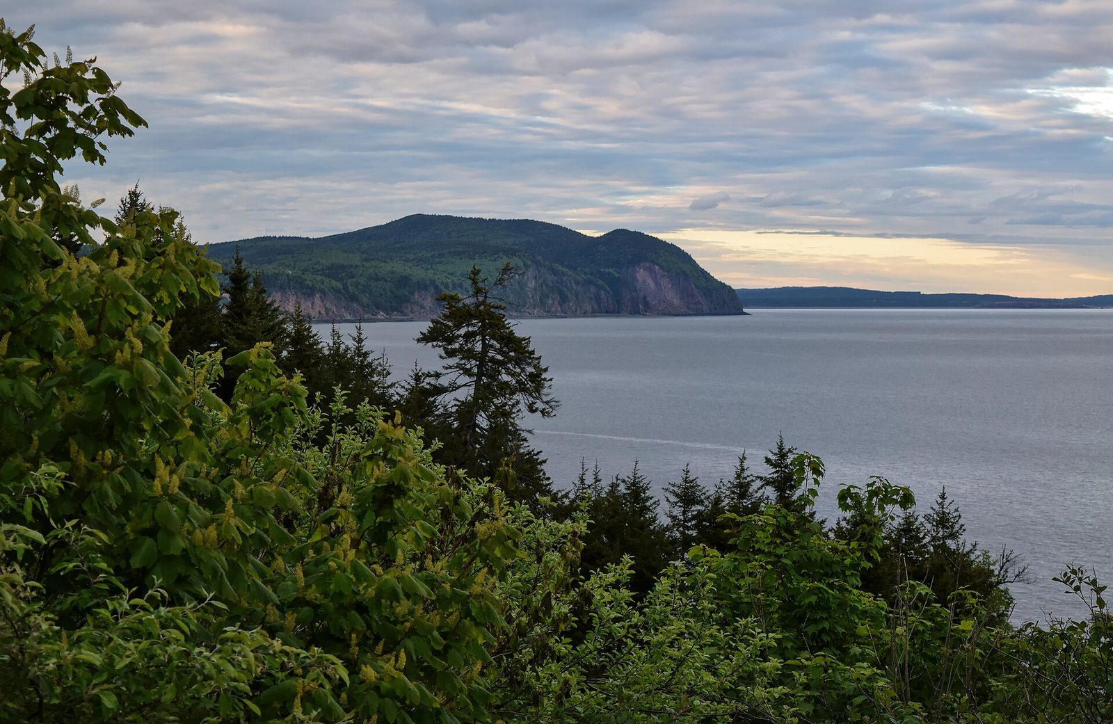
Herring Cove is a small, sheltered beach between rocky headlands, with a picnic area above it. At low tide the rocks and pools at the foot of the cliffs are full of life: barnacles, periwinkles, rockweed, sea stars and small crabs. It is a good place to sit and watch the tide come in, and quieter than Alma.
- Allow: 1 hour, timed around low tide
- Start: Herring Cove day-use area, off the main park road
- When: May to October
- Suits: everyone
7. Walk the Matthews Head loop
From the Herring Cove area, this loop leads through old fields and forest to Matthews Head, a headland with wide views along the coast and out over the bay, then follows the cliff tops back. It is one of the best coastal walks in the park, and on a clear day you can see across the bay to Nova Scotia.
- Distance: about 2.8 miles (4.5 km) loop
- Allow: 1.5 to 2 hours
- Start: Matthews Head trailhead, near Herring Cove
- When: May to October
- Suits: most walkers
8. Cross the bog at Caribou Plain
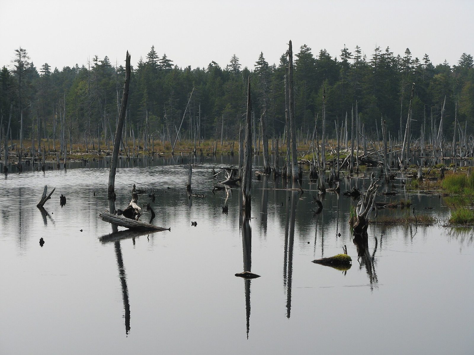
Up on the plateau, a boardwalk crosses a peat bog where pitcher plants, sundews and orchids grow in the sphagnum moss, with a beaver pond at its edge. The trail loops through the forest around it. In the early morning or evening you may see moose feeding in the pond. Caribou once roamed here, which gave the bog its name.
- Distance: a short boardwalk, on a forest loop of about 2 miles (3.4 km)
- Allow: 30 minutes for the boardwalk; 1.5 hours for the loop
- Start: Caribou Plain trailhead, on the main park road
- When: May to October; June for orchids
- Suits: everyone for the boardwalk
9. Swim and paddle at Bennett Lake
Bennett Lake, on the plateau, has a sandy beach and much warmer water than the bay, and it is the park’s place for a summer swim. Canoes and kayaks can be rented by the lake in summer to paddle its shoreline, where loons and beavers are often seen.
- Allow: half a day
- Start: Bennett Lake day-use area, off the main park road
- When: July and August
- Suits: everyone
10. Backpack the Fundy Footpath
For experienced backpackers, the Fundy Footpath runs west from the park along one of the last wild coastlines in the region, climbing in and out of steep river valleys again and again and crossing rivers that must be waded at low tide. It is one of the toughest coastal hikes in eastern Canada, with campsites along the way, and ends at the Fundy Trail Parkway.
- Distance: about 25 miles (41 km) one way
- Allow: 4 to 5 days
- Start: the park’s western trailhead, near Goose River
- When: June to September
- Suits: experienced backpackers who can plan around the tides
Before you go
This list covers what stays the same from year to year. Closures, trail conditions and tide times change, and Parks Canada posts closures on its own site. The link is on our Fundy National Park guide, with the map and how to get there.