

Top 10 things to do in Big Bend National Park
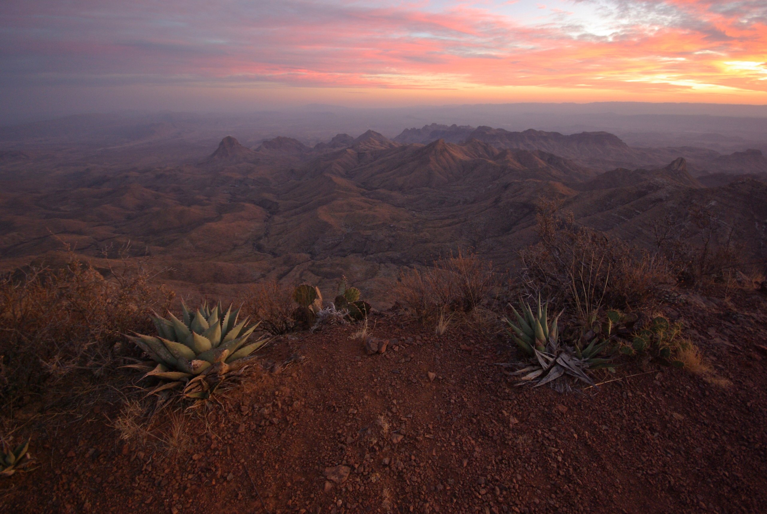
Big Bend National Park covers more than 1,200 square miles (3,100 km²) of the Chihuahuan Desert in far West Texas, where the Rio Grande makes its great bend along the border with Mexico. It holds three worlds in one park: the river and its sheer limestone canyons, the open desert of cactus, creosote and volcanic peaks, and the Chisos Mountains rising in the middle, cool and wooded with oak, juniper and pine. It is far from any city, which keeps it quieter than most big parks and gives it some of the darkest night skies in the country. These are the ten outings we would put first. The order starts with what the park is known for, then goes by what an outing gives back for the time and effort it takes. Distances are approximate; times are our estimates and do not include stops.
Distances here are long and services few: fill your fuel tank and carry plenty of water and food before you set out. From May to September the desert and river floor pass 100°F (38°C), so walk early and stay high in the Chisos in the heat of the day. Flash floods fill dry washes after storms, even under a clear sky. Black bears and mountain lions live in the Chisos: store food as the park directs and keep children close. Cross into Mexico only at the official crossing.
1. Hike the Lost Mine Trail
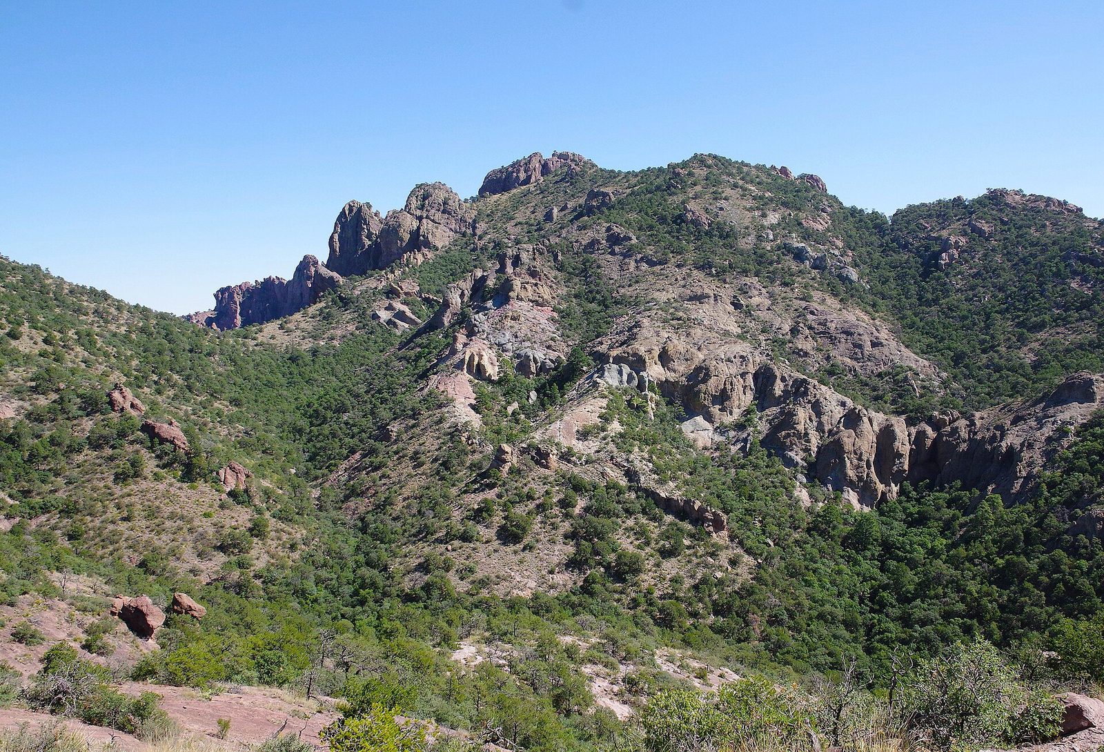
This is the best short hike in the Chisos and the best single walk in the park. It climbs steadily through oak, juniper and pinyon pine to a high, rocky ridge, with the view opening up the whole way: over Casa Grande and Juniper Canyon to the desert far below and the mountains of Mexico beyond. Come early in the morning, both for the light and because the small parking area fills quickly.
- Distance: 4.8 miles (7.7 km) round trip
- Climb: about 1,100 feet (340 m)
- Allow: 3 to 4 hours
- Start: Lost Mine trailhead, at Panther Pass on the Basin road
- When: all year; early morning
- Suits: most walkers
2. Walk into Santa Elena Canyon
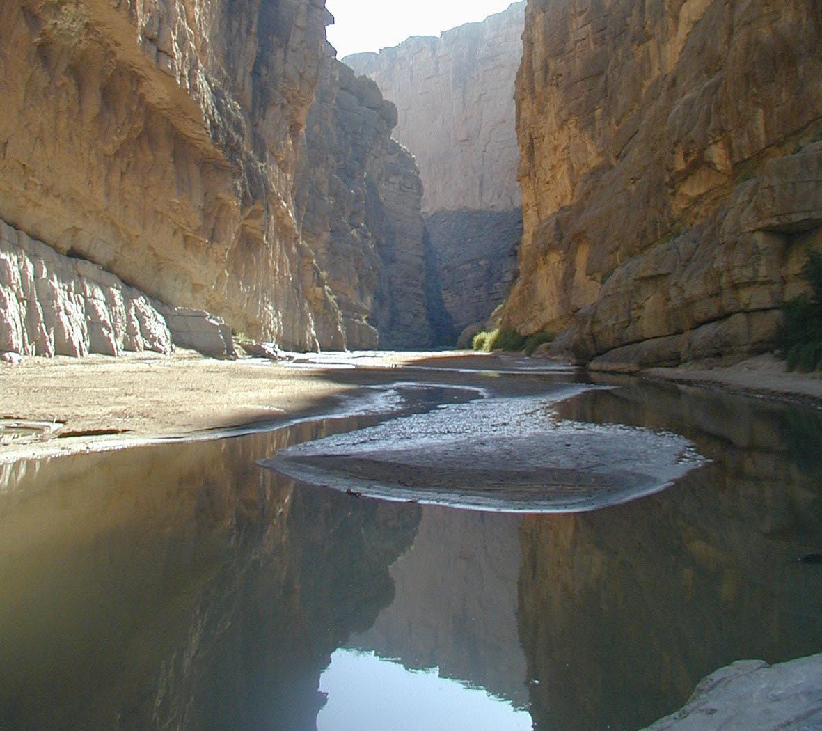
At the western end of the park, the Rio Grande comes out of a slot in a wall of limestone about 1,500 feet (460 m) high, with Texas on one side and Mexico on the other. A short trail crosses Terlingua Creek, climbs a set of ramps and steps up the canyon wall, and then drops to the river’s edge inside the canyon, between cliffs so close and tall that the sky narrows to a strip. The creek crossing can mean wading or deep mud: do not try it in flowing water above your knees.
- Distance: 1.7 miles (2.7 km) round trip
- Allow: 1.5 hours
- Start: Santa Elena Canyon trailhead, at the end of the Ross Maxwell Scenic Drive
- When: October to April; early morning or late afternoon in summer
- Suits: most walkers
3. Drive the Ross Maxwell Scenic Drive
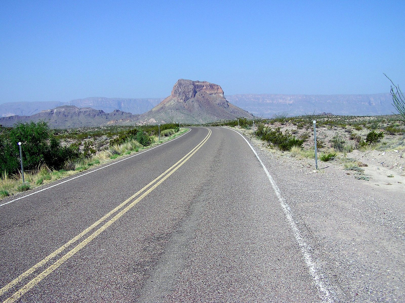
This road runs from the western slopes of the Chisos down through the desert to the river at Santa Elena Canyon, and it shows the park’s volcanic past better than anywhere. Stop at Sotol Vista for a view over the whole west side of the park, at the Mule Ears overlook to see two spires of dark volcanic rock, at Tuff Canyon to look into a narrow gorge cut in white ash, and at the old trading post at Castolon, a farming settlement on the river since the early 1900s.
- Distance: 30 miles (48 km) each way
- Allow: half a day with stops
- Start: the junction with the main park road west of Panther Junction
- When: all year
- Suits: everyone
4. Hike to the South Rim of the Chisos
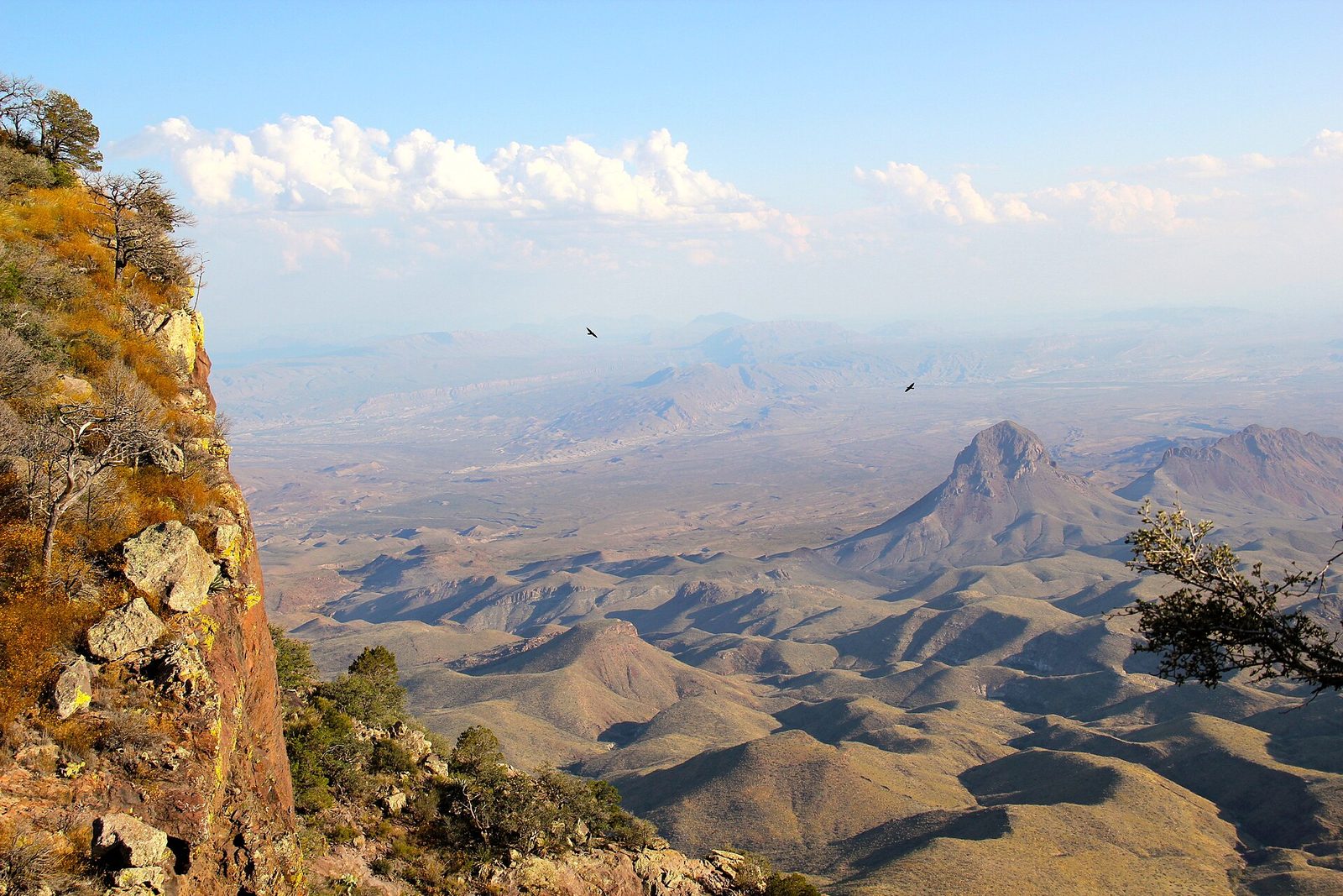
The South Rim is the great hike of Big Bend: a long loop from the Chisos Basin up through the forest of the high Chisos to the edge of a cliff some 2,500 feet (760 m) high, with the whole desert spread out below and the Rio Grande and the mountains of Mexico in the distance. Few views in Texas match it. Strong hikers can add a side trip to Emory Peak, the park’s highest point, at 7,832 feet (2,387 m), with a scramble at the top. Many people make it an overnight trip with a backcountry permit.
- Distance: about 12 to 14.5 miles (19 to 23 km) loop, depending on the route; add about 2 miles (3.2 km) round trip for Emory Peak
- Climb: about 2,000 feet (610 m)
- Allow: a full day
- Start: Chisos Basin trailhead, by the visitor center
- When: October to May; start at first light
- Suits: fit hikers
5. Hike down to the Window
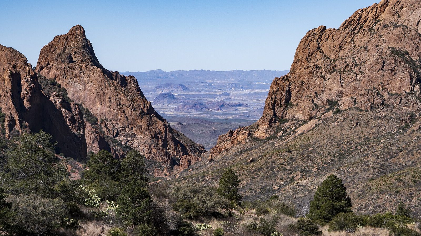
The Chisos Basin drains through a single narrow notch in its western wall, the Window, which frames the desert far below. The trail drops from the Basin down Oak Creek Canyon, among boulders, oaks and, in wet years, a trickle of water, to the top of the pour-off, where the rock falls away in a sheer drop. Stay back from the edge: the rock is polished smooth and slippery. Remember that the climb back up comes at the end, in the heat of the day. For a short version, the Window View Trail by the visitor center frames it at sunset.
- Distance: about 5.6 miles (9 km) round trip; 0.3 miles (500 m) for the Window View Trail
- Climb: about 1,000 feet (300 m), all on the way back
- Allow: 3 to 4 hours
- Start: Chisos Basin trailhead, by the visitor center
- When: all year; the morning, so the climb out is in the shade
- Suits: most walkers
6. Soak in the hot spring by the river
In 1909 J.O. Langford built a bathhouse around a hot spring on the bank of the Rio Grande and ran a small health resort there, with a store and a post office whose buildings still stand. The bathhouse washed away in a flood, but its stone foundation still holds the spring’s water at about 105°F (41°C), right at the edge of the river. A short trail leads to it past pictographs painted on the cliff. Sit in the warm water as the river runs by a few feet away.
- Distance: about half a mile (800 m) round trip; about 1 mile (1.6 km) for the loop past the historic buildings
- Allow: 1 hour
- Start: Hot Springs trailhead, at the end of Hot Springs Road off the road to Rio Grande Village
- When: October to April; early morning or evening in summer
- Suits: everyone; the road in is narrow and not suited to RVs or trailers
7. Walk into Boquillas Canyon
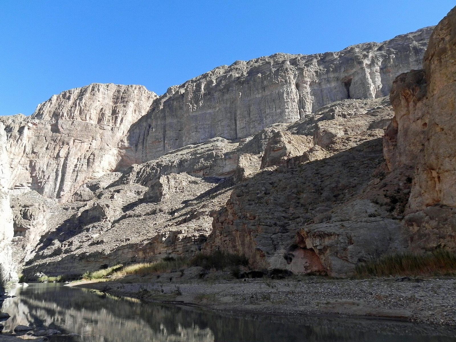
At the eastern end of the park, a short trail climbs over a low hill with a view up and down the river, then drops to a sandy beach at the mouth of Boquillas Canyon, where the Rio Grande enters walls of limestone about 1,500 feet (460 m) high. There is a large sand slide on the canyon wall that children like to climb. Go late in the afternoon, when the cliffs glow in the low sun.
- Distance: about 1.4 miles (2.3 km) round trip
- Allow: 1 hour
- Start: Boquillas Canyon trailhead, at the end of Boquillas Canyon Road beyond Rio Grande Village
- When: October to April; late afternoon
- Suits: most walkers
8. Cross the river to Boquillas del Carmen
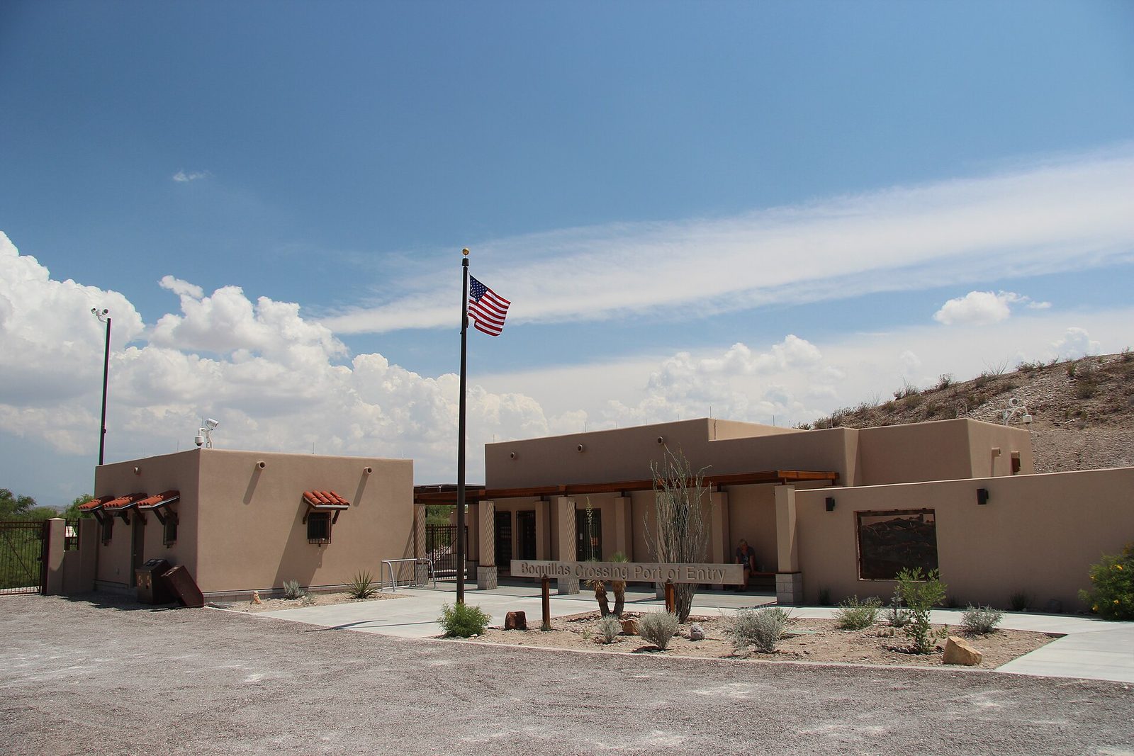
Big Bend has the only border crossing inside a national park. From the US port of entry, you walk down to the river and are rowed across the Rio Grande in a small boat to the village of Boquillas del Carmen in Mexico, where you can walk up the hill or ride a burro or a pickup, have lunch, and buy embroidery and wire sculptures from the villagers. Carry your passport, and US dollars for the rowboat, food and crafts. The crossing is open only on set days of the week.
- Allow: half a day
- Start: Boquillas Port of Entry, on the road to Boquillas Canyon
- When: on the port’s opening days
- Suits: everyone with a valid passport or other travel document accepted at the border
9. Walk to Balanced Rock in the Grapevine Hills
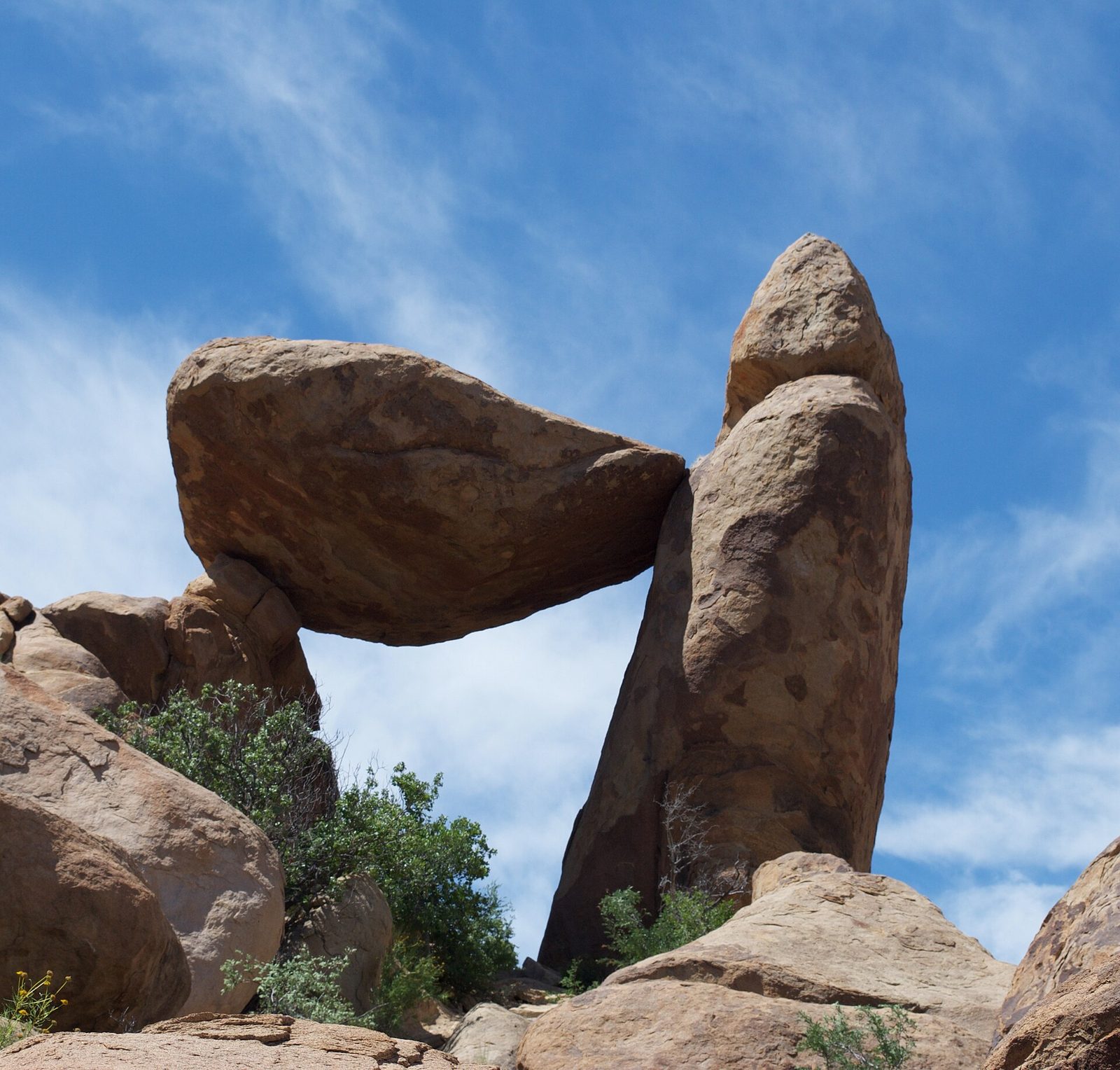
The Grapevine Hills are a jumble of rounded granite boulders, and the trail through them follows a sandy wash, then climbs a short, rocky stretch to Balanced Rock, a block of granite wedged between two others to form a window that frames the desert. It is the park’s favourite photograph, best in the soft light of early morning or late afternoon. The trailhead is reached on a gravel road that most cars can manage when it is dry.
- Distance: 2.2 miles (3.5 km) round trip
- Allow: 1.5 hours, plus the drive on gravel
- Start: Grapevine Hills trailhead, about 6 miles (10 km) up Grapevine Hills Road from the main park road
- When: October to April; early morning or late afternoon
- Suits: most walkers
10. Stay up for the stars
Big Bend is far from any city, and it has some of the darkest skies in the lower 48 states, recognized as an International Dark Sky Park. On a moonless night the Milky Way runs from horizon to horizon and the sky is crowded with stars. Any open spot away from lights will do; the campgrounds and the desert pullouts are best. Rangers lead night sky programs in the cooler months.
- Allow: an hour or two after dark
- Start: any pullout or campground away from lights
- When: all year, near the new moon
- Suits: everyone
Before you go
This list covers what stays the same from year to year. Closures, road conditions, heat warnings and the border crossing’s hours change, and the National Park Service posts them on its own site. The link is on our Big Bend National Park guide, with the map and how to get there.