

Top 8 things to do in Theodore Roosevelt National Park
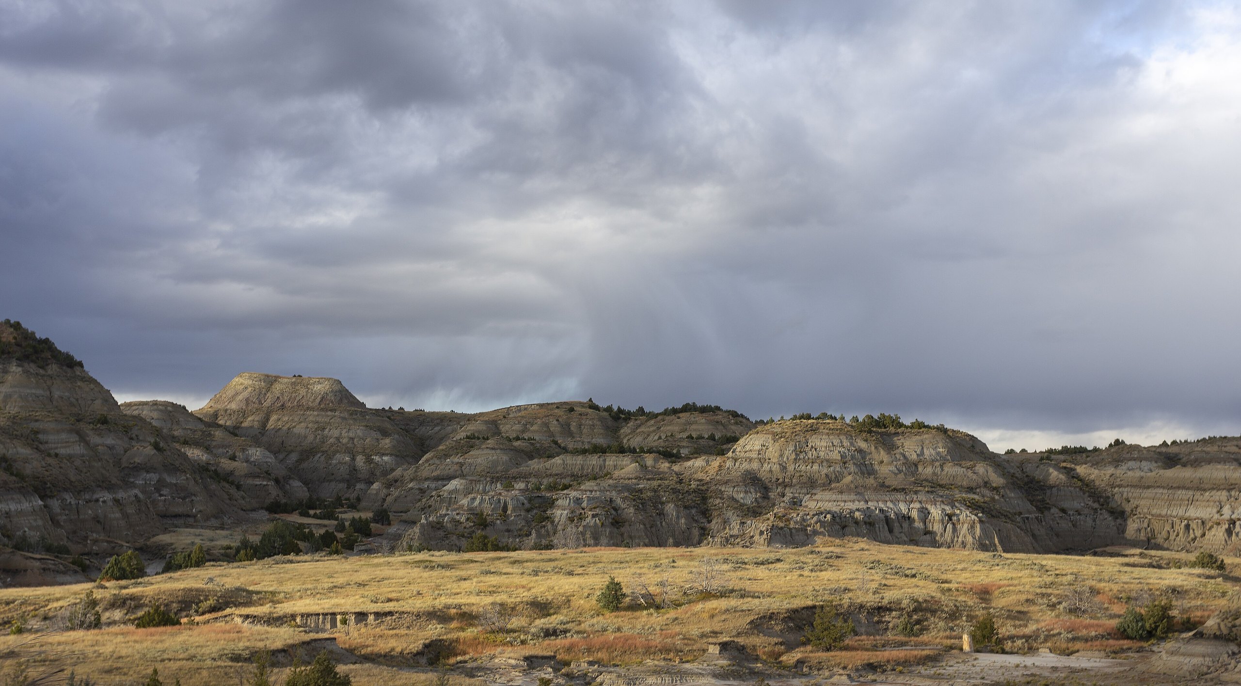
Theodore Roosevelt National Park protects the badlands of the Little Missouri River in western North Dakota, where a young Roosevelt came to hunt bison in 1883, bought into cattle ranches and returned, grieving, after his wife and mother died on the same day. He later said he would never have been president without his years here. The park is in three parts: the South Unit beside the town of Medora and Interstate 94, the quieter North Unit about 70 miles (110 km) to the north, and the remote site of his Elkhorn Ranch between them. Bison, wild horses, elk and prairie dogs live among the striped buttes. These are the eight outings we would put first. The order starts with what the park is known for, then goes by what an outing gives back for the time and effort it takes. Distances are approximate; times are our estimates and do not include stops.
Bison are the most dangerous animals here: they can run three times faster than you, and they injure visitors in national parks most years. Stay at least 25 yards (23 m) from bison, horses and elk. Rain turns the badlands clay to grease, on the trails and on dirt roads alike. There is little shade or water away from the visitor centers, and summer afternoons bring thunderstorms with lightning and hail. Prairie rattlesnakes are common.
1. Drive the South Unit Scenic Loop
This paved loop winds from Medora through the heart of the South Unit, past overlooks of the Little Missouri valley, prairie dog towns, coal seams in the hillsides and the trailheads for most of the unit’s walks. It is the best place in the park for wildlife: bison graze beside the road, elk come out at dusk, and bands of wild horses, descended from ranch stock, roam the hills. Drive it slowly, early or late in the day, and stop often.
- Distance: 36 miles (58 km) loop
- Allow: 2 to 3 hours
- Start: South Unit Visitor Center, Medora
- When: all year, though snow can close parts of it in winter; early morning and evening for wildlife
- Suits: everyone
2. Look into Painted Canyon
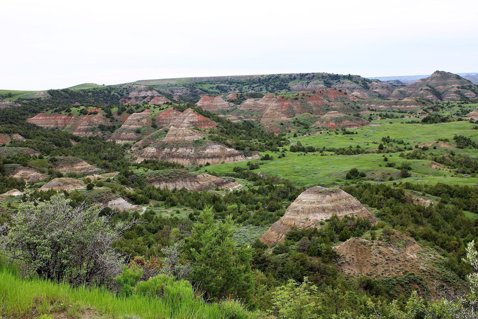
Right beside the interstate at the east edge of the South Unit, the rim of Painted Canyon gives the widest view in the park over the badlands: buttes banded in grey, tan, red and black, with green draws of juniper and ash between them. It is the stop most travellers make, and the best one for a first look. A short trail drops from the rim into the canyon among the formations and loops back, and bison sometimes wander through the picnic area.
- Distance: about 1 mile (1.6 km) loop for the trail
- Allow: 30 minutes for the overlook; 1 hour with the trail
- Start: Painted Canyon Visitor Center, at Exit 32 on Interstate 94
- When: all year; the colours glow at sunrise and sunset
- Suits: everyone for the overlook; the trail is steep in places
3. Watch the sunset from the Wind Canyon Trail
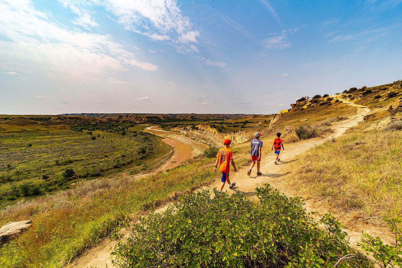
On the west side of the South Unit loop, this short trail climbs a bluff of soft sandstone that the wind has scoured into curves and hollows, to a viewpoint high above a great bend in the Little Missouri River. At sunset the river shines below and the badlands turn gold and red, and it is the park’s favourite place to end the day. Bison and wild horses often graze on the river flats below.
- Distance: about 0.4 miles (650 m) loop
- Allow: 30 minutes, plus time for the sunset
- Start: Wind Canyon trailhead, on the Scenic Loop Drive
- When: all year; the hour before sunset
- Suits: most walkers; the sand is soft and the edges are unfenced
4. Drive the North Unit to Oxbow Overlook
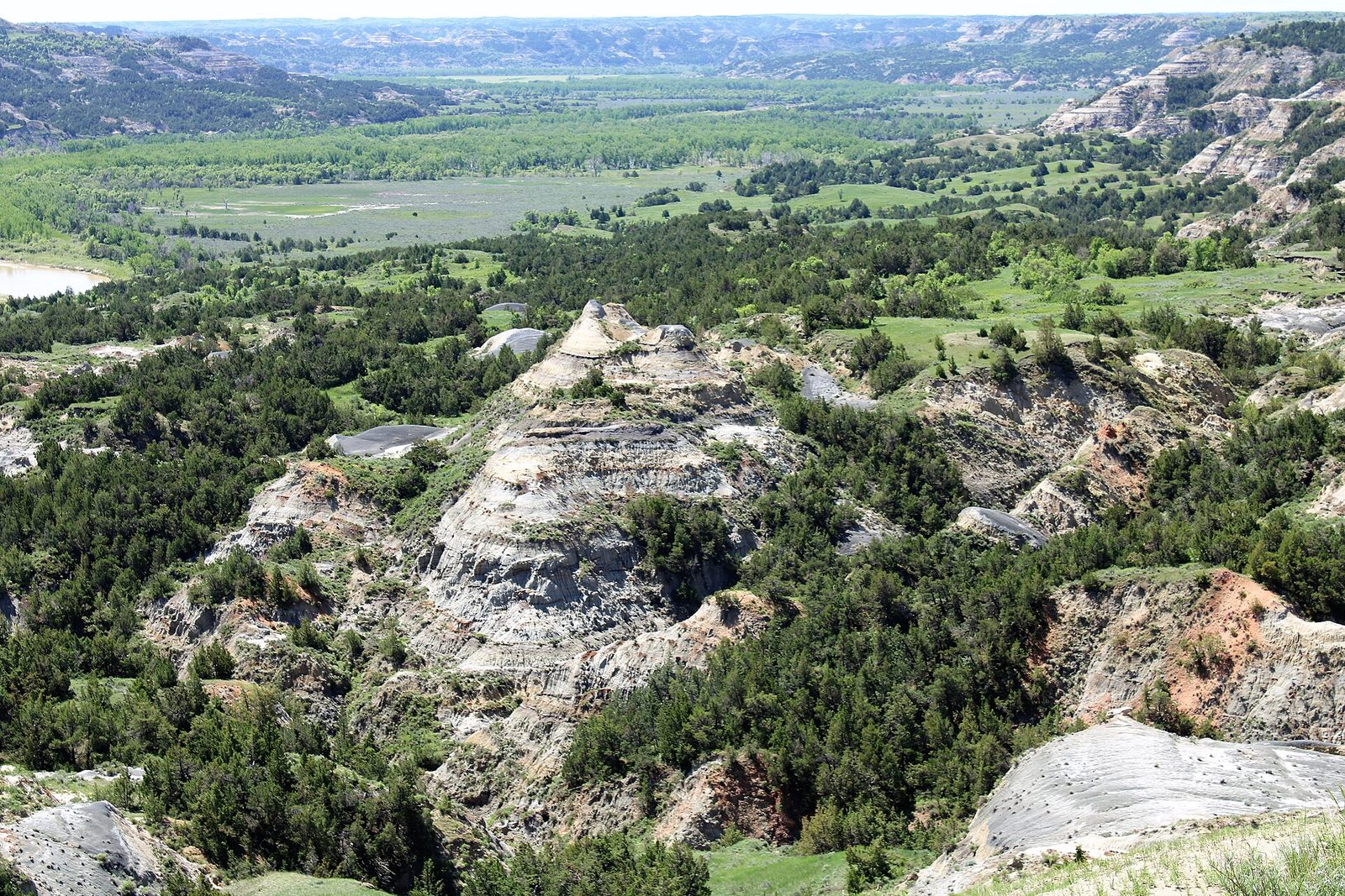
The North Unit is steeper and more rugged than the South, and far quieter. Its scenic drive runs west along the river, past a small herd of longhorn cattle kept to recall the cattle drives of Roosevelt’s day, bighorn sheep on the cliffs and bison in the bottomlands, to Oxbow Overlook, where the Little Missouri swings in a great bend below. Stop on the way at Riverbend Overlook, where a stone shelter built by the Civilian Conservation Corps in the 1930s looks down on another sweep of the river.
- Distance: 14 miles (23 km) each way
- Allow: 2 hours, there and back
- Start: North Unit Visitor Center, on US 85 south of Watford City
- When: all year, though snow can close the far end in winter
- Suits: everyone
5. Hike the Caprock Coulee Trail
This loop in the North Unit is the best way into the badlands on foot. It starts up a dry wash among concretions, round boulders of harder rock weathered out of the clay, and pillars capped with flat stones, then climbs onto the ridge above for long views over the river and the buttes before dropping back. Shorter options turn back after the first section, which has signs explaining the geology.
- Distance: about 4.1 miles (6.6 km) loop
- Allow: 2.5 to 3 hours
- Start: Caprock Coulee trailhead, on the North Unit scenic drive
- When: May to June and September to October; avoid it after rain
- Suits: steady walkers
6. See Roosevelt’s Maltese Cross Cabin
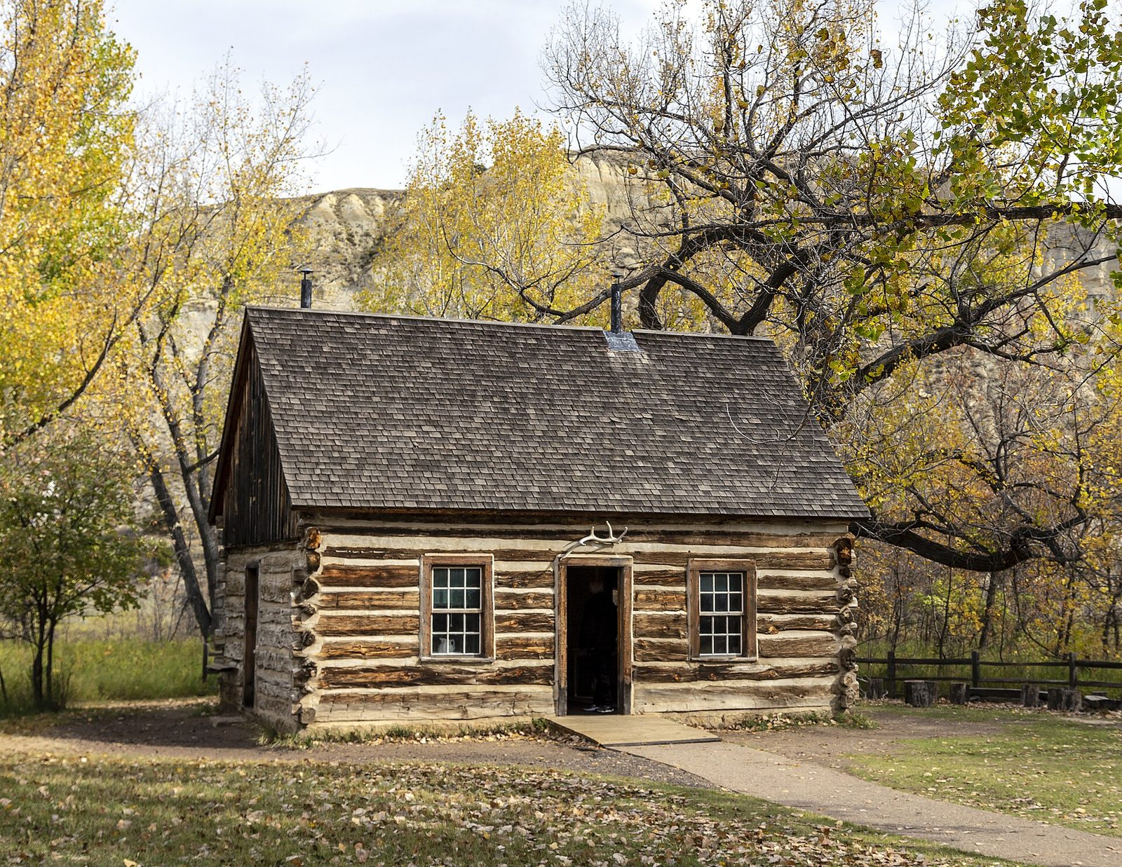
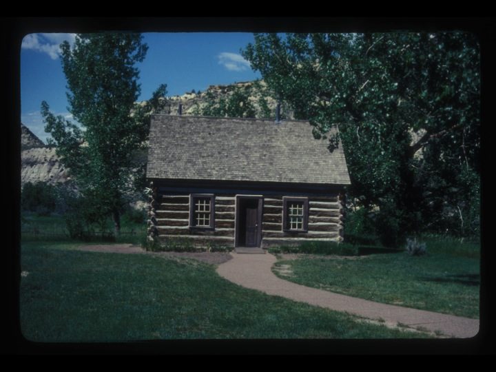
Roosevelt’s first ranch house in the badlands is a small cabin of ponderosa pine logs, built in 1883 for his Maltese Cross ranch, with a steep roof and, unusually for the frontier, a second storey. It travelled to world’s fairs after he became president, and now stands behind the South Unit Visitor Center, furnished with some of his belongings. Rangers lead short tours of it in summer. The visitor center itself has exhibits on his life in Dakota Territory.
- Allow: 45 minutes with the visitor center
- Start: South Unit Visitor Center, Medora
- When: all year; tours in summer
- Suits: everyone
7. Make the trip to the Elkhorn Ranch
In 1884, after his wife and mother died, Roosevelt set up a second ranch in a cottonwood grove on the Little Missouri, far from anyone, and lived and worked here for much of the next two years. Only the foundation stones of the house remain, with signs marking where the buildings stood, but the place itself is unchanged: the river, the cottonwoods and the silence that helped make him a conservationist. Reaching it takes a long drive on gravel roads that turn impassable when wet, followed by a short walk.
- Distance: about 35 miles (56 km) north of Medora by gravel road; under a mile (1.6 km) round trip on foot
- Allow: half a day
- Start: Elkhorn Ranch trailhead; get directions at the South Unit Visitor Center
- When: May to October, in dry weather
- Suits: anyone with a high-clearance vehicle and a dry forecast
8. Walk to the Petrified Forest
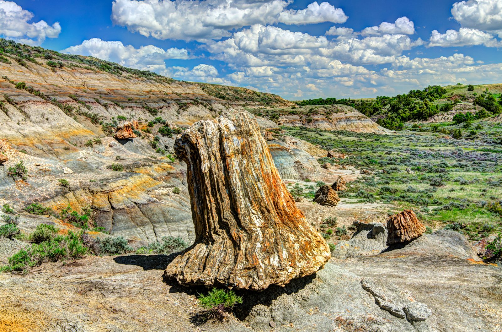
In the remote western part of the South Unit, the trunks of trees that grew in a swampy forest some 60 million years ago lie turned to stone across the hillsides, with stumps several feet across still standing where they grew. It is one of the largest displays of petrified wood in the country. The full loop crosses open prairie and badlands, and you may meet nobody all day.
- Distance: about 10 miles (16 km) loop; a shorter out-and-back reaches the first petrified wood
- Allow: 5 to 6 hours for the loop
- Start: Petrified Forest trailhead, at the end of a gravel road on the park’s western boundary, reached from Interstate 94 at Exit 23
- When: May to June and September to October
- Suits: fit hikers with good navigation; carry all your water
Before you go
This list covers what stays the same from year to year. Closures, road conditions, storm warnings and program schedules change, and the National Park Service posts them on its own site. The link is on our Theodore Roosevelt National Park guide, with the map and how to get there.