

Top 10 things to do in New River Gorge National Park
New River Gorge National Park and Preserve follows one of the oldest rivers in North America for 53 miles (85 km) through a canyon about 1,000 feet (300 m) deep in the plateau of southern West Virginia. The gorge was mined for coal and logged bare a century ago, and the forest has grown back over the old towns and tipples. Today it is known for a bridge, some of the best whitewater in the East, and miles of sandstone cliffs that draw climbers from around the world. These are the ten outings we would put first. The order starts with what the park is known for, then goes by what an outing gives back for the time and effort it takes. Distances are approximate; times are our estimates and do not include stops.
Most of the rim overlooks have no railings, and people have died in falls from them: keep children close and stay back from the edge, above all when the rock is wet. The river is far more powerful than it looks from above. Do not swim in it on the Lower New, and wear a life jacket on any trip. Timber rattlesnakes and copperheads live in the gorge, and ticks are common from spring to fall.
1. See the New River Gorge Bridge from the Canyon Rim boardwalk
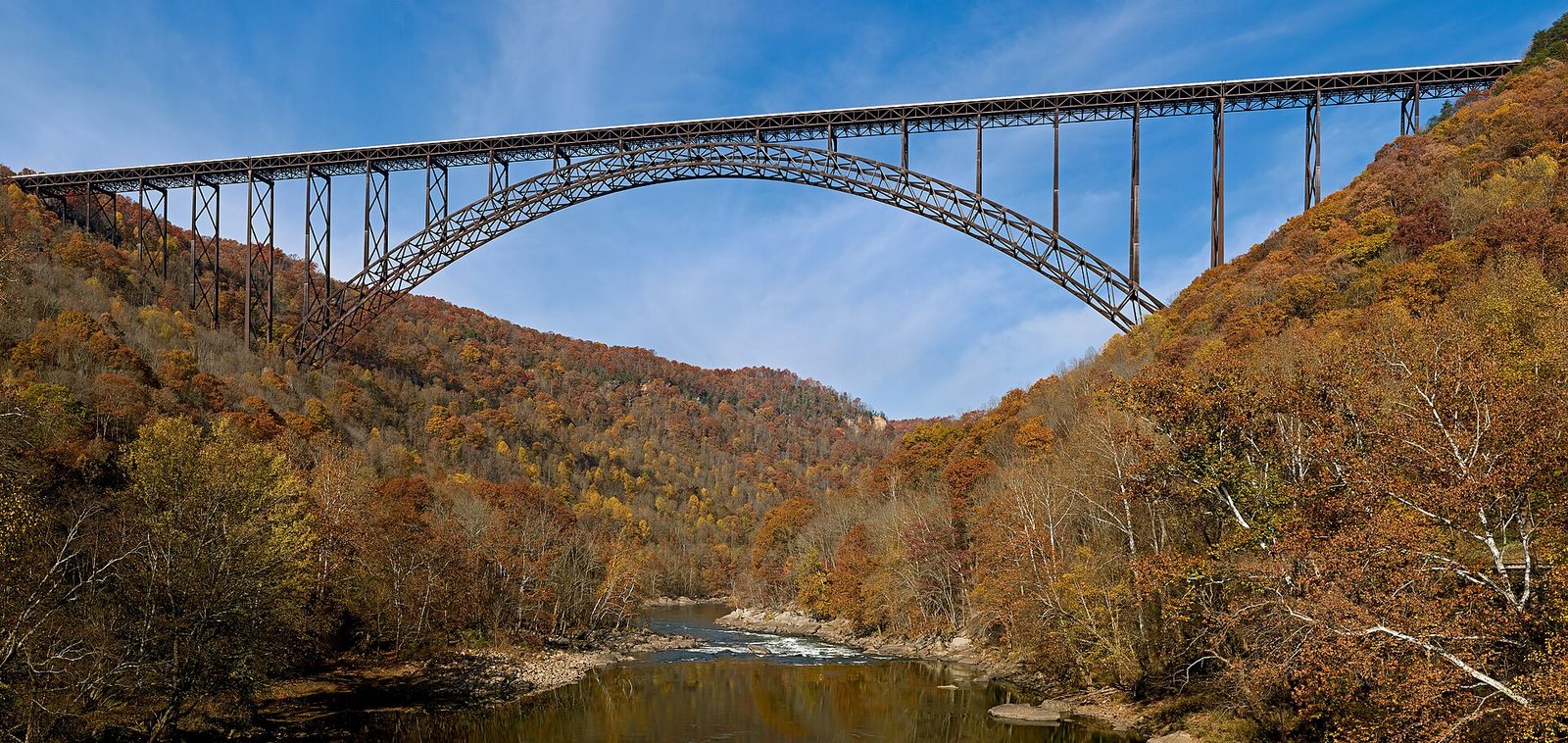
When the bridge opened in 1977, it cut the drive across the gorge from about 40 minutes on a road of switchbacks to under a minute. Its steel arch spans 1,700 feet (518 m) and carries the road 876 feet (267 m) above the river, and it is the picture on the back of West Virginia’s state quarter. Behind the Canyon Rim Visitor Center, a boardwalk leads to an accessible overlook level with the arch, and 178 steps go down to a lower deck, where the bridge fills the view against the far side of the gorge.
- Distance: a short boardwalk to the upper overlook; 178 steps down to the lower one
- Allow: 45 minutes, with the visitor center
- Start: Canyon Rim Visitor Center, off US 19 just north of the bridge, near Fayetteville
- When: all year; mid- to late October for the colour
- Suits: everyone for the upper overlook; the stairs back up are steep
2. Raft the Lower New
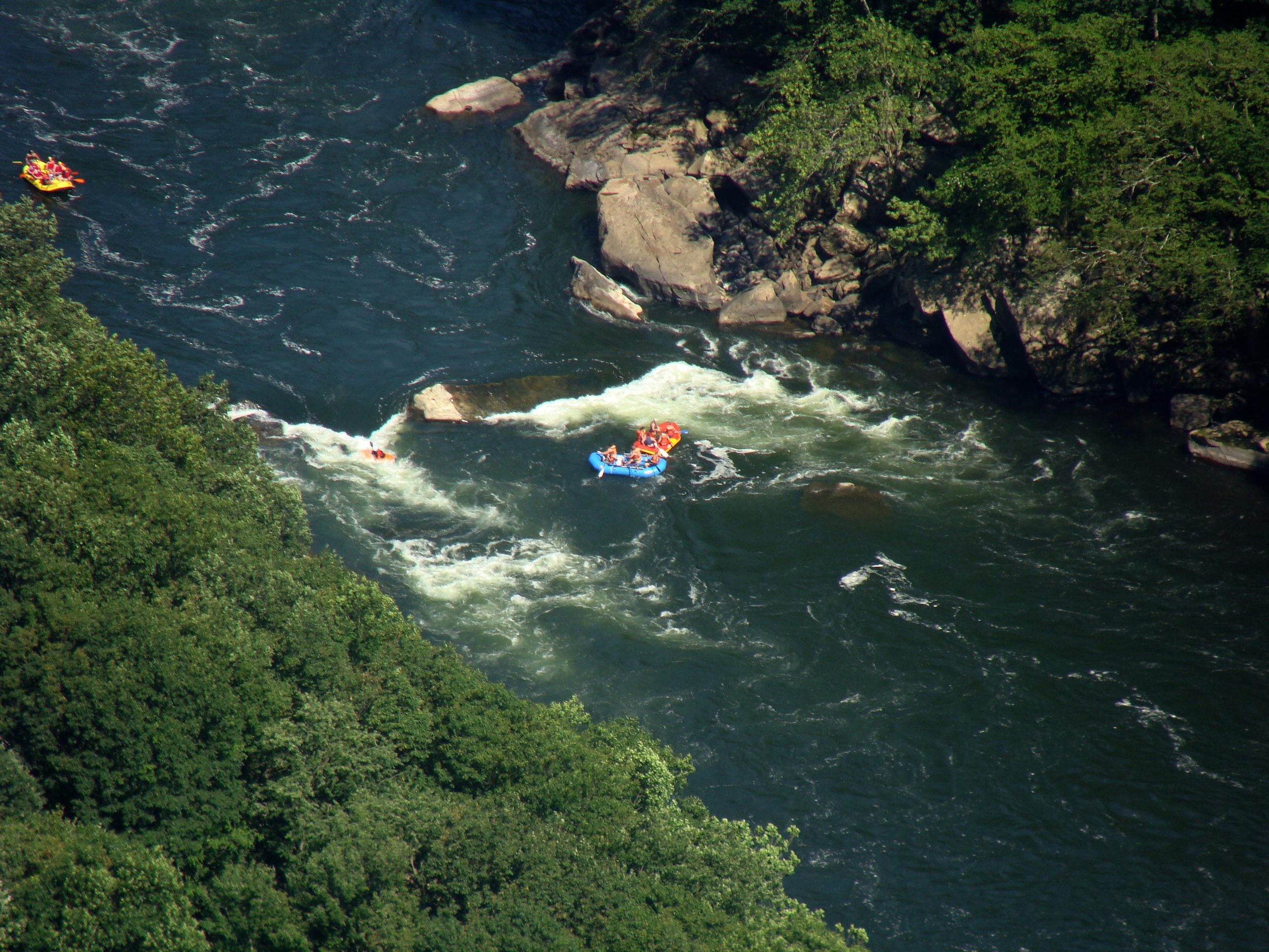
Below Thurmond, the river drops into the narrowest part of the gorge and through a run of big rapids with names like Keeneys, Double Z and Greyhound Bus Stopper, ending under the bridge itself. It is one of the classic whitewater runs in the East, and local outfitters have run it since the late 1960s. For families and young children, the Upper New, above Thurmond, is a gentler float with small rapids and places to swim. Trips are booked through the licensed outfitters around Fayetteville, who provide the boats, guides and gear.
- Allow: a full day, including the drive to the put-in and lunch on the river
- Start: your outfitter’s base, usually near Fayetteville or Lansing
- When: April to October; spring is highest and wildest, late summer is warmer and calmer
- Suits: fit adults and teenagers for the Lower New, within the outfitters’ age limits; everyone for the Upper New
3. Walk the Endless Wall Trail to Diamond Point
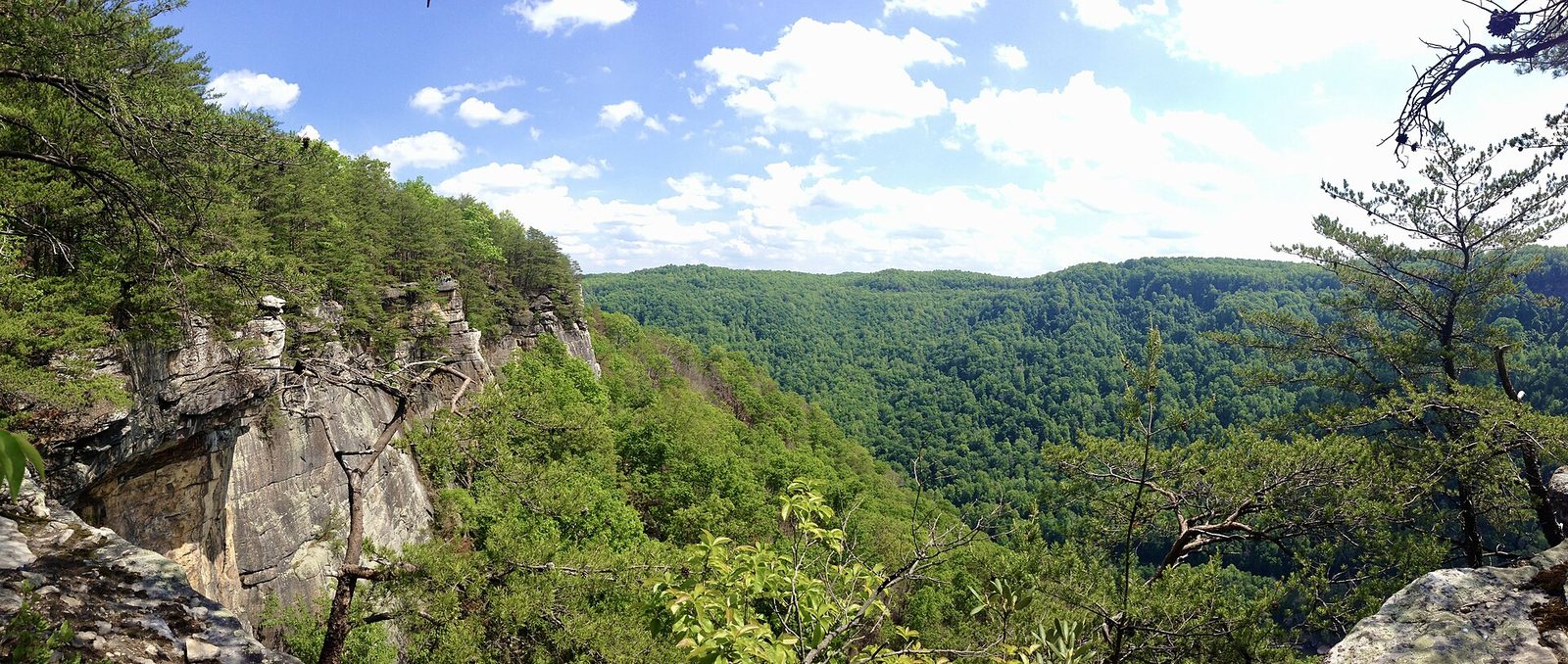
The Endless Wall is a cliff of hard sandstone that runs for miles along the rim, and the trail follows it through rhododendron thickets and hemlock to a string of overlooks. Diamond Point, about halfway, is the best: a bare point of rock above a bend in the river, with rafts in the rapids nearly 900 feet (270 m) below and climbers on the wall beside you. It is one of the finest short walks in the East. Walk it as an out-and-back from Fern Creek, or carry on to the second trailhead farther along Lansing Road and walk back along the road.
- Distance: 2.4 miles (3.9 km) one way between the two trailheads; about 2 miles (3.2 km) round trip from Fern Creek to Diamond Point
- Allow: 1.5 to 2 hours
- Start: Fern Creek trailhead, on Lansing Road east of US 19. The lot fills early on weekends.
- When: all year; late May and June for rhododendron, October for colour
- Suits: most walkers; the overlooks have no railings
4. Hike out to Long Point
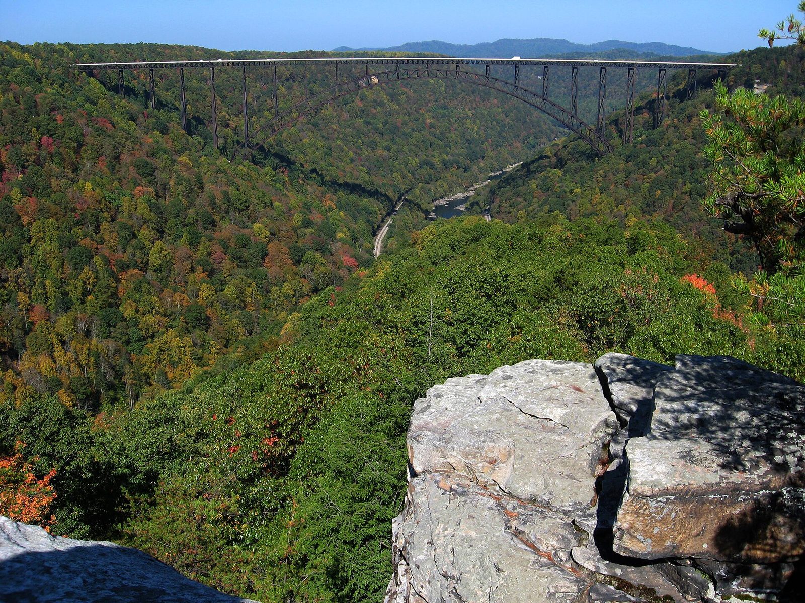
Long Point is a fin of rock that sticks out into the gorge opposite the bridge, giving the best view of it from the side, with the whole arch and the river below. The trail there runs through quiet woods and fields with little climbing, and the last stretch drops gently to the point. Go late in the day: the low sun lights the bridge and the far wall of the gorge. Bring a headlamp for the walk back.
- Distance: 3.2 miles (5.1 km) round trip
- Allow: 1.5 to 2 hours
- Start: Long Point trailhead, on Gatewood Road south of Fayetteville
- When: all year; late afternoon for the light
- Suits: most walkers
5. Drive the Fayette Station Road under the bridge
Before the bridge, this was the way across: a narrow road that twists down one side of the gorge in tight switchbacks, crosses the river on a low steel bridge and climbs out the other side. Most of it is now one-way. On the way down you pass under the great arch, and at the bottom you can stop by the river and look straight up at it, with rafts coming through Fayette Station Rapid beside you.
- Distance: about 8 miles (13 km)
- Allow: 45 minutes to 1 hour
- Start: signed from US 19 at the bridge; the Canyon Rim Visitor Center has a guide to the drive
- When: all year, though ice can close it in winter. Not suited to RVs or trailers.
- Suits: everyone
6. Look down on the horseshoe bend from Grandview
At Grandview, at the southern end of the park, the river loops in a great horseshoe around a wooded ridge some 1,400 feet (430 m) below the rim, and trains crawl along the bank at the bottom. The main overlook is a short walk from the parking area. In late May and early June, the rhododendrons along the rim flower pink and white. The Grandview Rim Trail follows the edge to Turkey Spur, a higher rock with a wider view of the bend.
- Distance: a short walk to the main overlook; about 3.2 miles (5.1 km) round trip on the rim trail to Turkey Spur
- Allow: 30 minutes; 2 hours with the rim trail
- Start: Grandview, off I-64 at Exit 129 near Beckley
- When: all year; late May to mid-June for rhododendron, October for colour
- Suits: everyone for the main overlook
7. See Sandstone Falls
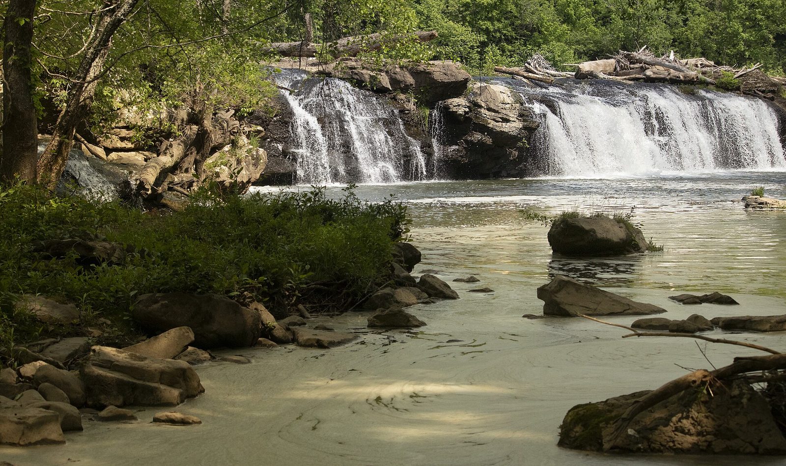
Near the south end of the park, the river spreads out to 1,500 feet (460 m) wide and pours over a ledge of sandstone between wooded islands. Sandstone Falls is the largest waterfall on the New, and unlike most of the gorge, you can get right down to it: a boardwalk crosses from the road onto the islands, past pools where herons fish. A quiet road follows the river up from Hinton to the falls, with a few pull-offs along the way.
- Distance: about a quarter mile (400 m) of boardwalk
- Allow: 1 hour, plus the drive
- Start: Sandstone Falls parking area, on River Road about 8 miles (13 km) north of Hinton
- When: all year; the boardwalk closes in high water
- Suits: everyone; the boardwalk is accessible
8. Climb down the Kaymoor Miners Trail
From 1900 to 1962, the Kaymoor mine took coal from a seam high in the gorge wall and sent it down to a processing plant and a town by the river. The Kaymoor Miners Trail leads through the woods to the mine entrance, and then down a staircase of 821 steps beside the old haulage incline to the ruins of the plant and the coke ovens at the bottom. Every one of those steps has to be climbed back up, so save some energy.
- Distance: about 2 miles (3.2 km) round trip, with the 821 steps
- Climb: about 600 feet (180 m) back up from the bottom
- Allow: 2 to 3 hours
- Start: Kaymoor Top trailhead, at the end of Kaymoor Road, Fayetteville
- When: spring and fall; summer is hot and humid on the stairs
- Suits: fit walkers
9. Visit Thurmond
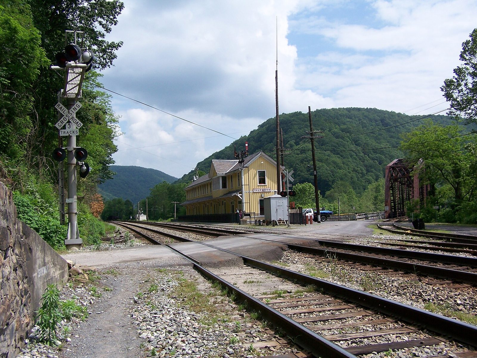
In the 1910s Thurmond was one of the busiest stops on the Chesapeake & Ohio, with more freight passing through it than through cities many times its size, and its bank was among the richest in the state. The coal trade moved away, and today a handful of people live in a town of empty brick storefronts facing the tracks, with no main street at all: the railroad was the street. The restored depot is a seasonal visitor center, and Amtrak’s Cardinal still stops here. A one-lane road with a single-lane bridge over the river leads in from US 19.
- Allow: 1 hour, plus the drive
- Start: Thurmond Depot, at the end of Thurmond Road (WV 25) from Glen Jean
- When: all year; the depot opens in summer
- Suits: everyone
10. Join the crowd on Bridge Day
For one day each year, on the third Saturday of October, the bridge closes to traffic and opens to people. Tens of thousands walk across it, and hundreds of BASE jumpers leap from it, opening their parachutes for the river landing far below, alongside rappellers lowering themselves on ropes. It is West Virginia’s largest one-day festival, at the peak of the fall colour. Book a room early, and use the shuttle buses: the roads around the bridge close.
- Allow: a day
- Start: the shuttle stops around Fayetteville
- When: the third Saturday in October
- Suits: everyone who can manage crowds
Before you go
This list covers what stays the same from year to year. Trail closures, river levels and the Bridge Day details are posted by the National Park Service and the event’s organizers on their own sites. The park link is on our New River Gorge National Park guide, with the map and how to get there.