

Top 10 things to do in Cape Breton Highlands National Park
Cape Breton Highlands National Park covers the northern end of Cape Breton Island in Nova Scotia, where a high, forested plateau drops straight into the sea on both sides. The Cabot Trail, one of the best-known scenic drives in Canada, runs through it up the west coast, across the highlands and down the east, and every outing on this list starts from that road. The west side, near the Acadian village of Chéticamp, has the big cliffs and sunsets. The east side, around Ingonish, has the beaches. These are the ten outings we would put first. The order starts with what the park is known for, then goes by what an outing gives back for the time and effort it takes. Distances and heights are Parks Canada figures; times are our estimates and do not include the drive.
Moose are the animal to plan around. There are a great many in the park, they stand on the road at dusk and after dark, and they are dangerous to approach on foot, most of all cows with calves in spring and bulls in the fall rut. Drive slowly in the evening and give any moose on a trail a wide berth. Coyotes here have attacked people: do not hike alone at dawn or dusk, and carry a stick.
1. Drive the Cabot Trail through the park
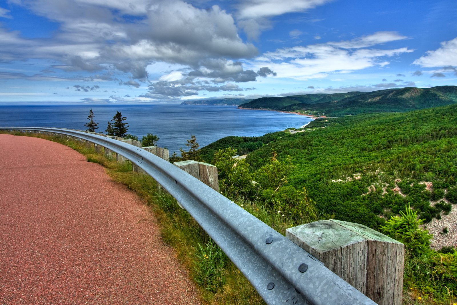
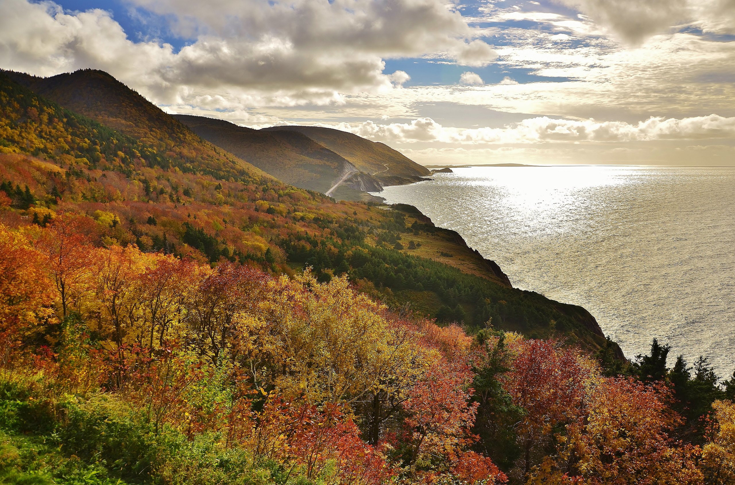
About a third of the Cabot Trail’s 185 miles (298 km) lies inside the park, and it is the best third. From Chéticamp the road runs along the foot of red cliffs beside the Gulf of St. Lawrence, then climbs French Mountain in sweeping bends to a plateau of bog and stunted spruce 1,500 feet (455 m) above the sea. It drops to Pleasant Bay, climbs again over North Mountain through old hardwood forest, and comes down to the Atlantic coast, which it follows south past coves of pink granite to Ingonish. More than twenty signed look-offs line the way.
In the first half of October the hardwoods on the mountainsides turn red, orange and gold, and the drive is at its best and busiest. The grades are long and steep, so use a low gear on the way down.
- Distance: about 66 miles (106 km) through the park between Chéticamp and Ingonish
- Allow: 2.5 hours without stops; a full day with them
- Start: the Chéticamp or Ingonish entrance
- When: May to October; early to mid-October for fall colour
- Suits: everyone. Driving clockwise keeps you on the inside lane; anticlockwise puts the sea on your side.
2. Walk the Skyline Trail at sunset
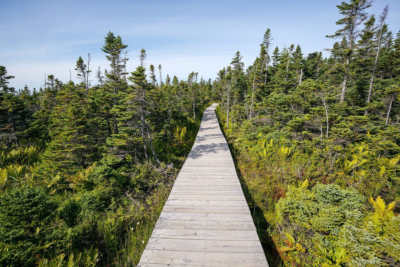
The Skyline is the park’s signature walk. A wide, level path crosses the plateau through fir and birch to the edge of French Mountain, where a boardwalk with steps runs down a bare headland high above the Gulf of St. Lawrence. Below you the Cabot Trail winds along the coast, and pilot whales and minke whales are often seen in the water offshore. Moose browse beside the path so regularly that part of the forest is fenced to let it grow back. The headland faces west, and at sunset the boardwalk is full.
Stay on the boardwalk: the plants on the headland are fragile, and the edge is a real cliff. Dogs are not allowed on this trail because of the moose.
- Distance: 4 miles (6.5 km) return to the headland; 5.1 miles (8.2 km) for the full loop
- Climb: about 250 feet (75 m) on the direct route, plus the boardwalk steps
- Allow: 2 to 3 hours
- Start: Skyline trailhead, at the top of French Mountain, 9 miles (15 km) north of the Chéticamp entrance
- When: May to October. Bring a headlamp for the walk back after sunset, and a jacket: the headland is windy.
- Suits: most walkers
3. Walk out to Middle Head
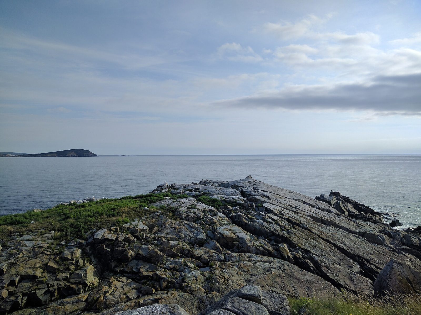
Middle Head is a long, thin finger of land that divides the two bays of Ingonish, and a trail runs its whole length through spruce woods and open grass to the cliffs at its tip. There is sea on both sides for most of the way, with Cape Smokey across the water to the south. Terns and gulls nest on the rocks at the end, and in summer you may see whales, seals and bald eagles from the point. It starts behind the Keltic Lodge, a 1940s resort hotel on the headland.
- Distance: 2.4 miles (3.8 km) return
- Allow: 1.5 to 2 hours
- Start: the parking area beyond the Keltic Lodge, Ingonish Beach
- When: May to October. The tip is closed at times in early summer to protect nesting birds.
- Suits: most walkers. The cliffs are unfenced.
4. Climb Franey
Franey is the best view on the east side, and you work for it. The trail climbs steeply through forest for a mile and a half (2.4 km) to a rocky summit with a fire tower, 1,400 feet (430 m) above the sea. From the open ledge below the tower you look straight down into the Clyburn Valley, a deep trench with a river winding along its floor, and out over Ingonish, Middle Head and the Atlantic. The return follows an old fire road, which is easier on the knees.
- Distance: a loop of 4.6 miles (7.4 km)
- Climb: about 1,100 feet (335 m)
- Allow: 2.5 to 3.5 hours
- Start: Franey trailhead, on a gravel road off the Cabot Trail just north of Ingonish Beach
- When: May to October; early October for colour in the valley
- Suits: fit walkers
5. Swim in salt and fresh water at Ingonish Beach
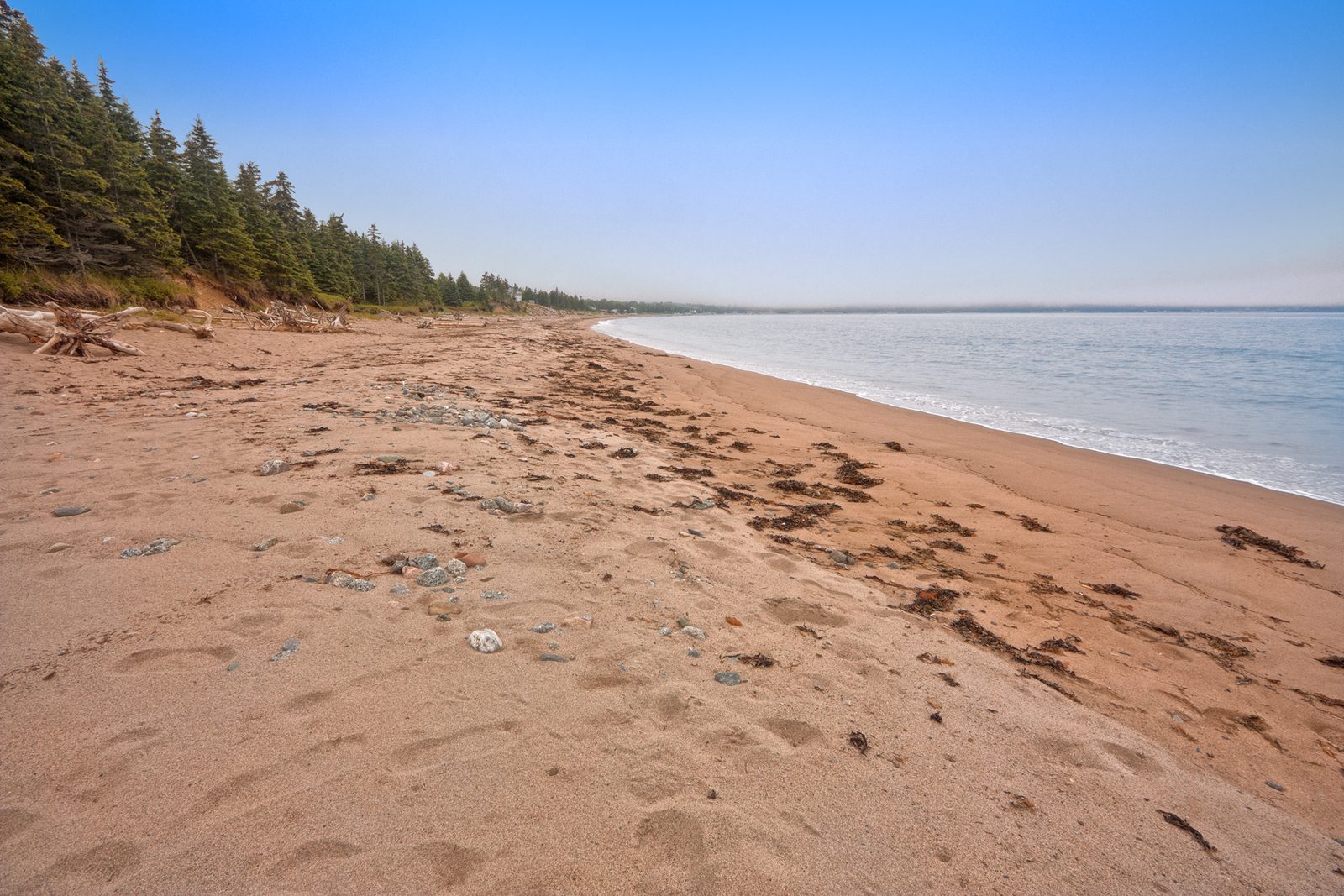
Ingonish Beach is a long bar of sand and cobble with the Atlantic on one side and a lake on the other. The sea here warms more than you would expect by August, and there is surf to play in on most days. A few steps behind the beach, Freshwater Lake is calm, shallow and warmer still, and better for small children. Lifeguards watch both in high summer. Few beaches let you swim in the ocean and a lake within a minute of each other.
- Allow: half a day
- Start: Ingonish Beach day-use area, just inside the Ingonish entrance
- When: July to early September for swimming
- Suits: families
6. Stop at Black Brook Cove
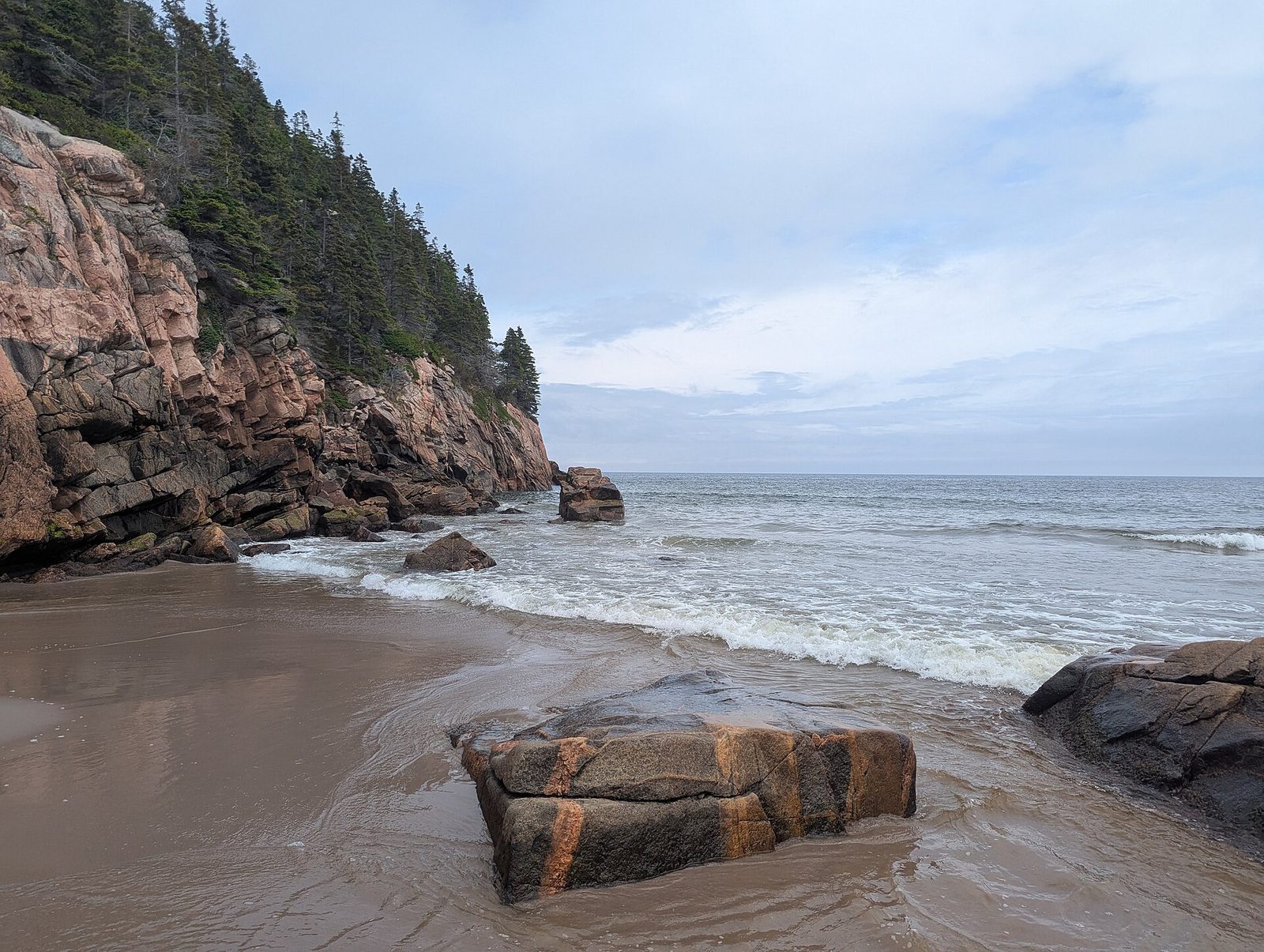
Black Brook is a small, sheltered beach of sand between granite headlands, and at its north end a brook comes down over a waterfall and runs out across the sand into the sea. You can stand under the falls and then walk into the surf. The Jack Pine Trail starts from the parking area and loops through a forest that grew after a fire in 1921, then follows the shore over smooth pink rock. Picnic tables in the trees make it the best lunch stop on the east coast.
- Distance: a few steps to the beach; a loop of 1.4 miles (2.3 km) on the Jack Pine Trail
- Allow: 1 to 2 hours
- Start: Black Brook day-use area, on the Cabot Trail north of Ingonish
- When: June to September
- Suits: everyone. Waves and currents can be strong; the beach is supervised in high summer.
7. Walk onto the rocks at Green Cove
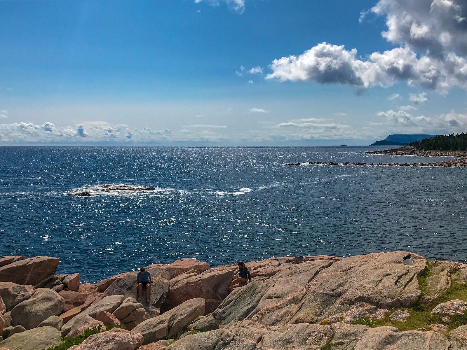
Green Cove is a short walk that takes ten minutes and that almost everyone remembers. A boardwalk and path lead out onto a headland of bare pink granite, crossed by dark bands of other rock, that pushes into the open Atlantic. Waves break on three sides. On a rough day the spray comes over the point, and you should watch from well back, since the wet rock is slippery and a wave can reach higher than the last. Seabirds and sometimes whales pass close to shore.
- Distance: about 0.2 miles (0.4 km) return
- Allow: 20 minutes
- Start: Green Cove, on the Cabot Trail between Black Brook and Neils Harbour
- When: all year
- Suits: everyone, with children kept close
8. Visit the Lone Shieling
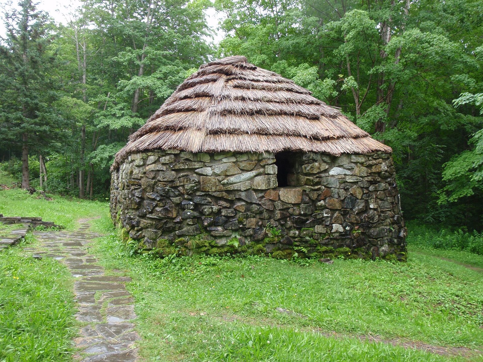
In the valley between the park’s two mountains stands a small stone hut with a thatched roof, a copy of the summer shelters that Scottish crofters built for tending sheep. It was put up in 1942 to honour the Gaelic-speaking Highlanders who settled Cape Breton. The short loop that passes it runs through one of the largest old-growth hardwood forests in the Maritimes, with sugar maples up to 350 years old. It is at its best in early October, when the whole canopy is yellow and orange.
- Distance: a loop of 0.4 miles (0.6 km)
- Allow: 20 to 30 minutes
- Start: Lone Shieling, on the Cabot Trail at the foot of North Mountain, east of Pleasant Bay
- When: May to October
- Suits: everyone
9. Go whale watching from Pleasant Bay
The waters off the park’s west coast hold pilot whales through the summer, often in pods of dozens, along with minke, fin and humpback whales, dolphins, seals and seabirds. Pleasant Bay, a fishing village on the Cabot Trail between the park’s two mountains, is the main harbour for whale-watching boats, and others leave from Chéticamp and from Ingonish. The trips run close under the sea cliffs of the park, which is the only way to see them from below.
- Allow: 2 to 2.5 hours on the water
- Start: the harbour at Pleasant Bay
- When: June to early October; July and August for the most whales
- Suits: everyone. It is much colder on the water than on shore.
10. Cool off at Mary Ann Falls
Mary Ann Brook drops over a series of rock ledges into a deep, clear pool in the forest, and on a hot afternoon it is the best freshwater swimming in the park. A staircase leads from the parking area to a viewing platform and down to the pool. Getting there takes a slow drive of about 4 miles (6.5 km) up a narrow gravel road, which keeps the numbers down. The water is cold in any month.
- Distance: a few minutes’ walk from the parking area
- Allow: 1 to 1.5 hours with the drive
- Start: Mary Ann Falls Road, off the Cabot Trail north of Ingonish near Broad Cove
- When: June to September. The road is closed in winter and may be closed after heavy rain.
- Suits: families. The rocks beside the falls are slippery.
Before you go
This list covers what stays the same from year to year. Trail closures, road conditions, beach supervision dates and wildlife warnings change, and Parks Canada posts them on its own site. The link is on our Cape Breton Highlands National Park guide, with the map, passes and how to get there.