

Top 10 things to do in Pacific Rim National Park Reserve
Pacific Rim National Park Reserve is a strip of the outer coast of Vancouver Island: open ocean beaches, rocky headlands and temperate rainforest, in the territories of the Nuu-chah-nulth peoples. It comes in three separate pieces. The Long Beach unit, between Tofino and Ucluelet, is the one you can drive to, and it holds the first eight entries here. The Broken Group Islands and the West Coast Trail are reached by boat or on foot, and take days. These are the ten outings we would put first. The order starts with what the park is known for, then goes by what an outing gives back for the time and effort it takes. Distances are Parks Canada figures; times are our estimates and do not include stops.
This is the open Pacific, and it deserves respect in any weather. Rip currents run off every beach, large waves arrive without warning and sweep the rocks and the drift logs, and the water is cold enough to disable a swimmer in minutes. Stay off wet rock and logs near the surf, and never turn your back on the sea. Wolves, cougars and black bears use the beaches and trails: keep dogs leashed and food packed away.
1. Walk Long Beach
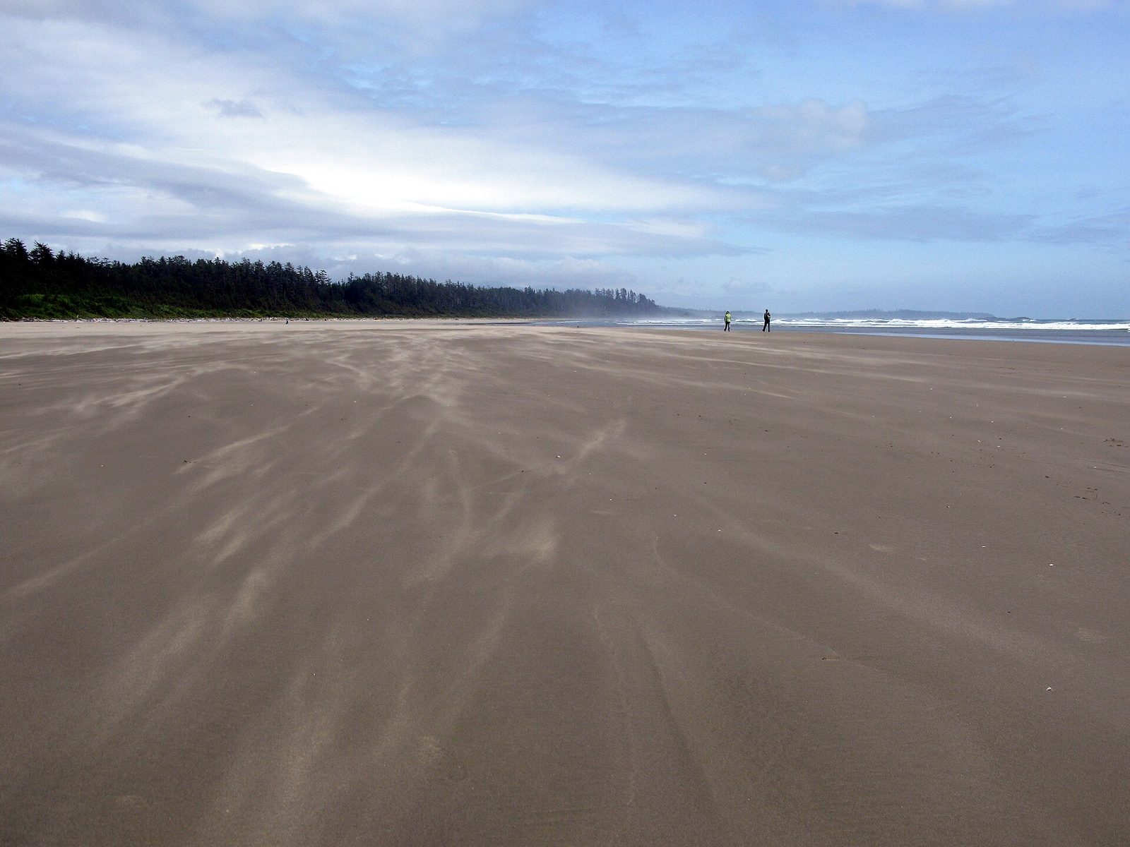
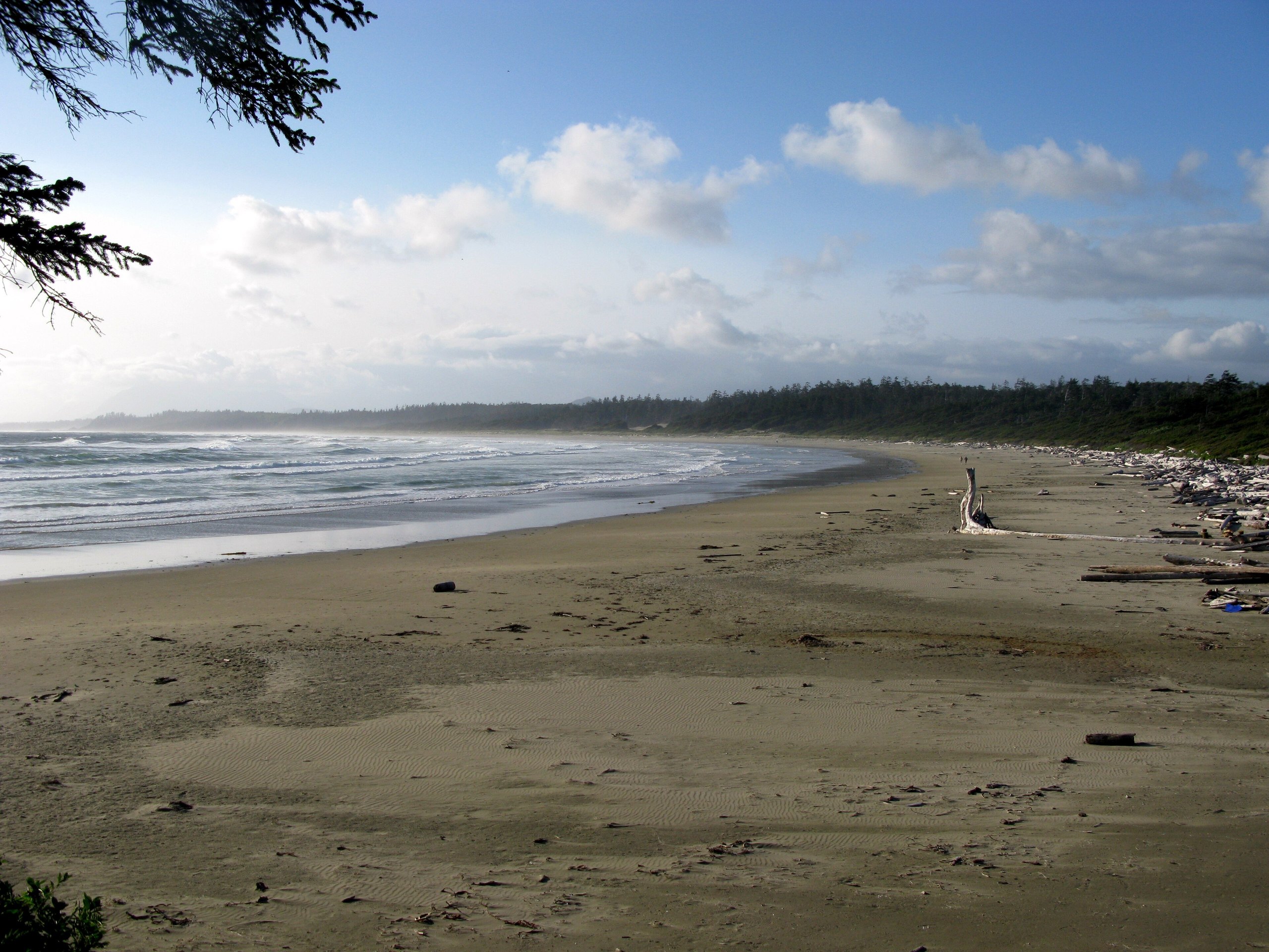
Long Beach is the longest sandy beach on the west coast of Vancouver Island, about 10 miles (16 km) of hard, pale sand between forested points, with surf rolling in from the open ocean the whole length of it. At low tide it is hundreds of yards wide and firm enough to walk for hours. Drift logs the size of trucks are stacked along the top by winter storms, and tide pools form around the rocky islets. Most people walk a mile (1.6 km) or so from one of the parking areas and turn back. Go farther and you will have it to yourself.
- Distance: as far as you like, on up to about 10 miles (16 km) of sand
- Allow: 1 hour to half a day
- Start: the Long Beach or Incinerator Rock parking areas, on the Pacific Rim Highway
- When: all year; within two hours of low tide for the widest beach and the tide pools
- Suits: everyone. Beach wheelchairs can be borrowed from the park.
2. Walk the Rainforest Trail
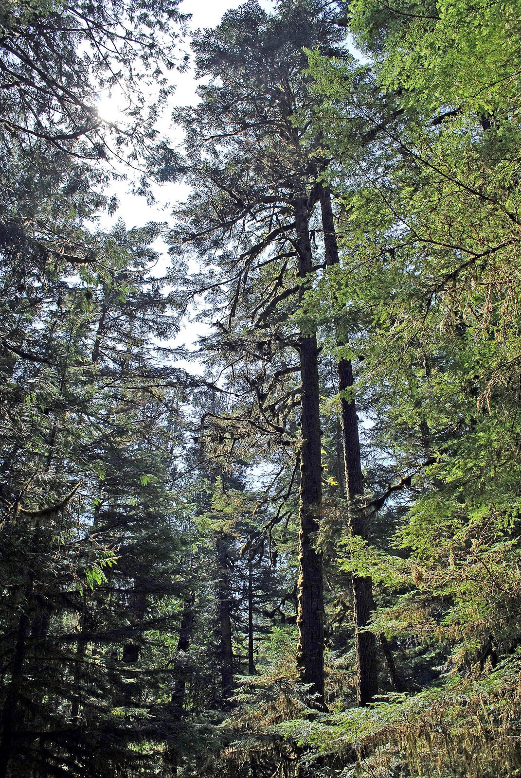
Two boardwalk loops, one on each side of the highway, wind through old-growth temperate rainforest: western red cedars many centuries old, hemlocks growing in rows along fallen logs, and moss and ferns on every surface. The boardwalks climb and drop on long flights of stairs, which lift you into the middle storey of the forest and keep your feet out of the mud. Signs along one loop explain the forest’s cycle of growth and decay, and along the other its history. It rains here on about 200 days a year, and the forest is at its best when it does.
For a level walk, the nearby Shorepine Bog Trail is a boardwalk loop through a stunted forest of pines only a few feet tall and hundreds of years old.
- Distance: two loops of about 0.6 miles (1 km) each; the bog loop is 0.5 miles (0.8 km)
- Allow: 1 hour for both rainforest loops
- Start: Rainforest Trail parking area, on the Pacific Rim Highway north of the Ucluelet junction
- When: all year. The boards are slippery when wet.
- Suits: most walkers who can manage stairs; the bog trail takes wheelchairs
3. Go surfing
This coast is the centre of surfing in Canada, and Long Beach and Wickaninnish Beach are where most people learn. The beaches are sand, the waves come in long, even lines, and in summer the surf is small enough for a first lesson. Surf schools in Tofino and Ucluelet rent boards and wetsuits and teach on the park’s beaches. Winter brings much bigger swells and experienced surfers.
The water is between about 45 and 57°F (7 and 14°C) all year, so a thick wetsuit is needed in every month. Ask about rip currents before you paddle out, stay away from the rocks and river mouths, and do not surf alone.
- Allow: half a day for a lesson
- Start: Long Beach, Incinerator Rock or Wickaninnish Beach
- When: June to September for beginners; October to March for big surf
- Suits: swimmers of any age, with a lesson
4. Watch a winter storm from Wickaninnish Beach
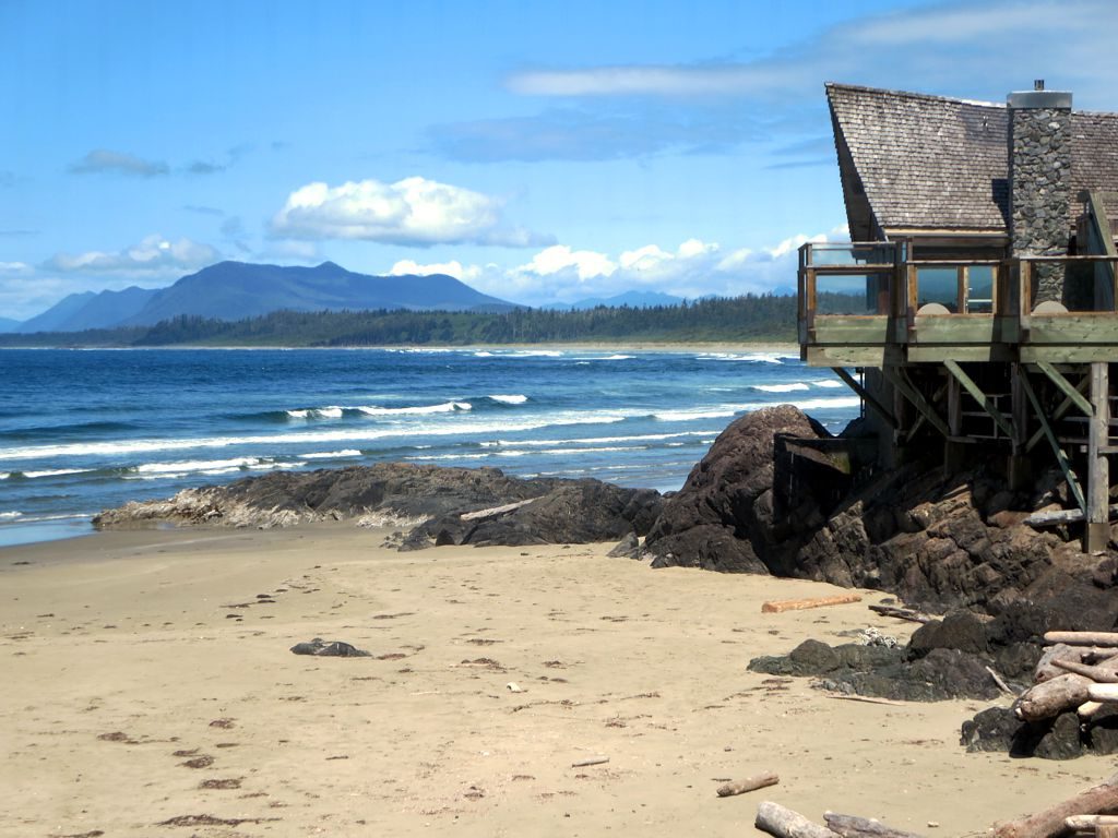
From November to February, storms come in off the North Pacific one after another, and people travel here to watch them. Swells of 20 feet (6 m) and more break across the reefs, spray blows over the trees, and the beach disappears under foam at high tide. The Kwisitis Visitor Centre, on the point at the south end of Wickaninnish Beach, has an observation deck and windows facing the surf. In summer the same deck is a good place to scan for whales, and the centre’s exhibits cover the natural and Nuu-chah-nulth history of the coast.
Watch from the deck or from well up the beach. Storm waves throw drift logs about like matchsticks, and people standing on the rocks have been washed off.
- Allow: 1 to 2 hours
- Start: Kwisitis Visitor Centre, at the end of Wick Road
- When: November to February for storms, near high tide
- Suits: everyone, from a safe place
5. Hike the Nuu-chah-nulth Trail to Florencia Bay
This trail links the park’s two southern beaches through forest and bog, on boardwalk for much of the way, following a route that Nuu-chah-nulth people used long before the park. Signs along it tell the story of the land in their words. It starts beside the visitor centre, passes side trails to the pebble coves of South Beach and Lismer Beach, where waves rattle the stones as they draw back, and ends at Florencia Bay, a wide, quiet crescent of sand under bluffs. Fewer people come here than to Long Beach.
- Distance: about 1.6 miles (2.5 km) one way to Florencia Bay; 1 mile (1.6 km) round trip to South Beach
- Allow: 2 to 2.5 hours out and back
- Start: Kwisitis Visitor Centre
- When: all year
- Suits: most walkers. There are stairs and slippery boards.
6. Take in the view from Radar Hill
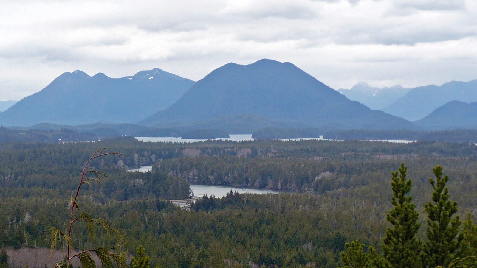
Radar Hill is the highest point you can drive to in the Long Beach unit, and a short paved path leads from the parking area to its top. The view runs north over Clayoquot Sound, with its forested islands and Meares Island’s old-growth ridges, and inland to the mountains of Vancouver Island. A radar station stood here during the Cold War; its concrete footings remain, beside a memorial to the Canadian soldiers who fought at Kapyong in the Korean War.
- Distance: about 0.2 miles (300 m) round trip, paved and steep
- Allow: 20 to 30 minutes
- Start: Radar Hill parking area, at the north end of the park near Tofino
- When: all year, on a clear day
- Suits: everyone; wheelchair users may need help on the grade
7. Cycle the park pathway
A paved multi-use pathway now runs the length of the Long Beach unit, about 15.5 miles (25 km), linking with paths to Tofino at one end and Ucluelet at the other. Its name, ʔapsčiik t̓ašii, means “going the right direction on the path” in the Nuu-chah-nulth language. It stays close to the highway but apart from it, through forest, with spurs to the beaches and trailheads. Bikes are rented in both towns, and riding between beaches is the simplest way to avoid the park’s full parking areas in summer.
- Distance: about 15.5 miles (25 km) end to end
- Allow: half a day to a full day
- Start: either end of the park, or any beach parking area
- When: all year; drier from May to September
- Suits: families and casual riders. Bears and wolves cross the path: ride in daylight.
8. Look for grey whales
About 20,000 grey whales pass this coast each spring on their way from Mexico to the Arctic, close enough to shore to be seen from the headlands, and some stay to feed through the summer. Humpbacks and orcas are also seen. From land, watch from the Kwisitis deck or the rocks above South Beach for the puff of a blow, which hangs in the air for a few seconds. Whale-watching boats run from Tofino and Ucluelet for a closer look, and both towns hold a whale festival in March.
- Allow: 1 hour from shore; 2 to 3 hours on a boat tour
- Start: Kwisitis Visitor Centre, or the harbours in Tofino and Ucluelet
- When: March and April for the migration; May to September for whales that stay
- Suits: everyone. Bring binoculars and a calm day.
9. Kayak the Broken Group Islands
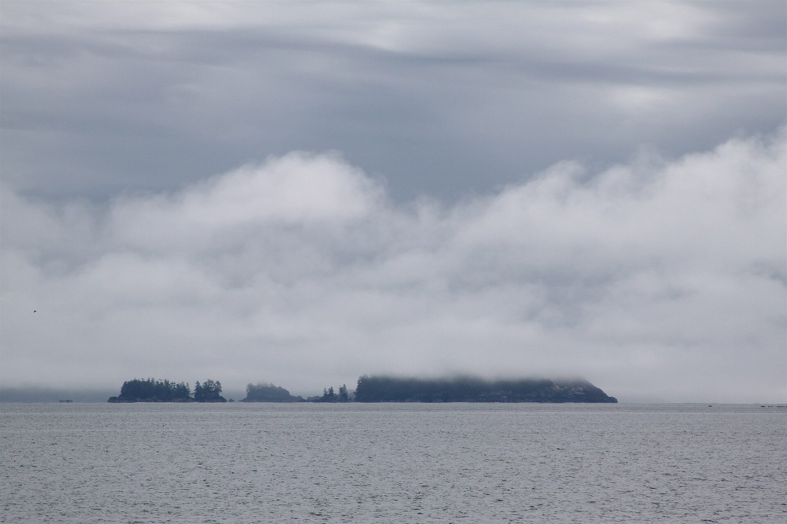
The Broken Group is a scatter of more than a hundred islands and islets in the middle of Barkley Sound, sheltered from the open ocean by its outer ring. Paddlers move between them through narrow channels and lagoons over clear water, landing on shell beaches, and camp at seven designated sites. Sea lions, eagles and, in season, whales are regular company. It is one of the best sea-kayaking trips in Canada, and it is not for beginners on their own: fog comes in fast, the crossings are exposed to wind, and the water is cold.
- Allow: three to five days
- Start: Toquaht Bay or Sechart, in Barkley Sound; a passenger ship from Port Alberni carries kayaks to Sechart
- When: June to September
- Needs: a backcountry camping permit, and all your own drinking water
- Suits: experienced sea kayakers, or anyone with a guide
10. Hike the West Coast Trail
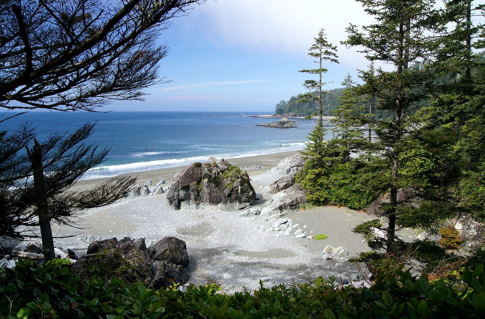
The West Coast Trail follows 47 miles (75 km) of the island’s southwest coast, a shore so hard on ships that it was called the Graveyard of the Pacific. The trail was built in 1907 so that shipwreck survivors could walk out. It is now one of the best-known backpacking routes in the world, and one of the hardest for its length: more than a hundred ladders, some of them several storeys high, hand-pulled cable cars over rivers, deep mud, slippery boardwalk and long stretches on the beach timed to the tides. Each night is spent camped on a beach.
About one hiker in a hundred is carried out injured. Go fit, with tested gear and a tide table, and do not make it your first backpacking trip.
- Distance: 47 miles (75 km) one way
- Allow: six to eight days
- Start: Pachena Bay near Bamfield, or Gordon River near Port Renfrew
- When: May to September, the only months the trail is open
- Needs: a reservation and permit, and an orientation session before you start
- Suits: experienced, fit backpackers
Before you go
This list covers what stays the same from year to year. Trail closures, wildlife warnings, tide times and West Coast Trail reservation dates change, and Parks Canada posts them on its own site. The link is on our Pacific Rim National Park Reserve guide, with the map, passes and how to get there.