

Aniakchak National Monument and Preserve
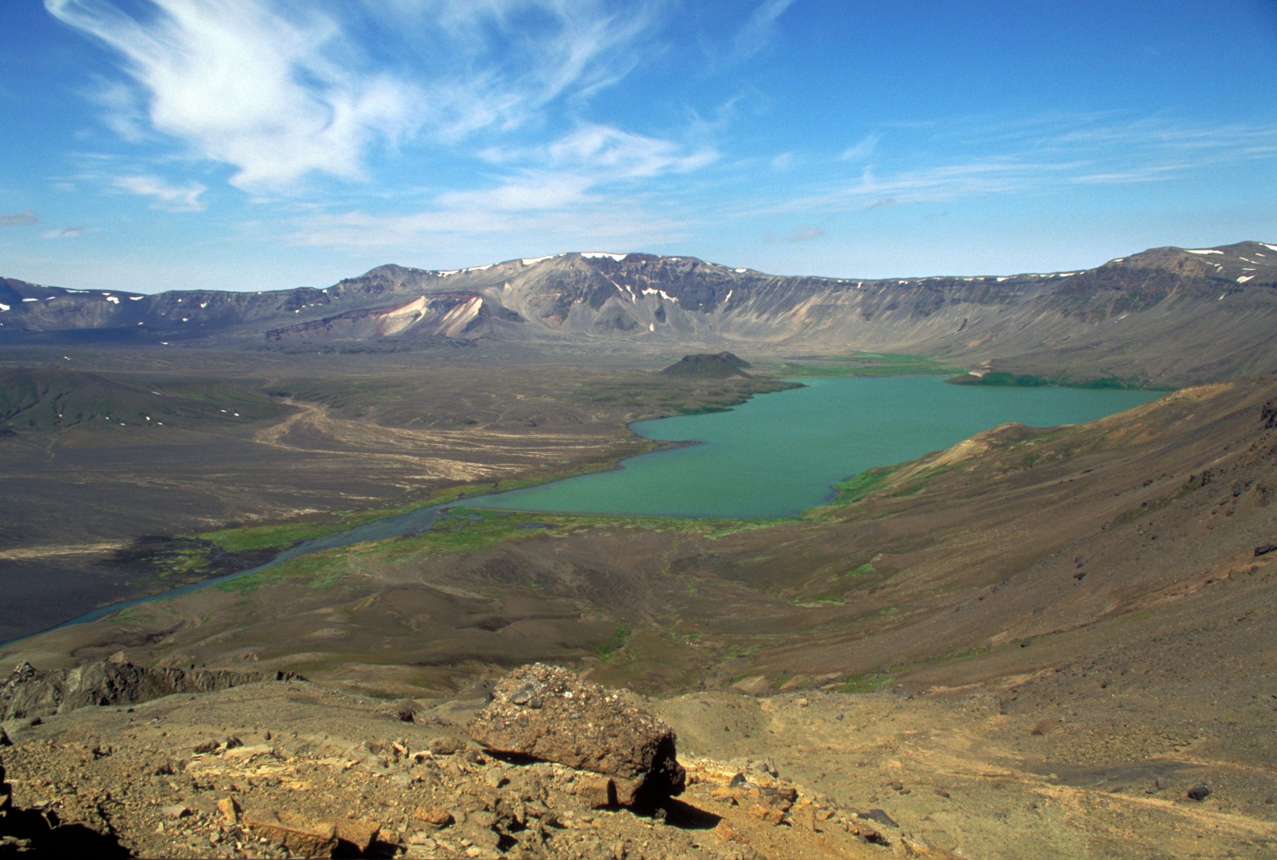
Aniakchak is a volcanic caldera 6 miles (10 km) wide on the Alaska Peninsula, one of the least-visited places in the National Park System. There are no roads, trails or facilities; visitors fly in, hike across the crater and float the Aniakchak River to the Pacific.
Fast facts
- Established: 1978; monument and preserve since 1980
- Size: about 600,000 acres (2,430 km²)
- Caldera: 6 miles (10 km) wide and up to 2,500 feet (762 m) deep, formed about 3,500 years ago
- Last eruption: 1931
- Gateway: King Salmon, Alaska, 450 miles (720 km) southwest of Anchorage
- Managed by: the National Park Service
The landscape
Inside the caldera, lava flows, cinder cones and Vent Mountain surround Surprise Lake, whose outflow breaks through the crater wall at a gap called The Gates to form the Aniakchak River. Outside, tundra and brush slope to the Bering Sea and the Pacific. Brown bears and caribou roam, and the weather is dominated by wind, rain and fog.
Best time to go
June to August is the only practical season, and even then storms, wind and fog are the norm. Plan for flights to be delayed by days.
Getting there and around
There are no roads. Air taxis fly from King Salmon and other Alaska Peninsula towns, landing on Surprise Lake or on beaches when weather allows. Drop-offs and pickups are often delayed by weather.
Things to do
This is an expedition, not a day trip. Hikers explore the caldera floor, climb Vent Mountain and camp among the volcanic features.
Paddlers carry packrafts or folding boats to float the Aniakchak River, a designated Wild River, from Surprise Lake through The Gates and down to Aniakchak Bay on the Pacific, a trip of several days with rapids in its upper section.
Staying safe
Weather is the greatest danger: high winds, cold rain and fog can pin you down for days, so carry extra food and a shelter that can stand in gales. Brown bears are common: carry bear spray and use bear-resistant food containers. Help is far away; carry a satellite messenger.
Know before you go
There are no fees, facilities, trails or rangers on site. Leave a detailed trip plan with the park and your air taxi. This page is a general overview, not a live conditions report, so confirm conditions with the National Park Service before you go.
- Coordinates
- 56.8570, -157.7519
- Magnetic declination
- 11.0° E (2026)
Set this declination on your compass, then align it to the map's north lines; it is the angle between true north and magnetic north, refreshed each year.
How declination works, and how to navigate with a map and compass
A spread of the park’s main places shows straight away, and the rest appear as you zoom in. You can also search above, or pick any place from the lists below, and the map will go to it. Places in bold, marked , have a short description.
Sights 14
Lakes
Points of interest
Peaks 10
Map data comes from third-party sources and may be incomplete or out of date, so carry a current official map (terms).
Looking for one of these closer to home?Destinations near me by trip type →
- Best seasons
- Summer (June to August)
- Difficulty
- Strenuous (remote wilderness)
- Access / trailheads
- Air taxi only, from King Salmon and Alaska Peninsula towns, weather permitting. No roads.
- Water
- Plentiful; treat all water.
- Cell / satellite coverage
- None. Carry a satellite messenger.
- Nearest ranger / SAR / emergency
- Emergencies: 911 via satellite messenger. Katmai, Aniakchak and Alagnak office (King Salmon): 907-246-3305.
- Permits & regulations
- No fees. No facilities; leave a trip plan with the park.
- Leave No Trace
- Store food in bear-resistant containers, camp on durable ground away from the lake shore, and pack out everything.
January
- Below freezing all day
February
- Below freezing all day
March
- Below freezing all day
April
- Below-freezing nights
May
June
July
August
September
October This month
- Below-freezing nights
November
- Below-freezing nights
December
- Below freezing all day
What to bring depends on your trip: how long you’re out, where you sleep, and how far you go from the road. The planner builds the list for yours.
Plan a trip here →Averages for 1991–2020 from NOAA U.S. Climate Normals, measured at the King Salmon station, 115 miles (186 km)186 km (115 miles) away at 661 feet (201 m)201 m (661 feet). That is the nearest station with long-term records, so treat these as a regional guide. Higher trails run colder, by about 3.5°F for every 1,000 ft (2°C per 300 m)2°C for every 300 m (3.5°F per 1,000 ft) of climb. Daylight runs from sunrise to sunset on the 15th, on the park’s own clock, for a level horizon. Valleys and slopes facing away from the sun are in shade earlier.
Nearby parks
-
 Katmai National Park
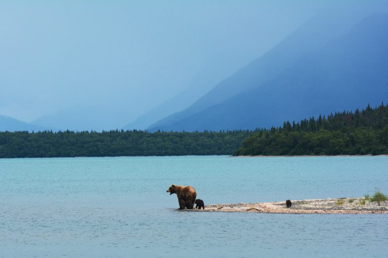
Brown bears fishing for salmon at Brooks Falls, and the Valley of Ten Thousand Smokes, on the Alaska Peninsula.
-
 Wood-Tikchik State Park
The largest U.S. state park: 1.6 million acres (6,500 km²) of fly-in lakes, rivers and brown bear country near Dillingham.
Straight-line distance between park centres. Road distance is usually longer.
Looking for somewhere closer to home?
See every park and monument within a day’s drive of where you are.