

Katmai National Park
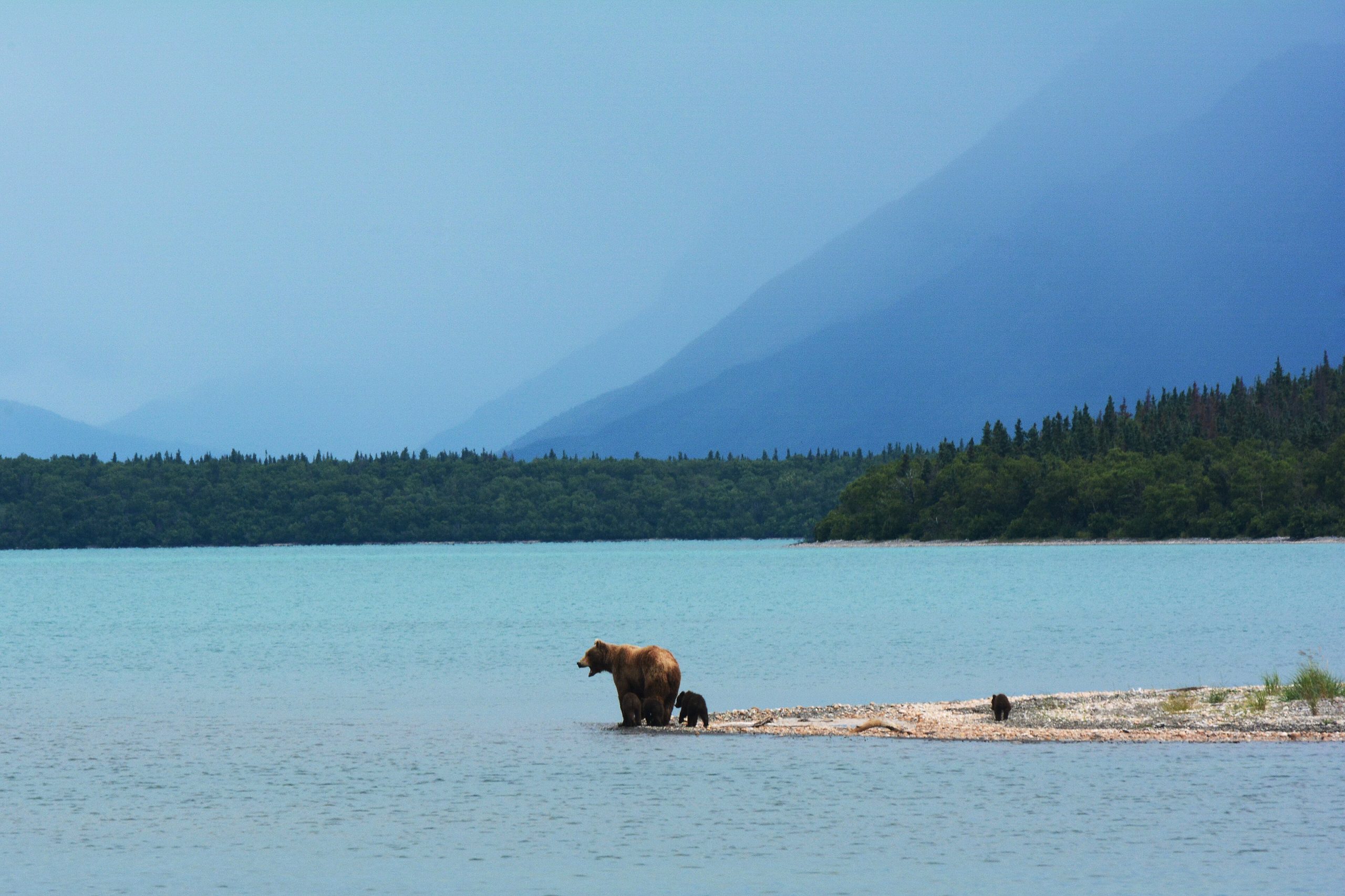
Katmai protects four million acres (16,000 km²) of Southwest Alaska and one of the greatest wildlife spectacles on Earth: brown bears lined up at Brooks Falls, snatching salmon out of mid-leap. More than 1,500 bears range across a landscape of volcanoes, salmon rivers and coastline, including the Valley of Ten Thousand Smokes, scoured by the largest eruption of the twentieth century. There are no roads in; you arrive by air, and the wild takes over from there.
Fast facts
- Established: 1918 (as a national monument; national park and preserve in 1980)
- Size: over 4 million acres (16,000 km²), one of the largest U.S. national parks
- Bears: more than 1,500 brown bears
- Signature site: Brooks Falls, and the Valley of Ten Thousand Smokes
- Location: the Alaska Peninsula, Southwest Alaska
- Managed by: National Park Service
The landscape
Katmai is vast, rugged and volcanic. Its centerpiece is the Valley of Ten Thousand Smokes, a moonscape of ash and pumice left by the 1912 Novarupta eruption. Beyond it lie mountains, rivers, lakes and a dramatic Pacific coastline, all stitched together by salmon runs. Brooks Falls, where sockeye leap upstream to spawn, is the stage for the park’s famous summer gathering of bears.
Best time to go
July is the marquee month: salmon are running hard at Brooks Falls and bears are most numerous and active. Visiting in the shoulder of summer trades some of that peak action for fewer people. Whenever you come, expect cool, wet, changeable weather typical of coastal Alaska.
Getting there and around
Reaching Katmai takes at least two flights: a commercial hop from Anchorage to King Salmon, then a floatplane or boat to Brooks Camp. No roads lead into the park, so once you arrive you get around on foot or by boat, and the terrain beyond the developed area is remote and undeveloped.
Things to do
Bear-and-salmon watching from the Brooks Falls platforms is the reason most people come, but Katmai offers far more: hiking and guided bus tours into the Valley of Ten Thousand Smokes, world-class fishing, sea kayaking along the coast, and backcountry travel through untouched wilderness. It is also an exceptional destination for wildlife photography.
Staying safe
Bear safety is non-negotiable here. Never run from a bear; in a close encounter, speak calmly and back away slowly, and if a brown bear attacks, protect your head and neck and play dead until it loses interest. Keep your pack on. Store all food and scented items in the provided bear-proof storage, keep required distances at the falls, and complete the mandatory orientation. Come prepared for cold, wet weather and understand there is no cell or internet service in the park.
Know before you go
Katmai is remote and self-service. Book air taxis and Brooks Camp lodging or camping well in advance, as they fill quickly. Pack for unpredictable Alaska weather, expect to be off the grid, and be ready for basic camping conditions if you are not staying at the lodge. This page is a general overview, not a live conditions report; confirm current conditions, reservations and bear-viewing rules with the National Park Service before your trip.
- Coordinates
- 58.5048, -154.8895
- Magnetic declination
- 12.1° E (2026)
Set this declination on your compass, then align it to the map's north lines; it is the angle between true north and magnetic north, refreshed each year.
A spread of the park’s main places shows straight away, and the rest appear as you zoom in. You can also search above, or pick any place from the lists below, and the map will go to it.
Getting there 1
Airstrip
On the trail 5
Trailheads
Campground
Picnic site
Sights 59
Viewpoints
Waterfalls
Heritage sites
Point of interests
Peaks 30
Map data comes from third-party sources and may be incomplete or out of date, so carry a current official map (terms).
- Best seasons
- Summer (July for peak bear viewing)
- Difficulty
- Easy to strenuous
- Access / trailheads
- No roads reach the park. Fly from Anchorage to King Salmon, then a floatplane or boat to Brooks Camp. Inside, travel is on foot or by boat.
- Water
- Abundant rivers and lakes; filter or treat all water.
- Cell / satellite coverage
- No cell service or internet in the park. Carry a satellite messenger and leave a trip plan.
- Nearest ranger / SAR / emergency
- Contact rangers at Brooks Camp or King Salmon; life-threatening emergencies: 911.
- Permits & regulations
- No entrance fee; Brooks Camp requires a camping reservation or day-use planning, and mandatory bear-safety orientation. Backcountry travel needs self-registration.
- Leave No Trace
- Store all food and scented items in bear-proof storage, keep 50 yards (46 m) from bears (more at the falls), pack out all waste, and follow Leave No Trace.
January
- Below freezing all day
February
- Below freezing all day
March
- Below freezing all day
April
- Below-freezing nights
May
June
July
August
September This month
October
- Below-freezing nights
November
- Below freezing all day
December
- Below freezing all day
What to bring depends on your trip: how long you’re out, where you sleep, and how far you go from the road. The planner builds the list for yours.
Plan a trip here →Averages for 1991–2020 from NOAA U.S. Climate Normals, measured at the King Salmon station, 32 miles (51 km) away at 144 feet (44 m). Conditions change with elevation: expect it colder higher up.