

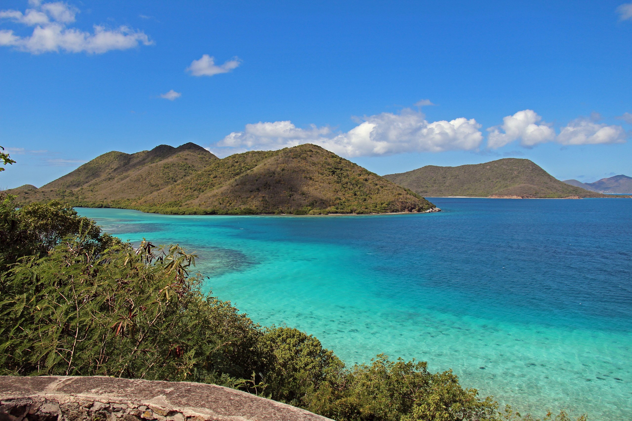
Top 9 things to do in Virgin Islands National Park
Virgin Islands National Park covers more than half of the island of St. John in the US Virgin Islands, along with much of the water around it: steep green hills of tropical forest, ruins of the sugar plantations worked by enslaved Africans, and white-sand bays where coral reefs, sea turtles and rays lie a few strokes from shore. Most of the land was bought and given to the nation by Laurance Rockefeller in the 1950s. St. John is reached by ferry from St. Thomas, and it has no airport. These are the nine outings we would put first. The order starts with what the park is known for, then goes by what an outing gives back for the time and effort it takes. Distances are approximate; times are our estimates and do not include stops.
Wear reef-safe sunscreen, which the Virgin Islands require, and never stand on or touch coral. Watch for long-spined sea urchins on rocks in the shallows, and swim with a partner, staying clear of boat channels. The sun is strong and the trails steep and hot, so carry plenty of water. The manchineel tree, common behind some beaches, has poisonous sap and fruit: do not touch it or shelter under it in the rain. Traffic drives on the left on St. John.
1. Snorkel the underwater trail at Trunk Bay
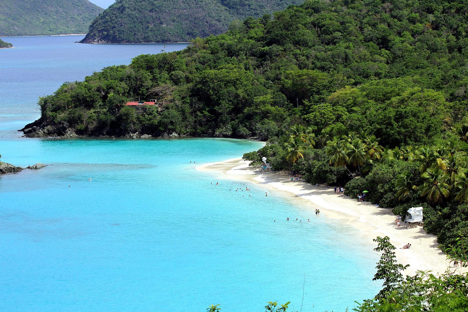
Trunk Bay is one of the most photographed beaches in the Caribbean, for its curve of white sand, turquoise water and the small, green Trunk Cay offshore. Around the cay, an underwater snorkel trail has signs on the seabed that name the corals and fish you are swimming over, making it an easy first snorkel for beginners. The beach has facilities, and it is the one beach on the island that charges a fee. Come early, before the cruise-ship day trippers arrive.
- Allow: half a day
- Start: Trunk Bay, on the North Shore Road
- When: all year; mornings are calmer and quieter
- Suits: everyone; good for first-time snorkelers
2. Swim with sea turtles at Maho Bay
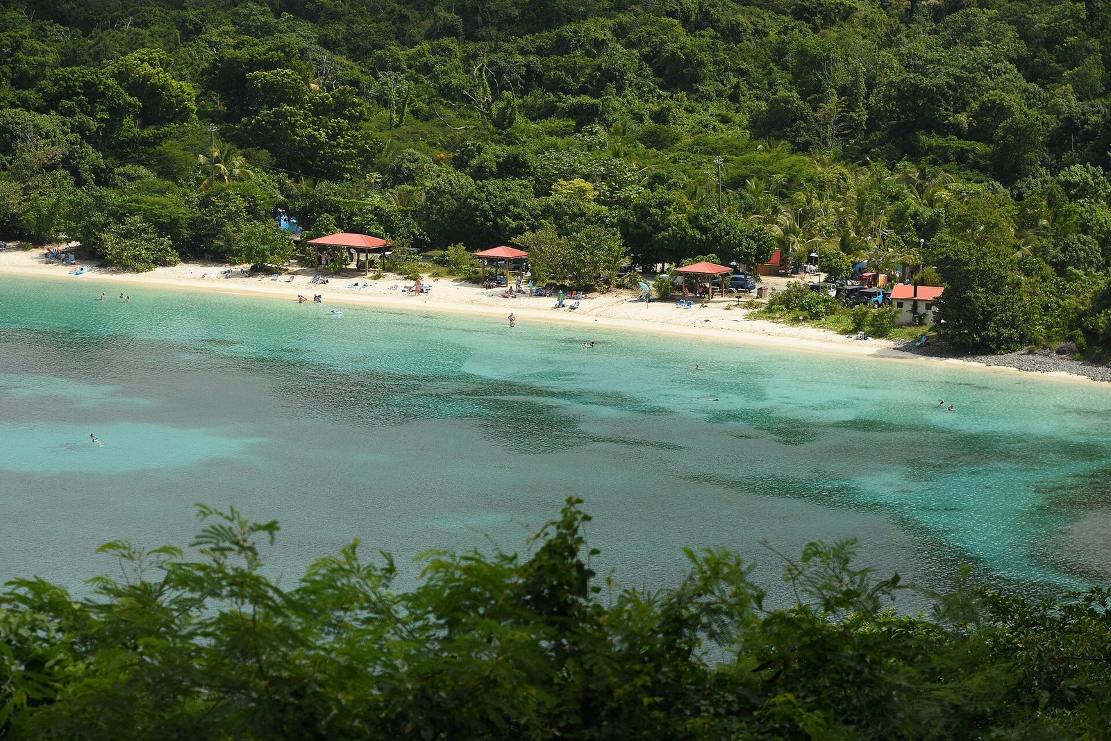
Maho Bay is calm, shallow and sheltered, and its seagrass beds are the most reliable place on the island to snorkel alongside green sea turtles, which graze on the grass in water only a few feet deep. Stingrays, squid and starfish are often seen too. The beach sits right beside the road, with shade trees along it. Watch the turtles quietly from a distance, and never chase or touch them.
- Allow: 2 hours to half a day
- Start: Maho Bay, on the North Shore Road
- When: all year; mornings for the calmest water
- Suits: everyone
3. Walk through the Annaberg Sugar Plantation ruins
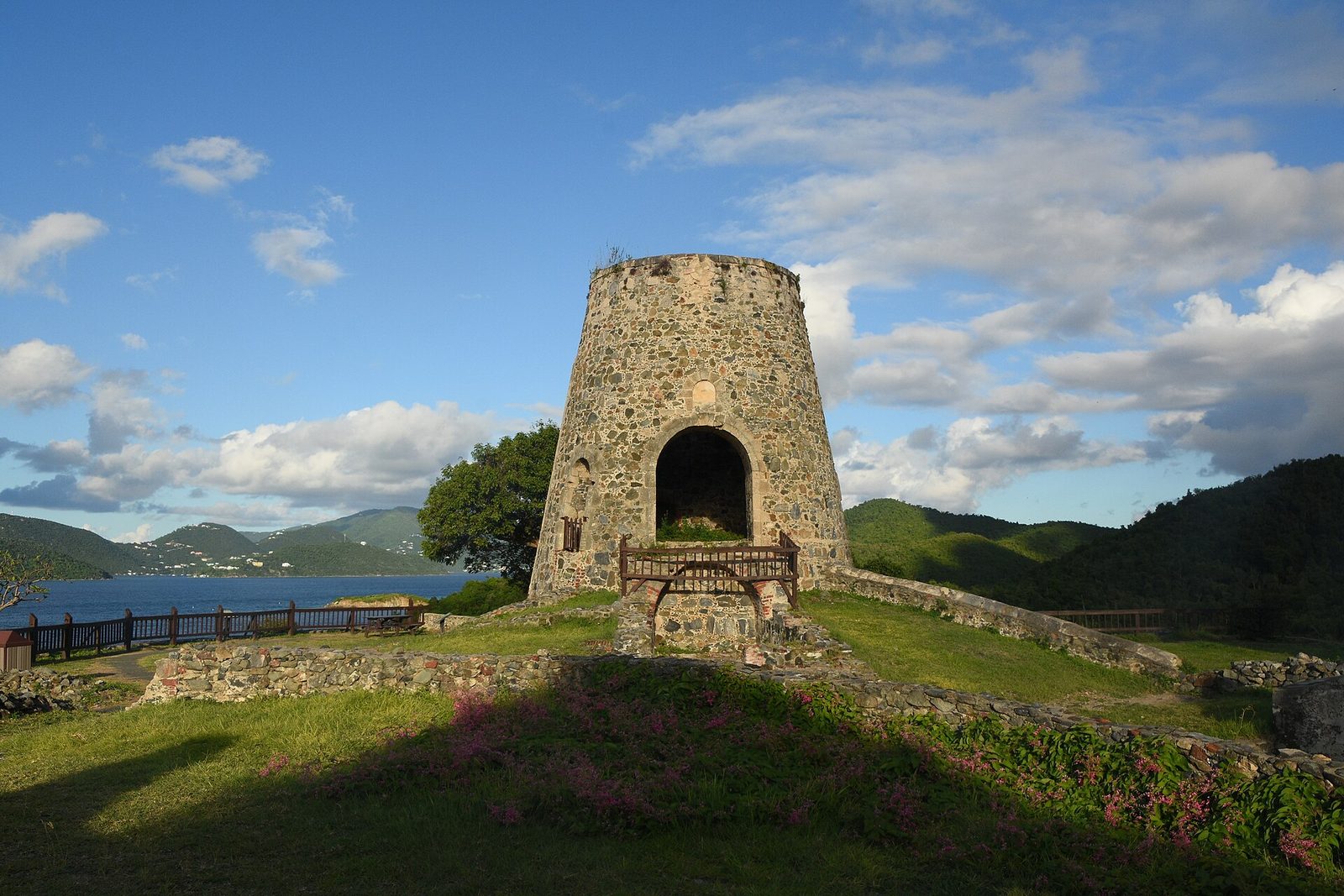
On a hillside above Leinster Bay, the ruins of Annaberg are the most complete plantation remains on St. John: the stone tower of a windmill, a horse mill, the boiling house where cane juice was cooked into sugar, and the foundations of the quarters where the enslaved people who did the work lived. A short loop trail with signs tells their story, including the 1733 revolt on St. John, one of the earliest slave uprisings in the Americas. The view over the bay to the British Virgin Islands is one of the finest on the island.
- Distance: a short loop trail
- Allow: 45 minutes
- Start: Annaberg parking area, at the end of Leinster Bay Road
- When: all year
- Suits: everyone
4. Snorkel around Waterlemon Cay
From the Annaberg area, a flat, shaded trail follows the shore of Leinster Bay to a small beach facing Waterlemon Cay, a little island ringed by reef. The swim out takes a few minutes, and around the cay the coral and rocks are crowded with fish, while sea turtles, rays, starfish and, sometimes, nurse sharks are common in the grass beds on the way. Currents can be strong off the far side of the cay, so stay close to it and go with a partner.
- Distance: about 20 minutes’ walk along the shore, then a short swim
- Allow: half a day
- Start: Leinster Bay Trail, near the Annaberg parking area
- When: all year, on calm days
- Suits: confident swimmers
5. Hike the Reef Bay Trail to the petroglyphs and the sugar mill
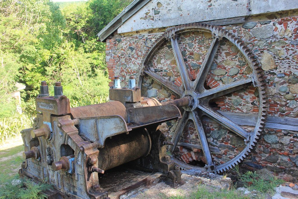
The island’s best hike drops steeply from the Centerline Road through shady tropical forest, past the ruins of old sugar estates, to the coast at Reef Bay. A side trail leads to a pool below a small waterfall, where the Taíno people carved faces and figures into the rocks between about AD 500 and 1500. At the bottom stand the ruins of the Reef Bay sugar mill, one of the last to work on the island, with its steam engine still in place. The whole way in is downhill, so the climb is on the way back out.
- Distance: about 4.4 miles (7 km) round trip, plus the petroglyph side trail
- Climb: about 900 feet (270 m), all on the way back
- Allow: 4 hours
- Start: Reef Bay trailhead, on Centerline Road
- When: all year; start early, before the heat
- Suits: fit walkers
6. Walk out to Ram Head
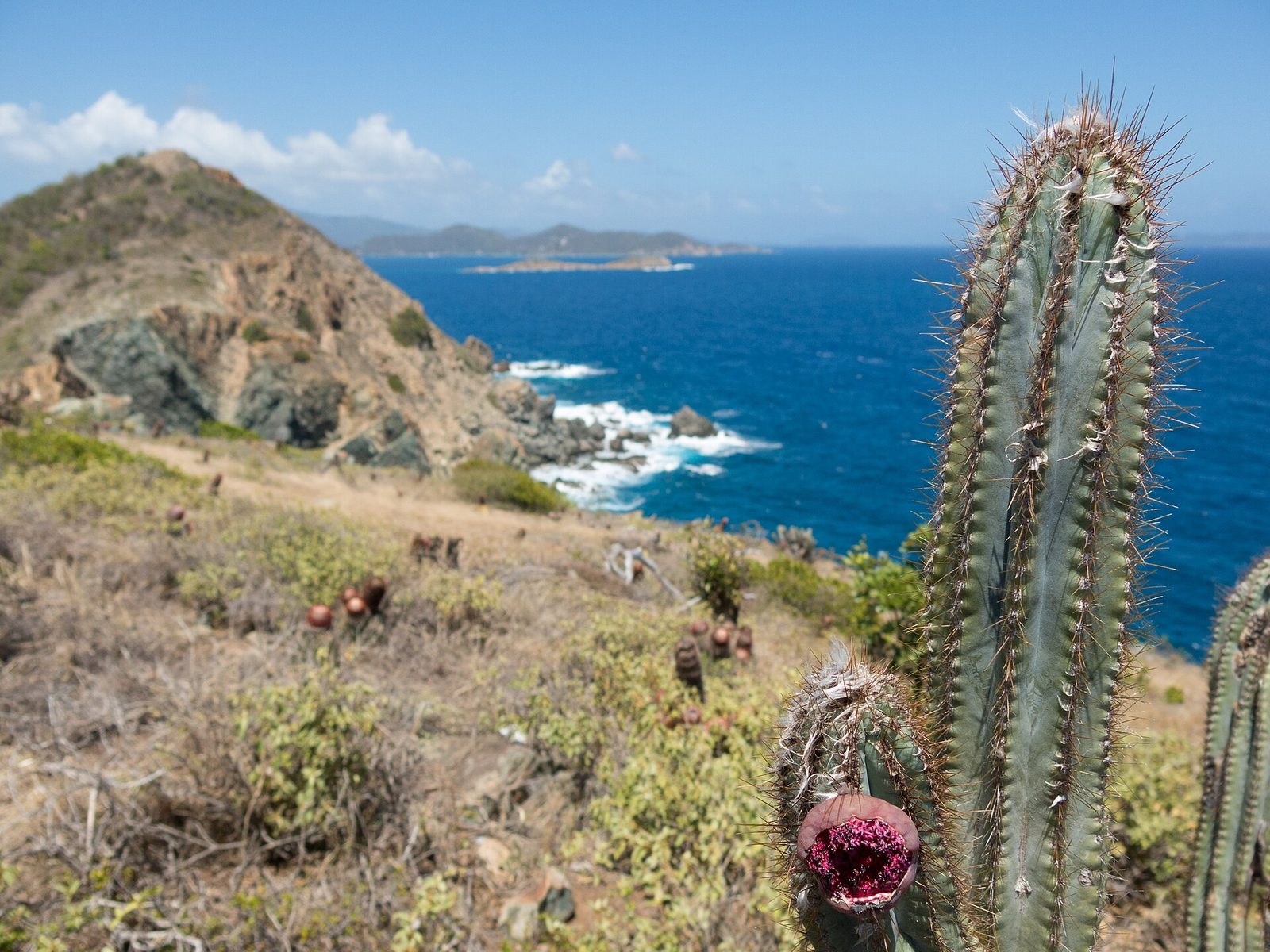
At the island’s southeastern tip, a trail leaves Salt Pond Bay, crosses a beach of blue cobbles, and climbs over dry, open hillside of cactus and scrub to the top of Ram Head, a rocky point high above the sea, with the Caribbean on three sides and the wind in your face. It is the island’s best viewpoint. There is no shade, so go early in the morning or late in the afternoon, and carry water.
- Distance: about 2 miles (3.2 km) round trip from Salt Pond Bay
- Allow: 1.5 hours
- Start: Salt Pond Bay parking area, on Route 107 near Coral Bay
- When: all year; early morning or late afternoon
- Suits: most walkers
7. Snorkel Salt Pond Bay
On the quieter, drier south side of the island, a short walk down from the road leads to Salt Pond Bay, a sheltered bay with reefs along both sides and a small rock in the middle that draws fish. It is a good place to see the south shore’s fish, and to cool off after the walk to Ram Head. The bay has few facilities, so bring what you need.
- Distance: a short walk from the parking area
- Allow: 2 hours to half a day
- Start: Salt Pond Bay parking area, on Route 107 near Coral Bay
- When: all year
- Suits: everyone
8. Spend a day at Cinnamon Bay
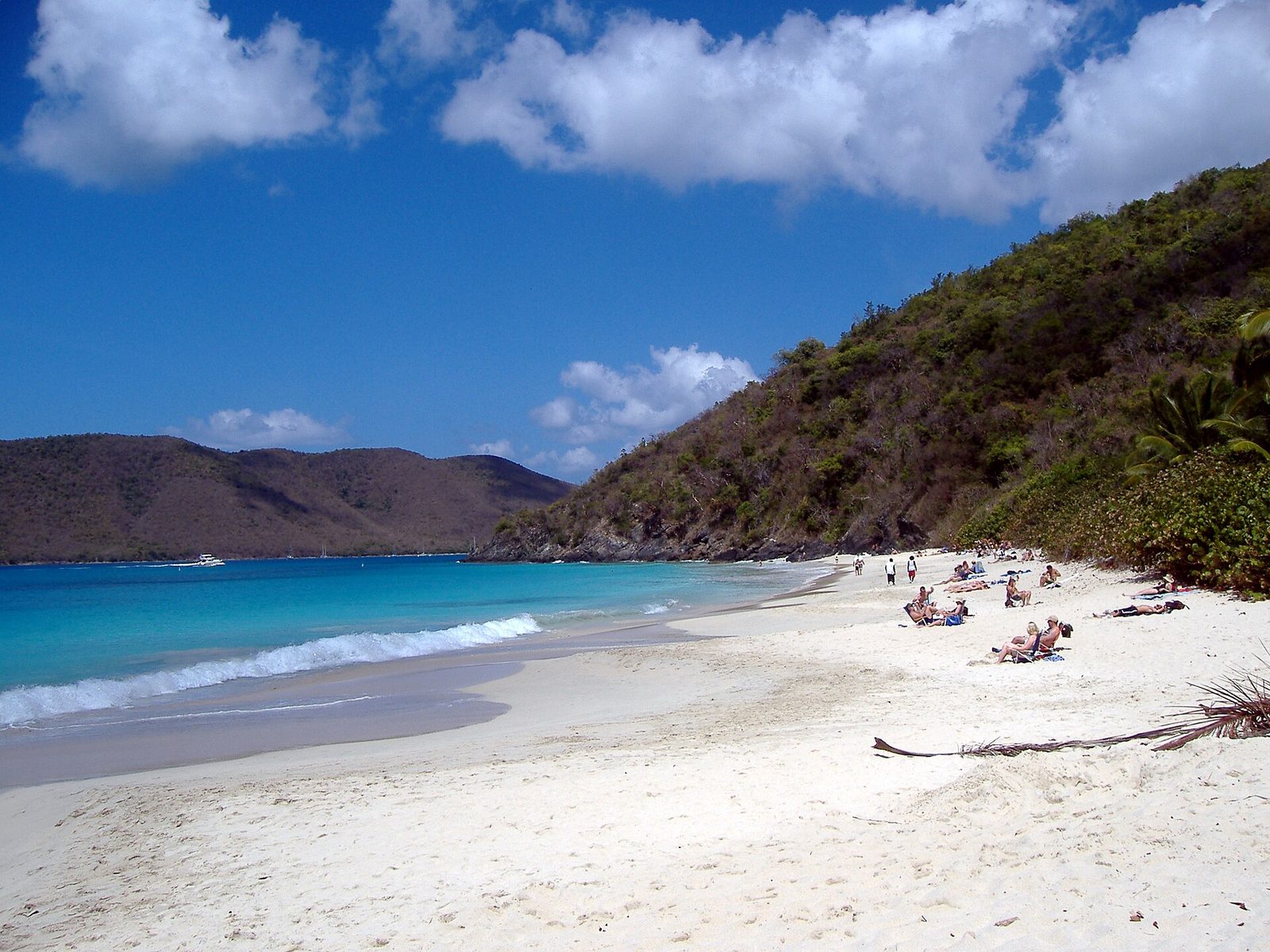
Cinnamon Bay is the longest beach on the north shore, with a campground behind it and a small cay offshore. A short loop trail behind the beach leads through the ruins of a sugar factory and into shady forest with signs about the plants, and kayaks and snorkel gear can often be rented on the beach. It is the easiest place on the island to spend a full day, or several, on one beach.
- Distance: about half a mile (800 m) for the loop trail
- Allow: half a day to a day
- Start: Cinnamon Bay, on the North Shore Road
- When: all year
- Suits: everyone
9. Drive the North Shore Road
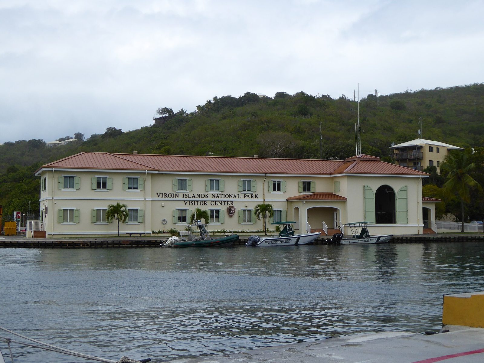
From the visitor center in Cruz Bay, where the ferries arrive, the North Shore Road winds along the island’s north coast, climbing over the hills and dropping to one perfect bay after another: Caneel, Hawksnest, Trunk, Cinnamon and Maho. Overlooks along the way give views over the beaches and the cays offshore. The road is steep, narrow and full of switchbacks, and you drive on the left.
- Allow: half a day with stops
- Start: Cruz Bay Visitor Center
- When: all year
- Suits: everyone; drive slowly and give way on the bends
Before you go
This list covers what stays the same from year to year. Closures, beach fees, storm warnings and ferry schedules change, and the National Park Service posts them on its own site. The link is on our Virgin Islands National Park guide, with the map and how to get there.