

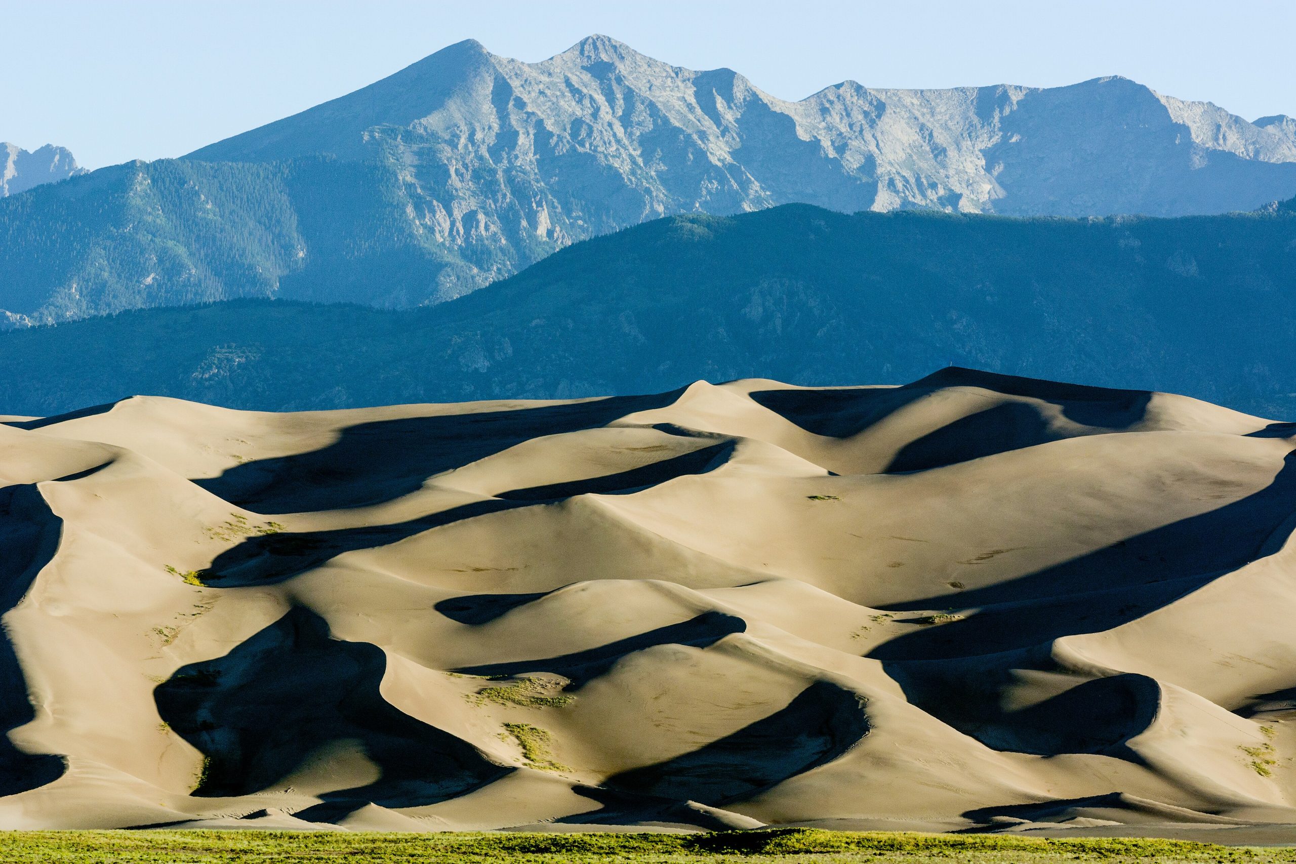
Great Sand Dunes National Park
Great Sand Dunes protects the tallest dunes in North America, a 30-square-mile sea of sand piled against the base of the rugged Sangre de Cristo Mountains in southern Colorado. The improbable pairing of star dunes rising 750 feet (230 m), snow-capped 13,000-foot (4,000 m) peaks behind them, and a seasonal creek that ripples across the sand makes this one of the most surreal landscapes in the park system.
Fast facts
- Established: national monument 1932; national park in 2004
- Size: about 149,000 acres (603 km²), with a 30-square-mile dune field
- Tallest dune: Star Dune / Hidden Dune, around 750 feet (230 m)
- Setting: the San Luis Valley at the foot of the Sangre de Cristo Range
- Dark sky: a certified International Dark Sky Park
- Managed by: National Park Service
The landscape
The dunes formed as wind funneled sand from the valley floor against the mountains, and they climb in great sculpted ridges below the peaks. At their edge, snowmelt feeds Medano Creek, which flows in a wide, shallow sheet across the sand in spring and early summer. Beyond the dunes, the park rises through grassland and forest into subalpine and alpine terrain, home to elk, pronghorn, black bears and, in the creek, a native tiger beetle found nowhere else.
Best time to go
Late spring and early fall are the sweet spots, comfortable temperatures and, in spring, the peak flow of Medano Creek. Summer afternoons see the sand surface reach 150°F (66°C) and bring lightning storms, so hike the dunes early or in the evening. Winter is cold and quiet, with snow dusting the dunes against the peaks for a striking scene.
Getting there and around
The park is reached via CO-150 off US-160 in the San Luis Valley, with the dune field, visitor center and campground clustered near the entrance. A vehicle gets you there; from the day-use lot you simply walk out onto the sand. The Medano Pass Primitive Road into the backcountry requires 4WD and low tire pressure.
Things to do
Climbing the dunes, and sandboarding or sand-sledding back down, is the signature experience, with the High Dune a popular objective. In spring, families splash and float in Medano Creek. Beyond the sand, trails climb into the mountains to Mosca Pass and alpine lakes, and after dark the park’s dark skies make for exceptional stargazing.
Staying safe
The sand can become dangerously hot underfoot in summer, so wear shoes and avoid midday; get off the exposed dunes when storms threaten lightning. Nights and the high country are cold even in summer, so carry layers, and mind the altitude, which starts above 8,000 feet (2,400 m). Medano Creek can surge with snowmelt, and there is no water or shade on the dunes. Carry plenty.
Know before you go
A park pass is required, and camping on the dunes or in the backcountry needs a permit. Check Medano Creek flow forecasts if that is your goal, since it varies year to year. This page is a general overview, not a live conditions report; always confirm current conditions and permits with the National Park Service before your trip.
- Coordinates
- 37.7945, -105.6130
- Magnetic declination
- 7.6° E (2026)
Set this declination on your compass, then align it to the map's north lines; it is the angle between true north and magnetic north, refreshed each year.
A spread of the park’s main places shows straight away, and the rest appear as you zoom in. You can also search above, or pick any place from the lists below, and the map will go to it.
Getting there 1
Park entrance
On the trail 6
Trailheads
Campgrounds
Sights 4
Peaks
Map data comes from third-party sources and may be incomplete or out of date, so carry a current official map (terms).
- Best seasons
- Late spring, Early fall
- Difficulty
- Easy to strenuous
- Access / trailheads
- Reached via CO-150 off US-160 in the San Luis Valley; the main dune field, visitor center and Piñon Flats Campground are near the entrance. Nearest hub is Alamosa.
- Water
- Seasonal Medano Creek and the campground have water; carry all you need on the dunes, where there is none.
- Cell / satellite coverage
- Little to no cell service. Carry a map and share your plans.
- Nearest ranger / SAR / emergency
- Contact park rangers; life-threatening emergencies: 911.
- Permits & regulations
- Per-vehicle entry fee (America the Beautiful pass accepted); backcountry and dunes camping require a permit, and 4WD is needed for the Medano Pass Primitive Road.
- Leave No Trace
- Pack out all waste, protect fragile creek and alpine areas, and follow Leave No Trace.
January
- Below-freezing nights
February
- Below-freezing nights
March
- Below-freezing nights
April
- Below-freezing nights
May
June
July
August
September This month
October
November
- Below-freezing nights
December
- Below-freezing nights
What to bring depends on your trip: how long you’re out, where you sleep, and how far you go from the road. The planner builds the list for yours.
Plan a trip here →Averages for 1991–2020 from NOAA U.S. Climate Normals, measured at the Great Sand Dunes National Park & Preserve station, 2 miles (3 km) away at 8,183 feet (2,494 m). Conditions change with elevation: expect it colder higher up.