

Top 12 things to do in Banff National Park
Banff is Canada’s first national park and its busiest, and most of what draws people sits in two places: the lakes around Lake Louise and the valley around the town of Banff. These are the twelve outings we would put first. The order starts with what the park is known for, then goes by what an outing gives back for the time and effort it takes. Distances, climbs and times are Parks Canada figures unless we say otherwise, and times are for the round trip.
Two things shape any plan here. Moraine Lake Road is closed to personal vehicles all year, and the Lake Louise lakeshore lot fills early, so the lakes are reached by shuttle or transit booked ahead. And this is grizzly country: carry bear spray on every trail and know how to use it.
1. See Moraine Lake from the Rockpile
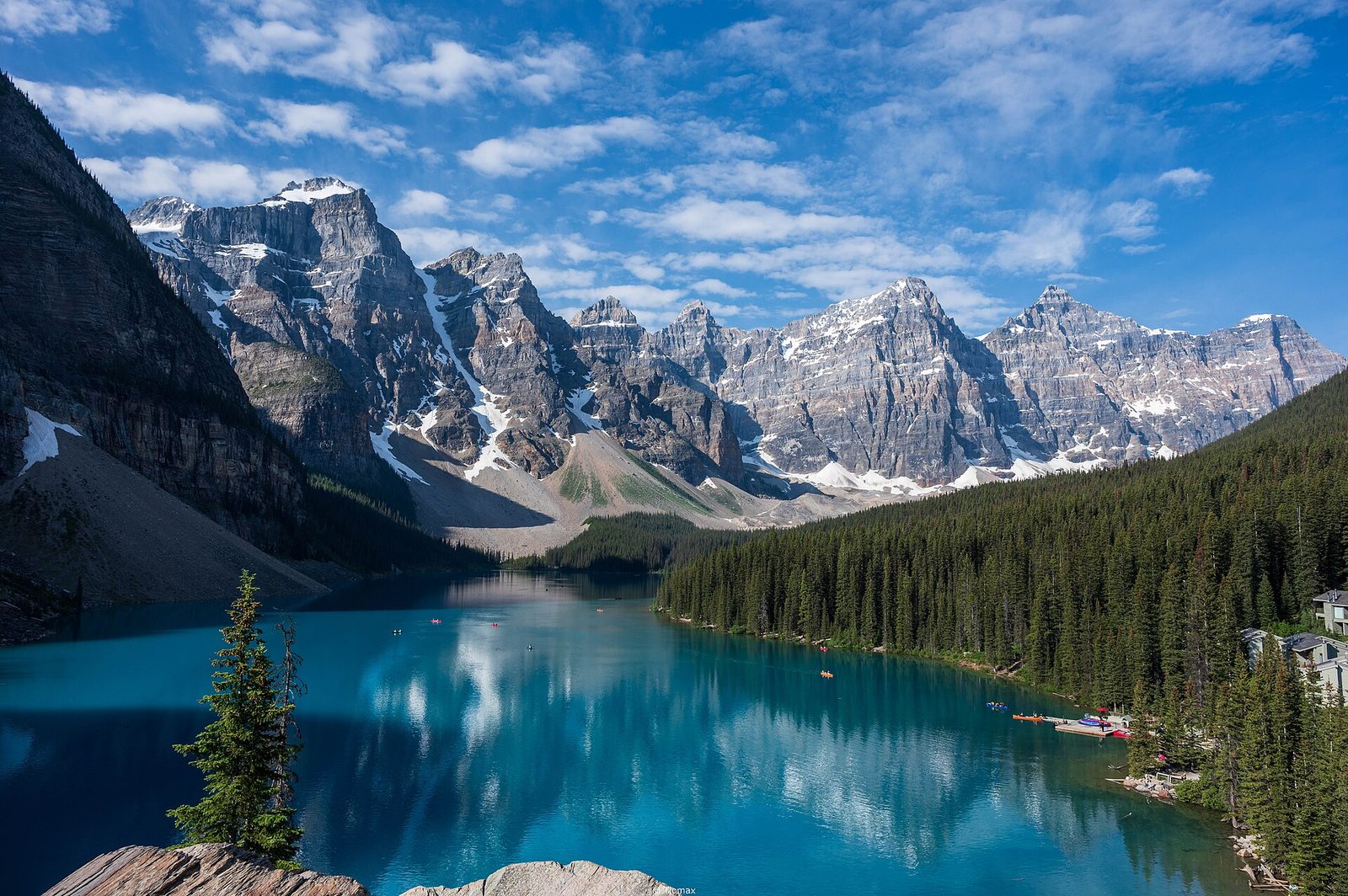
This is the view that was printed on the back of the Canadian $20 bill: a blue-green lake under ten peaks in a row. A short loop climbs the Rockpile, the heap of boulders at the lake’s outlet, to the viewpoint. The colour comes from rock flour ground fine by glaciers and held in the water, and it is strongest from late June, once the lake has filled with meltwater. A flat trail also follows the shore for 0.8 miles (1.3 km), and canoes are rented at the lodge.
You cannot drive here. Parks Canada shuttles run from the Lake Louise Park and Ride, every seat needs a reservation, and some seats are held back and released two days before each departure.
- Distance: a loop of 0.4 miles (0.7 km)
- Climb: 115 feet (35 m)
- Allow: 30 minutes for the Rockpile; two hours with the shoreline
- Start: Moraine Lake, by Parks Canada shuttle from the Lake Louise Park and Ride
- When: June to mid-October, while the road is open to shuttles. The lake is often still partly frozen in early June.
- Suits: anyone who can manage stone steps
2. Walk up from Lake Louise to the Lake Agnes Tea House
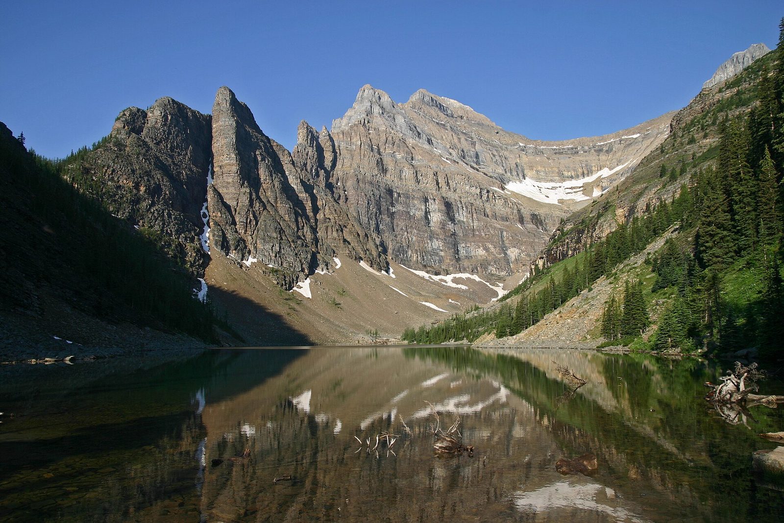
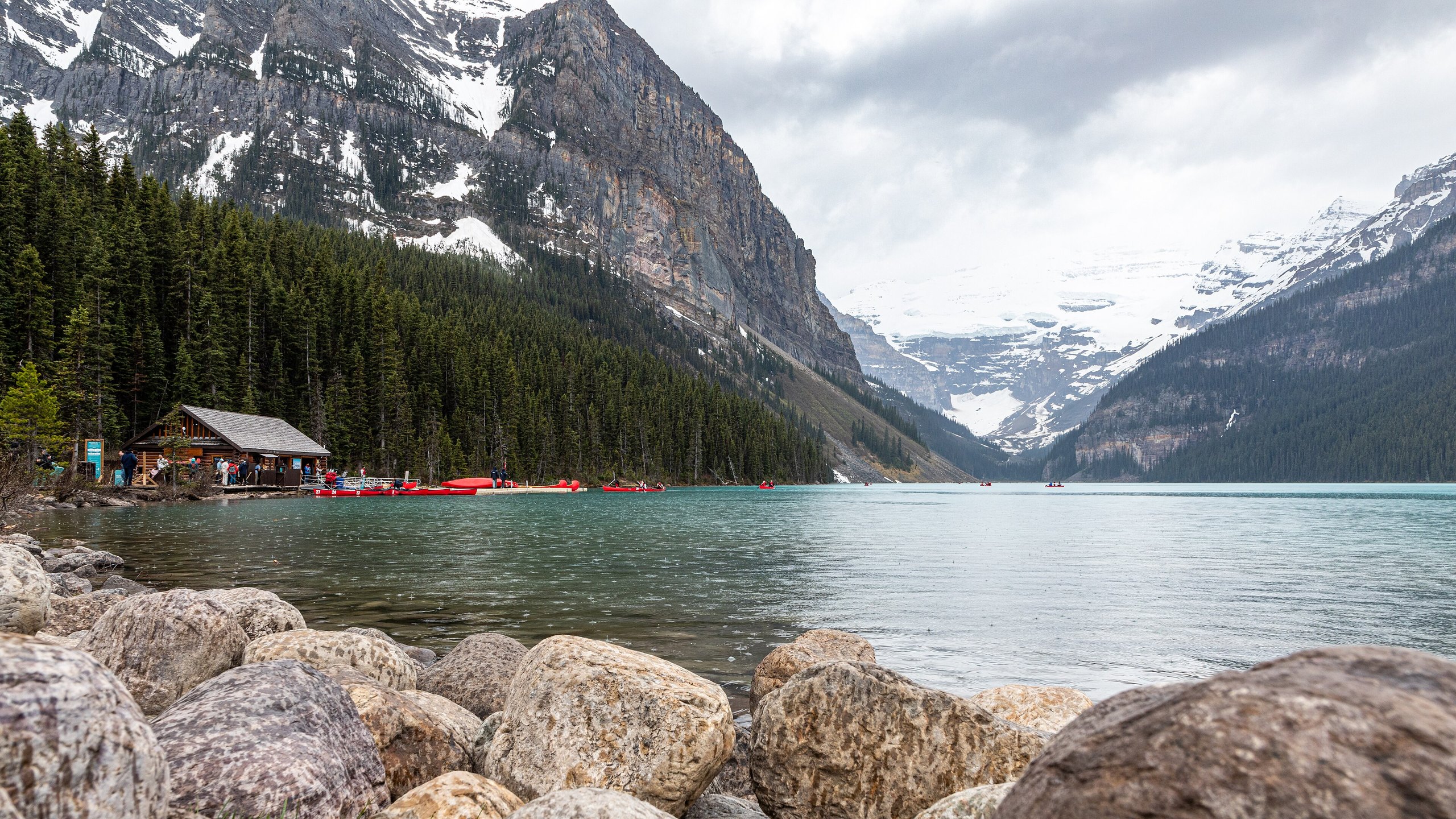
Lake Louise is the park’s other famous lake, with Victoria Glacier at its head. Most visitors stay on the paved shoreline. The better outing is the trail that climbs through forest from the shore to Lake Agnes, a small lake under cliffs where a tea house has served hikers since 1905. Expect a line there at midday in summer.
From Lake Agnes, switchbacks carry on to the Big Beehive, another 0.9 miles (1.5 km) and 490 feet (150 m) up, for the view straight down onto Lake Louise.
- Distance: 2.4 miles (3.9 km) one way
- Climb: 1,624 feet (495 m)
- Allow: 2.5 to 3 hours, more with the Big Beehive
- Start: Lake Louise lakeshore, 2.5 miles (4 km) from the village. Parking is paid and fills early; shuttles and Roam transit stop here.
- When: mid-June to early October, when the trail is clear of snow and the tea house is open
- Suits: most walkers, including children used to hills. The trail is wide and busy.
3. Walk the catwalks of Johnston Canyon
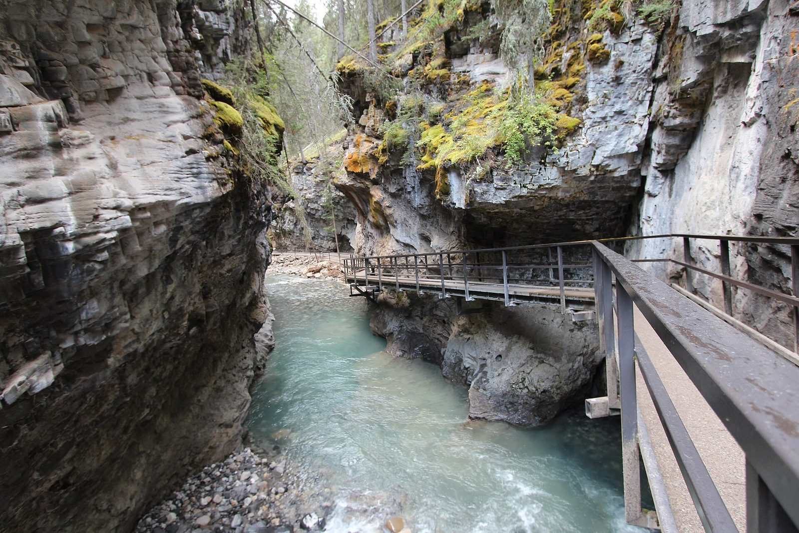
Johnston Creek has cut a narrow canyon into the limestone, and the trail runs through it on steel catwalks bolted to the walls. The Lower Falls come first, with a short tunnel to a viewing spot beside the plunge pool. The Upper Falls are higher and less crowded. Beyond them the trail leaves the canyon and climbs over a ridge to the Ink Pots, cold mineral springs that bubble up in an open meadow.
The trail to the Lower Falls is crowded through the middle of the day in July and August, so go early or in the evening. In winter the falls freeze into blue columns, and the catwalks are icy enough to need cleats.
- Distance: 0.7 miles (1.1 km) to the Lower Falls, 1.7 miles (2.7 km) to the Upper Falls, 3.6 miles (5.8 km) to the Ink Pots, each one way
- Allow: 1 hour for the Lower Falls, 2 hours for the Upper Falls, 4 hours for the Ink Pots
- Start: Johnston Canyon day-use area on the Bow Valley Parkway, 16 miles (25 km) northwest of Banff
- When: all year
- Suits: families as far as the falls; the Ink Pots add a steady climb
4. Drive the Icefields Parkway to Peyto Lake
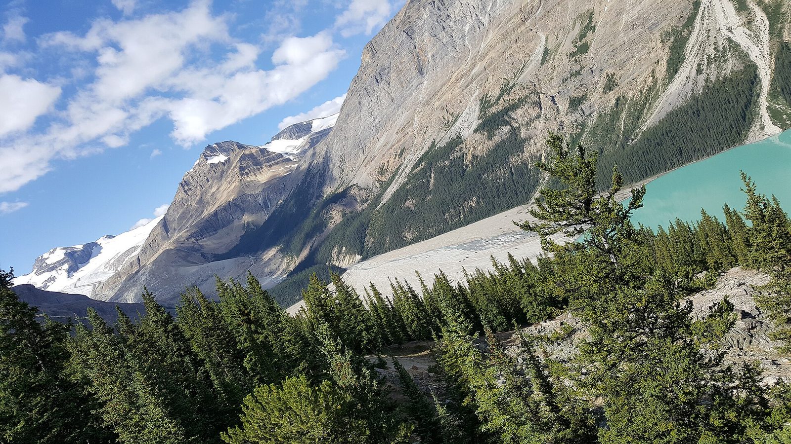
The Icefields Parkway runs 144 miles (232 km) from Lake Louise to Jasper along the Continental Divide, and the first hour of it holds some of the best roadside stops in the Rockies. The Crowfoot Glacier viewpoint is 22 miles (36 km) north of Lake Louise. Bow Lake comes next, with the red-roofed Num-Ti-Jah Lodge on its shore. At Bow Summit, the highest point on the road at 6,790 feet (2,070 m), a paved path leads to the platform above Peyto Lake.
Farther north is Mistaya Canyon, a slot canyon 550 yards (500 m) below the road, and a good place to turn back. Fill the tank before leaving Lake Louise. There is little cell coverage on the parkway, and snow can fall in any month.
- Distance: about 25 miles (40 km) each way from the Lake Louise junction to Peyto Lake; the walk to the viewpoint is 0.4 miles (700 m) round trip
- Allow: half a day with stops
- Start: Highway 93 North, from the Trans-Canada Highway just west of Lake Louise
- When: June to September for the lake colours. The road is open in winter but is not always passable, and winter tires are required.
- Suits: everyone, including visitors who cannot walk far
5. Hike Larch Valley in the last two weeks of September
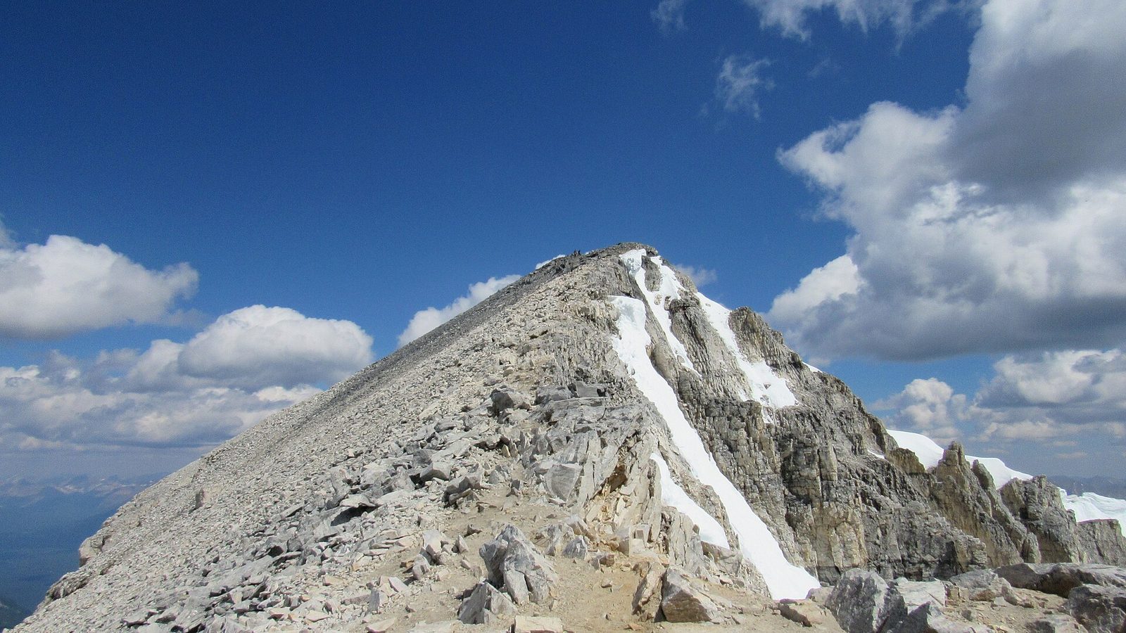
Larches are conifers that turn gold and drop their needles in fall, and the stand above Moraine Lake is the best known in the Rockies. The trail switchbacks up from the lake through forest, then opens into meadows of larch with the Ten Peaks behind and Mount Temple, the highest peak in the Lake Louise area, overhead. The Minnestimma Lakes at the top of the valley make a natural place to stop.
Strong hikers can carry on up steep switchbacks to Sentinel Pass, 3.5 miles (5.6 km) and 2,460 feet (750 m) from the lake. In larch season the shuttles sell out quickly. Because grizzly bears feed in the valley, Parks Canada at times requires hikers here to travel in tight groups of four or more.
- Distance: 2.8 miles (4.5 km) one way to the Minnestimma Lakes
- Climb: 1,870 feet (570 m)
- Allow: 3.5 to 4 hours; 4.5 to 5.5 hours for Sentinel Pass
- Start: Moraine Lake, just past the lodge, by shuttle
- When: the third and fourth weeks of September for gold larches; July and August for wildflowers
- Suits: hikers comfortable with a sustained climb
6. Go up Sulphur Mountain, on foot or by gondola
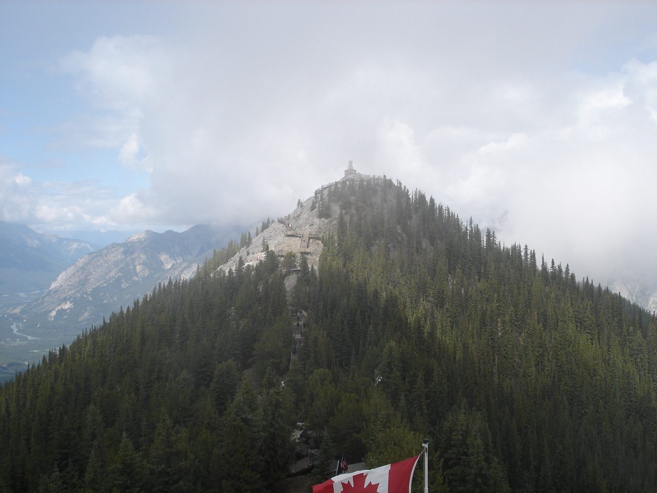
Sulphur Mountain stands over the town of Banff, and its summit ridge looks along the Bow Valley in both directions. The Banff Gondola carries most people up. The trail under it climbs the same slope in steady switchbacks through forest and costs nothing. Either way, a boardwalk along the ridge leads to Sanson’s Peak at 7,448 feet (2,270 m) and the stone weather station that Norman Sanson tended for more than 30 years.
- Distance: 3 miles (4.8 km) one way to the upper terminal, plus 0.3 miles (0.5 km) of boardwalk
- Climb: 2,149 feet (655 m)
- Allow: 4 hours on foot; 1.5 hours by gondola
- Start: Banff Upper Hot Springs parking area, 2.7 miles (4.3 km) south of downtown at the end of Mountain Avenue. Parking is paid; Roam transit runs here.
- When: all year by gondola; June to October on foot without snow
- Suits: everyone by gondola; fit walkers on the trail
7. Hike to the Plain of Six Glaciers
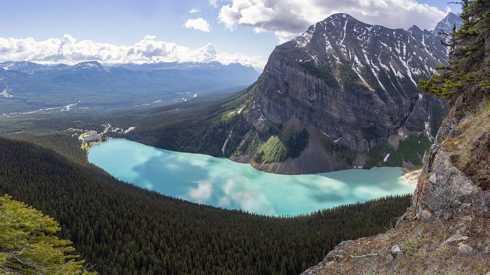
Where the Lake Agnes trail climbs away from Lake Louise, this one follows the shore to its far end and keeps going, up the valley toward Victoria Glacier. The forest gives way to moraine and open slopes, and the trail ends near a tea house built in 1924, with ice and rock on three sides. On warm afternoons ice and snow break off the cliffs above, and the sound carries down the valley.
The Highline Trail links this route with Lake Agnes to make a loop of 8.9 miles (14.3 km), which takes in both tea houses in one day.
- Distance: 3.7 miles (5.9 km) one way
- Climb: 1,952 feet (595 m)
- Allow: 4 hours; 5 hours for the loop with Lake Agnes
- Start: Lake Louise lakeshore
- When: July to September. Avalanche paths cross the upper trail, and snow lasts into early summer.
- Suits: hikers who want a full day with fewer people than Lake Agnes
8. Get out on Lake Minnewanka
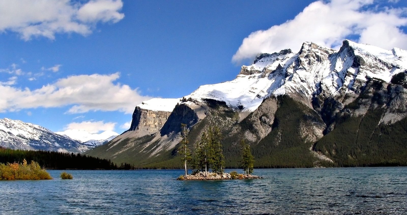
Lake Minnewanka is the largest lake in the park, 13 miles (21 km) long, and a short drive from town. It is the one lake in Banff where motorboats are allowed, and tour boats run its length in summer. On foot, an easy shoreline trail leads to the bridge over Stewart Canyon. The loop road to the lake is one of the more reliable places to see bighorn sheep, elk and, at dawn or dusk, bears.
Past the Stewart Canyon bridge the trail enters prime bear habitat, and seasonal restrictions on group size apply there in summer.
- Distance: 1 mile (1.6 km) one way to Stewart Canyon, nearly level
- Allow: 1 hour to walk; half a day with a boat tour or a picnic
- Start: Lake Minnewanka day-use area, 6 miles (10 km) northeast of downtown Banff. Roam transit runs here in summer.
- When: May to October. The lake is frozen in winter.
- Suits: families, and anyone wanting a quieter half-day near town
9. Walk the alpine meadows at Sunshine
Sunshine Meadows sits on the Continental Divide at treeline, and in summer the ski area’s gondola lifts walkers straight to it. A network of 6.4 miles (10.3 km) of trails crosses open meadow thick with wildflowers. The most walked route crests the divide and drops to a viewpoint over Rock Isle Lake; longer loops go on to Larix and Grizzly lakes or up to the Standish viewpoint. This is the easiest way in the park to spend a day above the trees without a long climb first.
- Distance: 6.4 miles (10.3 km) of trails, walked in loops of any length
- Allow: 4 to 5 hours
- Start: Sunshine Village parking area, 11 miles (18 km) southwest of Banff, then the gondola (a paid ride)
- When: early July to early September, while the gondola runs. Flowers peak from mid-July to mid-August.
- Suits: anyone who can walk uneven ground for a few hours
10. Spend a day around the town of Banff
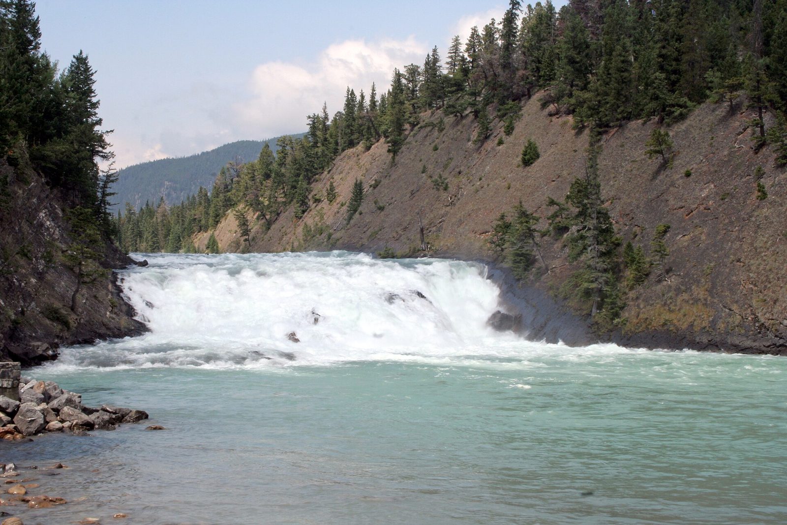
The town has enough within walking distance to fill a rest day. A riverside trail follows the Bow from downtown to Bow Falls, a 30-foot (9 m) drop below the Banff Springs Hotel. Cave and Basin, a short walk the other way, is the hot spring whose discovery by railway workers in the 1880s led to the creation of the park; it is now a national historic site with exhibits and boardwalks over the marsh. You cannot bathe there. For that, go up Mountain Avenue to the Banff Upper Hot Springs, an outdoor pool fed by the mountain’s springs, open all year.
- Distance: up to 3.5 miles (5.7 km) on the Bow River Trail, level
- Allow: a full day for all three
- Start: downtown Banff
- When: all year
- Suits: everyone; a good plan for a wet day or tired legs
11. Cycle the Bow Valley Parkway
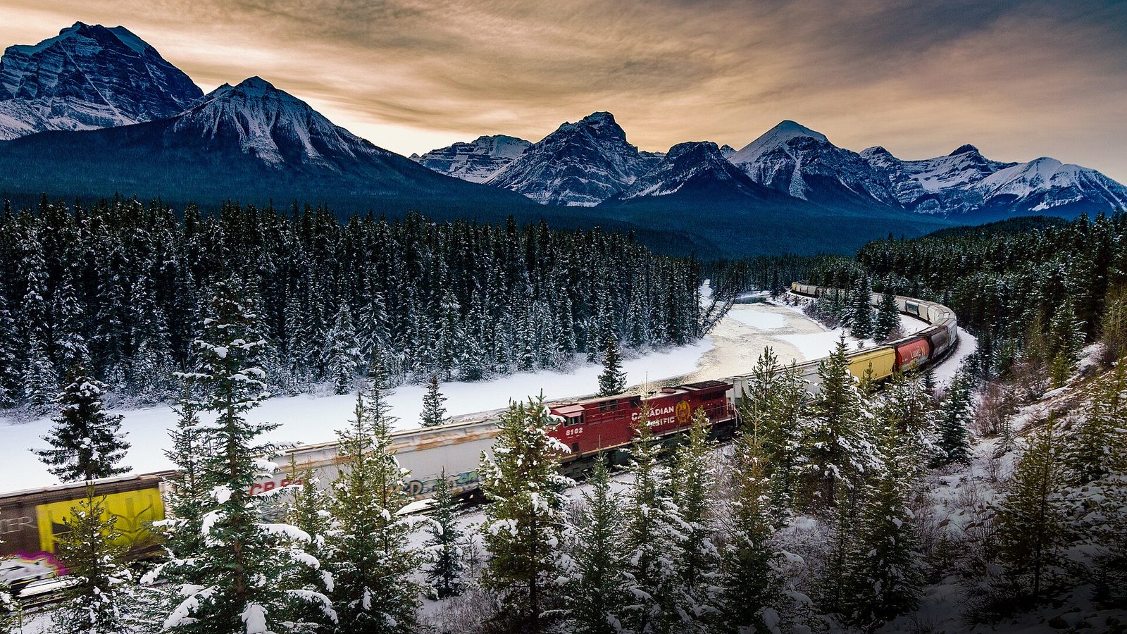
The Bow Valley Parkway is the old road between Banff and Lake Louise, about 30 miles (48 km) of two-lane highway through montane forest, with a low speed limit and far less traffic than the Trans-Canada beside it. It suits road cyclists well: the grades are gentle, Johnston Canyon makes a stop along the way, and near the Lake Louise end is Morant’s Curve, where the railway bends beside the river under the peaks. Wolves, bears and elk use this valley, so ride in daylight and give animals the road.
In some years Parks Canada has closed the eastern section to cars on set dates in spring and fall, leaving it to cyclists. Check whether that is running before you plan around it.
- Distance: about 30 miles (48 km) one way; many riders do one section and return
- Allow: half a day to a full day
- Start: the parkway’s east end, 3.5 miles (5.5 km) west of Banff on the Trans-Canada Highway, or Lake Louise
- When: May to early October
- Suits: cyclists comfortable on a road shared with cars; drivers can stop at the same places
12. Ski the park in winter
From December to March the park turns to skiing. Three resorts operate inside it: Lake Louise, the largest; Sunshine Village, on the Continental Divide with the longest season; and Mt Norquay, the small hill above town. Away from the lifts, groomed cross-country tracks run from the Lake Louise area, and the Skoki valley has drawn ski tourers since its lodge was built in 1930-31. Anything beyond the resort boundaries and groomed tracks is avalanche terrain and needs the training and equipment for it.
- Allow: one day per resort
- Start: Banff or Lake Louise; ski buses run to all three resorts
- When: December to March for the most dependable snow
- Suits: every level of skier and snowboarder at the resorts
Before you go
This list covers what stays the same from year to year. Shuttle dates, trail closures, bear restrictions and avalanche bulletins change, and Parks Canada posts them on its own site. The link is on our Banff National Park guide, with the map, passes and how to get there.