

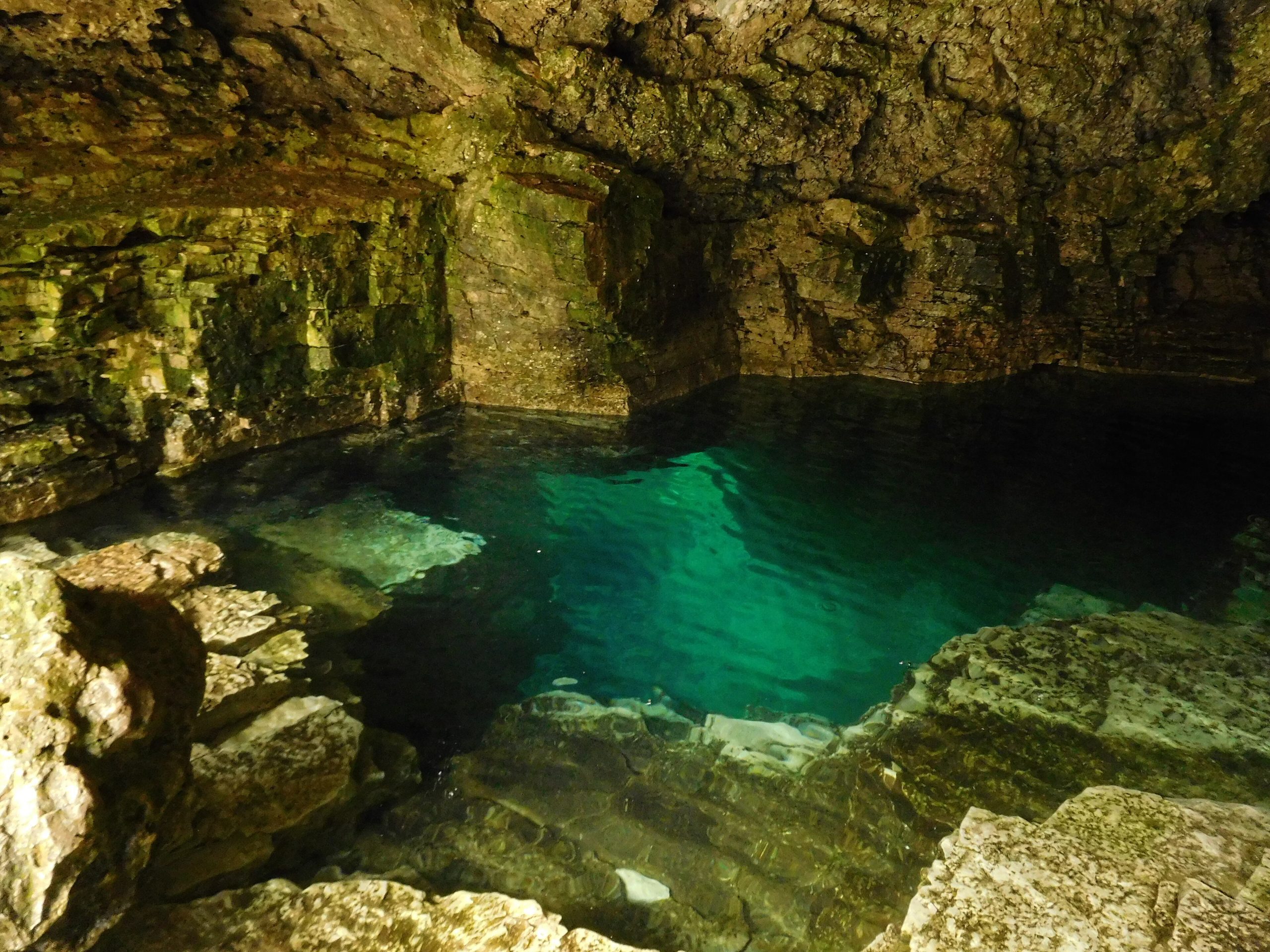
Bruce Peninsula National Park
Bruce Peninsula National Park guards a spectacular stretch of the Niagara Escarpment where it meets the turquoise water of Georgian Bay, white dolomite cliffs, the famous sea-cave Grotto, ancient cedars clinging to the rock, and some of the clearest, coldest swimming water in Ontario. It is the crown of the Bruce Trail and a magnet for hikers and paddlers.
Fast facts
- Established: 1987
- Size: about 60 square miles (156 km²) on the Bruce Peninsula
- Highlight: the Grotto sea cave and the Georgian Bay cliffs
- Biosphere: part of a UNESCO World Biosphere Reserve
- Gateway: Tobermory, Ontario
- Managed by: Parks Canada
The landscape
The park straddles the Niagara Escarpment, presenting sheer dolomite cliffs and cobble coves along the Georgian Bay shore and quieter forest, wetland and inland lakes behind. Ancient, gnarled eastern white cedars, some over a thousand years old, grow from the cliff faces, and the clear, cold bay water glows an almost Caribbean blue on sunny days.
Best time to go
Summer is peak season, with warm weather for hiking and swimming and the Grotto at its busiest, hence the timed parking reservations. Early fall brings color and thinner crowds. Winter is quiet and snowy, good for snowshoeing, though many services close and the cliffs turn icy and hazardous.
Getting there and around
The park sits near Tobermory at the tip of the peninsula via Highway 6. Reaching the popular Grotto and Cyprus Lake area requires a timed parking reservation in the busy season, so book ahead; a vehicle is the practical way to arrive, with trails radiating from the parking areas.
Things to do
Hike the rugged Georgian Bay shoreline section of the Bruce Trail to the Grotto and Indian Head Cove, swim or snorkel in the clear cold water, and paddle the coast by kayak. Inland, quieter trails circle Cyprus Lake and the forest, and Tobermory is the gateway to boat tours of nearby Fathom Five and its shipwrecks.
Staying safe
The Georgian Bay water is cold year-round and the cliffs above the Grotto are steep and slippery, where falls have caused serious injuries, move carefully and keep back from edges. Storms can whip up quickly on the open bay for paddlers, and ticks carrying Lyme disease are present, so use repellent and check yourself after hiking.
Know before you go
A Parks Canada pass plus a timed parking reservation for the Grotto area are required in the busy season, and camping should be booked ahead. This page is a general overview, not a live conditions report; always confirm current reservations, conditions and closures with Parks Canada before your trip.
- Coordinates
- 45.1646, -81.4853
- Magnetic declination
- 9.1° W (2026)
Set this declination on your compass, then align it to the map's north lines; it is the angle between true north and magnetic north, refreshed each year.
A spread of the park’s main places shows straight away, and the rest appear as you zoom in. You can also search above, or pick any place from the lists below, and the map will go to it.
Getting there 1
Ranger station
On the trail 7
Campgrounds
Hut or shelter
Sights 4
Viewpoints
Beach
Point of interest
Map data comes from third-party sources and may be incomplete or out of date, so carry a current official map (terms).
- Best seasons
- Summer, Early fall
- Difficulty
- Easy to strenuous
- Access / trailheads
- At the tip of the Bruce Peninsula in Ontario, near Tobermory, via Highway 6. The Grotto parking is reservation-controlled in summer.
- Water
- Potable water at the campground; carry water on trails.
- Cell / satellite coverage
- Patchy cell service on the trails; better near Tobermory.
- Nearest ranger / SAR / emergency
- Parks Canada dispatch: 1-877-852-3100; life-threatening emergencies: 911.
- Permits & regulations
- A Parks Canada pass is required, plus a separate timed parking reservation for the Grotto/Cyprus Lake area in the busy season; camping requires a reservation.
- Leave No Trace
- Stay on trails to protect fragile cliff-edge habitat, pack out all waste, and follow Leave No Trace.
January
- Below freezing all day
February
- Below freezing all day
March
- Below-freezing nights
April
May
June
July
August
September This month
October
November
- Below-freezing nights
December
- Below-freezing nights
What to bring depends on your trip: how long you’re out, where you sleep, and how far you go from the road. The planner builds the list for yours.
Plan a trip here →Averages for 1981–2010 from Environment Canada climate normals, measured at the Wiarton Airport station, 39 miles (63 km) away at 729 feet (222 m).