

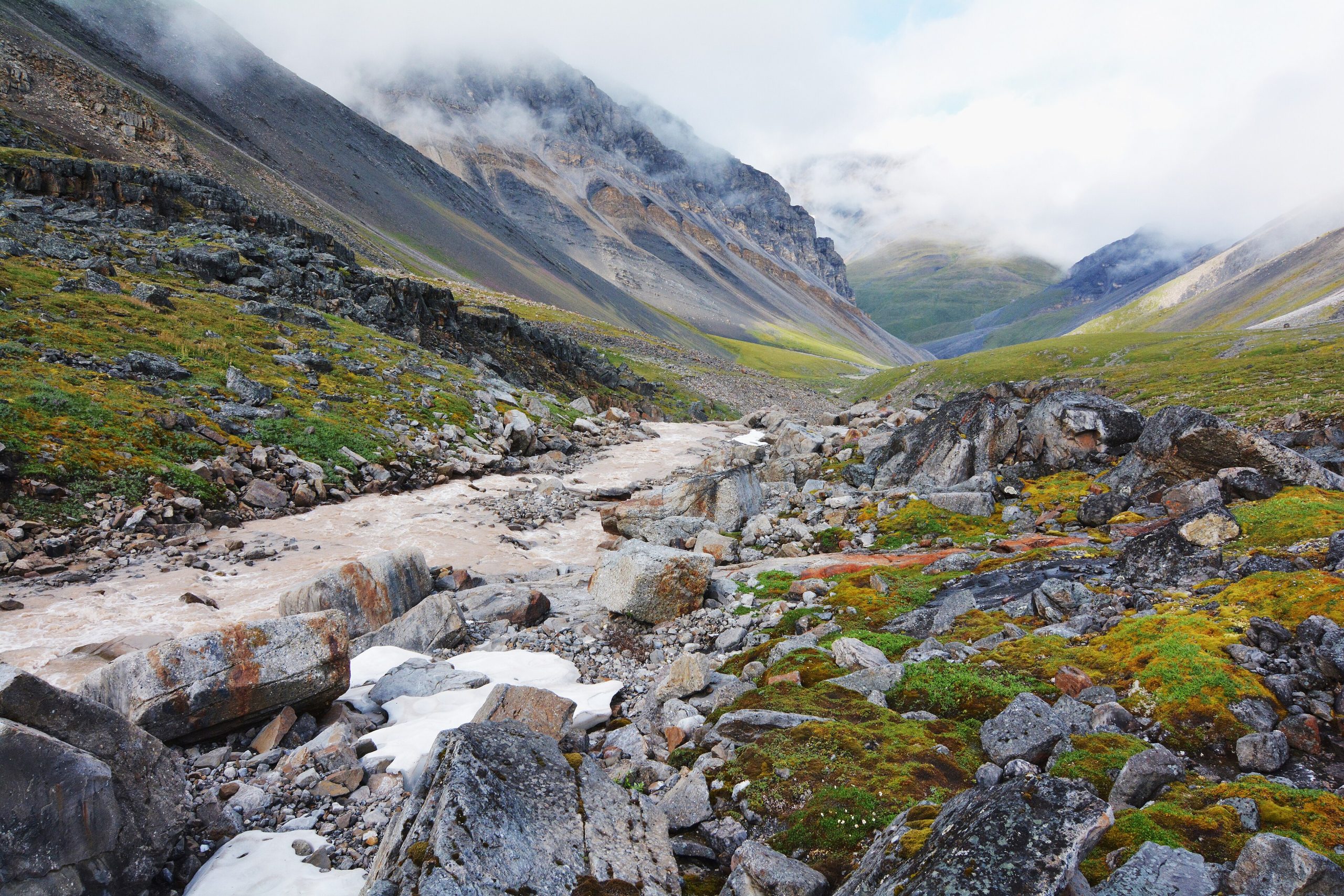
Gates of the Arctic National Park
Gates of the Arctic is America’s last great wilderness in the most literal sense, the largest national park in the country, entirely above the Arctic Circle, and almost entirely without roads, trails, signs or visitor centers. Fewer than one park in a hundred sees this few people. You forge your own route across 8.4 million acres (34,000 km²) of the Brooks Range, and the only footprints are the ones you leave in the tundra.
Fast facts
- Established: 1980, under the Alaska National Interest Lands Conservation Act
- Size: 8.4 million acres (34,000 km²), the largest national park in the U.S.
- Location: northern Alaska, entirely above the Arctic Circle
- Visitors: roughly 20,000 a year, one of the least-visited parks
- Status: 100% designated wilderness with no developed infrastructure
- Managed by: National Park Service
The landscape
The Brooks Range dominates, jagged peaks rising from broad valleys of alpine tundra, boreal forest and glacial troughs. Dozens of braided rivers, including the Kobuk, Noatak and John, cut through the land and serve as both ecological arteries and travel corridors. Because the park sits above the Arctic Circle it swings from nearly 24 hours of summer daylight to near-constant winter darkness, and permafrost shapes the ground into thermokarst lakes and polygonal tundra.
Best time to go
The window is narrow: mid-July to early August, when temperatures are mildest (50–65°F / 10–18°C) and the midnight sun gives up to 20 hours of light. Mosquitoes peak in late June and early July, so waiting until mid-July makes a real difference in comfort. By mid-August the bugs vanish but weather turns unpredictable, with rising odds of early snow and freezing nights. Winter travel is possible but reserved for experienced expeditioners.
Getting there and around
There are no roads in. Most visitors charter a bush plane from Bettles, Kotzebue or a nearby village and land on a gravel bar or river. Once inside, you move entirely on foot, by raft or by kayak. The braided rivers are the park’s highways, and many trips are multi-day float expeditions. Cross-country hiking demands solid off-trail navigation, because the tundra hides no marked route and can be deceptively slow to cross.
Things to do
This is a park for self-reliant wilderness travel: backpacking across unmarked passes, rafting or packrafting the Kobuk, Noatak or John rivers, and fly-fishing clear streams for Arctic char and grayling. Wildlife is abundant, caribou, grizzlies, Dall sheep, wolves, moose and Arctic foxes, and the photography, from glacial rivers to midnight-sun ridgelines, is extraordinary. All camping is primitive; there are no campgrounds, shelters or facilities.
Staying safe
The Arctic is unforgiving and demands serious preparation. Grizzlies are common, so carry bear spray, store food in bear canisters, and keep a clean camp. River crossings can be deadly, swift current, hidden rocks and near-freezing water, so check levels and cross with care. Weather can turn to high wind, freezing rain or snow even in summer. With no cell service and no in-park rescue, you must be self-reliant: carry a satellite communicator and file a detailed trip plan with the park service before you go.
Know before you go
A free backcountry permit is required for overnight trips. You pack in all food, fuel and gear and pack out all trash. There are no resupply points. GPS, a topographic map and a compass are mandatory, and strong off-trail navigation and a high level of fitness are essential over uneven, root-choked and rocky ground. This page is a general overview, not a live conditions report; confirm current conditions and logistics with the National Park Service before your trip.
- Coordinates
- 67.7508, -153.3869
- Magnetic declination
- 12.4° E (2026)
Set this declination on your compass, then align it to the map's north lines; it is the angle between true north and magnetic north, refreshed each year.
A spread of the park’s main places shows straight away, and the rest appear as you zoom in. You can also search above, or pick any place from the lists below, and the map will go to it.
Getting there 8
Airstrips
On the trail 2
Campground
Hut or shelter
Sights 33
Viewpoint
Islands
Peaks 30
Map data comes from third-party sources and may be incomplete or out of date, so carry a current official map (terms).
- Best seasons
- Summer (mid-July to early August)
- Difficulty
- Strenuous (expedition only)
- Access / trailheads
- No roads reach the park. Access is by bush plane onto gravel bars or rivers, or on foot/raft from villages such as Kotzebue, Bettles or Anaktuvuk Pass. Travel inside is off-trail on foot or by packraft.
- Water
- Clear rivers and streams throughout; filter or treat all water.
- Cell / satellite coverage
- No cell service and no emergency infrastructure, a satellite communicator (inReach/Zoleo) and a filed trip plan are essential.
- Nearest ranger / SAR / emergency
- No in-park SAR; contact the Bettles Ranger Station in advance. Life-threatening emergencies: 911 (response may be many hours or days).
- Permits & regulations
- Free backcountry permit required for overnight stays; there are no entrance stations, roads, trails or facilities. Visitors must be fully self-sufficient.
- Leave No Trace
- Pack in everything and pack out all waste; strict Leave No Trace is required to protect this pristine wilderness. No campgrounds or facilities exist.
January
- Below freezing all day
February
- Below freezing all day
March
- Below freezing all day
April
- Below-freezing nights
May
June
July
August
September This month
October
- Below freezing all day
November
- Below freezing all day
December
- Below freezing all day
What to bring depends on your trip: how long you’re out, where you sleep, and how far you go from the road. The planner builds the list for yours.
Plan a trip here →Averages for 1991–2020 from NOAA U.S. Climate Normals, measured at the Bettles Airport station, 76 miles (122 km) away at 645 feet (197 m). That is the nearest station with long-term records, so treat these as a regional guide. Conditions change with elevation: expect it colder higher up.