

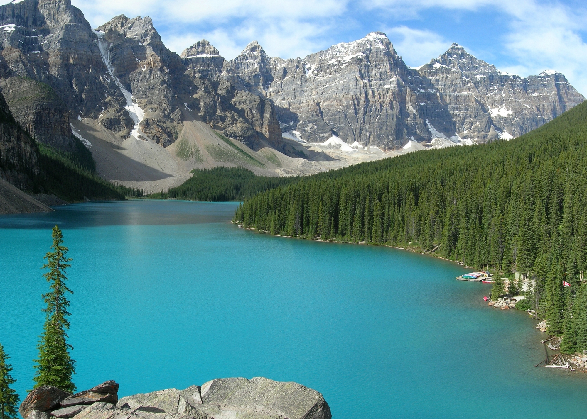
Banff National Park
Banff is Canada’s first national park and the flagship of the Rockies, a 6,641-square-kilometre sweep of glacier-fed lakes, limestone peaks and a walkable mountain town, all within a 90-minute drive of Calgary. It’s one of the most approachable big-mountain destinations in North America, which is exactly why it rewards a little planning: the same accessibility that makes a first car-camping trip easy also draws more than four million visitors a year, and the weather turns fast and cold at elevation.
Fast facts
- Established: 1885, Canada’s first national park (originally Rocky Mountains Park)
- Size: 2,564 square miles (6,641 km²) of the eastern Canadian Rockies
- Highest point: Mount Forbes, 11,850 feet (3,612 m)
- Visitors: more than 4 million a year
- World Heritage: part of the Canadian Rocky Mountain Parks UNESCO site (1984)
- Gateway: Calgary, about 81 miles (130 km) east; hubs at Banff and Lake Louise
- Managed by: Parks Canada
The landscape
Banff sits on the eastern slopes of the Canadian Rockies, spanning the Main and Front Ranges along the Continental Divide. Turquoise lakes like Louise and Moraine get their colour from suspended glacial rock flour; above them, dozens of peaks top 9,800 feet (3,000 m), capped by icefields that feed the Bow and North Saskatchewan rivers. The park climbs through three ecoregions, montane valley bottoms of aspen and Douglas fir, subalpine spruce and fir, and bare alpine tundra and permanent ice. It’s prime habitat for grizzly and black bears, elk, bighorn sheep, mountain goats, wolves, and the occasional wolverine or cougar.
Best time to go
Summer (July–August) is peak season: trails are largely snow-free, the Icefields Parkway is in full swing, and daytime temperatures are pleasant, though alpine nights stay cold year-round and afternoon thunderstorms are common. September brings thinner crowds, golden larch season around Lake Louise and Moraine Lake, and crisp, stable weather. Winter (December–March) turns Banff into a ski-touring and resort destination, with genuine avalanche terrain, short daylight and sub-freezing temperatures. Spring is unpredictable, with lingering snow up high and many high-country trails closed well into June or July.
Getting there and around
Most visitors fly into Calgary International Airport and drive the Trans-Canada Highway (Hwy 1) about 81 miles (130 km) west into the park. In summer the famous Lake Louise and Moraine Lake areas run on a shuttle-and-reservation system. Private vehicles are heavily restricted and parking fills before dawn, so book transit ahead. Other trailheads such as Johnston Canyon, Sunshine Meadows, Lake Minnewanka and the Bow Valley Parkway are reachable by car or the local Roam public transit buses, and the Banff and Lake Louise townsites are walkable once you’re there.
Things to do
Day hiking is the headline: routes range from the flat, family-friendly shoreline and waterfalls of Johnston Canyon to all-day alpine objectives like Sentinel Pass, Cory Pass and the Plain of Six Glaciers. The backcountry opens up multi-day circuits such as the Sawback and Skoki. Beyond hiking there’s canoeing on Lake Louise and Moraine Lake, cycling the Bow Valley Parkway, wildlife-watching along the Minnewanka loop, soaking in the Banff Upper Hot Springs, and, in winter, downhill skiing at three resorts (Lake Louise, Sunshine Village and Mt Norquay) plus backcountry touring and ice walks. History buffs can visit the Cave and Basin, the hot spring whose discovery in the 1880s led to the creation of the park.
Staying safe
This is real bear country: carry bear spray, know how to use it, make noise, travel in groups, and store food in the provided lockers or approved canisters. Mountain weather can swing from sun to snow in an afternoon even in July, so pack insulation and a waterproof shell regardless of the forecast, and start alpine days early to beat storms. Rivers and lakes run cold and fast with glacial melt. Crossings can be dangerous. Cell coverage is limited to the townsites; for the backcountry, carry a map, compass and a satellite messenger or PLB, watch for avalanche terrain in winter and shoulder seasons, and always leave a trip plan with someone before you head out.
Know before you go
Everyone entering the park needs a valid Parks Canada pass (daily or annual), and both backcountry and frontcountry camping require reservations that open months ahead and sell out fast. Fire bans, trail closures (often for bear activity), avalanche bulletins and seasonal road conditions change constantly. This page is a general overview, not a live conditions report, so always confirm current status, closures and permits with Parks Canada before your trip.
- Coordinates
- 51.4883, -116.2410
- Magnetic declination
- 14.2° E (2026)
Set this declination on your compass, then align it to the map's north lines; it is the angle between true north and magnetic north, refreshed each year.
A spread of the park’s main places shows straight away, and the rest appear as you zoom in. You can also search above, or pick any place from the lists below, and the map will go to it.
Getting there 14
Park entrances
Airstrips
Visitor centre
Ranger stations
On the trail 63
Trailheads
Campgrounds
Hut or shelters
Picnic sites
Sights 120
Viewpoints
Waterfalls
Heritage site
Point of interests
Peaks 30
Map data comes from third-party sources and may be incomplete or out of date, so carry a current official map (terms).
- Best seasons
- Summer, Early fall (shoulder)
- Difficulty
- Easy to strenuous
- Access / trailheads
- Trans-Canada Hwy 1; shuttle/reservation for Lake Louise & Moraine Lake; trailheads at Johnston Canyon, Sunshine, Lake Minnewanka.
- Water
- Abundant lakes and streams; filter or treat all backcountry water.
- Cell / satellite coverage
- Cell service in Banff & Lake Louise townsites only; little to none in the backcountry. Carry a satellite messenger or PLB.
- Nearest ranger / SAR / emergency
- Banff Dispatch (24/7): 1-403-762-1470; life-threatening emergencies: 911.
- Permits & regulations
- National park entry pass required; backcountry & frontcountry camping need Parks Canada reservations; seasonal fire bans possible.
- Leave No Trace
- Pack out all waste, use bear lockers/canisters for food, stay on trail, drones prohibited.
January
- Below freezing all day
- Avalanche terrain
February
- Below-freezing nights
- Avalanche terrain
March
- Below-freezing nights
- Avalanche terrain
April
- Below-freezing nights
- Avalanche terrain
May
June
July
August
September This month
October
- Below-freezing nights
- Avalanche terrain
November
- Below-freezing nights
- Avalanche terrain
December
- Below freezing all day
- Avalanche terrain
What to bring depends on your trip: how long you’re out, where you sleep, and how far you go from the road. The planner builds the list for yours.
Plan a trip here →Averages for 1981–2010 from Environment Canada climate normals, measured at the Kananaskis station, 39 miles (62 km) away at 4,564 feet (1,391 m). Conditions change with elevation: expect it colder higher up.