

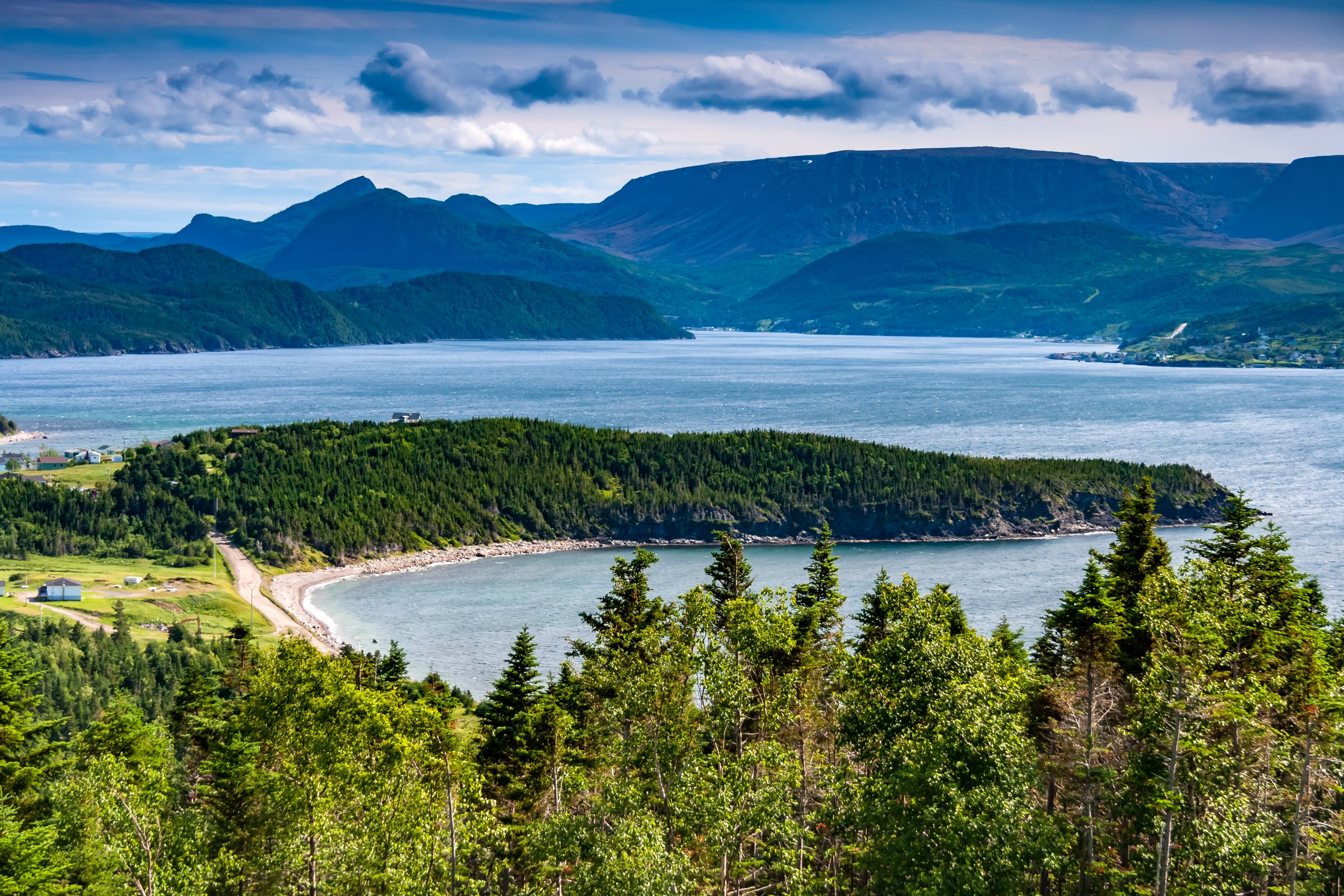
Top 9 things to do in Gros Morne National Park
Gros Morne National Park, on the west coast of Newfoundland, is a UNESCO World Heritage Site for its geology: here the rocks tell the story of how continents drift and collide more clearly than almost anywhere on Earth. In one park you can walk across a barren plateau of the Earth’s mantle, take a boat into a landlocked fjord between cliffs 2,000 feet (600 m) high, climb a flat-topped mountain where caribou and arctic hares live, and walk along a coast of fishing villages, sea stacks and wildflower meadows. These are the nine outings we would put first. The order starts with what the park is known for, then goes by what an outing gives back for the time and effort it takes. Distances are approximate; times are our estimates and do not include stops.
The weather on this coast changes fast, with fog, wind and rain at any time of year, and snow can linger on the high ground into June: carry warm, waterproof layers on every hike. Moose are everywhere in the park and are a real hazard on the roads, above all at dusk and at night, so drive slowly. Stay well back from the cliff edges, and check the tide before walking below the coastal cliffs.
1. Take the boat tour on Western Brook Pond
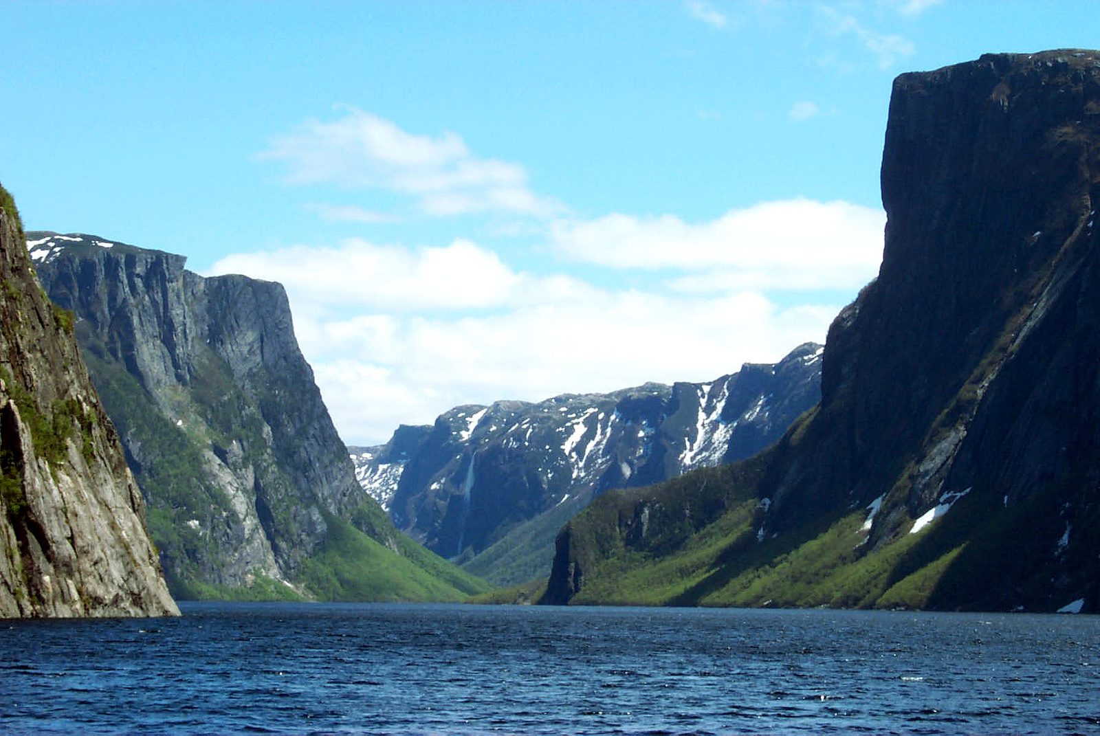
Western Brook Pond is a fjord carved by glaciers into the Long Range Mountains and later cut off from the sea, so its water is fresh. A boardwalk and trail cross bog and forest from the road to the dock, and from there a tour boat carries you up the pond between sheer cliffs that rise straight from the water, with waterfalls pouring off the plateau above, among them Pissing Mare Falls, one of the tallest in eastern North America. It is the park’s signature experience; book the boat ahead.
- Distance: about 1.9 miles (3 km) each way on foot to the dock
- Allow: 4 hours, with the walk and the boat tour
- Start: Western Brook Pond parking area, on Route 430 north of Rocky Harbour
- When: mid-May to mid-October, when the boat runs
- Suits: everyone who can walk the trail to the dock
2. Walk on the Earth’s mantle in the Tablelands
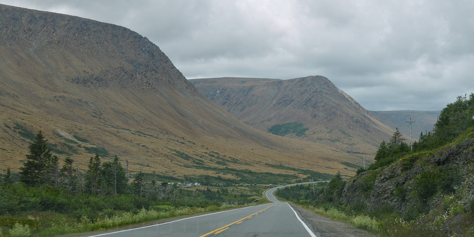
The Tablelands are a high, flat-topped mountain of brown, barren rock, so different from the green hills around them that they look like another planet. They are made of peridotite, rock from the Earth’s mantle, pushed up from deep below when the continents collided hundreds of millions of years ago, and they helped scientists prove the theory of plate tectonics. Little grows on the toxic soil. An easy trail leads into a valley among them, and rangers lead walks in summer.
- Distance: about 2.5 miles (4 km) round trip
- Allow: 1.5 hours
- Start: Tablelands trailhead, on Route 431 west of Woody Point
- When: May to October
- Suits: everyone
3. Climb Gros Morne Mountain
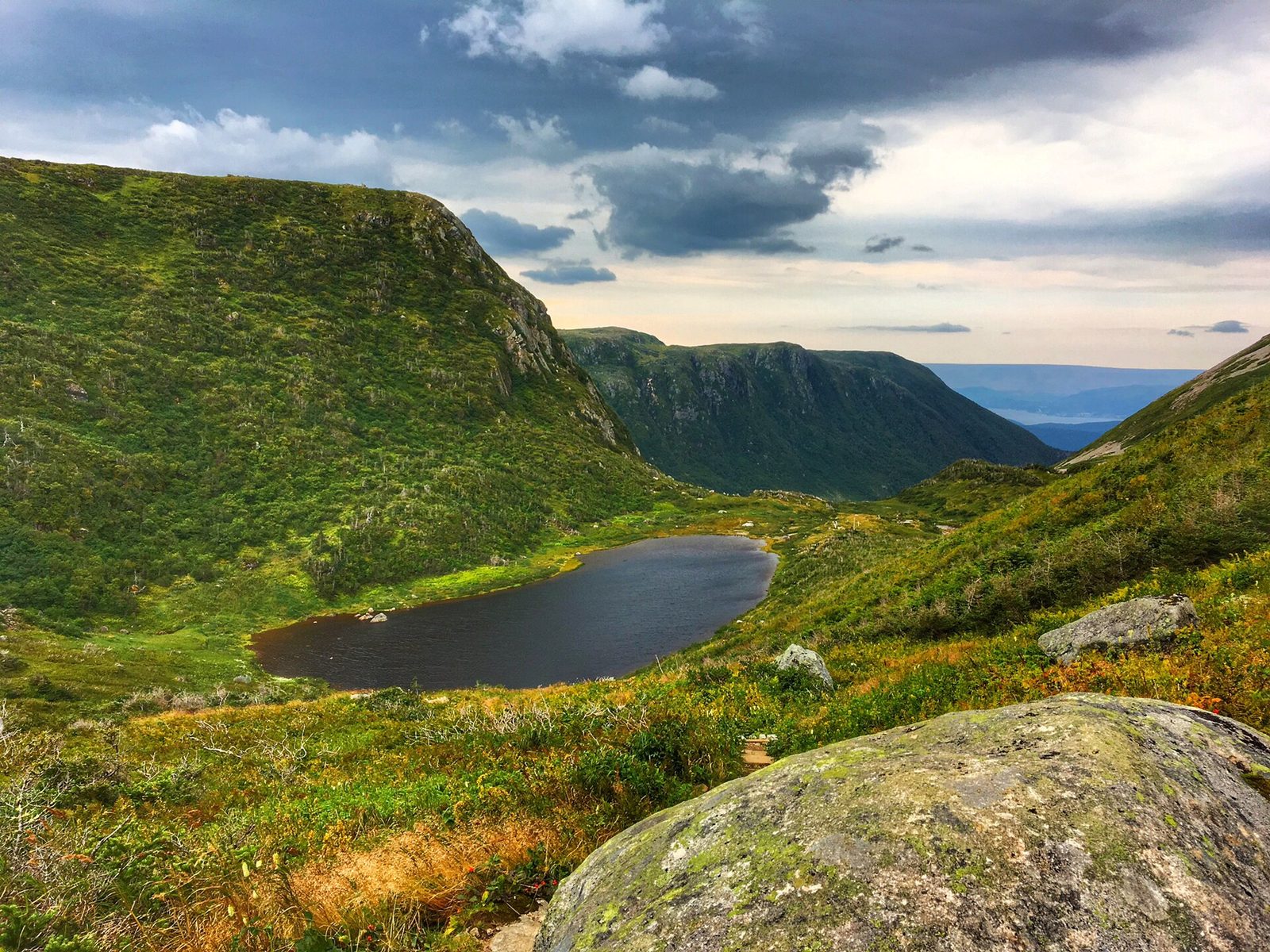
The park’s namesake is a great flat-topped mountain, 2,644 feet (806 m) high, and the hike to the top is the park’s best day out for strong walkers. The trail climbs through forest to the base of the mountain, then straight up a steep, rocky gully to the open summit plateau of arctic tundra, where you may see caribou, arctic hares and ptarmigan, and returns by a long loop past the Ten Mile Pond gorge. The summit is closed each spring to protect wildlife during the breeding season.
- Distance: about 10 miles (16 km) loop
- Climb: about 2,500 feet (760 m)
- Allow: 7 to 8 hours
- Start: Gros Morne Mountain trailhead, on Route 430 east of Rocky Harbour
- When: late June to September
- Suits: fit hikers
4. Hike the Green Gardens Trail
On the coast south of the Tablelands, this trail crosses the barren mantle rock and drops through forest to green coastal meadows on the clifftops, where sheep once grazed, above sea stacks, sea caves and black lava rocks left from an ancient ocean floor. At low tide you can explore the shore below. It is one of the finest coastal hikes in Newfoundland.
- Distance: about 5.6 miles (9 km) round trip to the meadows, or a longer loop
- Allow: 4 to 5 hours
- Start: Green Gardens trailhead, on Route 431 west of the Tablelands
- When: June to October
- Suits: fit walkers
5. See the boundary between two ages of the Earth at Green Point
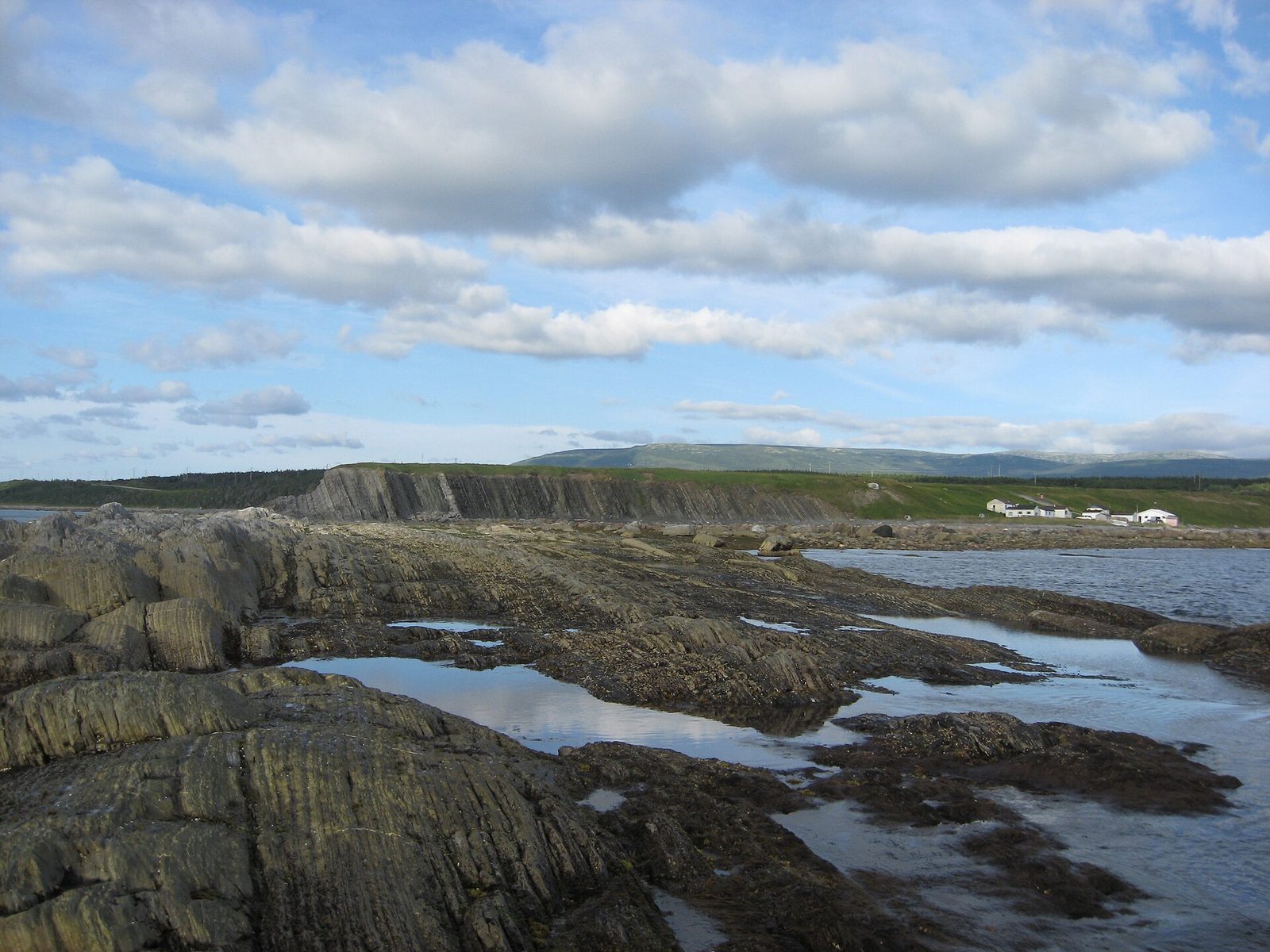
At Green Point, on the coast north of Rocky Harbour, the rock layers stand on end along the shore, and in them is the internationally agreed boundary between the Cambrian and Ordovician periods, about 485 million years ago, marked by a change in tiny fossils. Geologists come from around the world to see it. At low tide you can walk along the beach and see the layers yourself.
- Allow: 1 hour, at low tide
- Start: Green Point, off Route 430 north of Rocky Harbour
- When: May to October; check the tide
- Suits: everyone
6. Watch the sunset at Lobster Cove Head
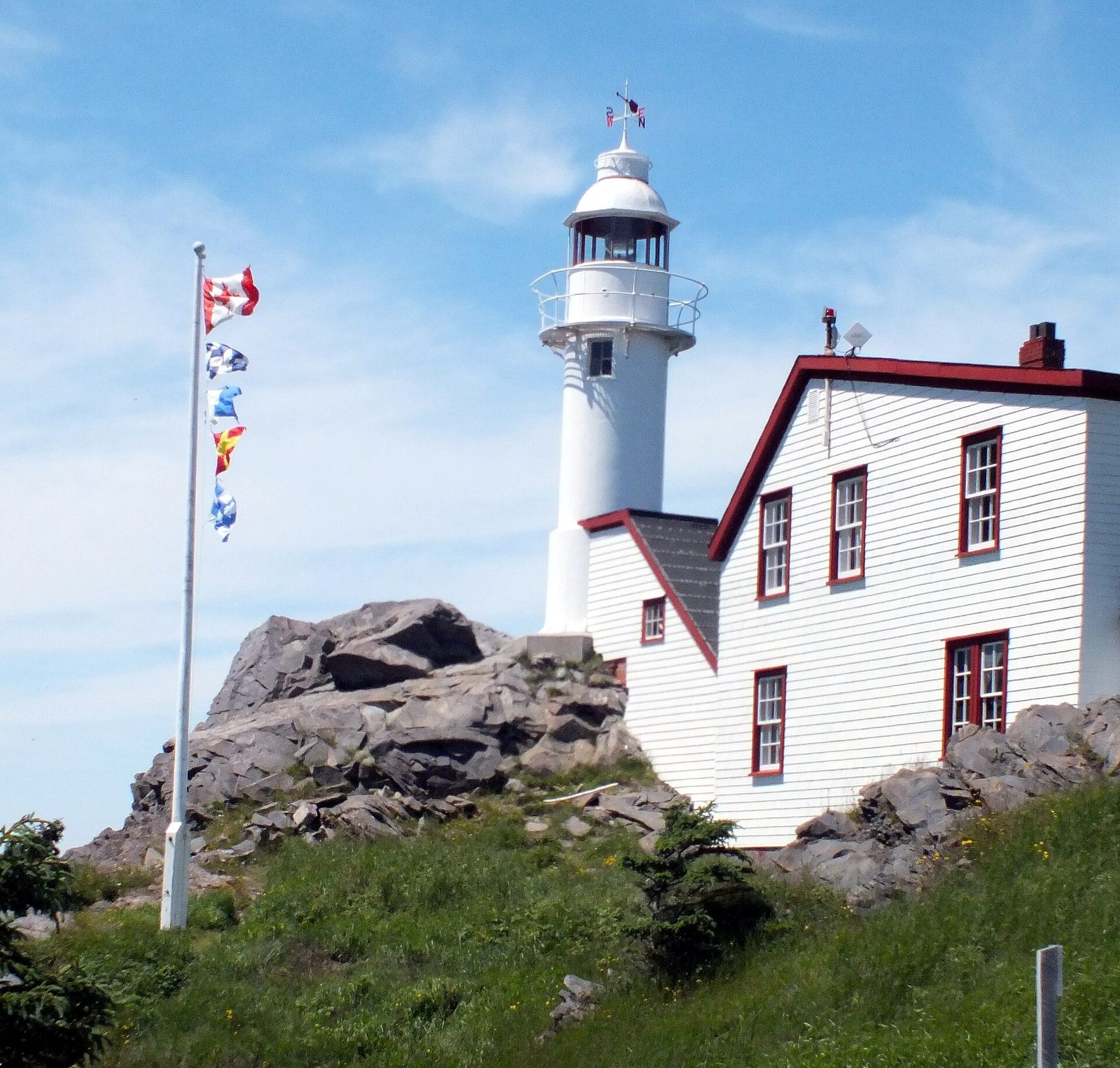
On a headland at the edge of Rocky Harbour, the red-and-white Lobster Cove Head Lighthouse looks out over the Gulf of St. Lawrence and the mouth of Bonne Bay. The lightkeeper’s house holds exhibits on the coast’s people and fisheries. Walk the short trail around the headland to the rocky shore, where the sunset over the gulf is the best in the park and whales are sometimes seen offshore.
- Allow: 1 hour
- Start: Lobster Cove Head, just north of Rocky Harbour
- When: May to October; the exhibits keep summer hours
- Suits: everyone
7. Explore Bonne Bay and Woody Point
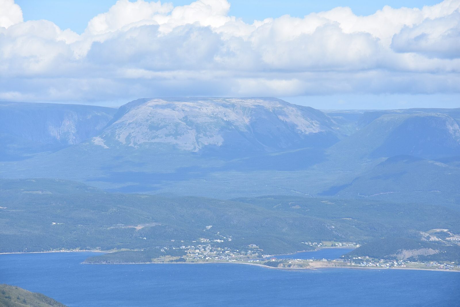
Bonne Bay is a long fjord that cuts deep into the park, splitting it in two. On its south shore, the old fishing village of Woody Point has colourful houses, cafés and a lively summer arts scene, and the park’s Discovery Centre nearby explains the geology of the Tablelands across the bay. A water taxi crosses the bay between Woody Point and Norris Point in summer, and boat tours and kayak trips explore the fjord.
- Allow: half a day
- Start: Woody Point, on Route 431
- When: June to September
- Suits: everyone
8. Visit the fishing premises at Broom Point
At Broom Point, on the coast north of Western Brook Pond, the park has restored the fishing premises of a family who fished here from the 1940s to the 1970s: a store, cabin and gear shed with boats, nets and tools, just as they left them. In summer, interpreters tell the story of life in the inshore fishery that built the villages of this coast.
- Allow: 45 minutes
- Start: Broom Point, off Route 430 north of Rocky Harbour
- When: summer, when the premises are open
- Suits: everyone
9. Trek the Long Range Traverse
For experienced backcountry hikers, the Long Range Traverse crosses the trackless plateau of the Long Range Mountains from the head of Western Brook Pond to Gros Morne Mountain, through bog, tundra and ponds with caribou and moose and no trail to follow. It is one of the great wilderness hikes in Canada, and the park requires a permit and an orientation for it, with proof that you can navigate by map and compass. You start by taking the boat up Western Brook Pond.
- Distance: about 22 miles (35 km)
- Allow: 4 to 5 days
- Start: the head of Western Brook Pond, by the tour boat
- When: July to September
- Suits: experienced backcountry hikers with strong navigation skills
Before you go
This list covers what stays the same from year to year. Closures, boat schedules and seasonal wildlife closures change, and Parks Canada posts them on its own site. The link is on our Gros Morne National Park guide, with the map and how to get there.