

Top 8 things to do in Glacier Bay National Park
Glacier Bay National Park and Preserve covers 3.3 million acres (13,000 km²) of fjords, tidewater glaciers, rainforest and high peaks in Southeast Alaska, west of Juneau. When Captain George Vancouver sailed past in 1794, the bay was a wall of ice; since then the glaciers have pulled back some 65 miles (105 km), one of the fastest retreats ever recorded, and forest, whales and bears have followed them in. No road reaches the park. Visitors arrive by small plane or ferry to Gustavus, by cruise ship or by private boat, and nearly everything is seen from the water. These are the eight outings we would put first. The order starts with what the park is known for, then goes by what an outing gives back for the time and effort it takes. Distances are approximate; times are our estimates and do not include stops.
The water in the bay stays near 40°F (4°C) all summer, and a capsized paddler has minutes before the cold takes away the use of their hands: wear a dry suit or wetsuit and a life jacket, and stay close to shore. The tides rise and fall more than 20 feet (6 m), so haul boats and pitch tents well above the high-water line. Brown and black bears live throughout the park, including around Bartlett Cove. Carry bear spray, cook and store food as the park directs, and expect rain and wind at any time.
1. Take the day boat up the bay
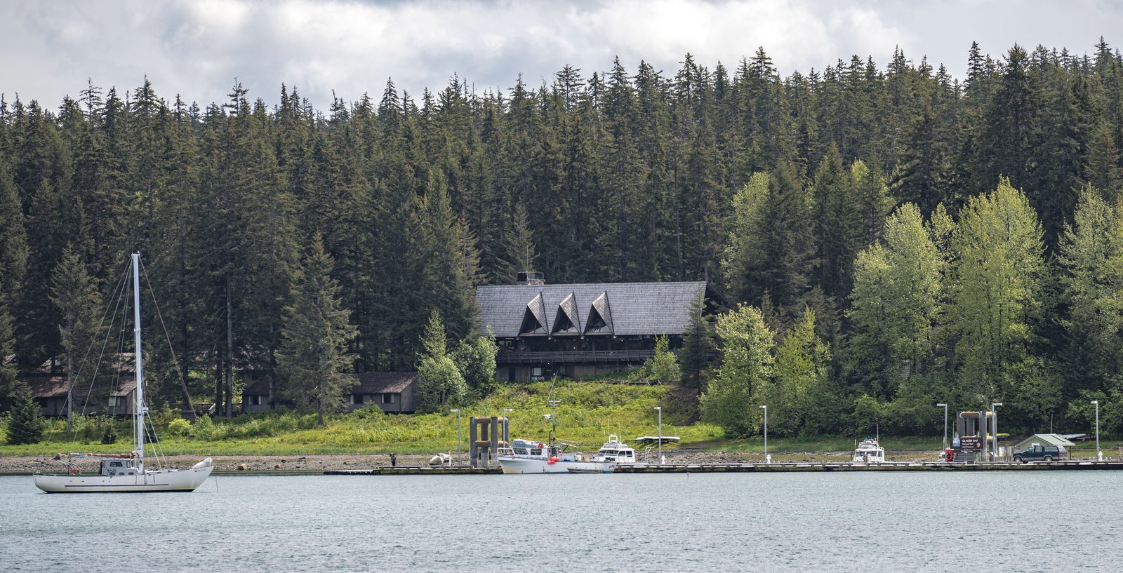
The one way most visitors see the upper bay is the day boat from Bartlett Cove, a full-day trip of about 130 miles (210 km) up to the tidewater glaciers at the head of the West Arm and back, with a park ranger on board to explain what you are seeing. On the way you pass seabird colonies with tufted puffins, Steller sea lions hauled out on the rocks of South Marble Island, sea otters, mountain goats on the cliffs and, often, humpback whales and brown bears on the shore. Book well ahead, and dress for cold wind on deck.
- Allow: a full day
- Start: the dock at Bartlett Cove, below Glacier Bay Lodge
- When: late May to early September
- Suits: everyone
2. Watch Margerie Glacier calve
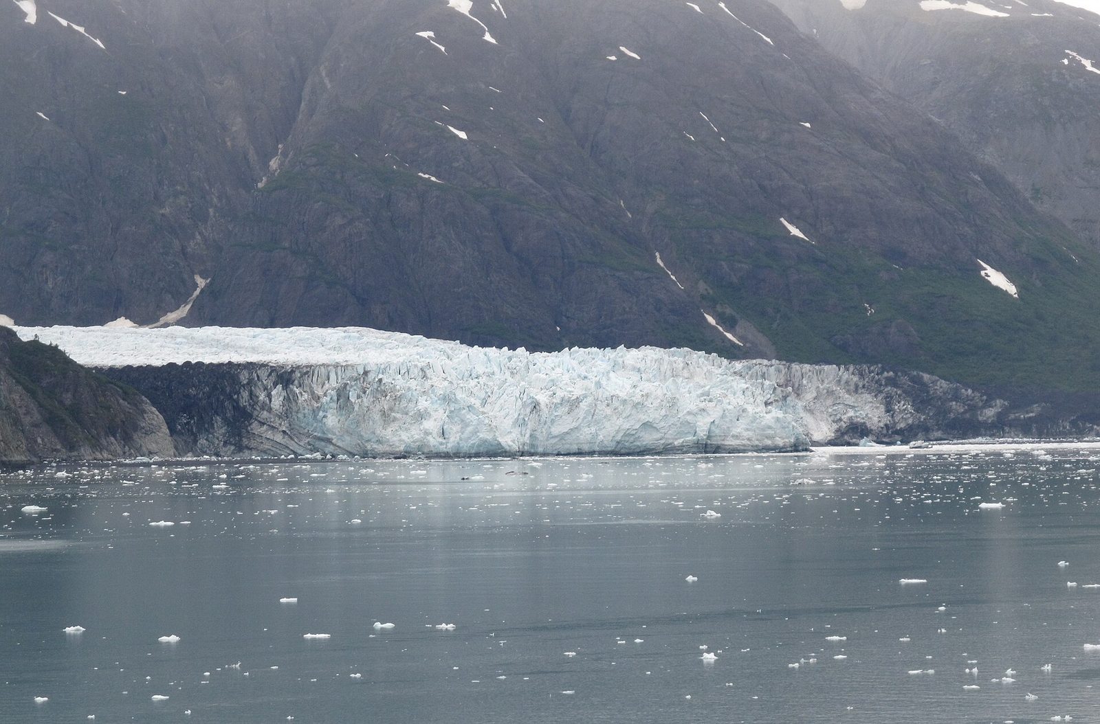
At the head of Tarr Inlet, Margerie Glacier ends in a wall of blue and white ice about a mile (1.6 km) wide and some 250 feet (76 m) high above the water. Every few minutes, with a crack like a rifle shot and a deep roar, a slab breaks off and crashes into the sea, sending a wave across the inlet. Boats sit quietly in front of it to watch and listen. Beside it, the Grand Pacific Glacier, once the giant that filled the whole bay, is now mostly covered in dark rock and gravel.
- Allow: about an hour in front of the glacier, on the day boat or a cruise
- Start: Tarr Inlet, at the head of the West Arm
- When: late May to September
- Suits: everyone
3. See the ice of Johns Hopkins Inlet
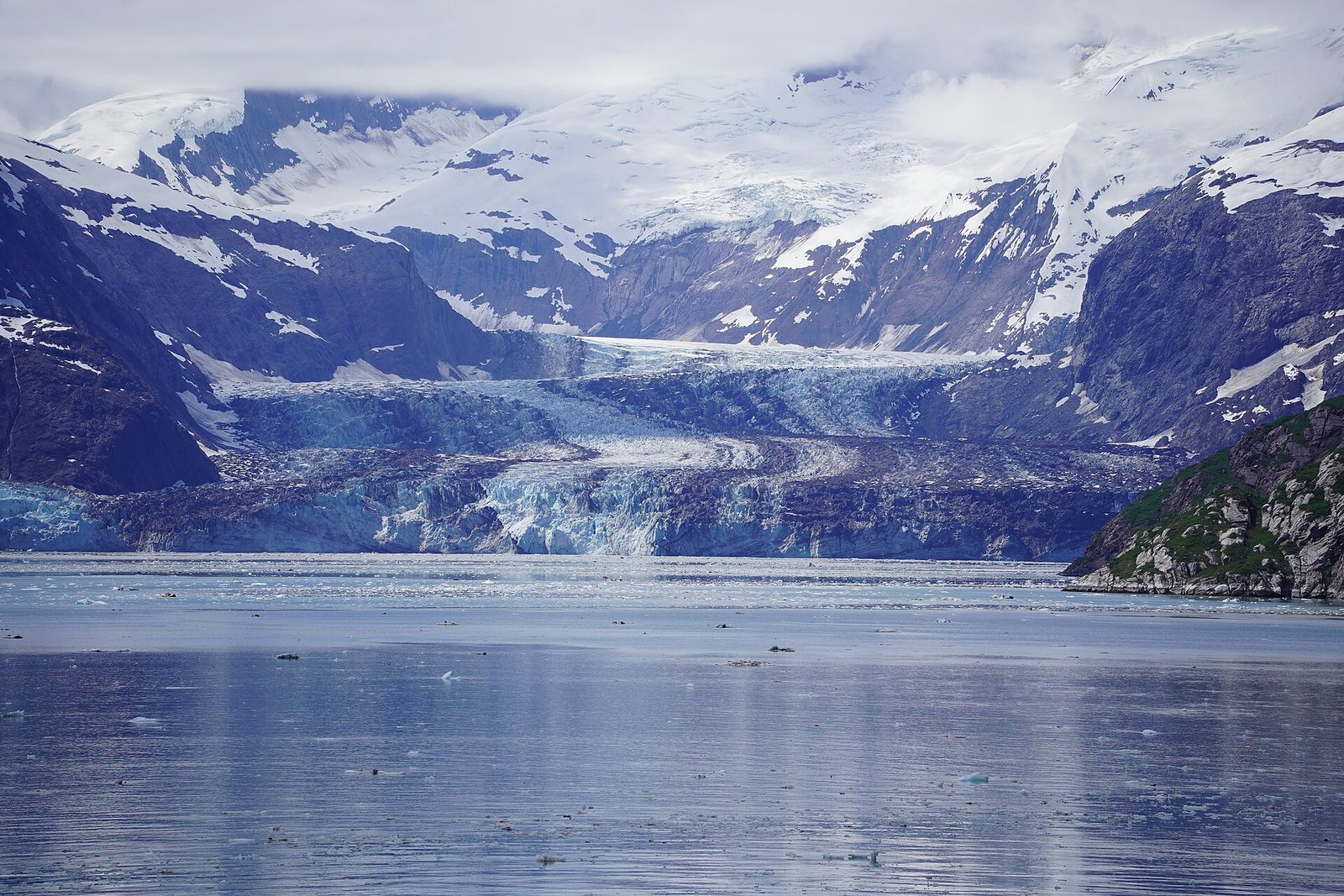
Johns Hopkins Inlet is the most dramatic fjord in the park: steep walls rising thousands of feet straight from the water, with glaciers hanging from them and a great tidewater glacier at its head, one of the few in the park that has advanced in recent decades. The inlet is often packed with floating ice, and in early summer hundreds of harbor seals haul out on the floes to give birth and nurse their pups. Boats keep their distance then, so that the seals are not disturbed.
- Allow: part of a day on the water
- Start: Johns Hopkins Inlet, off the West Arm
- When: June to September; boats stay well back during the seal pupping season in early summer
- Suits: everyone, by boat
4. Paddle a sea kayak
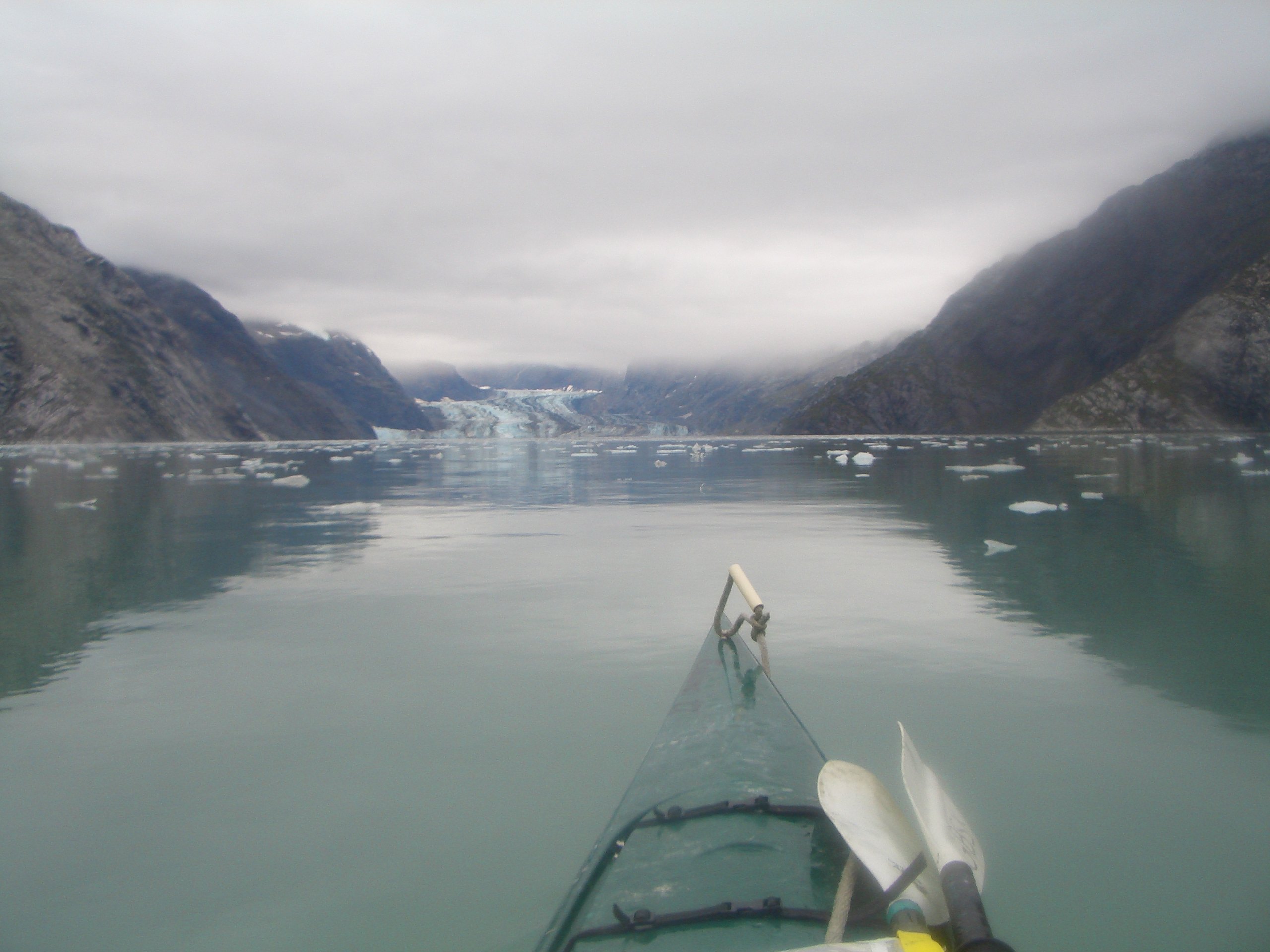
The best way to feel the size and quiet of Glacier Bay is from a kayak. From Bartlett Cove, guided day trips and rental kayaks head for the Beardslee Islands, a maze of low wooded islands and sheltered channels where harbor seals, sea otters, eagles and bears are common. For longer trips, the day boat drops paddlers and their kayaks at camping sites up the bay, and picks them up days later. Overnight trips need a free permit and a short orientation from the park.
- Allow: half a day to a week
- Start: Bartlett Cove, where guided trips and rentals are based
- When: late May to early September
- Suits: beginners with a guide; experienced sea kayakers on their own
5. Walk the Forest Loop at Bartlett Cove
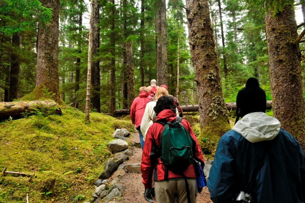
Bartlett Cove was under ice only about 250 years ago, and the forest here is young: a thick, mossy spruce and hemlock rainforest that has grown up since the glacier left. The Forest Loop winds through it on a mix of trail and boardwalk past still ponds, then comes back along the beach, where at low tide you can walk out on the rocks among barnacles, sea stars and seaweed. It is the park’s easy introduction, starting right outside the lodge.
- Distance: about 1 mile (1.6 km) loop
- Allow: 45 minutes
- Start: Forest trailhead, beside Glacier Bay Lodge at Bartlett Cove
- When: May to September
- Suits: everyone; part of the loop is accessible boardwalk
6. Visit the Huna Tribal House
The Huna Tlingit lived in Glacier Bay until the advancing ice drove them out several centuries ago, and they moved across Icy Strait to Hoonah. In 2016 the Huna Tlingit and the Park Service opened Xunaa Shuká Hít, a clan house on the shore at Bartlett Cove, with carved and painted house screens and posts, as a place for the Huna to gather in their homeland again. In summer, rangers and Tlingit cultural interpreters give talks and programs there. The short Tlingit Trail leads to it along the shore.
- Allow: 45 minutes
- Start: Xunaa Shuká Hít, on the shore at Bartlett Cove, a short walk from the lodge
- When: summer, during programs; the outside can be seen at any time
- Suits: everyone
7. Hike the Bartlett River Trail
This trail leaves the road between Gustavus and Bartlett Cove and follows a tidal lagoon through the forest to the mouth of the Bartlett River. In late summer, salmon run up the river, and the bears, seals and eagles come for them, so the trail end is a good place to sit and watch the water, quietly and from a distance. Moose and waterfowl feed in the meadows along the way.
- Distance: about 4 miles (6.4 km) round trip
- Allow: 2 to 3 hours
- Start: Bartlett River trailhead, on the road about a mile (1.6 km) from Bartlett Cove
- When: May to September; August and September for salmon
- Suits: most walkers; make noise, as bears use the trail
8. Fly over the Fairweather Range
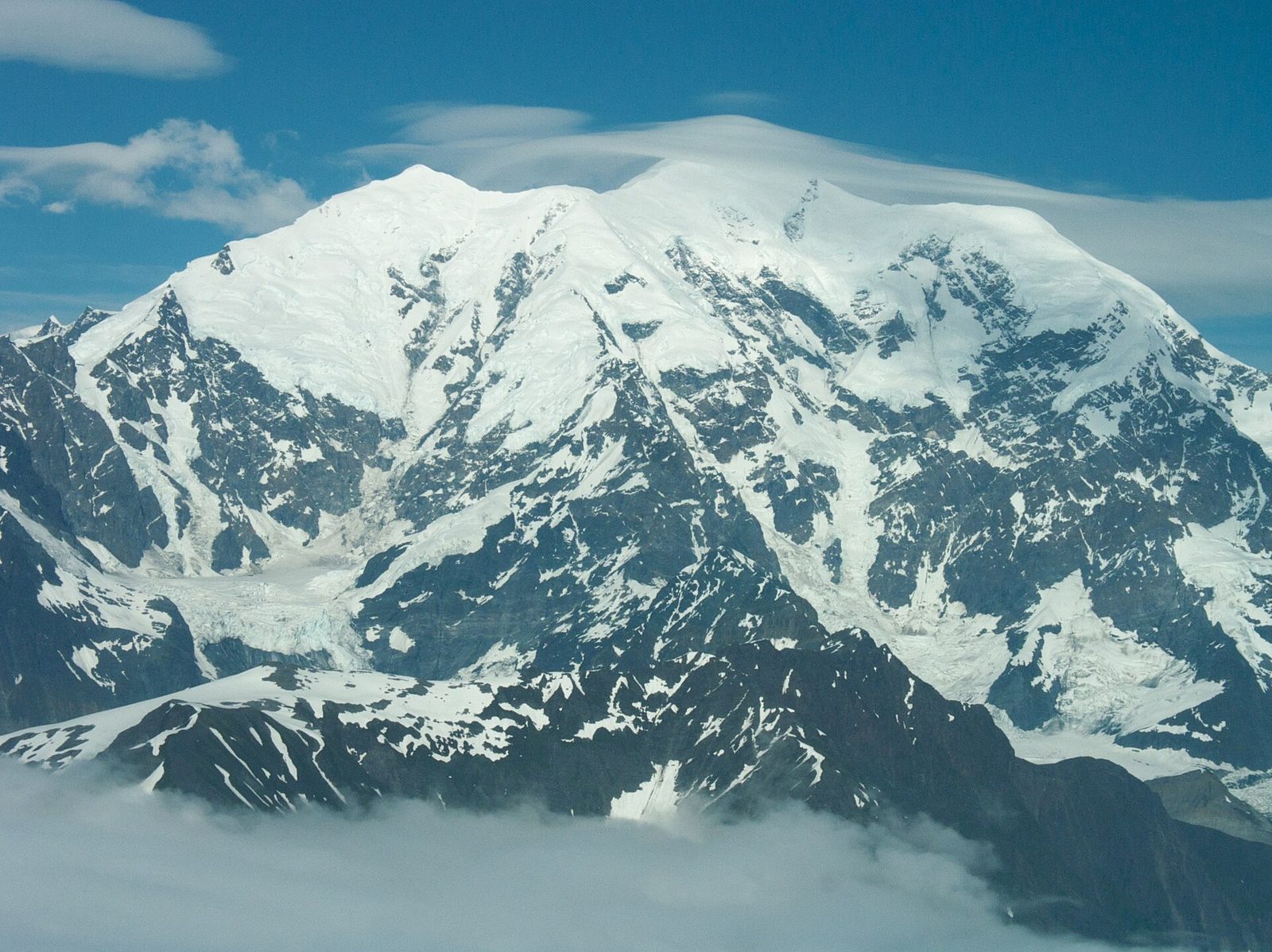
Between the bay and the open Pacific, the Fairweather Range rises to more than 15,000 feet (4,600 m) at Mount Fairweather, about 15 miles (24 km) from the sea, one of the steepest rises from ocean to summit anywhere. Most of it can only be seen from the air. On a clear day, flightseeing tours from Gustavus, Haines, Skagway and Juneau fly over the icefields and the glaciers that pour from them into the bay and the ocean. Clear days are rare, so leave room in your plans to go when the weather opens.
- Allow: 1 to 2 hours
- Start: an air-tour operator in Gustavus, Haines, Skagway or Juneau
- When: May to September, on clear days
- Suits: everyone
Before you go
This list covers what stays the same from year to year. Closures, boat schedules, bear warnings and permit rules change, and the National Park Service posts them on its own site. The link is on our Glacier Bay National Park guide, with the map and how to get there.