

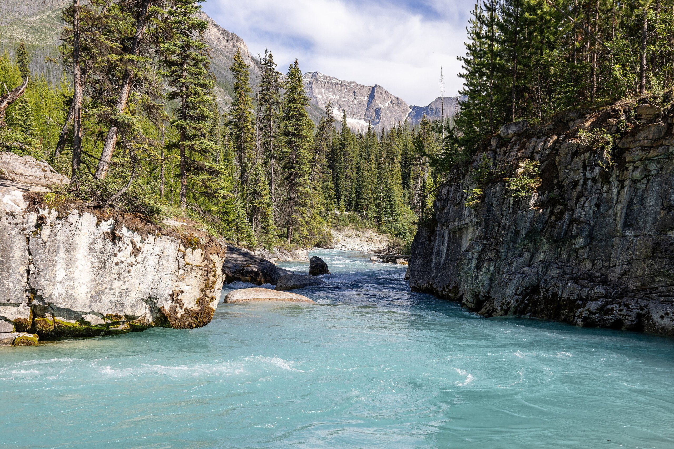
Top 10 things to do in Kootenay National Park
Kootenay is the national park that most people drive through on the way to somewhere else, and that is its advantage. One road, Highway 93 South, runs its whole length from the Continental Divide near Banff down to the hot springs at Radium, and nearly everything on this list is a stop beside it. You can see the highlights in a day, or use them to break a drive between Alberta and British Columbia. These are the ten outings we would put first. The order starts with what the park is known for, then goes by what an outing gives back for the time and effort it takes. Distances and heights are Parks Canada figures; times are our estimates and do not include the drive.
Large parts of the park have burned, in 1968, 2003 and since, so many trails cross open slopes of standing dead trees and young pine, with wide views, wildflowers and little shade. There is no fuel and almost no phone coverage on the 58 miles (94 km) between Castle Junction and Radium. This is grizzly country: carry bear spray.
1. Walk the bridges of Marble Canyon
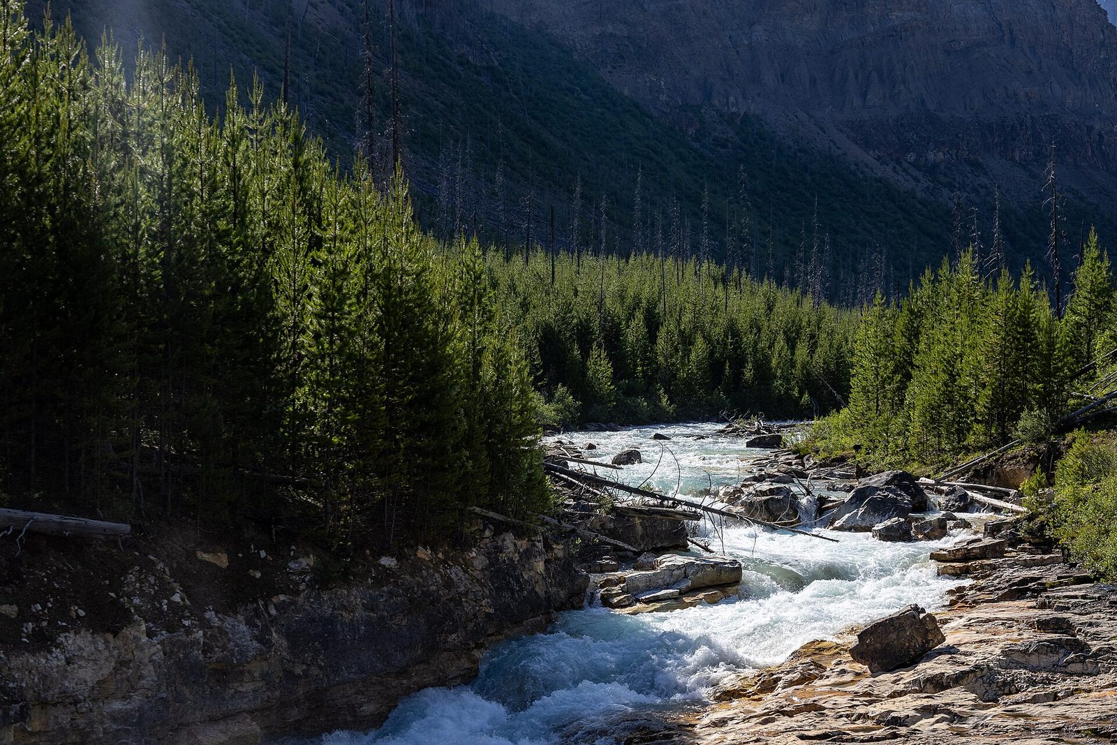
Tokumm Creek has cut a slot through pale limestone that is, in places, 130 feet (40 m) deep and narrow enough to step across, if it were not for the fences. The trail climbs beside it and crosses seven times on footbridges, each one looking straight down into the gorge, with blue-white glacial water roaring at the bottom. At the top the creek drops into the slot over a waterfall. The forest around the canyon burned in 2003, so the walk is open and bright, with fireweed in July.
- Distance: 0.6 miles (0.9 km) each way
- Allow: 45 minutes
- Start: Marble Canyon day-use area, on Highway 93 South, 4 miles (7 km) from the Alberta border
- When: May to October. The bridges and steps are icy in winter.
- Suits: most walkers; there are steps
2. Soak at Radium Hot Springs
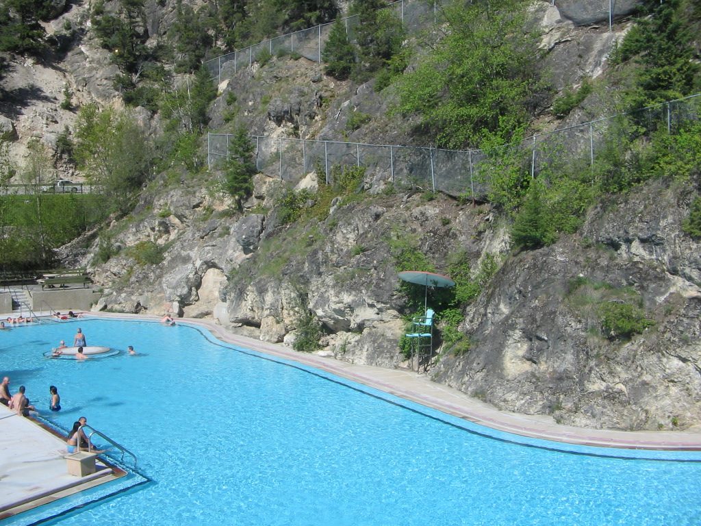
At the park’s south end, hot water comes out of the wall of Sinclair Canyon and fills two large outdoor pools under red cliffs: a hot pool kept at about 102°F (39°C) and a cooler swimming pool. Unlike most hot springs, the water has no smell of sulphur. Bighorn sheep often stand on the ledges above the pools, and in winter you sit in the steam with snow falling. It is run by Parks Canada and is the largest hot springs pool in the Canadian national parks.
- Allow: 1 to 2 hours
- Start: Radium Hot Springs pools, on Highway 93 South, 1.2 miles (2 km) inside the park’s west gate
- When: all year
- Suits: everyone. Swimsuits and towels can be rented.
3. See the Paint Pots
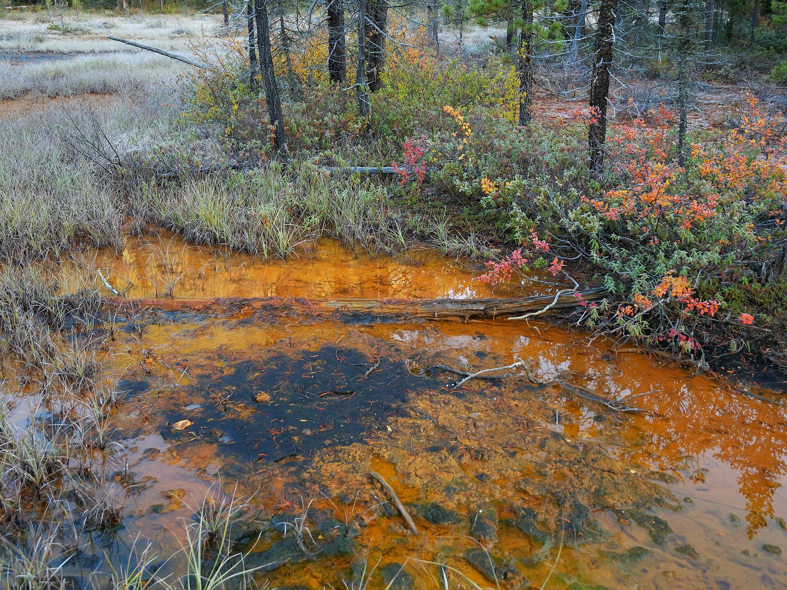
Cold springs full of dissolved iron rise here through a clay flat and stain it rust, orange and yellow. Ktunaxa, Stoney and Blackfoot people gathered the ochre for thousands of years, baked it, and mixed it with fat to make red paint, and in the early 1900s it was dug commercially; rusted machinery still lies beside the trail. The path crosses the Vermilion River on a suspension bridge, passes the ochre beds, and ends at three round pools, each a different colour, rimmed with iron. The ground is soft and stains everything, so wear old shoes.
- Distance: 0.6 miles (1 km) each way
- Allow: 45 minutes to 1 hour
- Start: Paint Pots parking area, on Highway 93 South, 2 miles (3 km) south of Marble Canyon
- When: May to October
- Suits: everyone. This is a sacred place: take nothing.
4. Hike to Stanley Glacier
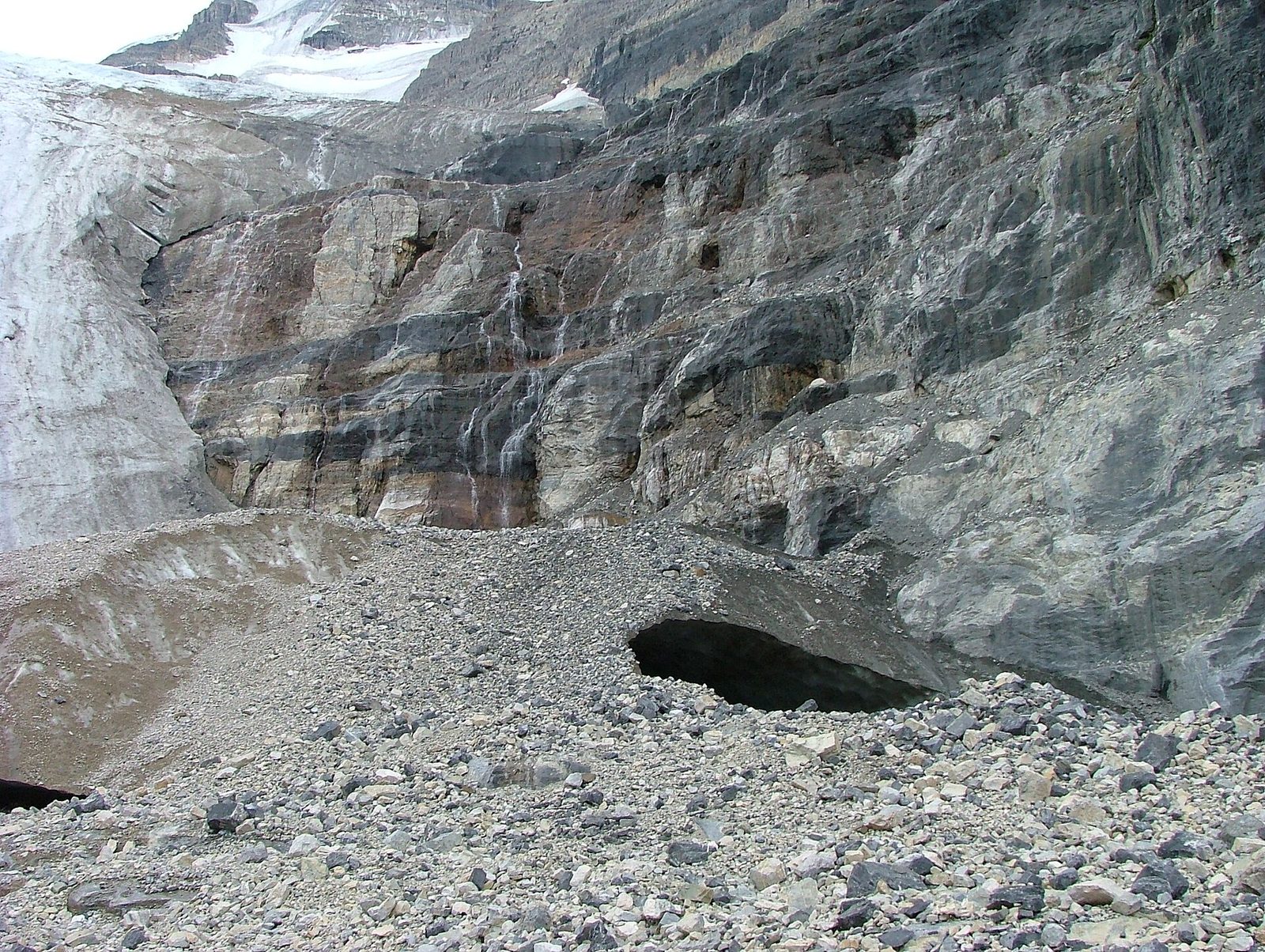
This is the park’s best half-day hike. The trail switchbacks up through forest that has burned twice, in 1968 and 2003, and is now thick with young lodgepole pine and flowers, then enters a hanging valley with a cliff 1,500 feet (450 m) high along one side. Waterfalls pour off the cliff from the snowfields above, and the glacier itself hangs at the head of the valley. The maintained trail ends on a rock moraine with the whole basin in view. The rocks in this valley hold Burgess Shale fossils, and Parks Canada runs guided hikes to see them in summer.
- Distance: 2.6 miles (4.2 km) each way
- Climb: about 1,200 feet (365 m)
- Allow: 3 to 4 hours
- Start: Stanley Glacier trailhead, on Highway 93 South, 2 miles (3.5 km) west of the Alberta border
- When: late June to September. Avalanches cross the valley until early summer.
- Suits: steady walkers. It is illegal to collect fossils.
5. Drive the Banff-Windermere Highway
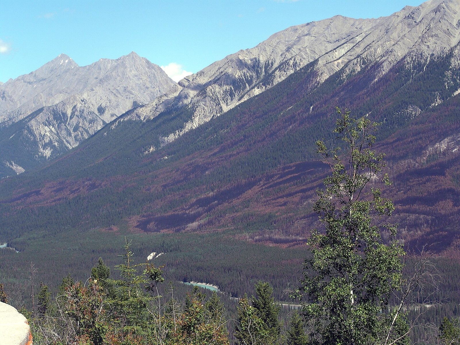
The road through the park was the first motor road across the Canadian Rockies, finished in 1923, and the park was created to protect a strip on either side of it. From Castle Junction it climbs to the Continental Divide at Vermilion Pass, 5,512 feet (1,680 m), then follows the Vermilion and Kootenay rivers down two long valleys before crossing Sinclair Pass and dropping through a red canyon to Radium. Stop at the Continental Divide, where a short loop explains the fires, and at the Kootenay Valley Viewpoint. Moose, elk, black bears and wolves all use the roadside, most at dawn and dusk, and fencing with underpasses now protects the southern stretch.
- Distance: 58 miles (94 km) from Castle Junction to Radium Hot Springs
- Allow: 1.5 hours without stops; a full day with them
- Start: Castle Junction, on the Trans-Canada Highway between Banff and Lake Louise, or Radium Hot Springs
- When: all year; winter tires are required from October to April
- Suits: everyone. Fill the tank before you start.
6. Pass through Sinclair Canyon
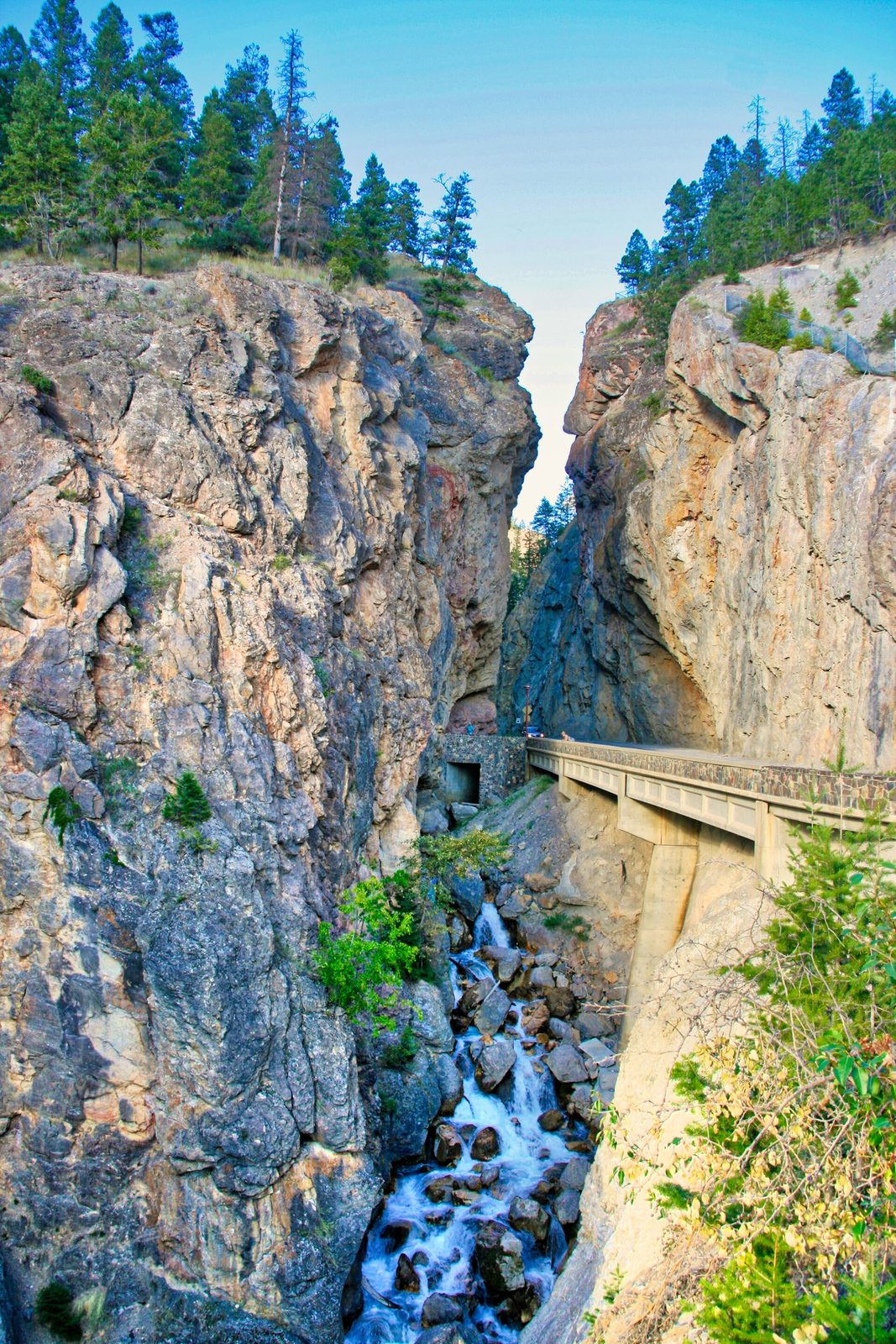
At the park’s west gate the highway squeezes through a gap in a wall of rust-red rock barely wider than its two lanes, with Sinclair Creek beside it. It is one of the more dramatic park entrances in the country. Above it, the cliffs of the Redwall Fault are stained red by iron and are a reliable place to see bighorn sheep, which also wander the streets of Radium village below. The Juniper Trail starts near the gate and climbs to a viewpoint over the canyon and the Columbia Valley.
- Distance: at the roadside; the Juniper Trail is a loop of about 2 miles (3.2 km)
- Allow: 15 minutes, or 1.5 hours with the trail
- Start: the west gate, just above the village of Radium Hot Springs
- When: all year for the canyon; May to October for the trail
- Suits: everyone. Give the sheep room, most of all the rams during the November rut.
7. Stop at Numa Falls
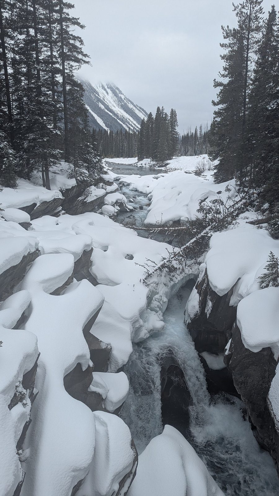
Numa Falls is a five-minute stop that most drivers miss. The Vermilion River, pale blue with glacial silt, drops through a short gorge of smooth, water-carved rock, and a footbridge crosses directly over it. There are picnic tables in the trees beside the parking area, and it is a good place to break the drive.
- Distance: a few steps from the parking area
- Allow: 15 minutes
- Start: Numa Falls day-use area, on Highway 93 South, about 8 miles (13 km) south of Marble Canyon
- When: May to October
- Suits: everyone
8. Look for trout in Olive Lake
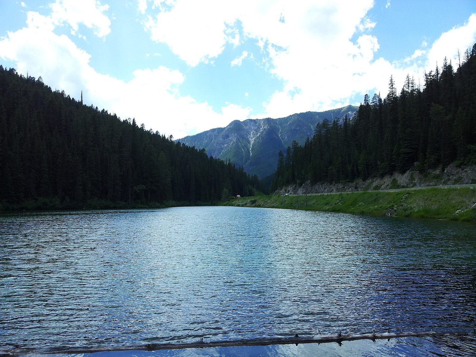
Olive Lake is a small, clear, green lake in the forest at the top of Sinclair Pass. A boardwalk and a level path lead to two viewing platforms over the water, where brook trout hang in plain sight above the pale bottom. Signs explain the lake and the forest. It takes ten minutes, it is fully accessible, and on a hot day the shade is welcome.
- Distance: about 0.3 miles (0.5 km) round trip
- Allow: 15 to 20 minutes
- Start: Olive Lake day-use area, on Highway 93 South, 8 miles (13 km) from Radium Hot Springs
- When: May to October
- Suits: everyone, including wheelchair users
9. Hike to Floe Lake
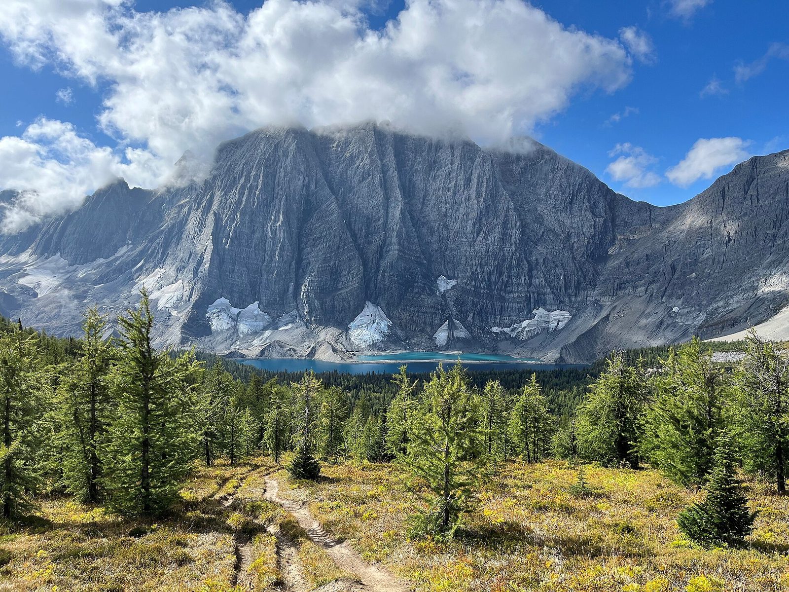
Floe Lake lies at the foot of the Rockwall, a limestone cliff more than 3,000 feet (900 m) high that runs for about 19 miles (30 km) along the park’s western edge. Small icebergs break from a glacier at the base of the wall and drift across the lake into summer, which is how it got its name. The trail climbs through a long burn, steadily at first and then in steep switchbacks up the headwall, to a shore lined with larch trees. In the last two weeks of September the larches turn gold, and it is one of the finest sights in the Rockies.
It is a long, hard day there and back. Most people camp at the lake, which needs a reservation made months ahead.
- Distance: about 6.5 miles (10.5 km) each way
- Climb: about 2,350 feet (715 m)
- Allow: 7 to 9 hours
- Start: Floe Lake trailhead, on Highway 93 South, 14 miles (22 km) south of the Alberta border
- When: July to September
- Suits: fit hikers. The burn has no shade, so start early.
10. Backpack the Rockwall
The Rockwall Trail is one of the great backpacking routes of the Canadian Rockies. It follows the foot of the same cliff for about 34 miles (55 km), climbing over three high passes and dropping into a valley between each, past hanging glaciers, flower meadows and Helmet Falls, one of the highest waterfalls in the Rockies. Floe Lake is at one end. The climbing adds up to more than 8,500 feet (2,600 m), so the days are hard, and the campgrounds are among the most sought after in the mountain parks.
- Distance: about 34 miles (55 km)
- Allow: four to five days
- Start: Floe Lake trailhead; finish at the Paint Pots, 8 miles (13 km) up the highway
- When: mid-July to mid-September
- Needs: backcountry camping reservations for every night, booked when they open early in the year
- Suits: fit, experienced backpackers
Before you go
This list covers what stays the same from year to year. Fire closures, trail conditions, bear warnings and pool hours change, and Parks Canada posts them on its own site. The link is on our Kootenay National Park guide, with the map, passes and how to get there.