

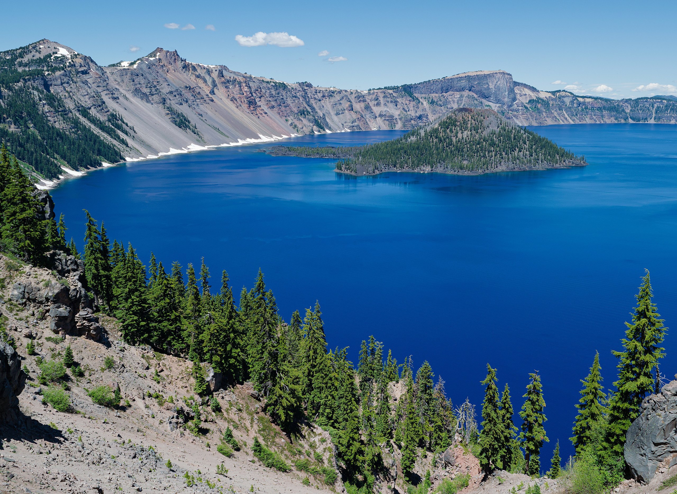
Top 10 things to do in Crater Lake National Park
Crater Lake fills the hollow left when a volcano, Mount Mazama, collapsed about 7,700 years ago. At about 1,940 feet (590 m) it is the deepest lake in the United States, and because no river flows into it, only rain and snow, it is among the clearest and bluest in the world. The park is the lake: a road circles the rim, and nearly everything on this list is a viewpoint or a short climb off it. These are the ten outings we would put first. The order starts with what the park is known for, then goes by what an outing gives back for the time and effort it takes. Distances and heights are National Park Service figures; times are our estimates and do not include stops.
Snow decides the season. The park gets about 42 feet (13 m) of it in an average winter, and the full Rim Drive is usually open only from some time in July to October. The rim is above 7,000 feet (2,130 m), so walk the first trail slowly, and stay behind the walls and away from the edge: the inner slope is loose, steep and has killed people who stepped over for a photograph.
1. Drive the Rim Drive
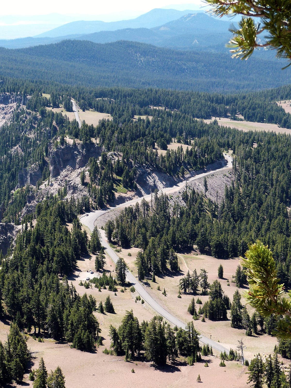
The Rim Drive circles the caldera in 33 miles (53 km), with about 30 pullouts, and each one shows the lake from a different angle and in a different light. The west side is the busier half, close above Wizard Island. The east side is quieter and has the long views, with Cloudcap Overlook, the highest paved point in Oregon, and the Phantom Ship and Pinnacles turnoffs. Drive it clockwise so that the pullouts are on your side of the road. In summer a ranger-narrated trolley makes the same circuit for those who would sooner look than steer.
- Distance: a loop of 33 miles (53 km)
- Allow: 2 to 3 hours with stops; half a day with a short walk or two
- Start: Rim Village, 7 miles (11 km) from the south entrance
- When: about July to October for the full loop. The road is narrow, with no shoulder in places, and cyclists share it.
- Suits: everyone
2. Take a first look from the Sinnott Memorial
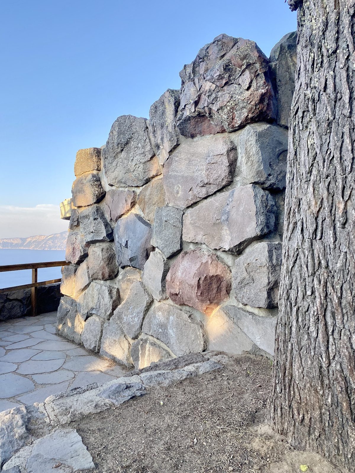
Rim Village is where most people first see the lake, and the best place to do it is the Sinnott Memorial, a stone shelter built into the cliff 900 feet (270 m) above the water, a few steps below the rim walk. The open front frames the whole caldera, and a relief model and exhibits inside explain how the mountain blew itself apart and the lake filled. Rangers give talks here through the summer. A paved path follows the rim in both directions from the door.
- Distance: a few hundred yards from the parking area, with stairs
- Allow: 30 to 45 minutes
- Start: Rim Village, beside the small visitor center
- When: about late June to October; Rim Village itself is open all year, weather allowing
- Suits: everyone who can manage the steps; the rim walk above is level
3. Watch sunset from the Watchman
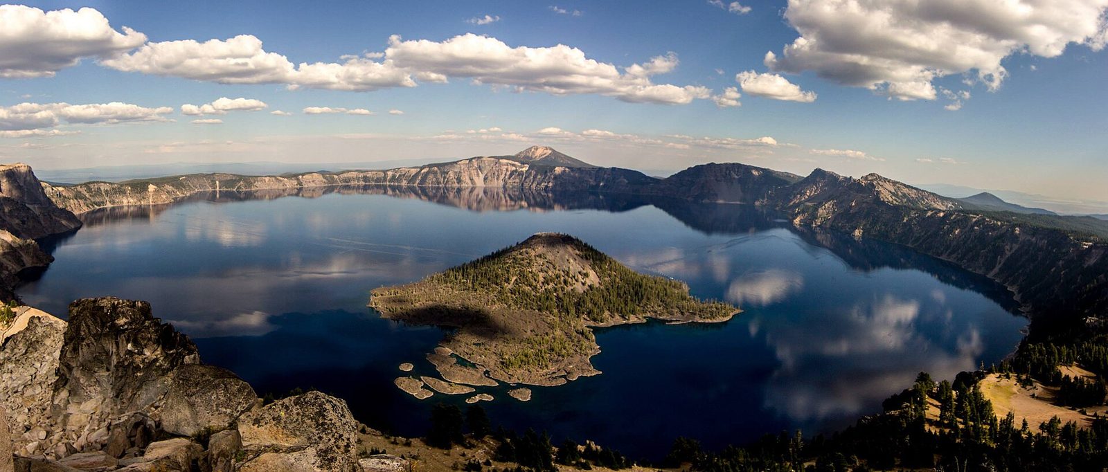
The Watchman is a peak on the west rim with a stone fire lookout on top, and the short trail to it gives the best view in the park for the effort: straight down onto Wizard Island, the cinder cone that rose from the lake floor after the collapse, with the whole circle of the rim beyond. The trail follows an old road at an easy grade, then switchbacks to the summit. It faces west as well, over the Cascades, and at sunset the lake goes dark blue while the rim turns pink. Bring a light for the walk down.
- Distance: 1.6 miles (2.6 km) round trip
- Climb: about 420 feet (130 m)
- Allow: 1 hour
- Start: Watchman Overlook, on West Rim Drive, 4 miles (6.4 km) north of Rim Village
- When: July to October. Snow covers the trail well into summer.
- Suits: most walkers, including children
4. Climb Garfield Peak
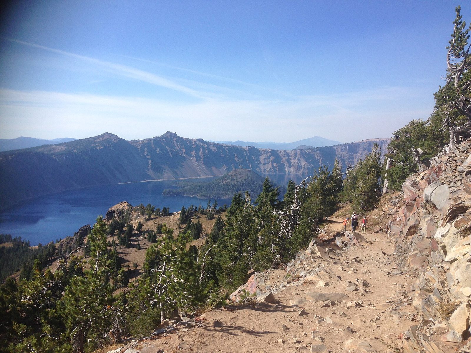
Garfield Peak rises directly behind Crater Lake Lodge, and its trail starts from the lodge’s back terrace. It climbs the rim in long switchbacks through meadows and whitebark pine, with the lake in view below you for most of the way, to a summit at 7,976 feet (2,431 m). From the top you look down the length of the lake and out over the Klamath Basin to Mount Shasta, more than 100 miles (160 km) south, on a clear day. Marmots and pikas live in the rocks along the trail, and the flowers are best in late July.
- Distance: 3.4 miles (5.5 km) round trip
- Climb: about 1,000 feet (300 m)
- Allow: 2 to 3 hours
- Start: Crater Lake Lodge, Rim Village
- When: mid-July to October
- Suits: fit walkers. There are drops beside the upper trail.
5. See the Phantom Ship from Sun Notch
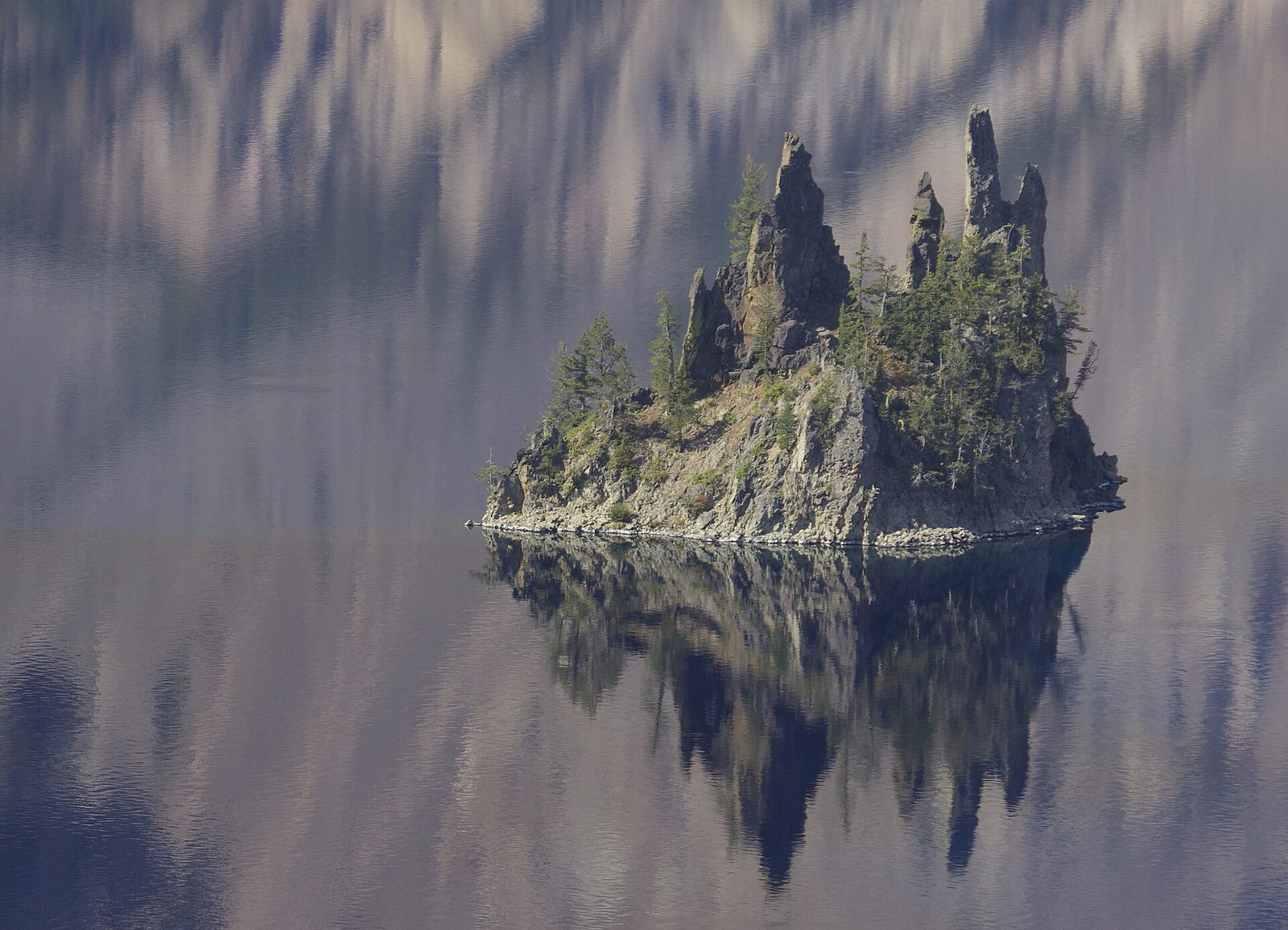
The Phantom Ship is a small island of jagged rock near the south shore, the oldest rock exposed in the caldera, and from above it looks like a sailing ship with its masts up. It is about 170 feet (52 m) high, though the scale of the lake makes it seem a toy. The closest view is from Sun Notch, where a short loop trail climbs through a meadow to the rim directly above it. In mist or low light the island fades in and out against the far wall, which is how it got its name.
- Distance: a loop of 0.8 miles (1.3 km)
- Climb: about 150 feet (45 m)
- Allow: 30 to 45 minutes
- Start: Sun Notch, on East Rim Drive, 4.4 miles (7 km) east of park headquarters
- When: July to October
- Suits: most walkers; the first part of the loop takes wheelchairs with help
6. Hike Mount Scott
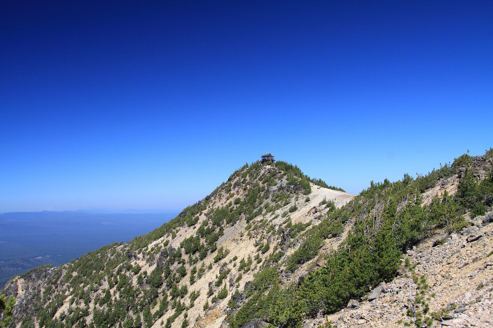
Mount Scott, at 8,929 feet (2,722 m), is the highest point in the park, and it stands back from the rim on the east side, so its summit is the one place where you can see the whole lake at once and fit it in a single photograph. The trail climbs steadily across open pumice slopes and through thin forest to a fire lookout on the summit ridge. To the north you can see the Three Sisters, and to the south Mount Shasta. Start in the morning, when the light is on the lake and before the afternoon wind.
- Distance: 5 miles (8 km) round trip
- Climb: about 1,250 feet (380 m)
- Allow: 3 to 4 hours
- Start: Mount Scott Trailhead, on East Rim Drive across from the Cloudcap turnoff
- When: mid-July to October
- Suits: fit walkers used to altitude
7. Walk to Plaikni Falls
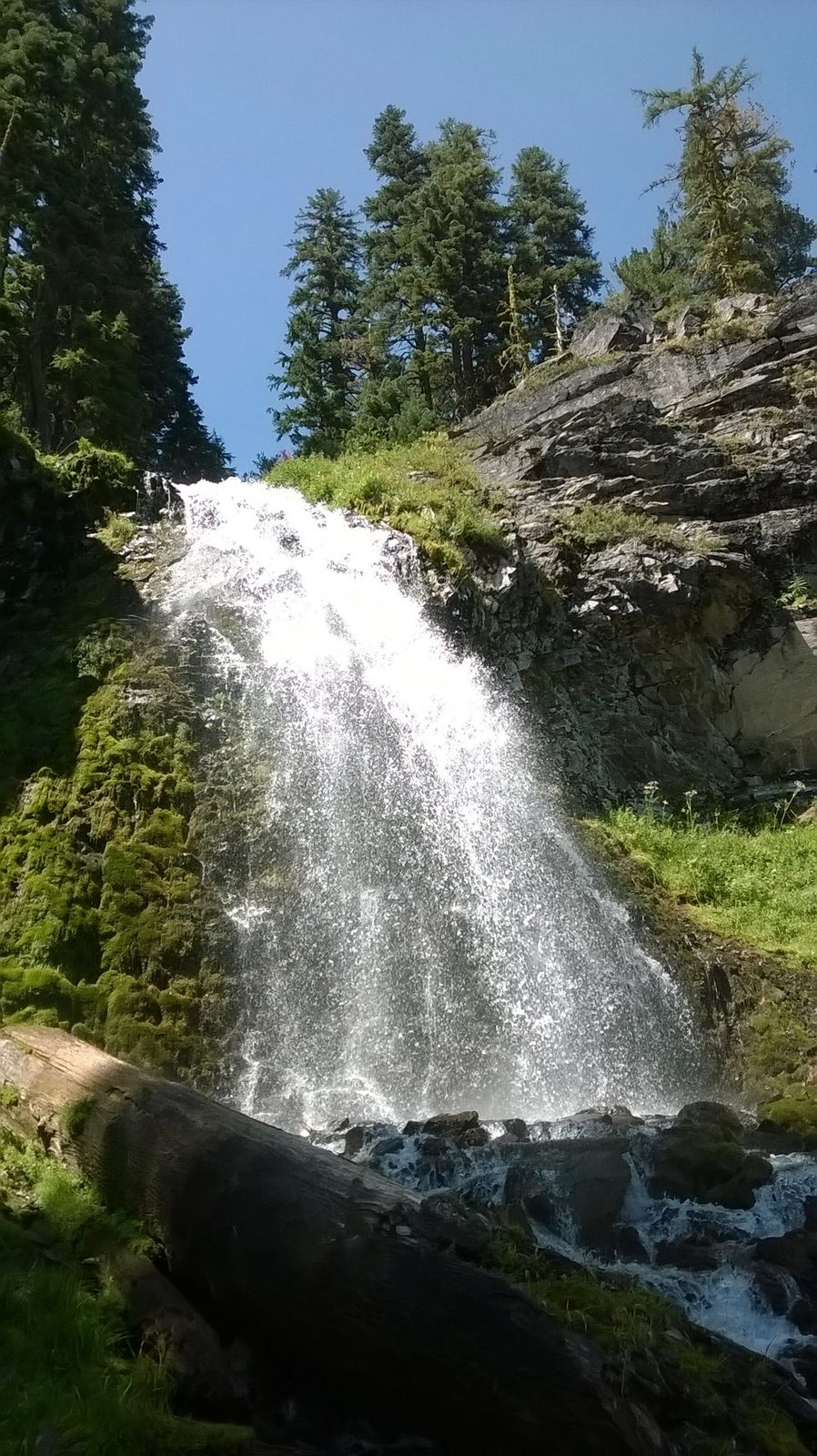
This is the park away from the rim. A wide, nearly level trail runs through old-growth fir and hemlock, under cliffs, to a creek fed by snowmelt that tumbles over a rock face into a glen full of wildflowers. The name is a Klamath word for “from the high country”. It is the gentlest real trail in the park and stays cool and shaded on a hot afternoon, which the rim does not.
- Distance: 2 miles (3.2 km) round trip
- Climb: about 100 feet (30 m)
- Allow: 1 hour
- Start: Plaikni Falls Trailhead, on Pinnacles Road, 1.2 miles (1.9 km) from East Rim Drive
- When: July to October; flowers peak in late July
- Suits: families; most of the trail takes wheelchairs with help, apart from the last short climb
8. See the Pinnacles
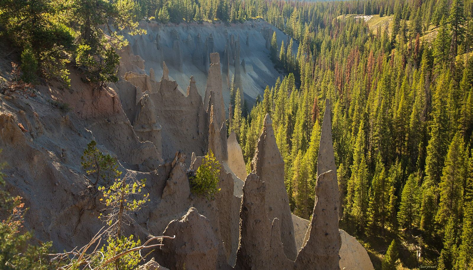
At the end of the same side road, a canyon wall is lined with hundreds of grey and tan spires, some 100 feet (30 m) tall. They are the vents through which hot gas escaped from a deep layer of ash after the eruption, welding the ash around them into rock. The softer ash has since washed away and left the vents standing. A level path follows the canyon rim for a closer look. Few people drive out here.
- Distance: about 0.8 miles (1.3 km) round trip along the rim
- Allow: 30 minutes, plus the drive of 6 miles (10 km) each way from East Rim Drive
- Start: the end of Pinnacles Road
- When: July to October
- Suits: everyone
9. Sit on the porch at Crater Lake Lodge
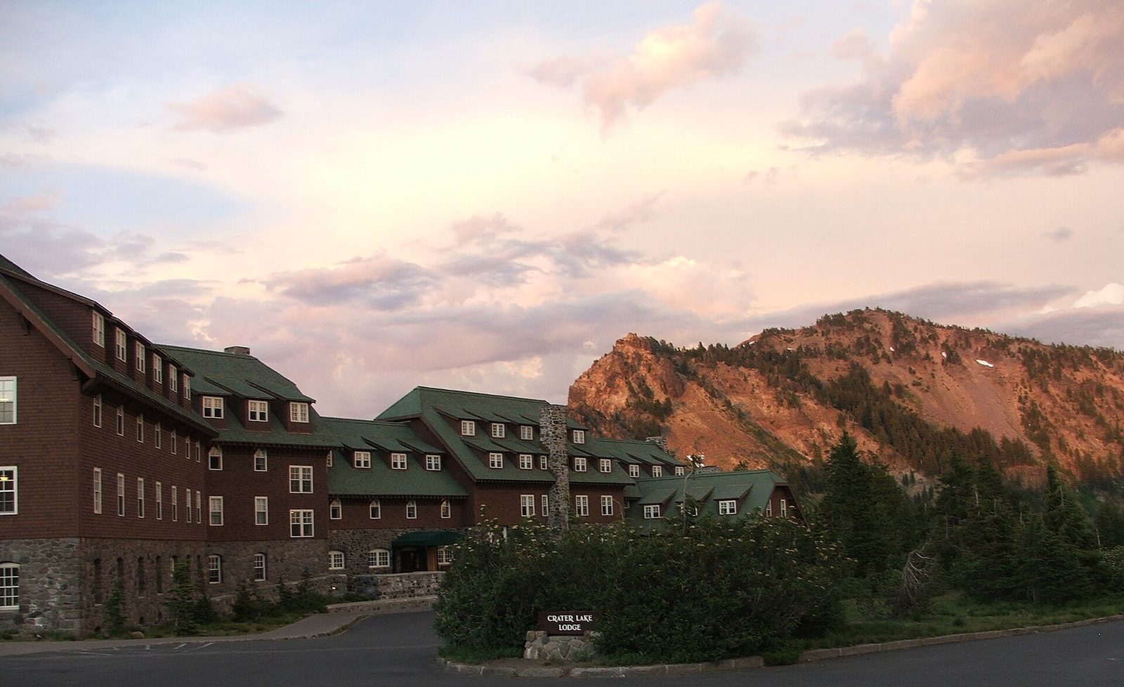
Crater Lake Lodge opened in 1915 on the edge of the rim, 1,000 feet (300 m) above the water, and was rebuilt from the frame out in the 1990s. Its Great Hall has a massive stone fireplace, and the terrace behind it, lined with rocking chairs, faces the lake. Anyone may sit there with a drink, whether staying or not. At the end of a day of driving and walking the rim, it is the right place to watch the light go.
- Allow: 30 minutes to an evening
- Start: Crater Lake Lodge, at the east end of Rim Village
- When: about mid-May to mid-October, while the lodge is open
- Suits: everyone
10. Snowshoe the rim in winter
For eight months of the year the park is under snow, often 10 to 15 feet (3 to 4.5 m) deep at the rim, and the lake, which almost never freezes, lies dark blue inside a white bowl. The road from the south entrance to Rim Village is ploughed all winter, though storms close it for days at a time. From there you can snowshoe or ski along the unploughed Rim Drive as far as you like, and rangers lead snowshoe walks on winter weekends with snowshoes provided. The lake is hidden by cloud on about half of all winter days, so check the webcam before driving up.
- Allow: half a day
- Start: Rim Village, by the south entrance
- When: December to April
- Suits: anyone dressed for deep snow. Stay well back from the rim: the snow overhangs the edge in cornices that break off.
Before you go
This list covers what stays the same from year to year. Road opening dates, trail and facility closures and construction change, and the National Park Service posts them on its own site. The link is on our Crater Lake National Park guide, with the map, passes and how to get there.