

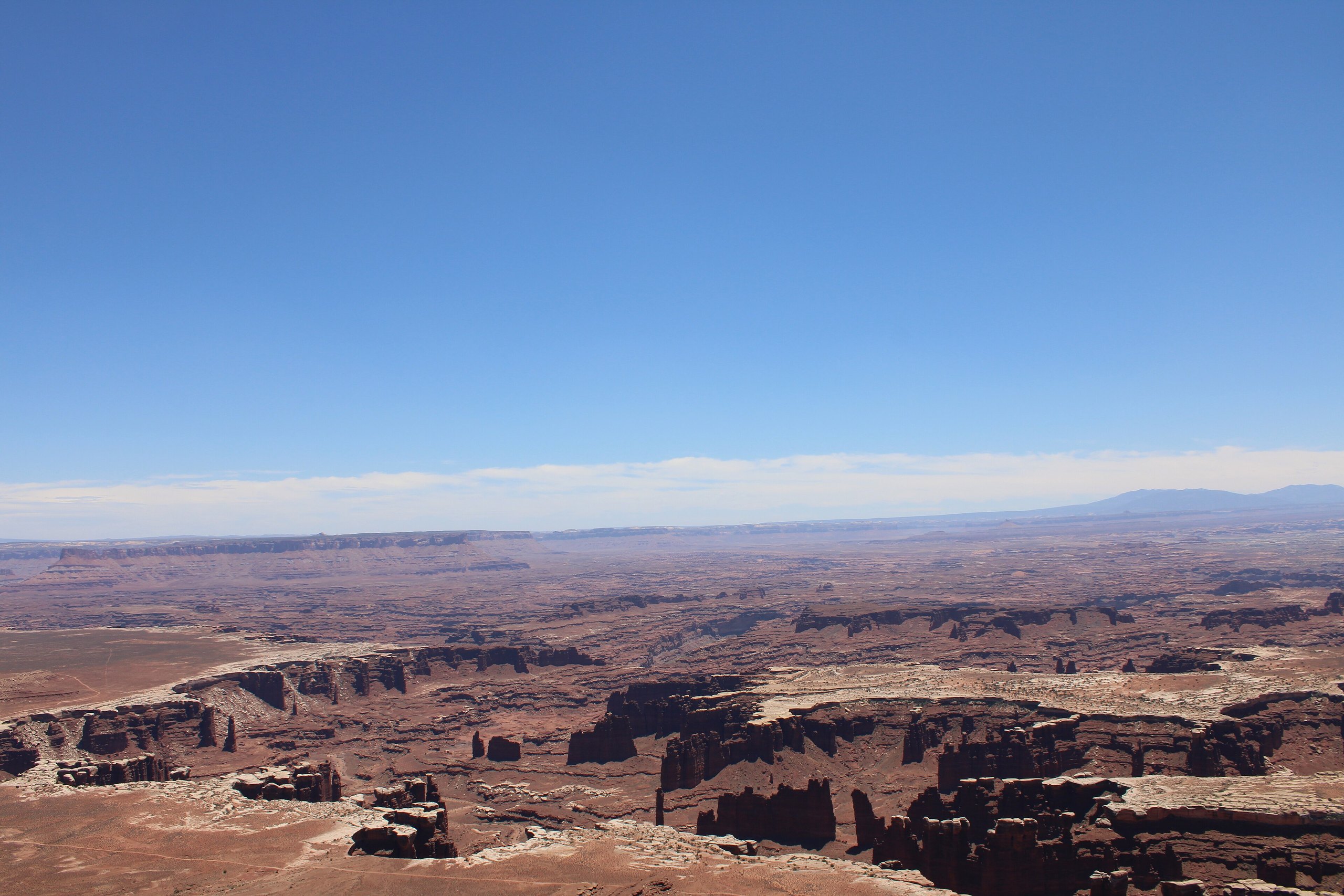
Top 10 things to do in Canyonlands National Park
Canyonlands is Utah’s largest national park and its least crowded: a wilderness of canyons cut by the Green and Colorado rivers, which divide it into districts that do not connect by road. Island in the Sky, a mesa 40 minutes from Moab, is where most people go and holds the first six entries here. The Needles, two hours from Moab, is hiking country. The detached Horseshoe Canyon unit holds the last. These are the ten outings we would put first. The order starts with what the park is known for, then goes by what an outing gives back for the time and effort it takes. Distances and heights are National Park Service figures; times are our estimates and do not include the drive.
This is remote desert with almost no water, shade or cell coverage. Summer afternoons pass 100°F (38°C). Carry at least a gallon (4 litres) of water per person per day, fill the tank in Moab or Monticello, and stay off the dark, lumpy soil crust beside the trails: it is alive, and one footprint kills what took decades to grow.
1. Watch sunrise through Mesa Arch
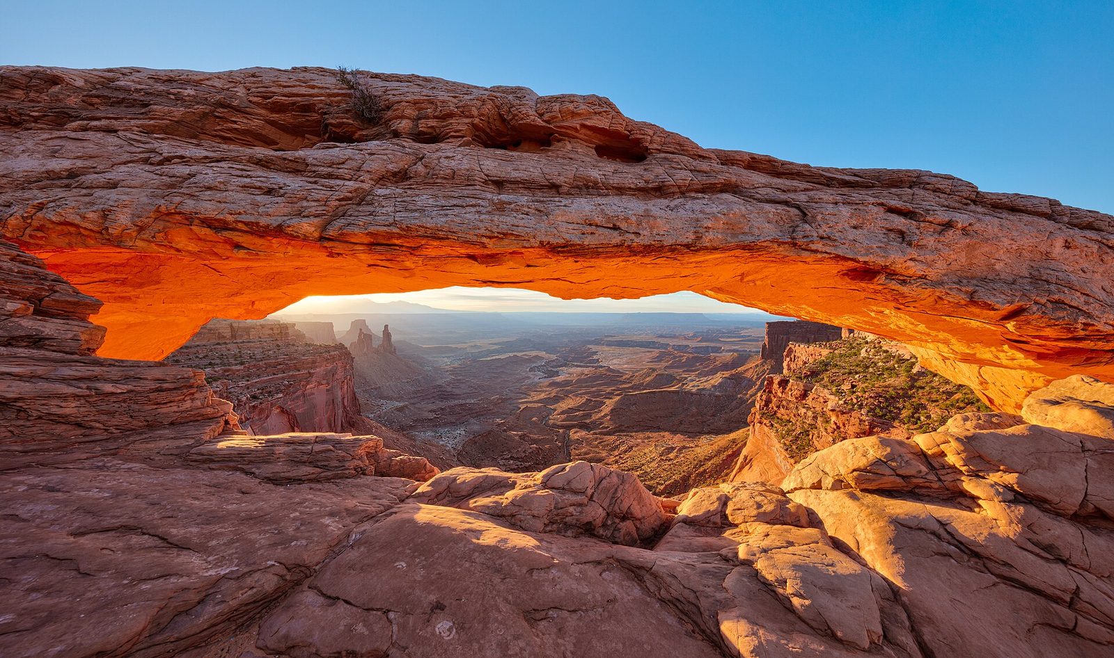
Mesa Arch is a low stone span on the very edge of a cliff, and it frames a view of buttes, the La Sal Mountains and a drop of more than 1,000 feet (300 m). At sunrise the light reflects off the cliff below and turns the underside of the arch a glowing orange for a few minutes. It is one of the best-known photographs in the Southwest, and a line of tripods is in place an hour before dawn. Come then if you want the picture. Come at any other time of day and you may have the arch to yourself, with the same view.
- Distance: a loop of 0.5 miles (0.8 km)
- Allow: 30 to 45 minutes
- Start: Mesa Arch Trailhead, 6 miles (10 km) south of the Island in the Sky Visitor Center
- When: all year
- Suits: everyone. The cliff edge behind the arch is unfenced; do not climb on the arch.
2. Walk the rim at Grand View Point
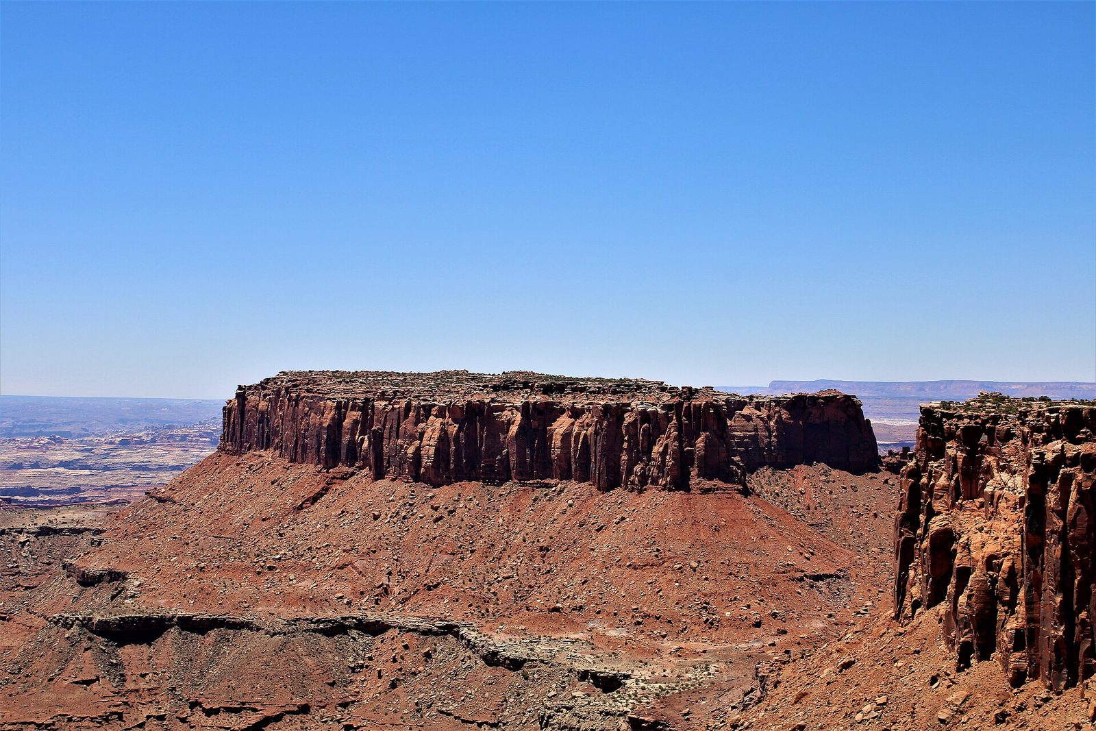
The road across Island in the Sky ends at the mesa’s southern tip, and the view from there is the widest in the park. About 1,000 feet (300 m) below is the White Rim, a bench of pale sandstone, with Monument Basin’s spires cut into its edge. Below that again, out of sight, are the two rivers, and beyond are the Needles, the Maze and three mountain ranges. A trail follows the rim to the very point of the mesa, level and easy, with the drop always beside you.
- Distance: 2 miles (3.2 km) round trip; the first viewpoint is beside the parking area
- Allow: 1 to 1.5 hours
- Start: Grand View Point, 12 miles (19 km) south of the visitor center
- When: all year; late afternoon for light
- Suits: everyone at the viewpoint; the trail has unfenced edges
3. Catch sunset at the Green River Overlook
This is the western view from the mesa: the Green River winding through its canyon far below, the White Rim around it, and the Maze and the Henry Mountains beyond. It faces the setting sun, and the canyon fills with shadow layer by layer as the light goes. The overlook is a short paved walk from the parking area and is far quieter than Mesa Arch at dawn. Stay for the stars. The park is an International Dark Sky Park, and there is no light on this horizon at all.
- Distance: about 100 yards (90 m), paved
- Allow: 30 minutes
- Start: Green River Overlook, on the Upheaval Dome road near Willow Flat Campground
- When: all year; the last hour of light
- Suits: everyone, including wheelchair users
4. Look into Upheaval Dome
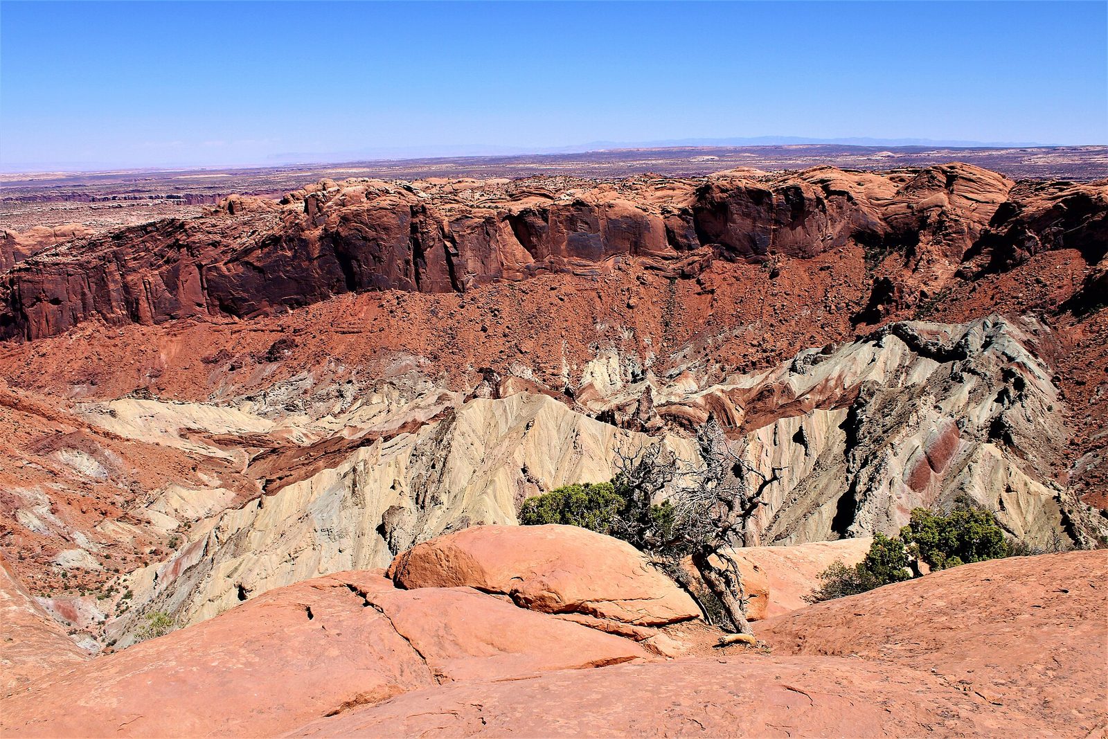
Upheaval Dome is a crater about 3 miles (5 km) across where the rock layers, flat everywhere else in the park, are bent up into a ring around a jumble of pale green and grey spires. Geologists argued for a century over what made it, a rising plug of salt or a meteorite. Shocked quartz found in the rock has settled most of them on the meteorite. A short, steep trail climbs over slickrock to an overlook on the rim, and continues to a second with a view down the canyon that drains it.
- Distance: about 1 mile (1.6 km) round trip to the first overlook; 1.8 miles (2.9 km) to the second
- Allow: 45 minutes to 1.5 hours
- Start: Upheaval Dome Trailhead, at the end of the Upheaval Dome road
- When: all year
- Suits: most walkers. Follow the cairns across the rock.
5. See the Shafer Trail from above
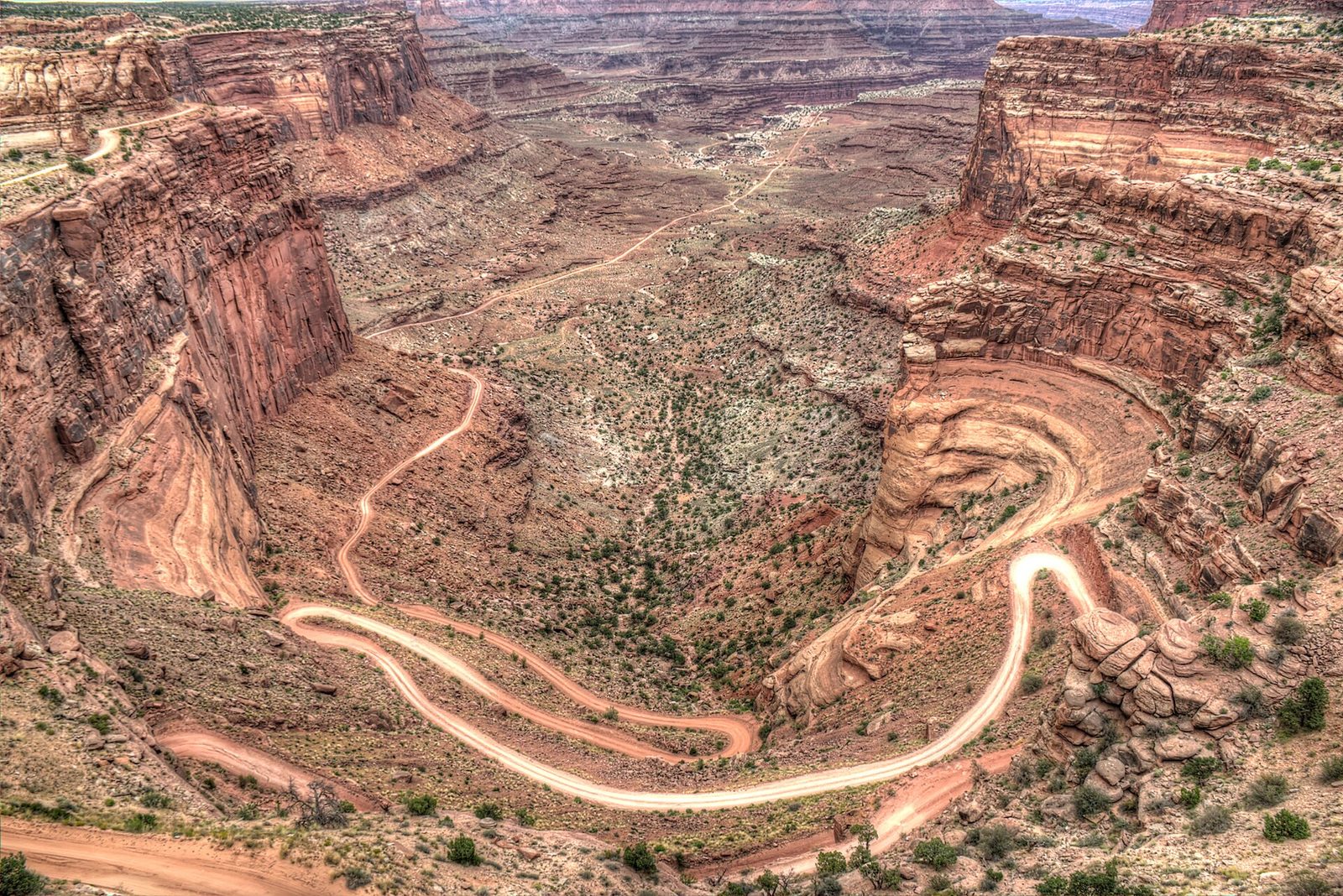
Just inside the park entrance, the Shafer Canyon Overlook looks straight down on a dirt road that drops 1,500 feet (460 m) off the mesa in a stack of switchbacks cut into the cliff. Cattlemen built it as a stock trail, and uranium prospectors widened it for trucks in the 1950s. Watching a vehicle creep down it is entertainment enough for most people. Driving it takes a high-clearance four-wheel-drive vehicle, a dry day and a steady nerve: the road is one lane wide in places, with no barrier.
- Distance: the overlook is at the roadside; the road is about 18 miles (29 km) from the mesa to the highway near Moab by Potash Road
- Allow: 15 minutes to look; 2 to 3 hours to drive
- Start: Shafer Canyon Overlook, 0.5 miles (0.8 km) south of the visitor center
- When: all year to look; the road is impassable when wet or icy
- Suits: everyone at the overlook; experienced off-pavement drivers on the road
6. Drive or ride the White Rim Road
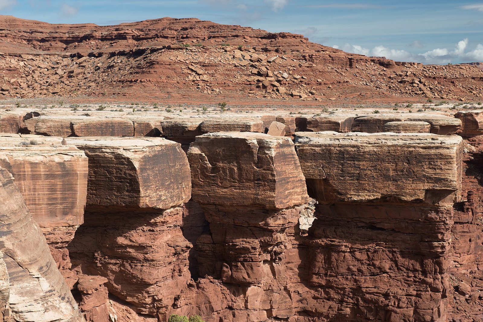
The White Rim Road circles Island in the Sky on the sandstone bench halfway between the mesa top and the rivers, about 100 miles (160 km) of rough track with the cliffs above and the canyons below the whole way. It is the classic multi-day trip of the park, done in two or three days by four-wheel-drive vehicle and three or four by mountain bike, with nights at small designated camps. There is no water anywhere on the route, and no help: carry everything, including a full-size spare.
- Distance: about 100 miles (160 km)
- Allow: two to four days
- Start: the Shafer Trail or Mineral Bottom Road
- When: March to May and September to October
- Needs: a permit for day use as well as for camping; campsites are booked months ahead
- Suits: experienced four-wheel-drive travellers and fit mountain bikers
7. Walk the Cave Spring loop in the Needles
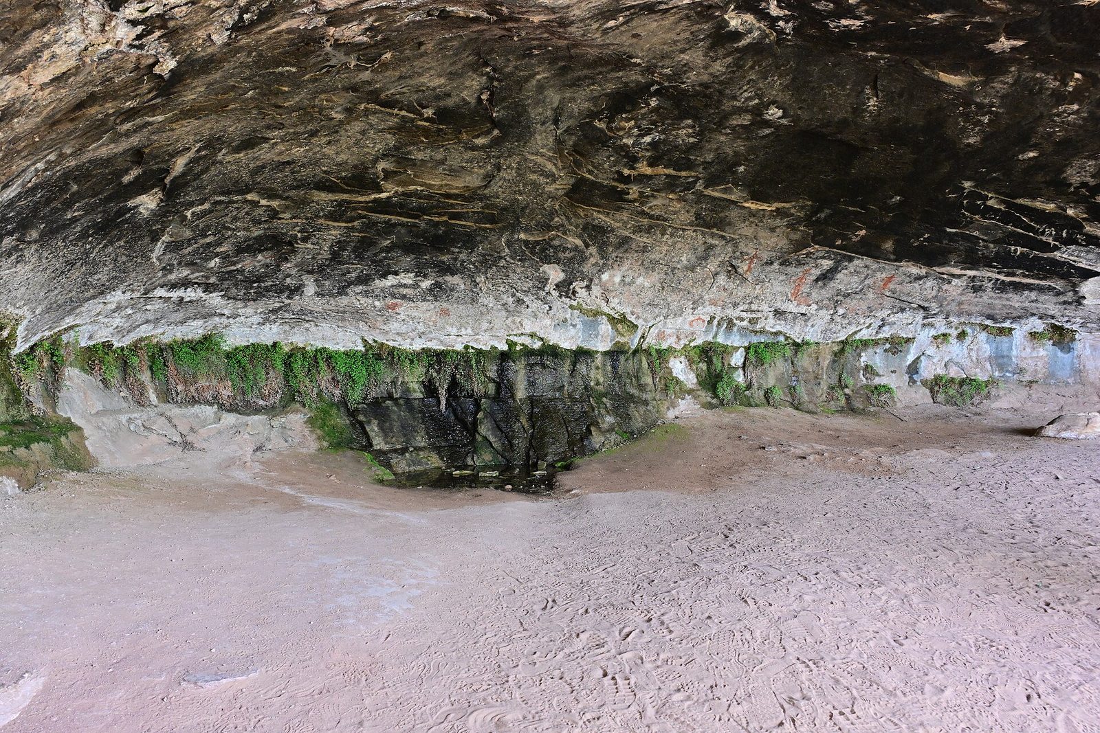
The Needles district is named for its forest of red-and-white banded spires, and this short loop is the best introduction to it. The trail passes under a deep rock overhang where cowboys kept a camp from the 1890s until 1975, with their table, stove and tack still in place, then a seep that has drawn people for far longer, with handprints and painted figures on the wall behind it. Two wooden ladders take you up onto the slickrock for a view of the spires before the loop returns.
- Distance: a loop of 0.6 miles (1 km)
- Allow: 45 minutes
- Start: Cave Spring Trailhead, on a gravel road near the Needles Visitor Center, about 75 miles (120 km) from Moab
- When: March to May and September to November
- Suits: families who can manage two ladders. Do not touch the rock art.
8. Hike to Chesler Park
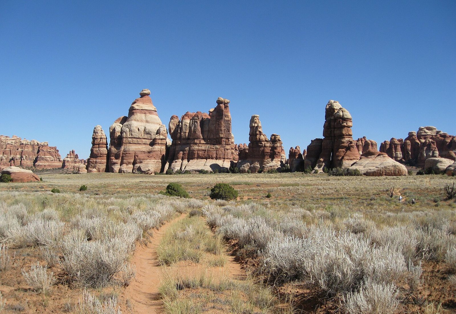
Chesler Park is a round meadow of grass and sage about a mile (1.6 km) across, completely ringed by needles of banded sandstone. The trail to it climbs and drops through cracks, over slickrock passes and across sandy washes, marked by cairns, with something new at every turn. The viewpoint on the rim of the park is a good goal for a half day. Strong hikers go on around the meadow and through the Joint Trail, a crack between rock walls a few feet wide and hundreds of yards long, for the best full-day hike in the park.
- Distance: about 6 miles (9.7 km) round trip to the viewpoint; about 11 miles (18 km) for the loop with the Joint Trail
- Allow: 3 to 4 hours, or 6 to 7 hours
- Start: Elephant Hill Trailhead, at the end of a gravel road passable to ordinary cars
- When: March to May and September to November
- Suits: fit hikers used to following cairns. There is no water.
9. Hike to Druid Arch
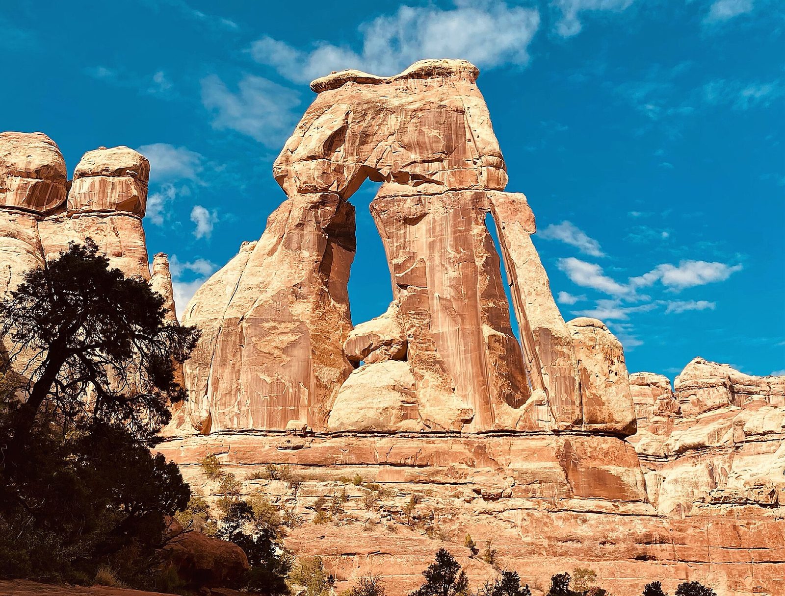
Druid Arch is a 150-foot (46 m) slab of sandstone pierced by two tall slots, standing alone at the head of a canyon and looking more like a piece of Stonehenge than a natural arch. The route follows the sandy floor of Elephant Canyon between the needles for most of its length, then finishes with a steep scramble, including one ladder, to a ledge facing the arch. It is a long day with deep sand underfoot, and the best single destination in the Needles.
- Distance: about 11 miles (18 km) round trip
- Allow: 5 to 7 hours
- Start: Elephant Hill Trailhead
- When: March to May and September to November
- Suits: fit hikers
10. Walk down Horseshoe Canyon to the Great Gallery
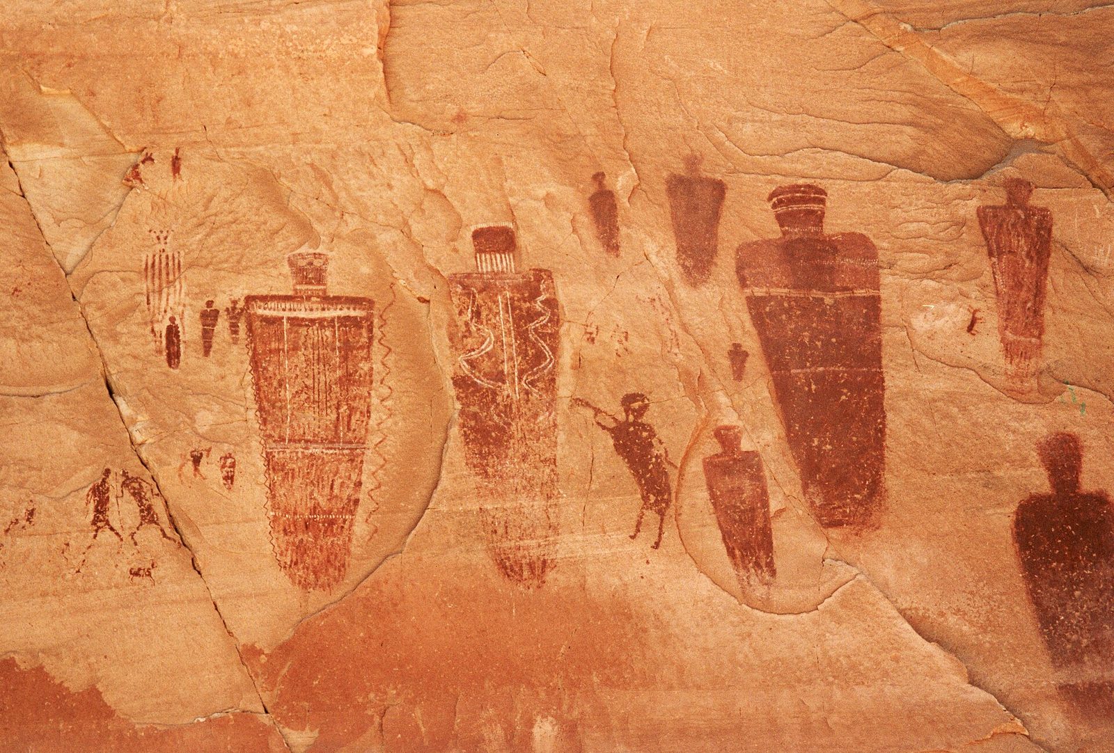
The Great Gallery is among the finest rock art in North America: a panel 200 feet (61 m) long of life-size painted figures, armless and tapering, some with hollow eyes, made by hunter-gatherers at least 1,000 years ago. It is in a separate piece of the park, far from the rest, and reaching it is part of the experience. A trail drops into Horseshoe Canyon and follows the sandy wash under cottonwoods past three smaller panels to the Gallery. The climb out comes at the end of the day, in full sun.
The trailhead is 30 miles (48 km) down a graded dirt road that is impassable after rain. There is no water in the canyon and no shade on the climb. Stay behind the chain: the oil on a hand damages the paint.
- Distance: 7 miles (11 km) round trip
- Climb: about 780 feet (240 m), on the return
- Allow: 5 to 6 hours, plus about 2.5 hours’ drive each way from Moab
- Start: Horseshoe Canyon Trailhead, reached from Highway 24 north of Hanksville
- When: March to May and September to November
- Suits: fit walkers prepared for a long, hot, remote day
Before you go
This list covers what stays the same from year to year. Road conditions, permit rules and flash-flood warnings change, and the National Park Service posts them on its own site. The link is on our Canyonlands National Park guide, with the map, permits and how to get there.