

Top 10 things to do in Sequoia National Park
Sequoia National Park protects the largest trees on Earth, in groves on the western slope of the Sierra Nevada, and behind them a wilderness of granite peaks that includes Mount Whitney. Nearly everything most visitors do is in the Giant Forest, a plateau of sequoias at about 6,500 feet (2,000 m), reached by one steep road. These are the ten outings we would put first. The order starts with what the park is known for, then goes by what an outing gives back for the time and effort it takes. Distances and heights are National Park Service figures; times are our estimates and do not include stops.
The Giant Forest is high enough to leave visitors from sea level short of breath, so take the first walks slowly. Black bears are active throughout the park and break into cars for food: store everything scented in the metal lockers at trailheads and campgrounds. In summer a free shuttle links the main sights, and parking at the Sherman Tree fills by mid-morning.
1. Stand at the foot of the General Sherman Tree
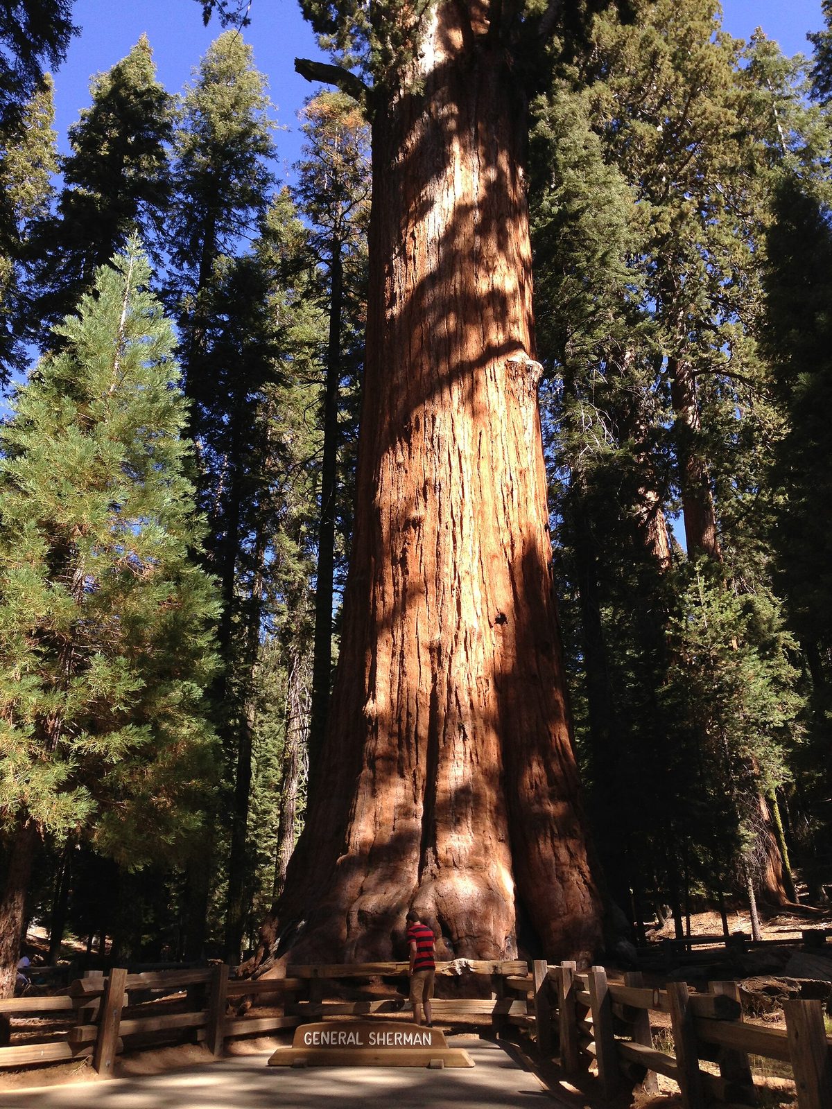
The General Sherman is the largest living tree on Earth by volume: 275 feet (84 m) tall, 36 feet (11 m) across at the base, and about 2,200 years old. It is neither the tallest tree nor the widest, but nothing alive has more wood in it. A paved trail drops from the main parking area to the tree, with a paved patch on the way that marks out the size of its base. The climb back up, at 7,000 feet (2,130 m), is harder than it looks. A second, lower parking area for vehicles with a disability placard gives a nearly level approach.
- Distance: about 1 mile (1.6 km) round trip
- Climb: about 200 feet (60 m), on the return
- Allow: 45 minutes to 1 hour
- Start: Sherman Tree main parking area, off Wolverton Road; shuttles stop at both ends
- When: all year; early morning or evening to avoid the crowd
- Suits: everyone. Stay behind the fences: sequoia roots are shallow and easily damaged.
2. Walk the Congress Trail
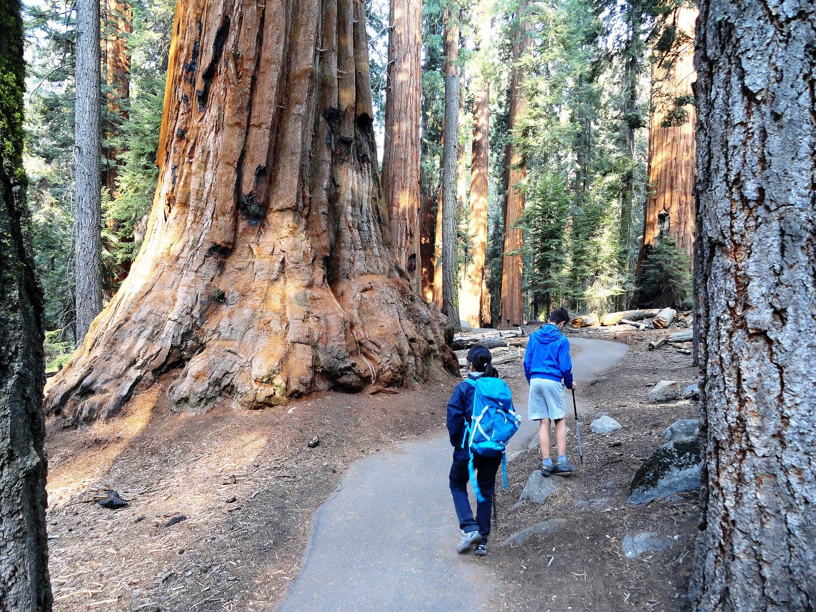
Most people photograph the Sherman Tree and leave. The paved loop that starts beside it goes on through the heart of the Giant Forest, and within five minutes the crowd is gone. It passes the President Tree, one of the largest trees in the world, and two tight clusters of big sequoias called the House and the Senate, where you stand among a dozen trunks at once. This is the walk that shows what a sequoia forest is like, as opposed to one famous tree.
- Distance: a loop of 2 miles (3.2 km), plus the trail down from the parking area
- Allow: 1.5 to 2 hours
- Start: the General Sherman Tree
- When: May to October on dry pavement; on snowshoes in winter
- Suits: most walkers; the grades are gentle
3. Climb the steps of Moro Rock
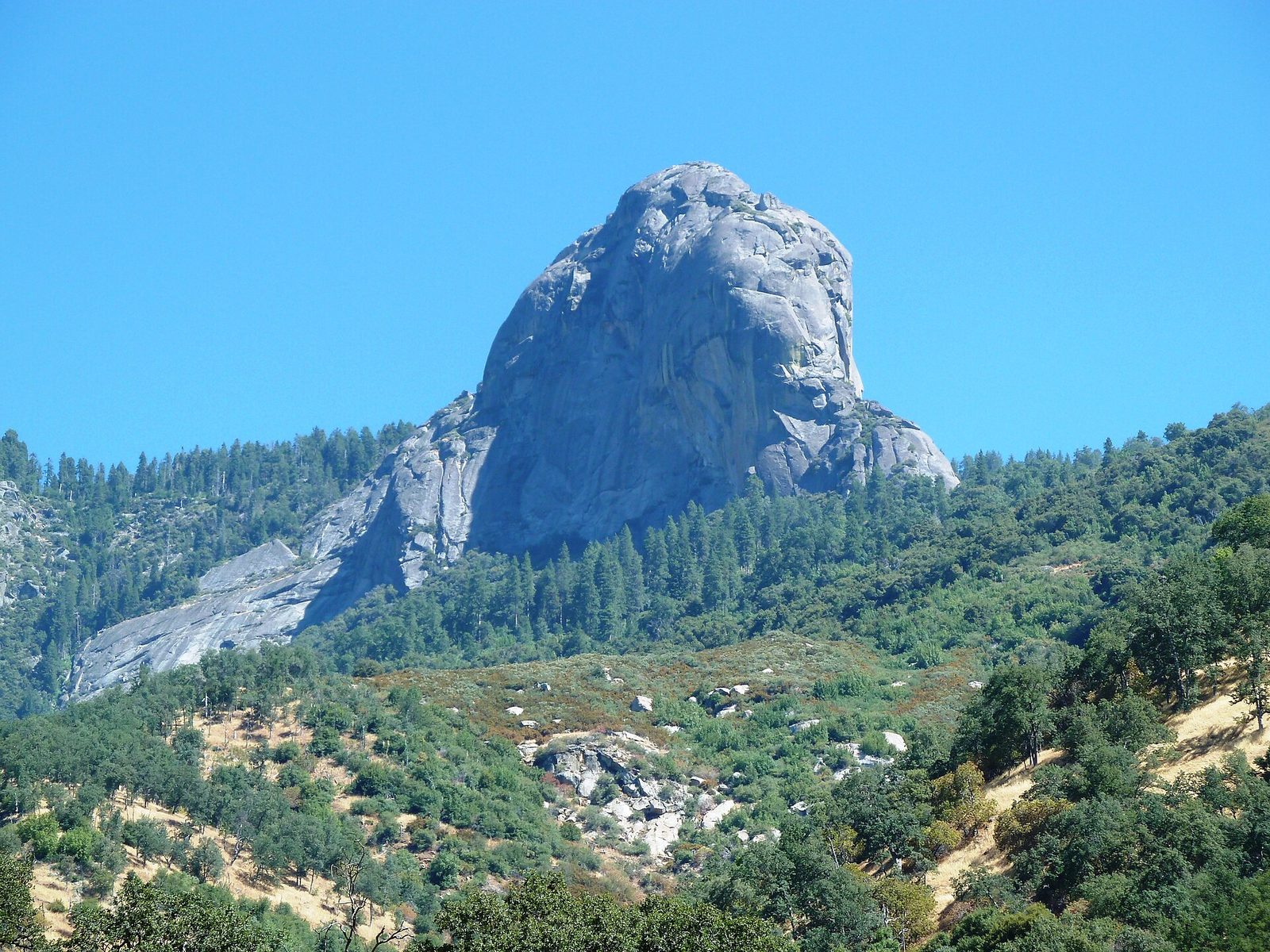
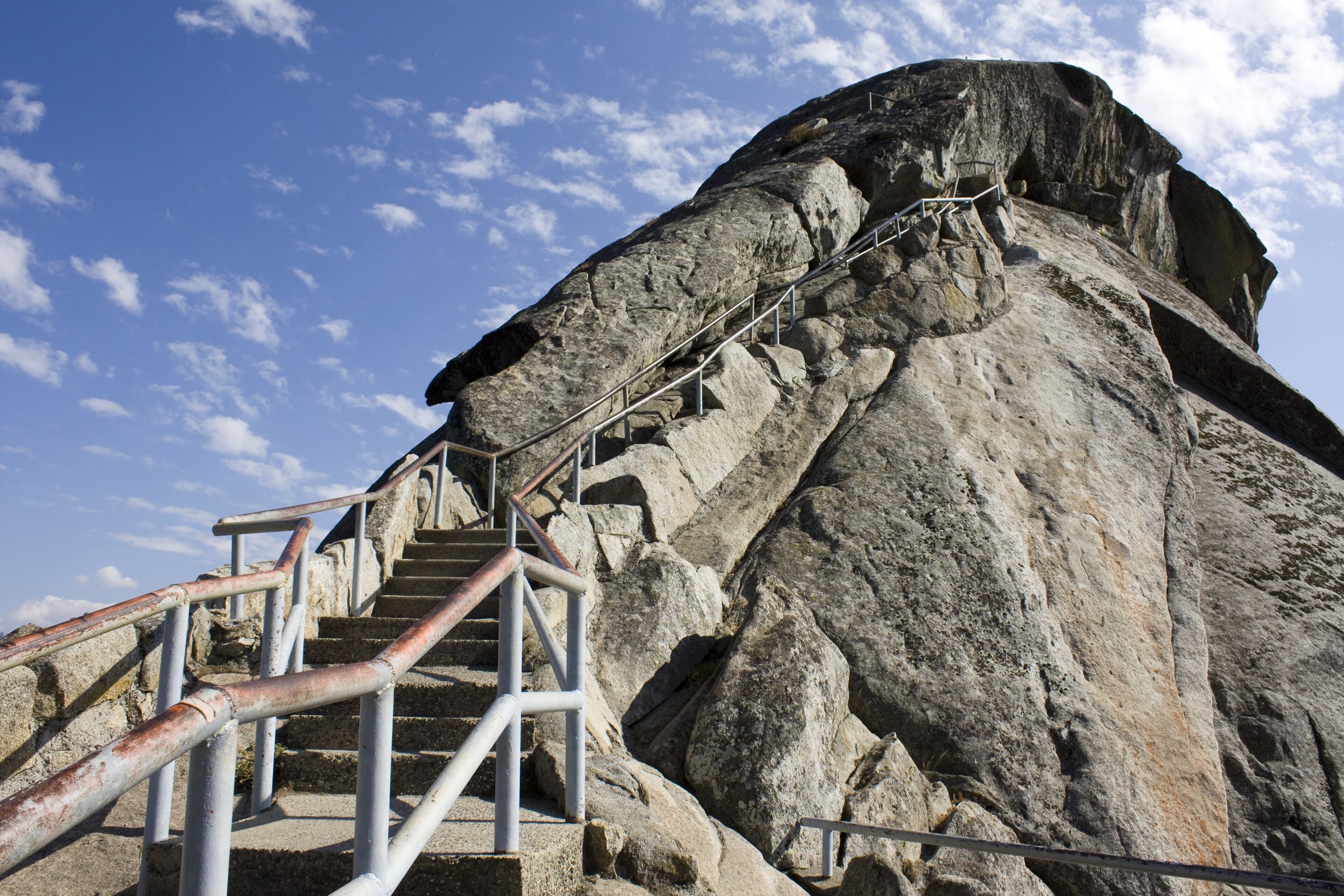
Moro Rock is a bare granite dome on the edge of the Giant Forest plateau. A staircase of about 350 steps, cut and built into the rock in 1931, winds up a crack to a railed walkway along the top at 6,725 feet (2,050 m). To the east the saw-toothed peaks of the Great Western Divide fill the horizon; to the west the land falls 4,000 feet (1,200 m) to the Kaweah River and, on a clear day, the Central Valley. The climb is short and steep, with railings all the way.
Do not go up if a thunderstorm is anywhere near. The dome is struck by lightning often, and people have been hit on it.
- Distance: about 0.5 miles (0.8 km) round trip
- Climb: about 300 feet (90 m)
- Allow: 45 minutes
- Start: Moro Rock parking area, on Crescent Meadow Road; by shuttle on summer weekends, when the road is closed to cars
- When: about May to October. The stairs are closed when icy.
- Suits: most walkers who are comfortable with heights
4. Circle Round Meadow on the Big Trees Trail
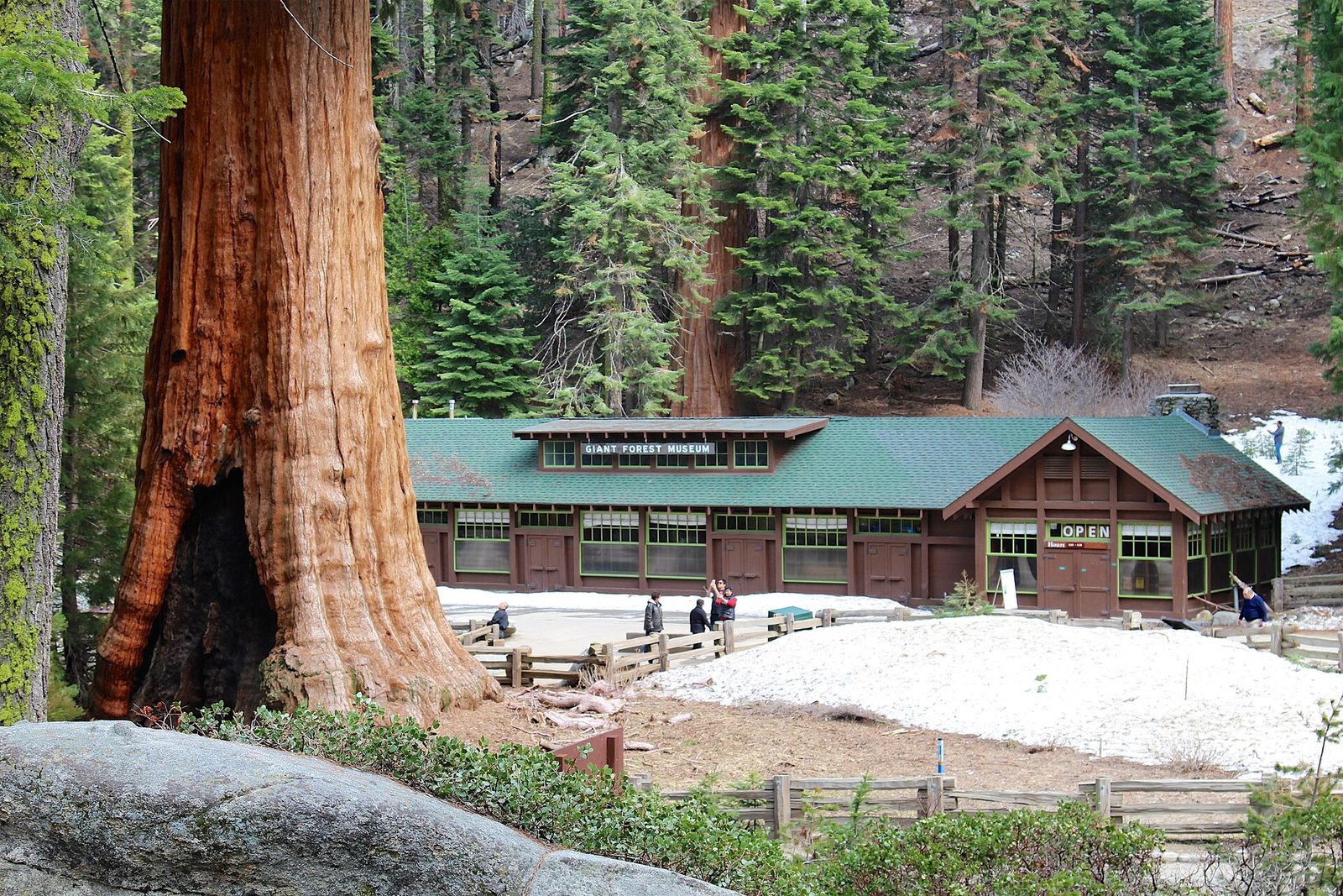
This level, paved loop goes around a small wet meadow ringed by giant sequoias, with signs explaining why the trees grow where they do: at the meadow’s edge, where there is water but the ground is not waterlogged. Because the meadow is open, you can stand back and see whole trees from root to crown, which is hard to do inside the forest. Start at the Giant Forest Museum, which has the best exhibits on the sequoias and on the fires they depend on.
- Distance: a loop of 0.8 miles (1.3 km) from the trailhead; about 1.3 miles (2.1 km) from the museum
- Allow: 1 hour with the museum
- Start: Giant Forest Museum, on the Generals Highway
- When: all year; June for meadow flowers
- Suits: everyone, including wheelchairs and strollers
5. Walk around Crescent Meadow to Tharp’s Log
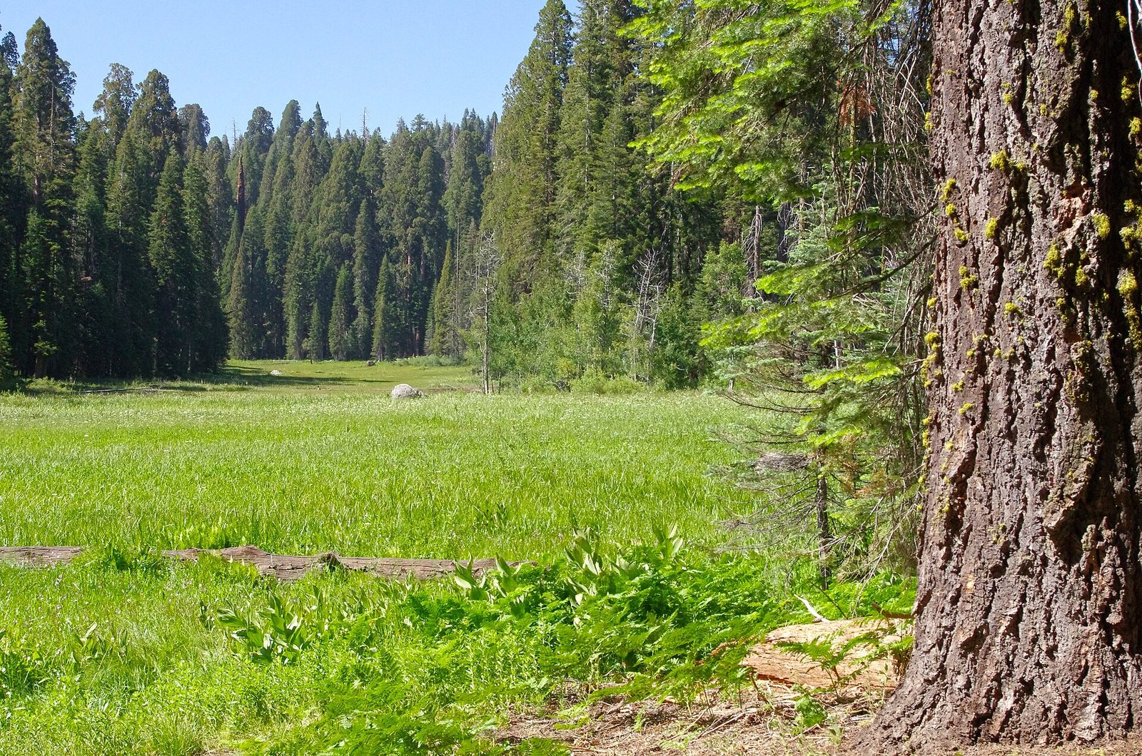
Crescent Meadow is a long curve of grass and wildflowers with sequoias and firs around its rim. A trail circles it and its neighbour, Log Meadow, where a rancher named Hale Tharp spent his summers from the 1860s in a fallen, fire-hollowed sequoia. He fitted it with a door, a window and a stone fireplace, and it is still there to look into. Black bears graze these meadows in early summer, and this is one of the likeliest places in the park to see one. Watch from a distance and never from between a mother and cubs.
- Distance: a loop of about 1.8 miles (2.9 km) with Tharp’s Log
- Allow: 1 to 1.5 hours
- Start: Crescent Meadow parking area, at the end of Crescent Meadow Road
- When: late May to October, while the road is open
- Suits: families
6. Drive through Tunnel Log
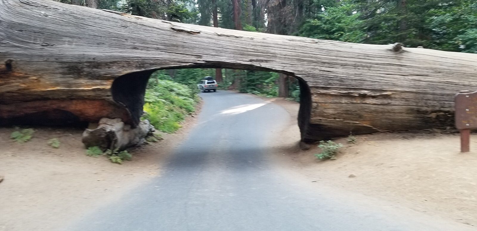
In 1937 a sequoia 275 feet (84 m) tall fell across the road to Crescent Meadow. The following year a crew cut a tunnel through it, 17 feet (5.2 m) wide and 8 feet (2.4 m) high, and cars have been driving through ever since. It is a small thing, and almost everyone enjoys it. A bypass runs round the side for taller vehicles. On summer weekends, when the road is closed to private cars, you walk to it from the shuttle stop.
- Distance: at the roadside
- Allow: 10 minutes
- Start: Crescent Meadow Road, 2.7 miles (4.3 km) from the Giant Forest Museum
- When: late May to October
- Suits: everyone
7. Hike to Tokopah Falls
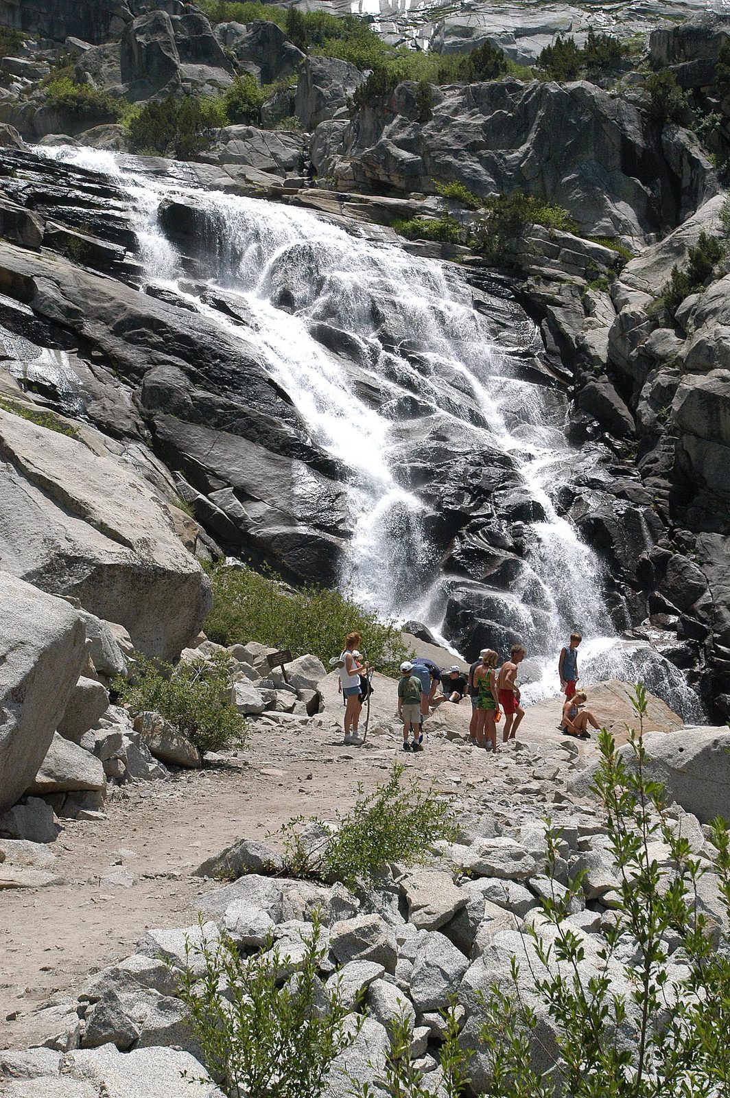
This trail leaves the sequoias behind for the granite country above them. It follows the Marble Fork of the Kaweah River up a glacier-carved canyon, under the 1,600-foot (490 m) cliff of the Watchtower, to the foot of a cascade that comes down the headwall in a long series of steps, 1,200 feet (370 m) in all. Marmots sun themselves on the boulders along the way. The falls are a spring and early-summer sight, fed by snowmelt, and are often down to a trickle by September.
The river is fast and cold when the falls are at their best. People have drowned in the Kaweah’s forks. Stay off the wet rock at the water’s edge.
- Distance: 3.4 miles (5.5 km) round trip
- Climb: about 500 feet (150 m)
- Allow: 2 to 2.5 hours
- Start: Lodgepole Campground, beyond the bridge over the river
- When: May to July for water; the trail is open until snow closes it
- Suits: families with children used to walking
8. Tour Crystal Cave
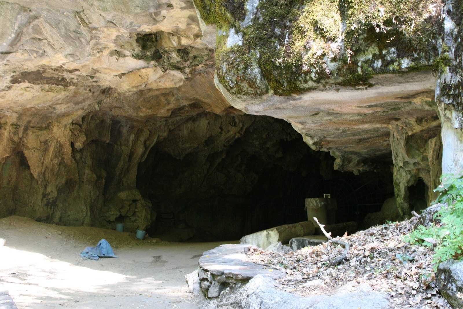
The park has more than 240 known caves, and Crystal Cave is the only one open to visitors. It is a marble cave, with a stream running through it and rooms hung with stalactites, curtains and flowstone, and it stays at about 50°F (10°C) all year. It is seen only on guided tours of about 50 minutes, run in summer by the park’s non-profit partner. Tickets are sold in advance and are not available at the cave. A steep half-mile (0.8 km) path leads down from the parking area to the entrance, and back up afterwards.
- Distance: about 1 mile (1.6 km) round trip on the access path, plus the tour
- Allow: half a day, with the slow, winding drive from the Generals Highway
- Start: Crystal Cave Road, off the Generals Highway south of the Giant Forest. Vehicles longer than 22 feet (6.7 m) are not allowed.
- When: summer, on the days tours are running
- Needs: a tour ticket bought ahead, and a jacket
- Suits: most visitors who can manage the path
9. Drive the Generals Highway up from the foothills
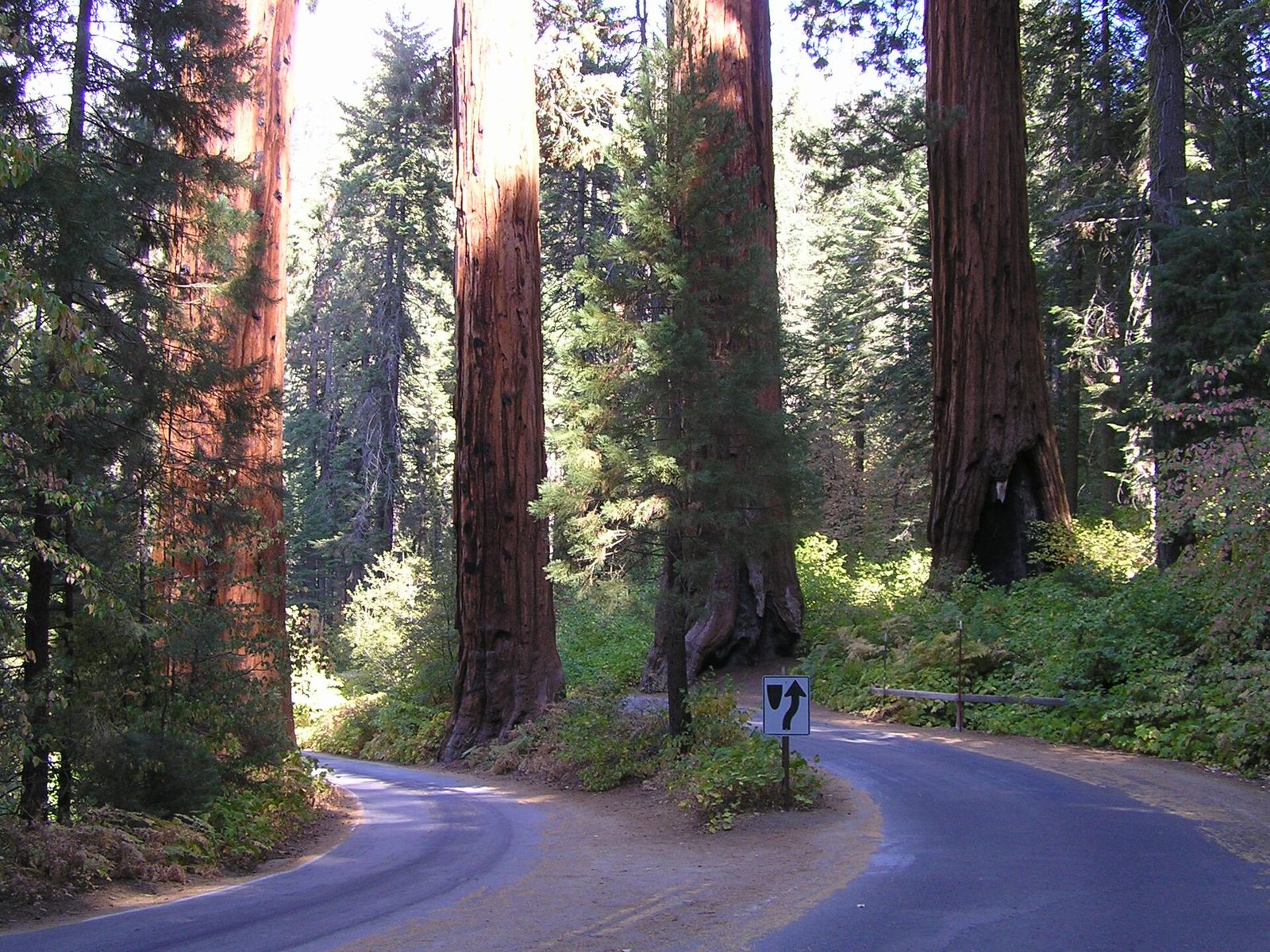
The road into the park from Three Rivers is an experience in itself. It starts in hot oak and chaparral foothills beside the Kaweah River and climbs about 5,000 feet (1,500 m) in 16 miles (26 km) of tight switchbacks, with Moro Rock overhead, before it levels out among the first sequoias. Stop at Hospital Rock for the pictographs and grinding holes left by the Western Mono people who lived there. Beyond the Giant Forest the highway carries on through forest to Kings Canyon National Park.
- Distance: 32.5 miles (52.3 km) from the Ash Mountain Entrance to Kings Canyon
- Allow: 1 hour from the entrance to the Giant Forest without stops; 2 hours to drive it all
- Start: Ash Mountain Entrance, on Highway 198 above Three Rivers
- When: all year, with chain controls and closures in winter. Vehicles longer than 22 feet (6.7 m) are advised against the section below the Giant Forest.
- Suits: everyone who does not suffer on winding roads
10. See the sequoias in snow
From December to March the Giant Forest is under several feet of snow, and the red bark of the sequoias against it is the park at its most striking and least crowded. The Generals Highway is ploughed to the Giant Forest, and marked snowshoe and ski trails lead from the museum and from Wolverton to the Sherman Tree and the Congress Trail. Rangers lead snowshoe walks on some weekends. Carry tyre chains whenever you drive up in winter: they are often required, including on four-wheel-drive vehicles.
- Allow: a day
- Start: Giant Forest Museum or Wolverton
- When: December to March
- Suits: anyone dressed for snow
Before you go
This list covers what stays the same from year to year. Road closures, shuttle dates, cave tour schedules and fire restrictions change, and the National Park Service posts them on its own site. The link is on our Sequoia National Park guide, with the map, permits and how to get there.