

Top 12 things to do in Death Valley National Park
Death Valley is the largest national park in the lower 48 states and the hottest, driest and lowest place in North America. Its best-known sights are spread along about 60 miles (100 km) of the valley floor around Furnace Creek, and they are closer to the road than the park’s size suggests: most of this list is a short walk from a parking area. These are the twelve outings we would put first. The order starts with what the park is known for, then goes by what an outing gives back for the time and effort it takes. Distances and heights are National Park Service figures; times are our estimates and do not include the long drives between places.
Come between November and March. From May to September the valley floor is regularly above 110°F (43°C) and has reached 130°F (54°C), and people die here after walking a mile or two (2 to 3 km) from their cars. In the hot months, stay on paved roads, do not hike on the valley floor after 10 a.m., and carry at least a gallon (4 litres) of water per person per day in the vehicle. There is no cell coverage in most of the park. If your vehicle breaks down, stay with it.
1. Walk onto the salt at Badwater Basin
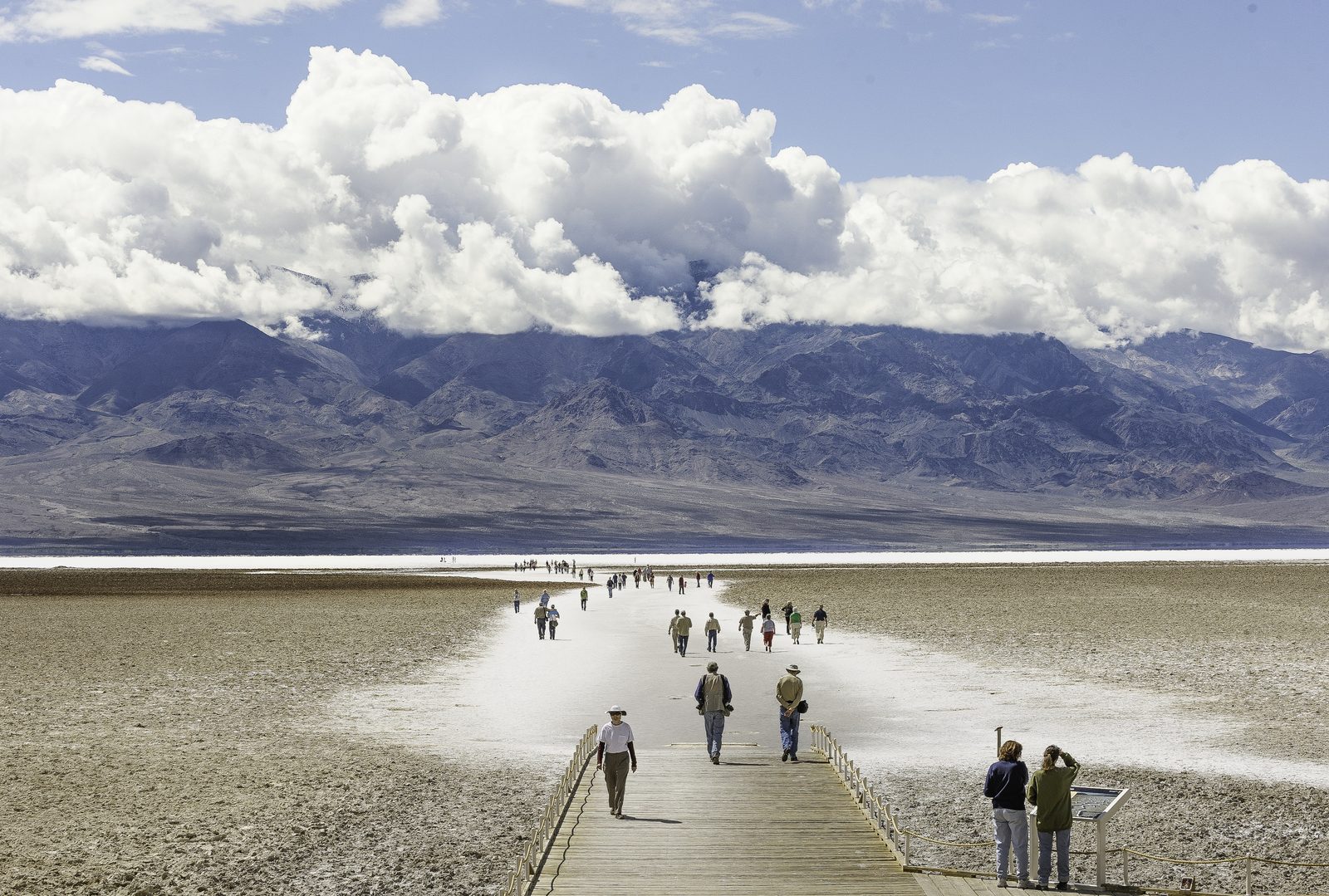
Badwater Basin is the lowest point in North America, 282 feet (86 m) below sea level. A sign on the cliff behind the parking area, far over your head, marks sea level. A boardwalk leads past the small spring-fed pool that gave the place its name and out onto a salt flat that covers nearly 200 square miles (520 km²). Keep walking past the trampled section and the salt forms a crust of raised polygons that runs to the far side of the valley, with Telescope Peak, more than 11,000 feet (3,350 m) above you, on the skyline.
- Distance: 1 to 2 miles (1.6 to 3.2 km) round trip to reach clean polygons, level
- Allow: 1 hour
- Start: Badwater Basin parking area, 17 miles (27 km) south of Furnace Creek on Badwater Road
- When: November to March; sunrise or the last hour of light
- Suits: everyone in cool weather. The boardwalk takes wheelchairs.
2. Watch sunrise at Zabriskie Point
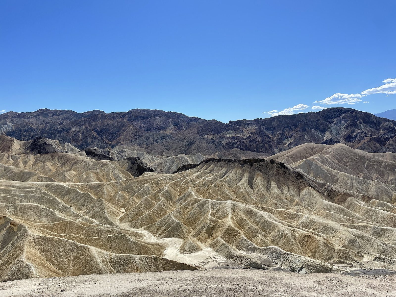
Zabriskie Point looks over a maze of badlands, the mud of a lake that dried up five million years ago, folded and cut into yellow and brown ridges. At sunrise the light reaches the Panamint Mountains across the valley first, turning them pink, then drops onto the badlands and picks out every fold. A short, steep paved path climbs from the parking area to the viewpoint. It is the most popular sunrise in the park, so arrive half an hour early for a place at the wall.
- Distance: about a quarter-mile (400 m) round trip, steep
- Allow: 45 minutes
- Start: Zabriskie Point, on Highway 190, 5 miles (8 km) east of Furnace Creek
- When: all year at sunrise
- Suits: everyone
3. Climb the Mesquite Flat Sand Dunes
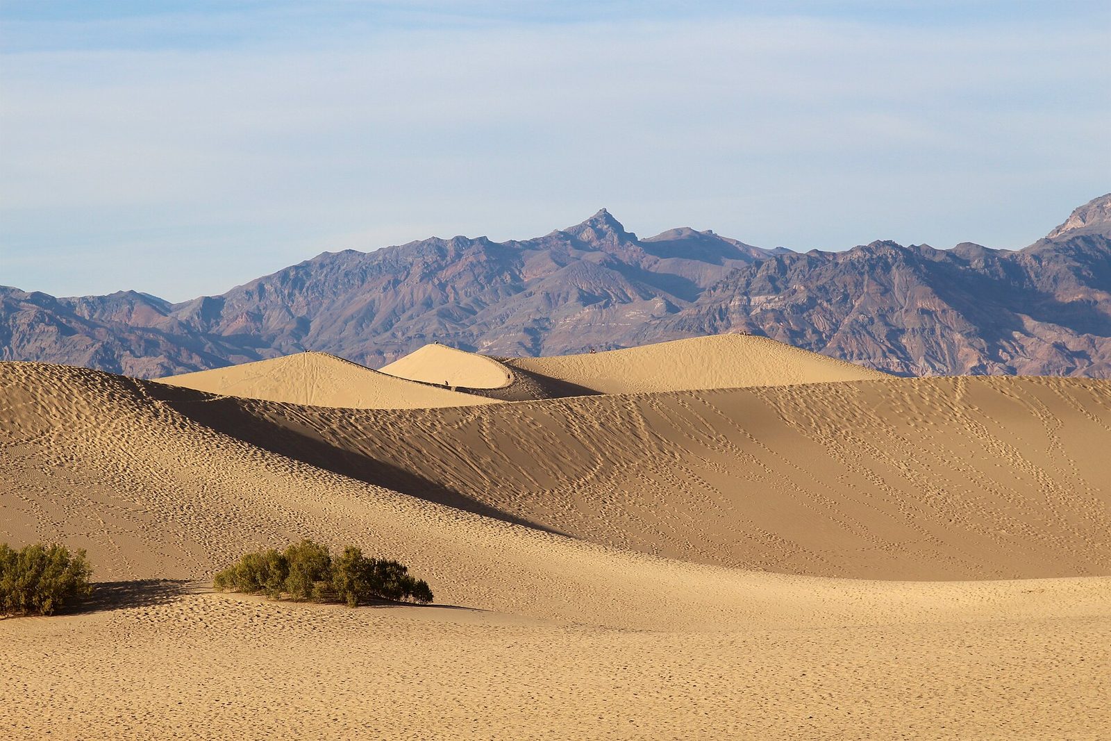
These are the dunes people picture: 14 square miles (36 km²) of rippled sand, with crests up to 130 feet (40 m) high, set against bare mountains. There is no trail. You walk out from the parking area toward whichever dune you like, and the highest is about a mile (1.6 km) away in a straight line and much farther in effort. Go at sunrise, when the low light shows the ripples and the night’s animal tracks are still in the sand, or under a full moon. Sidewinder rattlesnakes live here and move at night, so watch where you put your feet and hands.
- Distance: about 2 miles (3.2 km) round trip to the highest dune
- Allow: 1 to 2 hours
- Start: Mesquite Flat Sand Dunes parking area, on Highway 190 near Stovepipe Wells
- When: November to March; sunrise, sunset or moonlight. The sand is dangerously hot in summer.
- Suits: families. Note where you parked: the dunes all look alike on the way back.
4. Drive Artists Drive
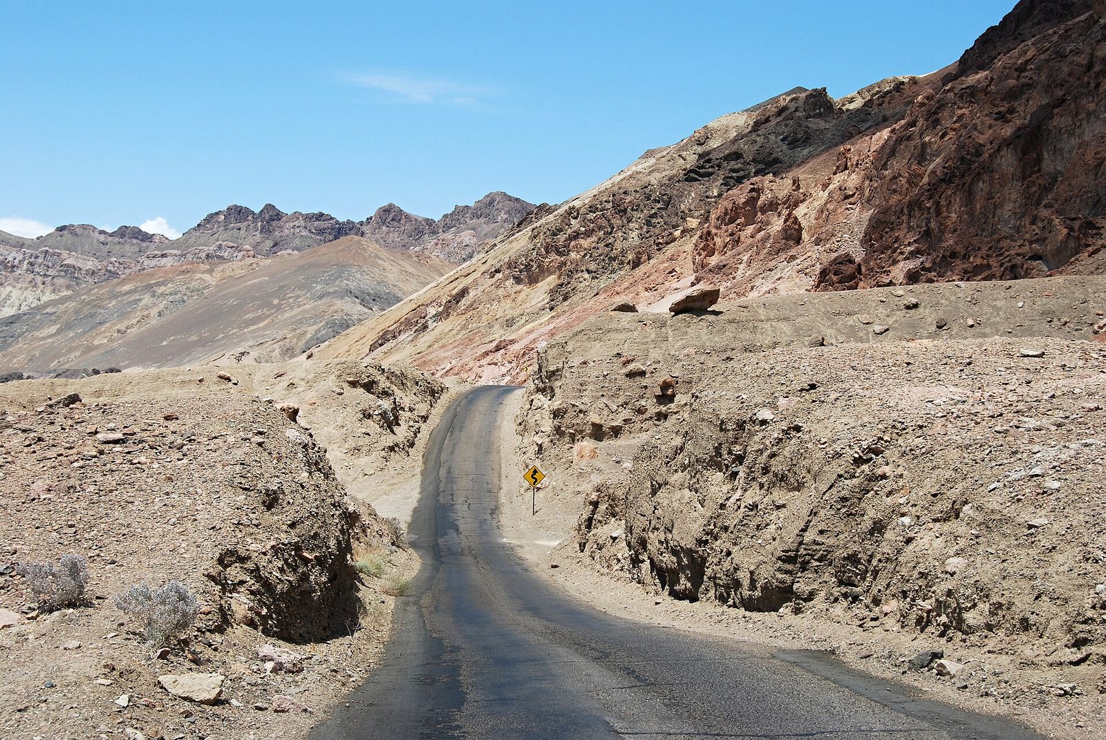
This one-way road loops up into the foothills of the Black Mountains and back, dipping and twisting through washes like a roller coaster. Halfway round is Artists Palette, a hillside streaked pink, green, purple and gold by iron, mica and manganese in the volcanic ash. The colours are strongest in the late afternoon, when the sun is low and behind you. The road is narrow, with sharp bends, and vehicles longer than 25 feet (7.6 m) are not allowed.
- Distance: 9 miles (14.5 km), one way from south to north
- Allow: 45 minutes
- Start: Badwater Road, about 9 miles (14.5 km) south of Highway 190
- When: all year; late afternoon
- Suits: everyone
5. Look down on the valley from Dante’s View
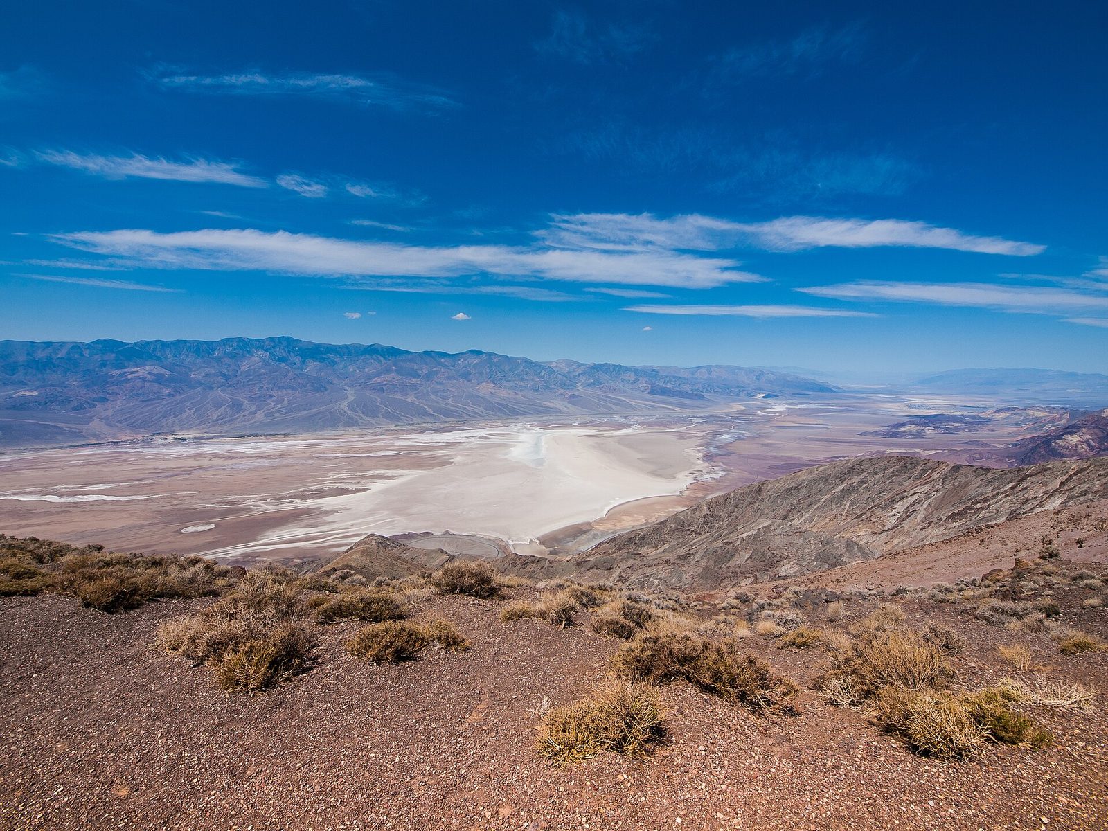
Dante’s View sits on the crest of the Black Mountains at 5,476 feet (1,669 m), directly above Badwater. The whole basin is laid out more than a mile (1.7 km) below: the white salt flat, the alluvial fans spilling from every canyon, and the Panamint Range rising on the far side to Telescope Peak. It is far cooler up here than on the valley floor, which makes it the one place to stand outside in the middle of a hot day.
- Distance: at the parking area, with paths along the ridge in both directions
- Allow: 1.5 hours with the drive from Highway 190
- Start: the end of Dante’s View Road, 25 miles (40 km) from Furnace Creek. The last stretch is steep, and vehicles longer than 25 feet (7.6 m) are not allowed.
- When: all year; sunrise for the light on the Panamints
- Suits: everyone
6. Hike Golden Canyon
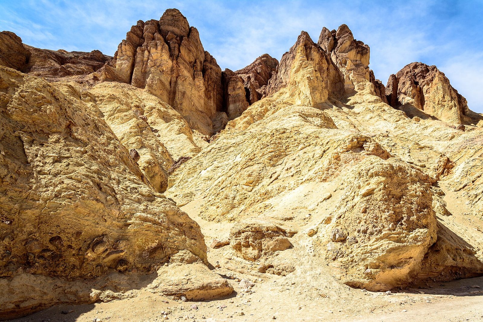
Golden Canyon is the best short hike in the park. The trail goes up a narrowing canyon between walls of yellow mudstone, tilted and rippled, to the foot of the Red Cathedral, a wall of red cliffs fluted like organ pipes. For a longer walk, climb the side trail under Manly Beacon, the sharp fin seen from Zabriskie Point, and return down Gower Gulch, a wide gravel wash. There is no shade in any of it, and the canyon holds heat. Do not attempt it after mid-morning from April to October.
- Distance: 3 miles (4.8 km) round trip to the Red Cathedral; a loop of 4.3 miles (6.9 km) with Gower Gulch
- Climb: about 580 feet (177 m) to the Red Cathedral
- Allow: 1.5 to 2.5 hours
- Start: Golden Canyon parking area, on Badwater Road 2 miles (3.2 km) south of Highway 190
- When: November to March
- Suits: most walkers in cool weather
7. Listen at the Devil’s Golf Course
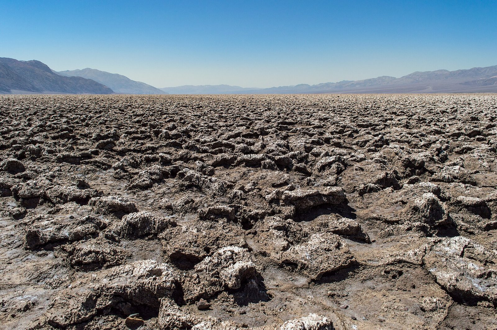
Here the salt pan is not flat. Groundwater rising and evaporating has built the salt into a field of jagged, knee-high spires as far as you can see, too rough and too sharp to walk across. On a still, warm day you can hear a faint pinging and cracking as the crystals expand in the heat. Stay near the parking area and step with care: a fall on these spires cuts like broken glass.
- Distance: at the parking area
- Allow: 20 minutes
- Start: the end of a short gravel road off Badwater Road, 11 miles (18 km) south of Furnace Creek
- When: all year; the road closes after rain
- Suits: everyone, with children kept close
8. Stay out after dark
Death Valley has some of the darkest night skies in the United States, and it holds the highest rating the International Dark-Sky Association gives. On a moonless winter night, with dry air and no cloud, the stars reach right down to the horizon. Harmony Borax Works, the Mesquite Flat dunes and Badwater are all good places to watch from, a few steps from the car. Rangers run night sky programs in winter and a dark sky festival early in the year.
- Allow: an evening
- Start: any parking area away from the lights of Furnace Creek and Stovepipe Wells
- When: November to March, around the new moon
- Suits: everyone. Desert nights are cold in winter.
9. Walk the rim of Ubehebe Crater
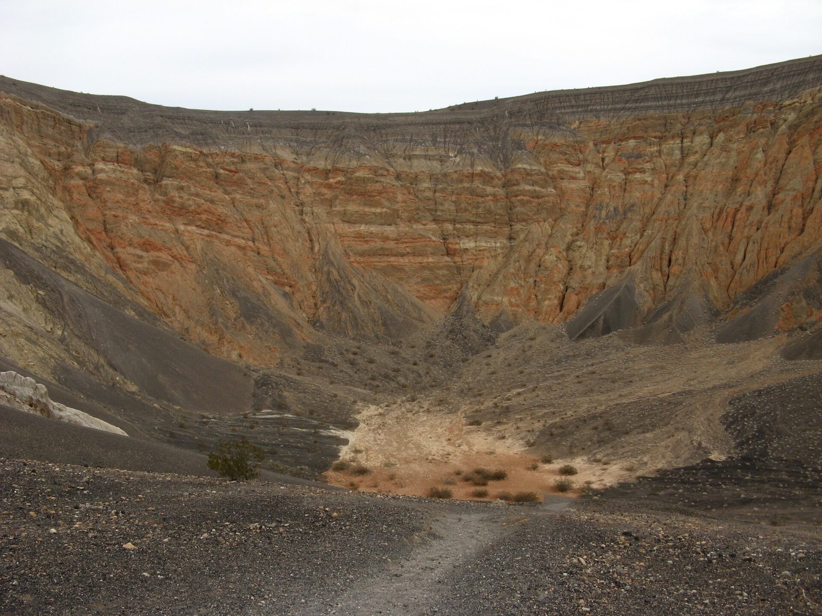
At the north end of the valley, rising magma met groundwater and the steam blew a hole half a mile (800 m) wide and about 600 feet (180 m) deep, about 2,100 years ago. You park at the rim. The walls are banded orange and grey, and black cinders cover the country all around. A trail circles the rim past several smaller craters, and another runs straight down the loose slope to the bottom, which is easy to descend and exhausting to climb back out of. The rim is very windy.
- Distance: a loop of 1.5 miles (2.4 km) around the rim
- Allow: 1 hour, plus an hour’s drive each way from Furnace Creek
- Start: Ubehebe Crater, 56 miles (90 km) north of Furnace Creek
- When: October to April
- Suits: most walkers on the rim. The edge is loose and unfenced.
10. See where the borax came from
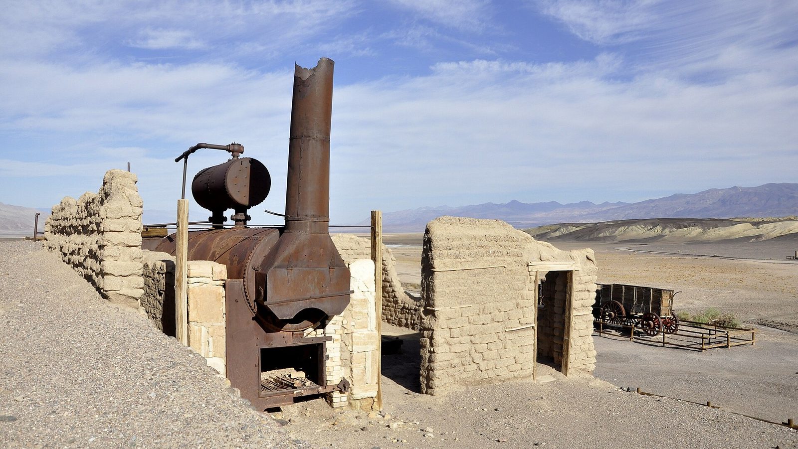
Borax, not gold, was the mineral that paid in Death Valley. At Harmony Borax Works, a short paved loop passes the adobe ruins and boilers of the 1880s plant and one of the original wagon sets: two huge wagons and a water tank that teams of twenty mules hauled 165 miles (265 km) to the railway. Nearby, Twenty Mule Team Canyon is a one-way dirt road that winds through pale badlands riddled with old prospect tunnels. Ordinary cars manage it when it is dry.
- Distance: a loop of about 0.4 miles (0.6 km) at Harmony; 2.7 miles (4.3 km) of road through the canyon
- Allow: 1 hour for both
- Start: Harmony Borax Works, 1 mile (1.6 km) north of Furnace Creek; the canyon road leaves Highway 190 east of Zabriskie Point
- When: all year
- Suits: everyone
11. Drive to the Racetrack
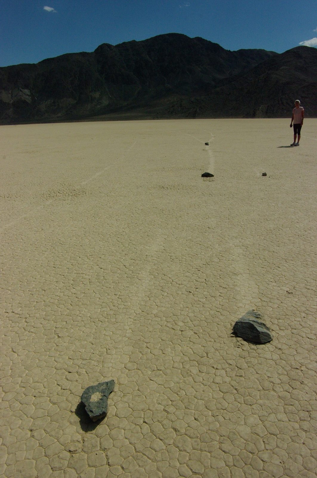
On a dry lake bed in a remote valley, rocks weighing up to about 700 pounds (320 kg) lie at the ends of long, shallow tracks, some of them 1,500 feet (460 m) long. Their movement was first recorded in the winter of 2013, by researchers: on rare winter mornings, thin sheets of ice break up and are pushed by light wind, sliding the rocks across wet mud. Do not walk on the playa when it is wet, and never move a rock. Footprints and tyre tracks left in the mud last for years.
The road in is 27 miles (43 km) of sharp, washboarded gravel that cuts ordinary tyres. Take a high-clearance vehicle with heavy-duty tyres and a full-size spare, carry extra water and food, and tell someone your plan. A tow from here costs a great deal and takes a day to arrive.
- Distance: 27 miles (43 km) each way on rough road from Ubehebe Crater
- Allow: a full day from Furnace Creek
- Start: Racetrack Road, beside Ubehebe Crater
- When: October to April, in dry weather
- Suits: prepared drivers with the right vehicle
12. Climb Telescope Peak
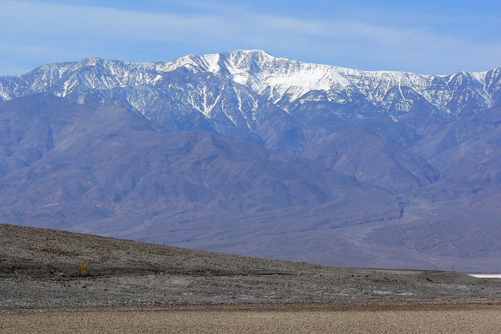
Telescope Peak, at 11,049 feet (3,368 m), is the highest point in the park, and from its summit you look down on Badwater, more than 11,000 feet (3,350 m) below. It is the reverse of everything else here: a mountain trail through pinyon and, higher up, bristlecone pines thousands of years old, along an open ridge with a view to both sides. The trail is well built and never steep for long, but it is long and high. It is also a summer and fall hike, when the valley is too hot to visit. Snow and ice close it to ordinary walkers in winter and spring.
- Distance: 14 miles (23 km) round trip
- Climb: about 3,000 feet (900 m)
- Allow: 7 to 9 hours
- Start: Mahogany Flat Campground, at the end of Emigrant Canyon Road. The last stretch is rough and steep and needs high clearance.
- When: June to October
- Suits: fit hikers used to altitude
Before you go
This list covers what stays the same from year to year. Flash floods close roads here often and for a long time, and heat warnings and program schedules change. The National Park Service posts them on its own site. The link is on our Death Valley National Park guide, with the map, passes and how to get there.