

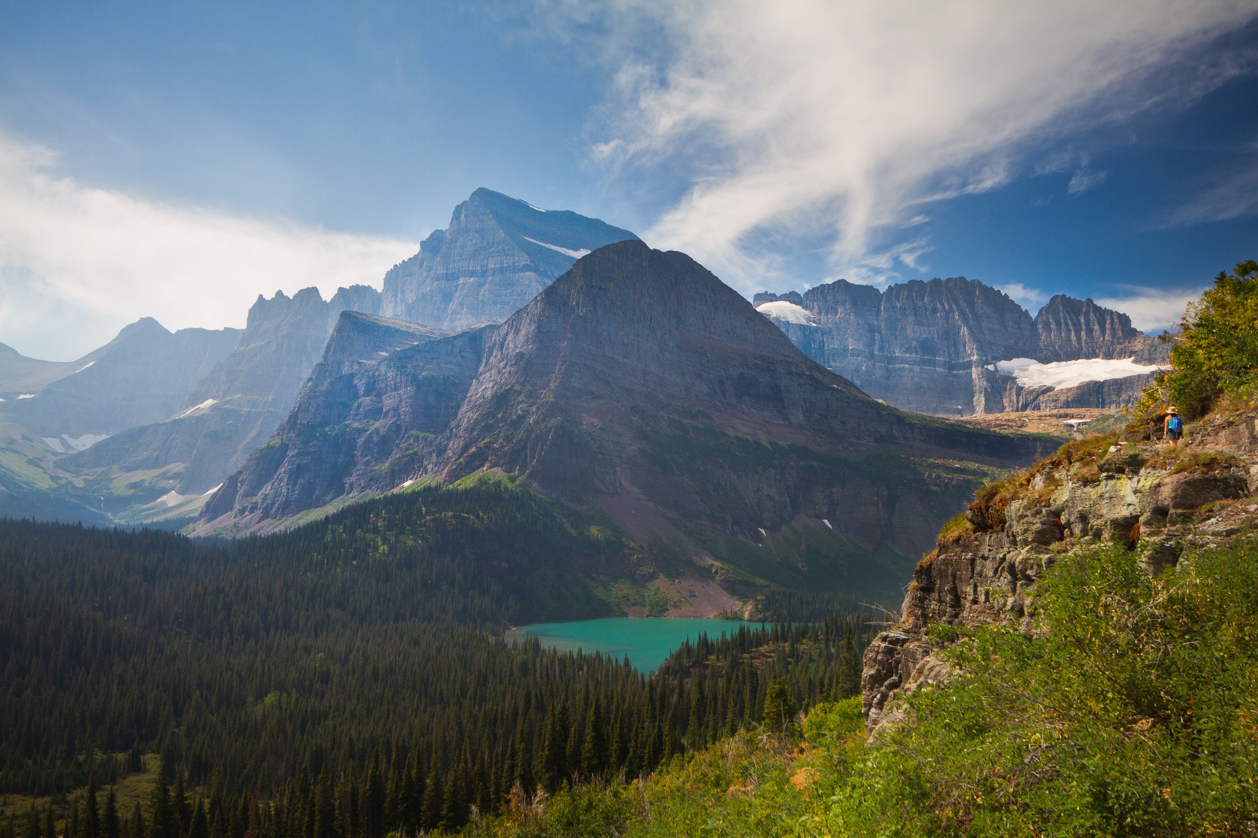
Top 10 things to do in Glacier National Park, Montana
Glacier National Park, in northwest Montana, is built around one road. Going-to-the-Sun Road crosses the Continental Divide at Logan Pass, and most of what visitors come for is on it or in the valleys of the east side: Many Glacier, St. Mary and Two Medicine. These are the ten outings we would put first. The order starts with what the park is known for, then goes by what an outing gives back for the time and effort it takes. Distances and heights are National Park Service figures; times are our estimates and do not include stops.
The season is short. The road over Logan Pass is usually open end to end from late June or early July to early October, and snow covers the high trails into July. In most recent summers the park has required a vehicle reservation for some entrances at busy hours, with rules that change from year to year. This is also grizzly country, more so than almost anywhere else in the lower 48 states: carry bear spray on every trail, hike in a group, and make noise.
1. Drive Going-to-the-Sun Road
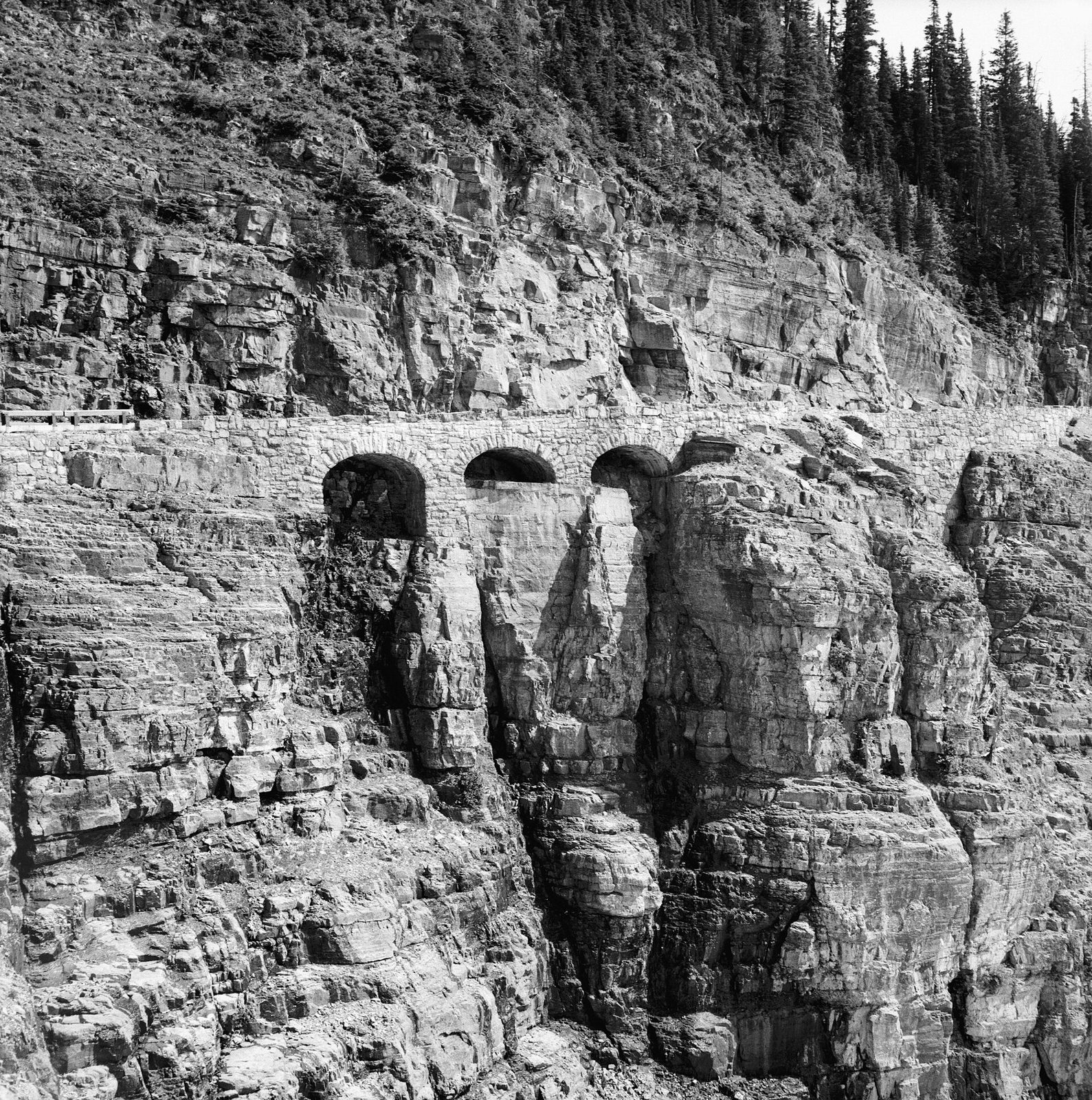
The road runs about 50 miles (80 km) from West Glacier to St. Mary, and for its middle section it is cut into a cliff face called the Garden Wall, with a stone guard wall on one side and rock on the other. From the west it follows Lake McDonald, climbs past Bird Woman Falls and the Weeping Wall, where meltwater runs onto the road, and tops out at Logan Pass, 6,646 feet (2,026 m). On the east side it drops past the Jackson Glacier Overlook to Saint Mary Lake and the view of Wild Goose Island.
Vehicles longer than 21 feet (6.4 m) or wider than 8 feet (2.4 m) are not allowed over the high section. If the drive makes you nervous, ride the park shuttle or one of the red 1930s tour buses and look out of the window. The Logan Pass parking area fills early in the morning in July and August.
- Distance: about 50 miles (80 km) one way
- Allow: 2 hours without stops; a full day with them
- Start: West Glacier or St. Mary
- When: about late June to early October for the full road. The lower sections on both sides are open for much longer.
- Suits: everyone
2. Walk to the Hidden Lake Overlook
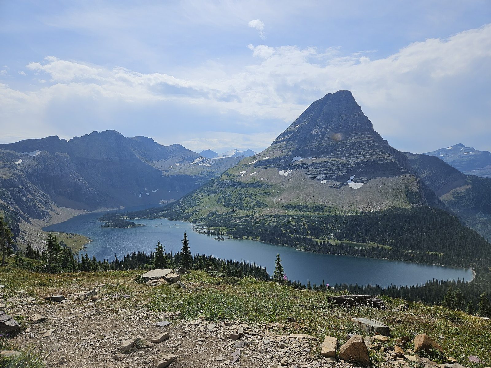
From the Logan Pass visitor center a boardwalk climbs in steps across the Hanging Gardens, alpine meadows that flower in late July and August, to a saddle looking down on Hidden Lake and Bearhat Mountain. Mountain goats are often seen on this trail, sometimes within a few yards of the boardwalk, and bighorn sheep and marmots are common. The trail continues steeply down to the lakeshore for those with time.
Snow covers much of the route into July, when it is a walk across packed snowfields. Stay on the boardwalk where it is clear: the meadow plants grow for only a few weeks a year. Give goats 25 yards (23 m), however close they come to you.
- Distance: 2.7 miles (4.3 km) round trip
- Climb: about 500 feet (150 m)
- Allow: 1.5 to 2 hours
- Start: Logan Pass Visitor Center
- When: July to September
- Suits: most walkers, including children
3. Hike the Highline Trail
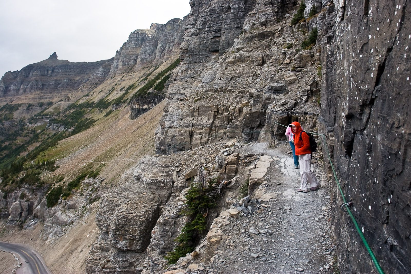
The Highline starts across the road from Logan Pass and follows the Garden Wall north, staying high above the valley on a path that stays nearly level for miles. Early on it crosses a ledge blasted into a cliff, with a hand cable along the wall; after that the trail runs through flower meadows with open views the whole way. It reaches Granite Park Chalet, a stone hut built in 1914. From there most hikers drop down the Loop Trail to Going-to-the-Sun Road and take the shuttle back to the pass.
Near the chalet a steep side trail climbs to a gap in the Garden Wall and looks straight down on Grinnell Glacier. It is a hard extra hour and worth it on a clear day.
- Distance: 7.6 miles (12.2 km) one way to Granite Park Chalet; about 11.8 miles (19 km) one way from Logan Pass to the Loop
- Climb: about 800 feet (240 m) to the chalet, then a descent of about 2,300 feet (700 m) to the Loop
- Allow: 6 to 8 hours
- Start: Logan Pass; finish at the Loop, a shuttle stop on Going-to-the-Sun Road
- When: about mid-July to September. A steep snowfield near the start keeps the trail closed after the road opens.
- Suits: fit hikers. The ledge is wide, but those with a strong fear of heights will not enjoy it.
4. Hike to Avalanche Lake
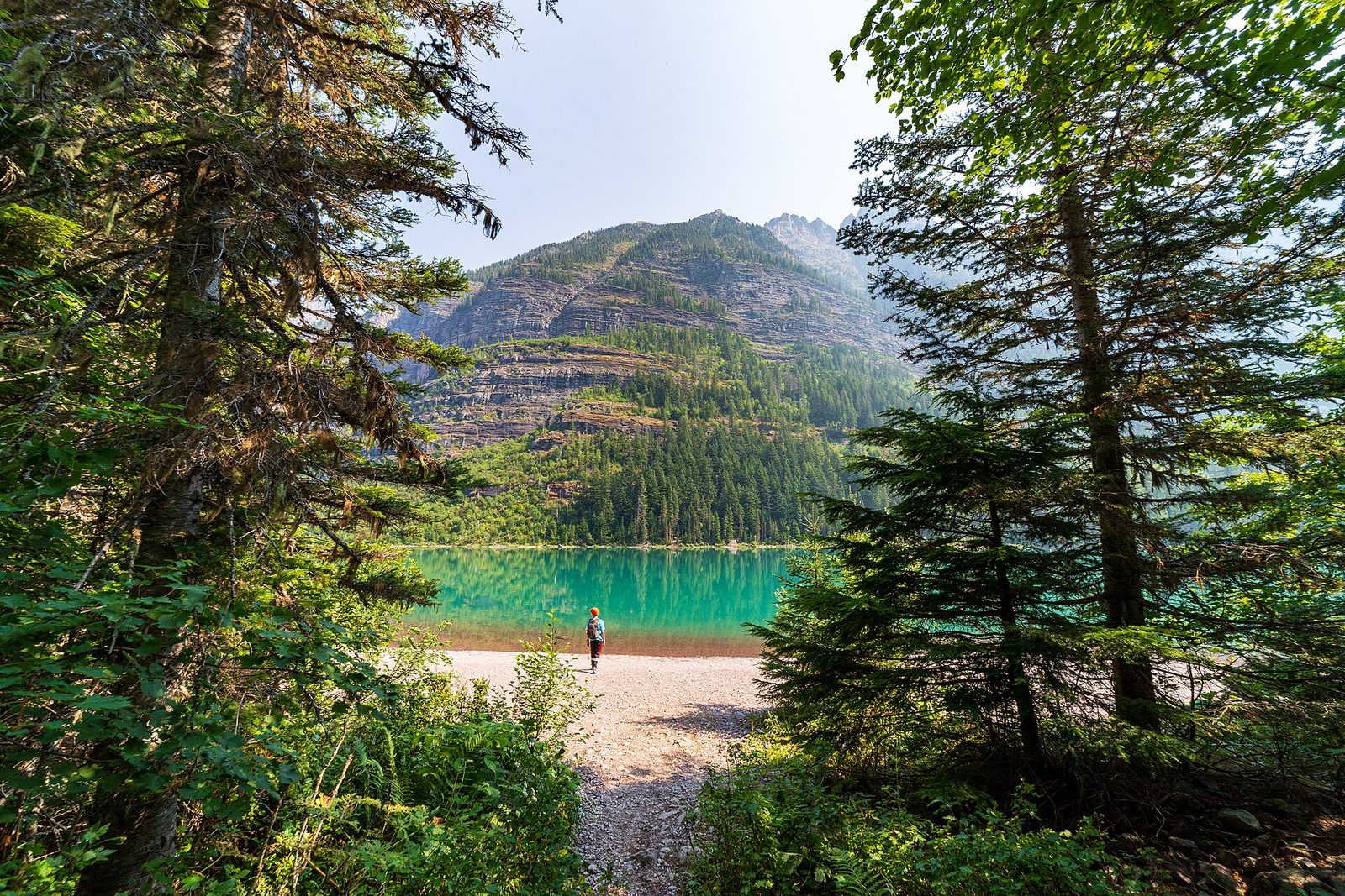
This is the best-known hike on the west side and a good one for a cloudy day, because it is all in forest. It begins on the Trail of the Cedars, a level boardwalk loop through old western red cedars and hemlocks, then turns up beside Avalanche Creek, which has cut a narrow, twisting gorge of red rock. The trail climbs gently through mossy forest to a lake in a bowl of cliffs, with several long waterfalls coming down the headwall from Sperry Glacier’s basin above.
The parking area fills very early. The west-side shuttle stops here.
- Distance: about 4.6 miles (7.4 km) round trip; the Trail of the Cedars alone is a loop of 0.6 miles (1 km)
- Climb: about 500 feet (150 m)
- Allow: 2.5 to 3.5 hours
- Start: Avalanche, on Going-to-the-Sun Road 16 miles (26 km) from the West Entrance
- When: May to October. This part of the road opens weeks before the pass.
- Suits: families. The Trail of the Cedars takes wheelchairs.
5. Hike to Grinnell Glacier
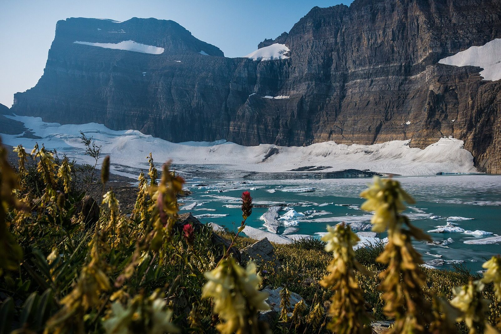
Many Glacier, on the east side, is the part of the park that hikers rate highest, and this is its signature trail. From Swiftcurrent Lake, where the Many Glacier Hotel has stood since 1914, the route passes Lake Josephine and then climbs a long bench above Grinnell Lake, which is a milky turquoise from glacial silt. It ends at the edge of Upper Grinnell Lake, with icebergs in the water and the glacier on the far side under the Garden Wall. The glacier is a fraction of the size it was a century ago, and the bare rock around the lake shows where the ice used to be.
A concessioner’s boats cross Swiftcurrent Lake and Lake Josephine and cut about 3.4 miles (5.5 km) off the round trip. Bears are often on this trail, and rangers close it at times because of them.
- Distance: 11.1 miles (17.9 km) round trip
- Climb: about 1,840 feet (560 m)
- Allow: 6 to 8 hours
- Start: Grinnell Glacier Trailhead, near the Many Glacier Hotel
- When: about mid-July to September, once the upper snowfields are safe
- Suits: fit hikers
6. Hike to Iceberg Lake
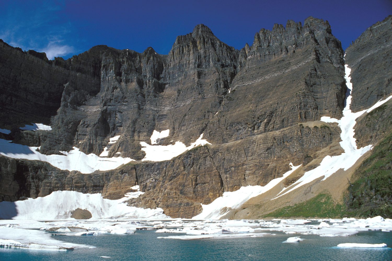
Iceberg Lake sits in a cirque with walls 3,000 feet (900 m) high on three sides, shaded enough that ice floats on it into August. The trail there is the gentlest of Many Glacier’s big hikes: one short, steep pull at the start, then a long, even climb across open slopes with views down the valley, past Ptarmigan Falls. The slopes are thick with beargrass and other flowers in July. Grizzlies feed on them too, and this is one of the trails where they are most often met.
- Distance: 9.7 miles (15.6 km) round trip
- Climb: about 1,275 feet (390 m)
- Allow: 5 to 6 hours
- Start: Iceberg Ptarmigan Trailhead, behind the Swiftcurrent Motor Inn at Many Glacier
- When: July to September
- Suits: steady walkers; a good first long hike in the park
7. Walk to St. Mary and Virginia falls
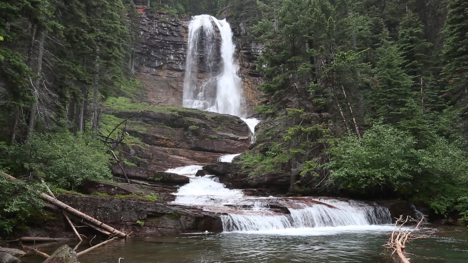
Two waterfalls on one short trail make this the best easy hike on the east side. St. Mary Falls drops 35 feet (11 m) in two steps into a pool of bright blue-green water, with a footbridge across the river just below. Virginia Falls, farther up a side creek, is a 50-foot (15 m) veil you can walk right up to, with smaller cascades along the way. The trail runs through forest burned in 2015, so it is open, sunny and full of fireweed in summer.
- Distance: about 3 miles (5 km) round trip to Virginia Falls; 1.7 miles (2.8 km) round trip to St. Mary Falls alone
- Climb: about 450 feet (140 m), most of it on the way back
- Allow: 1.5 to 2.5 hours
- Start: St. Mary Falls Trailhead, on Going-to-the-Sun Road west of Sun Point; the east-side shuttle stops here
- When: June to October
- Suits: families
8. Spend an evening at Lake McDonald
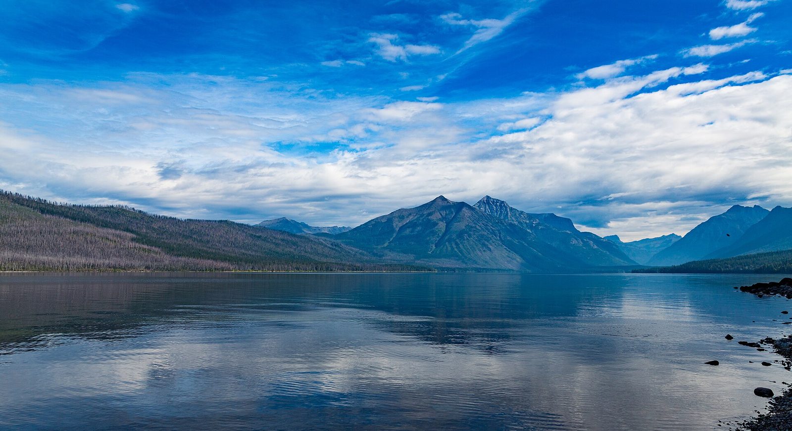
Lake McDonald is the park’s largest lake, about 10 miles (16 km) long, and its water is clear enough to show the red, green and maroon stones of the bottom well out from shore. The stones are best seen at Apgar, at the foot of the lake, on a calm, bright day. Apgar is also where to rent a canoe, kayak or paddleboard, and where to be at sunset, when the peaks at the head of the lake hold the light. Lake McDonald Lodge, partway up the east shore, has been taking guests since 1914.
- Allow: 2 hours to a full day
- Start: Apgar Village, 2 miles (3.2 km) inside the West Entrance
- When: May to October. Every boat needs an inspection for invasive species before it launches.
- Suits: everyone, and the best plan for a rest day
9. Take a day in Two Medicine
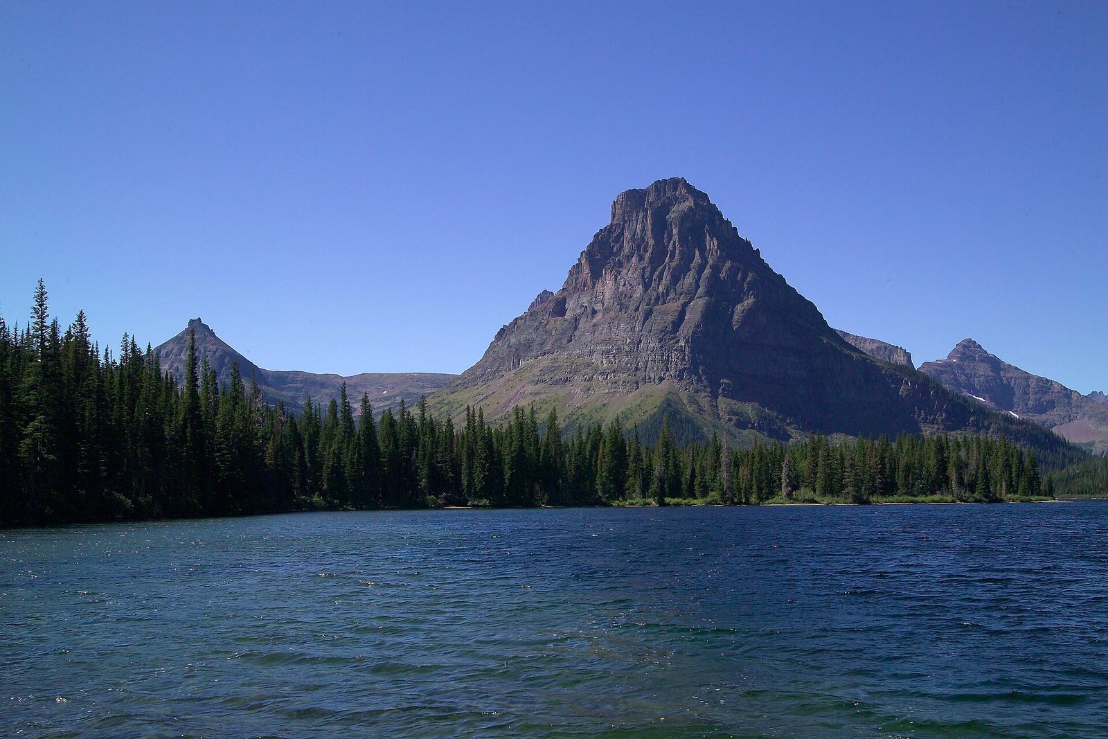
Two Medicine, in the park’s southeast corner, was its main destination before the road over the pass was built, and it is now the quietest of the valleys with a paved road. Two Medicine Lake lies under the pyramid of Sinopah Mountain. On the way in, a level path leads to Running Eagle Falls, where one stream pours over a ledge and another comes out of the rock beneath it. From the lake, a boat tour shortens the walk to Twin Falls, and longer trails climb to Scenic Point and the Dawson and Pitamakan passes.
- Distance: 0.6 miles (1 km) round trip to Running Eagle Falls
- Allow: half a day to a full day
- Start: Two Medicine Road, off Highway 49 north of East Glacier Park
- When: June to September
- Suits: everyone. It can be very windy.
10. Drive the North Fork to Bowman Lake
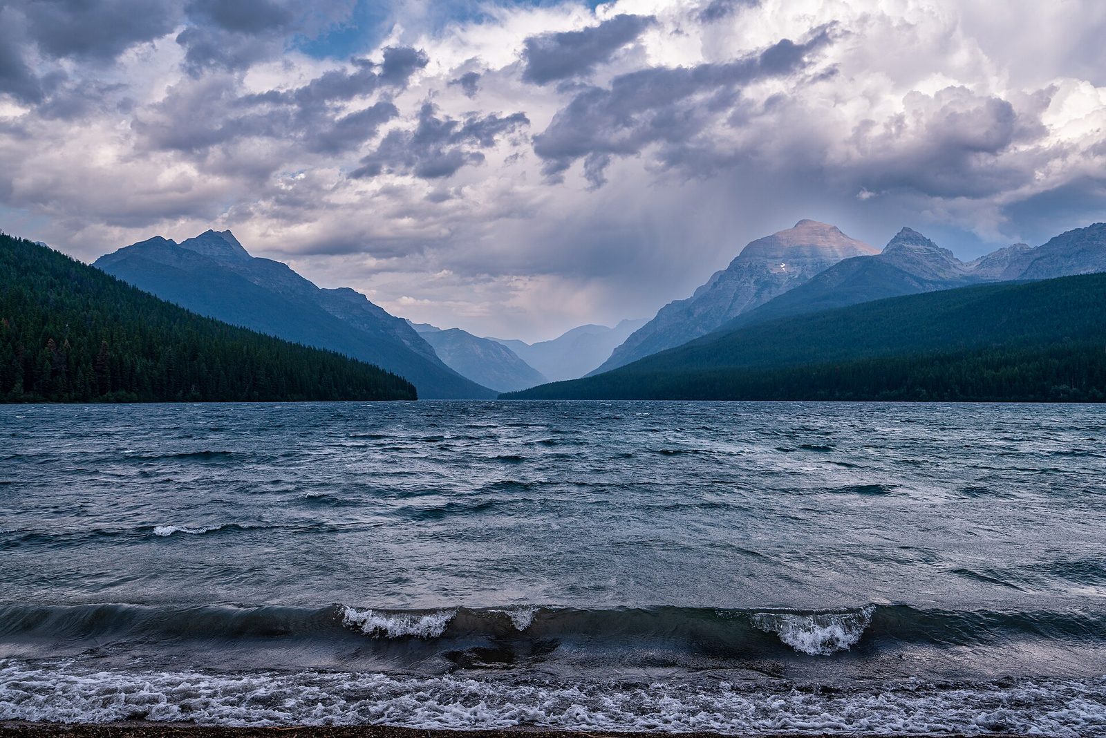
The park’s northwest corner has no pavement, no lodges and no cell coverage, and that is why people go. A long gravel road leads up the North Fork of the Flathead River to Polebridge, a few buildings around a century-old general store known for its bakery. From there 6 miles (9.7 km) of narrow, rough road climb to Bowman Lake, a long, still lake between forested ridges with peaks at its head. There is a small campground at the foot of the lake, and the paddling is the best in the park when the wind is down.
- Distance: about 35 miles (56 km) each way from Apgar, most of it unpaved
- Allow: a full day
- Start: the Camas Road or the Outside North Fork Road, from Apgar or Columbia Falls
- When: June to September, in dry weather. Carry a spare tyre; long vehicles and trailers cannot use the Bowman Lake road.
- Suits: visitors who want quiet and do not mind dust
Before you go
This list covers what stays the same from year to year. Road opening dates, vehicle reservations, bear closures and construction change, and the National Park Service posts them on its own site. The link is on our Glacier National Park guide, with the map, permits and how to get there.